GetOutside champion Hilary Tomlinson guides you from Hawksmoor to Dimmingdale in this easy circular walk.
Here’s a short walk (7km) in the lovely Staffordshire Moorlands, close to the delightful Churnet Valley.
Only a few miles away from Alton Towers it’s a lovely stroll along quiet rural lanes and then through the lovely Dimmingsdale past numerous ponds and with a delightful stream, perfect for wading and splashing about in if you have children with you.
It is generally easy but with three moderate uphills and will take about two hours but there’s chance for refreshments halfway (not Mondays).
The walk starts at the National Trust’s small Hawksmoor car park which is signed just off the B5417 between Cheadle and Oakamoor, opposite the Greendale Lane turning and between two imposing brick and stone entrance pillars. There’s parking for just over half a dozen cars, but you can nearly always find a space.
Ignoring the gravel track down into Hawksmoor Nature Reserve go back through the entrance onto the main road and cross over following the minor road down signed Greendale Lane.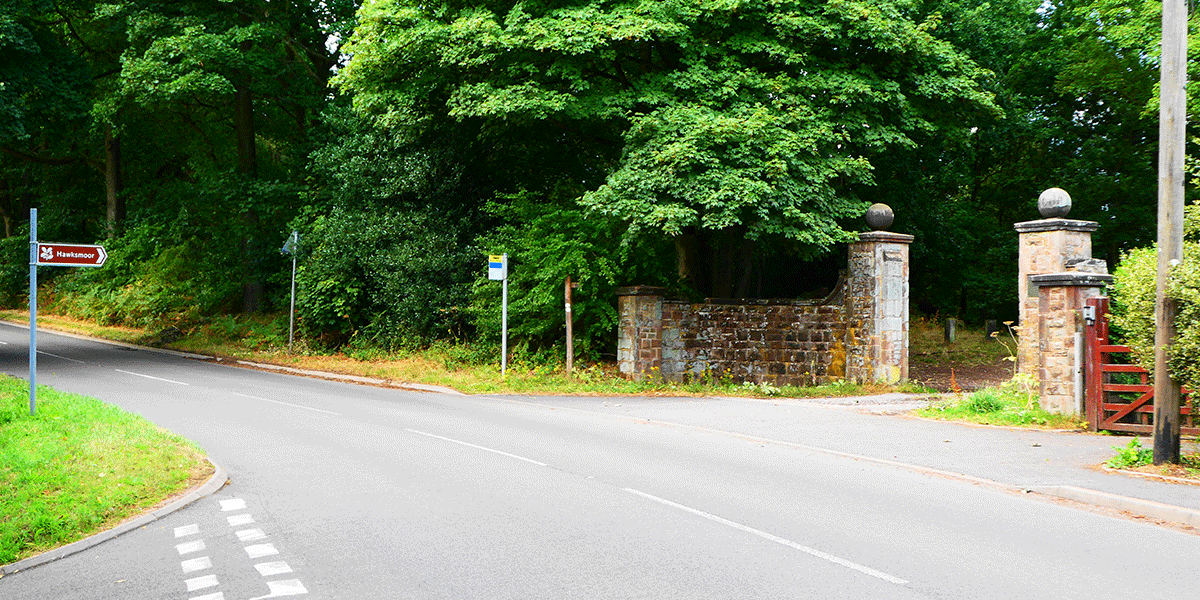
At the bottom of the hill ignore the footpath sign (for Dimmingsdale) pointing left ahead of you, and instead turn right up the lane past Old Furnace Cottage. You can take a minor short cut through the field gate after about 25 metres but my route continues on the lane up the hill, thus avoiding the possibility of cows in the field.
The lane can be a bit of a pull but it’s only for about 600 metres up to the top.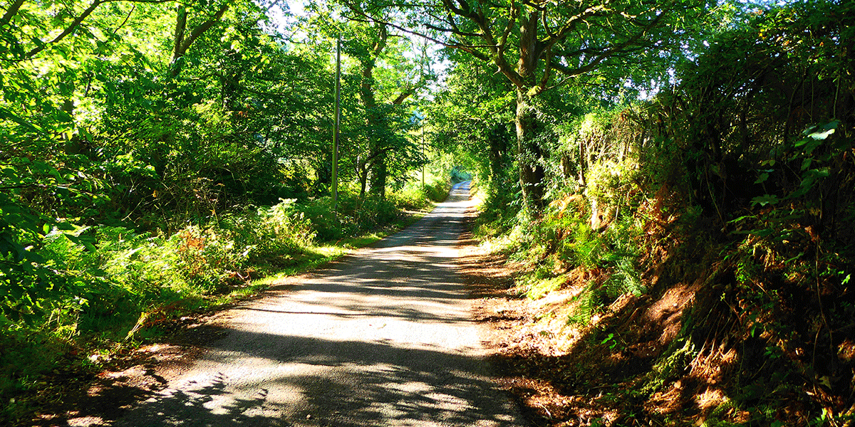
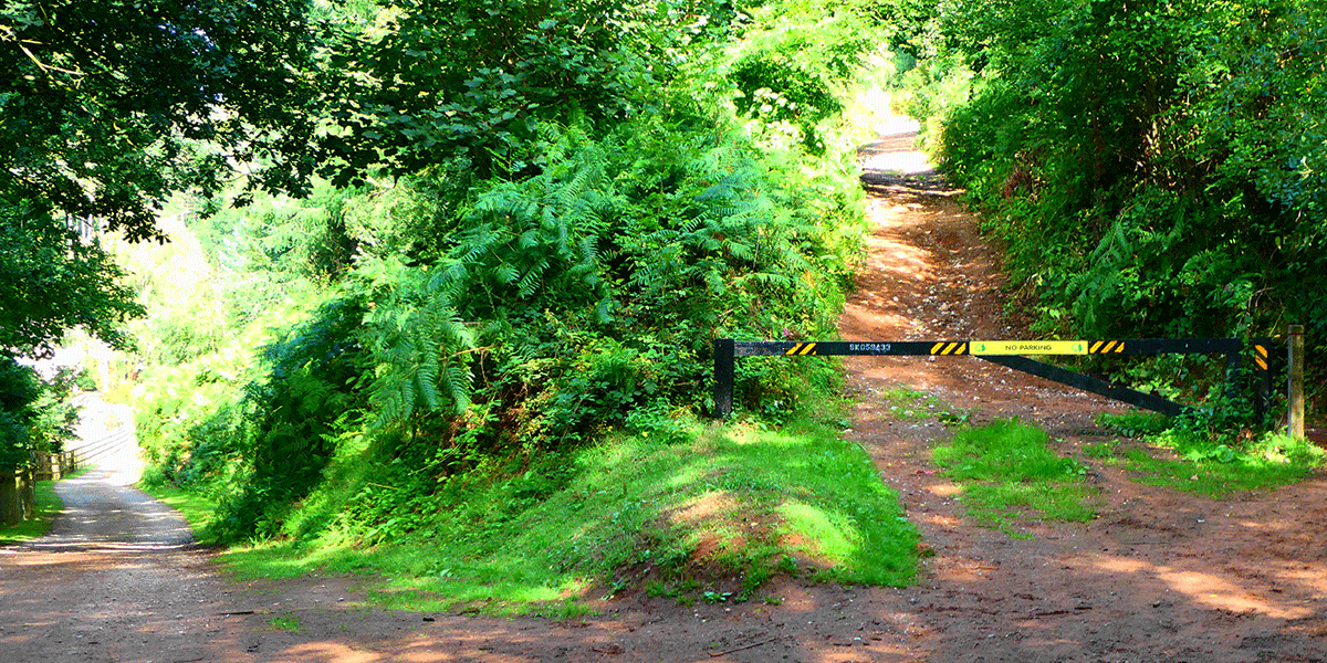
At the top of the hill you’ll see a muddy lay-by on your left and this is where you turn sharp left and slightly back on yourself onto a gravel track through the metal vehicular barrier.
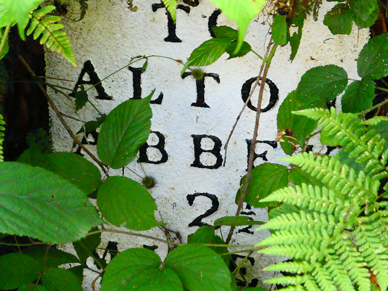
This is the top of the Dimmingsdale track and was originally one of the carriage ways to Alton Towers in its days as a stately home and not a theme park.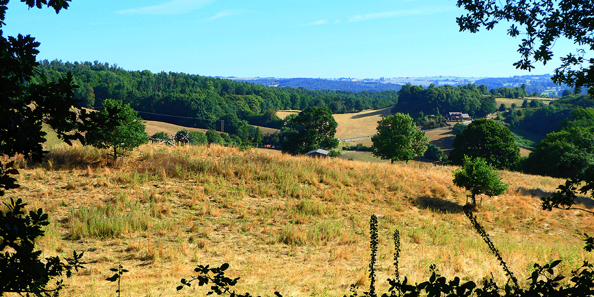
Look out for old mileage markers…
The route now couldn’t be any easier.
Just follow your nose as the track gradually descends the full length of Dimmingsdale, eventually passing a series of ponds and keeping the stream always on your left.
From time to time you’ll see tracks leading off to both the left and the right, one or two with little bridges across the stream.
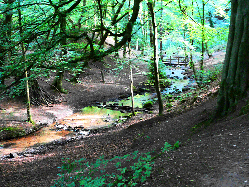
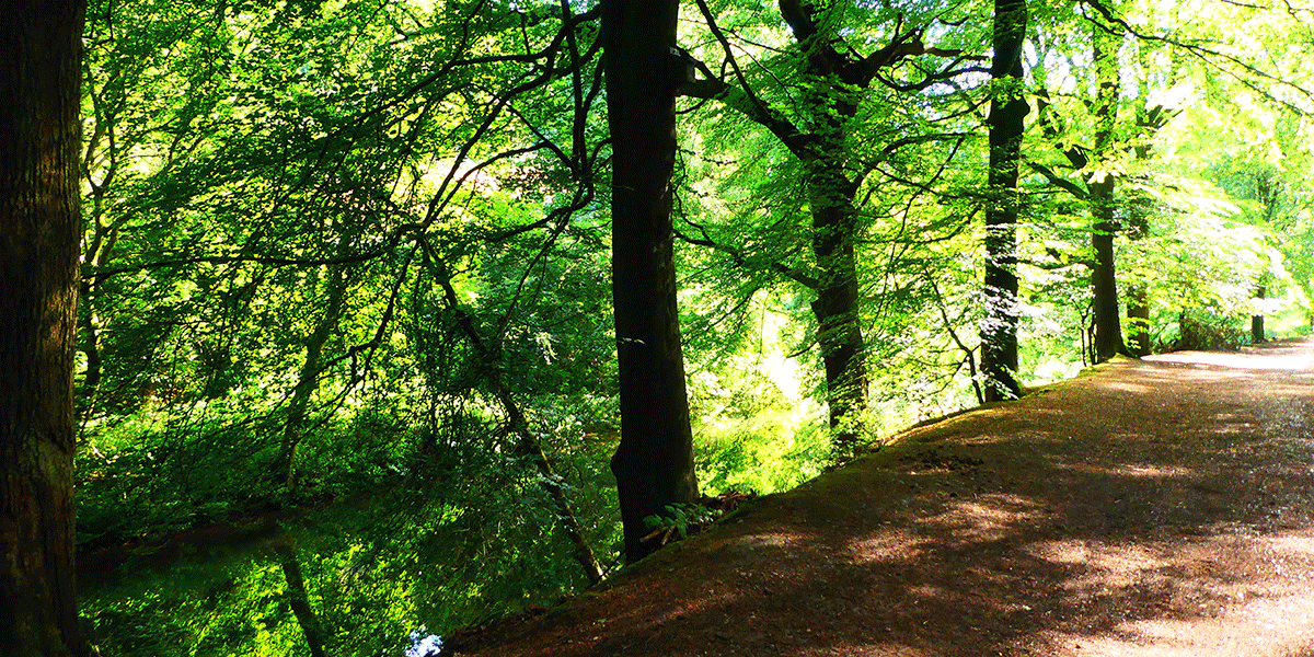
All of these can be lovely diversions if you’ve got time but for the purposes of this walk just keep on the main track where you are always in and out of the shade of mixed but mainly mature beech and oak woodland.
After approximately 2km you’ll notice a lovely modern house set in its own grounds down to your left by a pond. This is at the head of the largest of the ponds which is big enough to be classed as a small lake.
Again, keep on the main path and don’t be tempted by the track below that goes close to this house.
You’ll very soon bear right past a rhododendron hedge and post fence with the large pool always on your left. At the very end of this pond our route crosses over the dam wall and then turns left up another clear gravel track (that is the vehicular access to the modern house previously mentioned).
Pause to look back up the large pond towards the modern house and admire its glorious setting.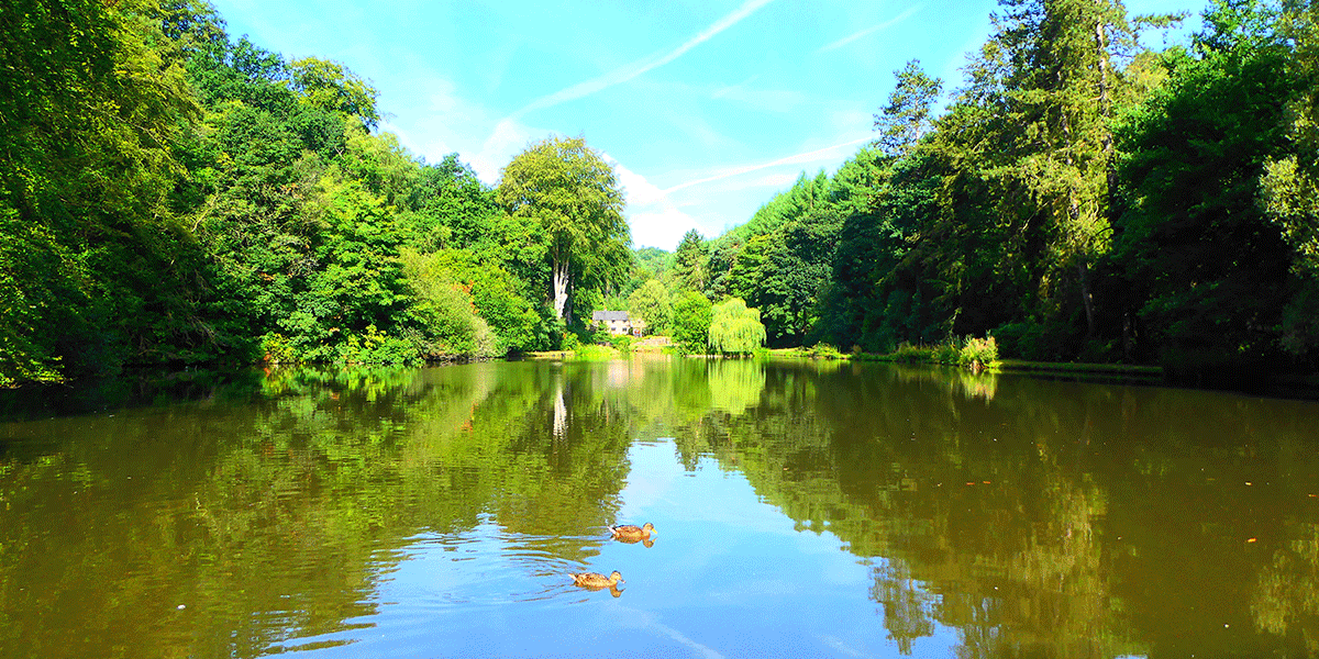
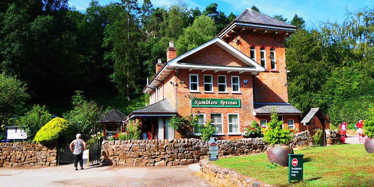
If however you want to pause in these delightful surroundings carry on another 150 metres to the renowned Ramblers Retreat Tea Rooms where you can get a full meal, snacks, ice creams or cakes, whichever takes your fancy. You have the option of sitting either inside this former Lodge for Alton Towers or in the little garden oasis.
Don’t worry if you take this extra diversion as the two tracks meet outside the entrance to the Ramblers Retreat. From there just make sure you take the right hand path back up the dale. This is also the alternative start for this walk with large Forestry Commission car park adjacent to the Ramblers Retreat.
On the route shown however, you will have just crossed the short dam wall and turned left onto the gravel track with the large pond now immediately on your left. Proceed along the track for about 25 metres where you will see another track heading uphill through a vehicle barrier to your right. This is your route.
Go past the barrier and up the track which is another former carriage way for Alton Towers.
This gradual ascent will bend right after a couple of hundred metres and you will then see a picnic bench straight ahead. Turn left here on the main track always gradually gaining height with gorgeous view back and to your left over Dimmingsdale.
(You may become aware of shouting and screaming which is coming from the rides in Alton Towers less than one mile away as the crow flies).
The woodland has now changed to birch and conifer.
This next section can get a bit muddy after rain, but it never lasts long, and you can nearly always get past on the edge without too much difficulty.
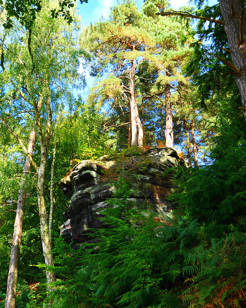
From time to time you may come across rock climbers practising on the red sandstone outcrops to your right or see the chalk marks from their various handholds.
If you look closely you will see pebbles embedded in the rocks. This is because this area was once part of an ancient sea bed.
At the top of the track it narrows and turns left but straight ahead is another narrow pathway up by the side of a very tiny stream (dry in summer).
Take this pathway and in about 100 metres you will see a drystone wall ahead and come to a cattle grid on a tarmac lane (to the left the lane leads to the former Ranger Station shown on OS maps as a Youth Hostel but this closed about 2 years ago and is now being converted into holiday lets). Where the pathway meets the tarmac lane turn right and cross this cattle grid keeping to the lane.
This is part of the Staffordshire Way long distance footpath. Follow the lane for about one mile to the end where you will come to a T junction on a minor rural road. To the left takes you back to Greendale, but we turn right and downhill for 300 metres or so.
On your left you will see another vehicle barrier and a signpost for Stoneydale (also part of the Staffordshire Way). Go up this gravel path.
Unfortunately there are a few ruts here where heavy rains occasionally wash away the very sandy soil and it can be a steepish pull towards the top. But from the bottom of Stoneydale it’s only about 800 metres back to the car park, so not much further to go now.
After about 500 metres you’ll reach the top where there is a junction of a couple of paths. Turn right and then bear immediately left and downhill on the gravel track. Within 50 metres or so an open area on your right appears (occasionally occupied by piles of logs), and you will see a house ahead. Head for this house but keep it to your left past the vehicular barrier by the main road.
Turn left on the main road and you will see the entrance pillars for the car park 150 metres on your right.
I hope you enjoy it as much as me!
This is my favourite walk near home and when done regularly is great stamina training for much more serious walking in the Lake District…