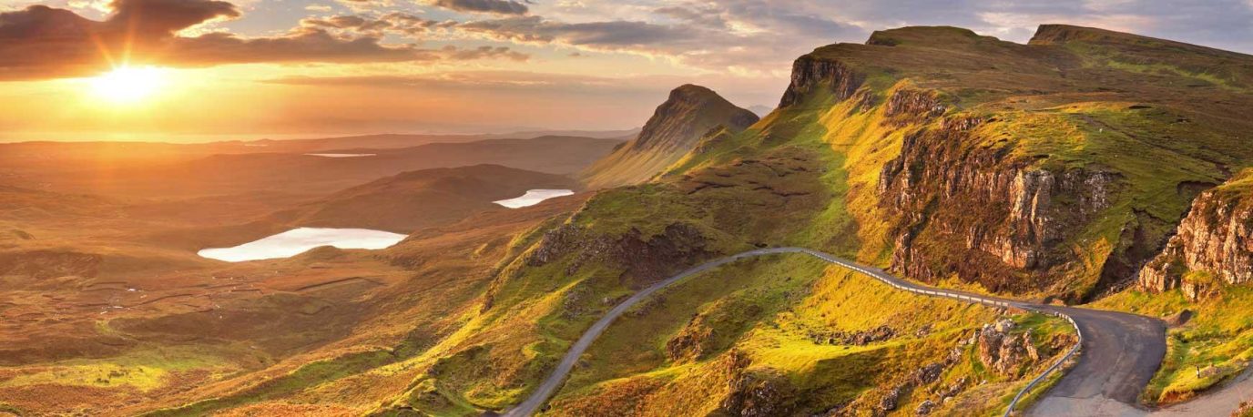
Find out what every symbol means on an OS Explorer map
This simple map reading guide explains every map symbol on an OS Explorer map (1: 25 000 scale), most popular for walking and cycling. Learn what each map symbol represents on the ground and how you can find points of interest, access land and public rights of way to make the most of your time outside.
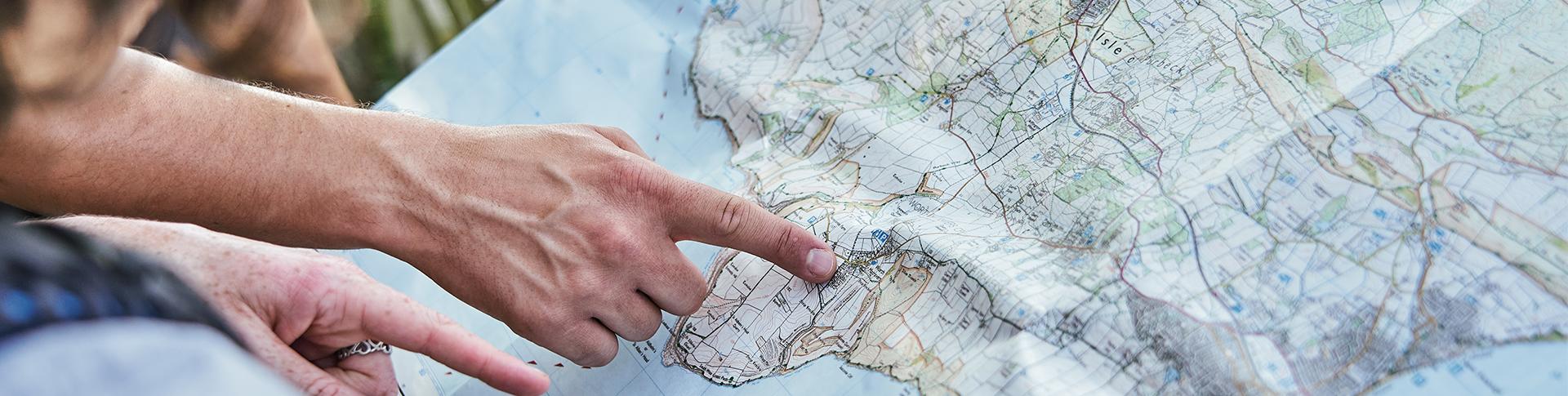
Have you ever studied a map and tried to work out what a symbol or line meant? Debated with friends and family over what it could represent? We’ve all been there!
Map symbols do more more than help you navigate. They help you find new and exciting places like castles, nature reserves and even pubs. They teach you about the history of the area and allow you to plot the best routes with ease. And last but not least, they show you where you can and can’t go, protecting both ourselves and nature. These map symbols can be seen on OS Explorer maps and of course, our very own OS Maps app.
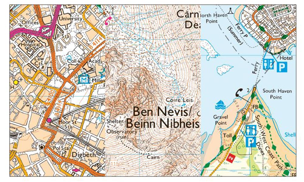
Map symbols OS Explorer Map
Public rights of way
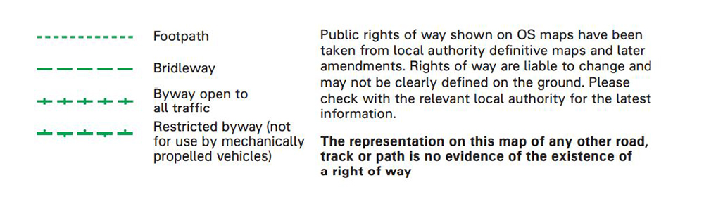
OS Map Symbols for public rights of way

Hiking for Beginners – A Complete Guide
Hiking for beginners, a complete guide to hiking safety, hiking fitness and the best UK Routes for beginners

How to Avoid Blisters When Hiking
How to avoid blisters when hiking! Learn how to ensure you don’t get a blister on your next hike

How to Build Outdoor Confidence: A Beginner’s Guide to Getting Outside
GROW YOUR HIKING CONFIDENCE! You don’t need to grow up hiking or arrive with all the gear and knowledge – follow our expert tips
Public access

OS Map Symbols for public access
Access land (England and Wales)
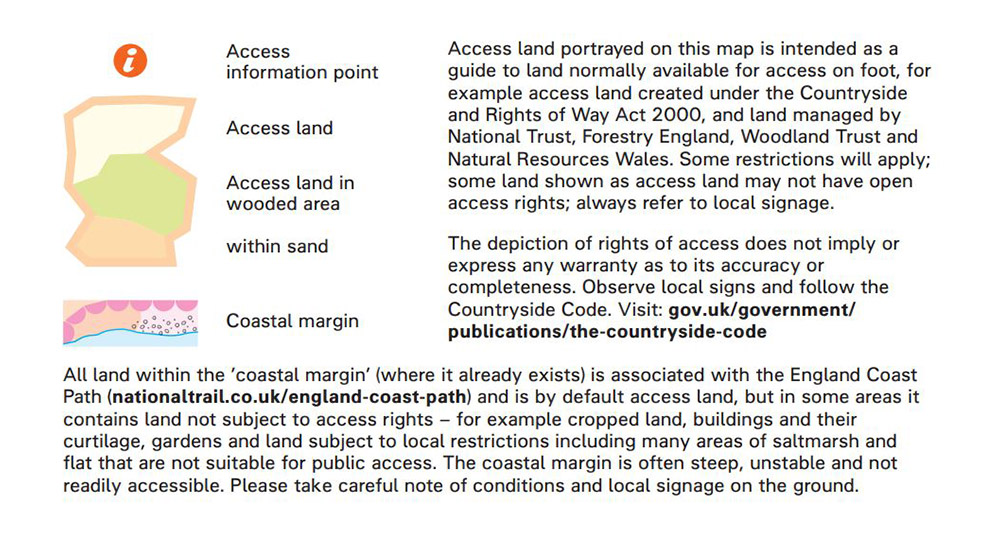
OS Map Symbols for access land (England and Wales)
Access land (Scotland)
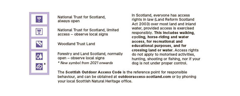
OS Map Symbols for access land (Scotland)
Roads
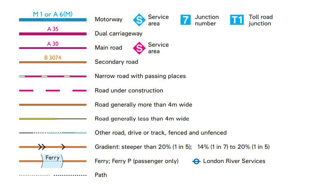
OS Map Symbols for roads
Railways
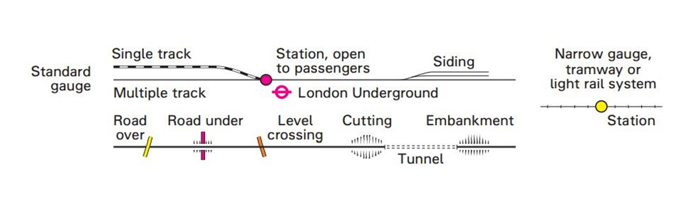
Map symbols for railways
General features
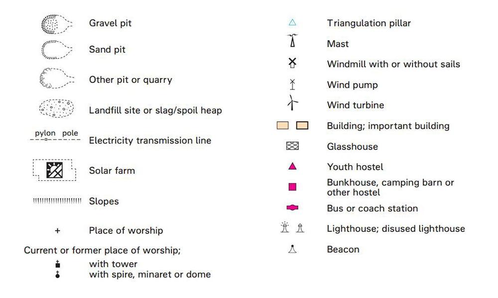
Map symbols for general features
Abbreviations
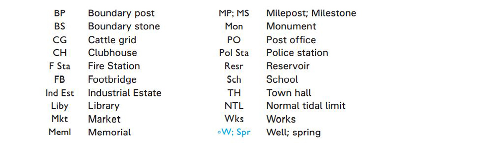
Map symbols for abbreviations
Archaeological and historical information
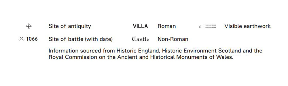
Map symbols for archaeological and historical information
Boundaries
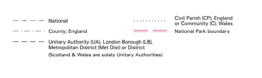
Map symbols for boundaries
Heights and natural features
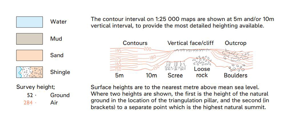
Map symbols for heights and natural features
Vegetation
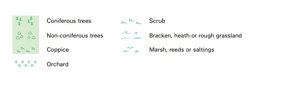
Map symbols for vegetation
Tourist and leisure information
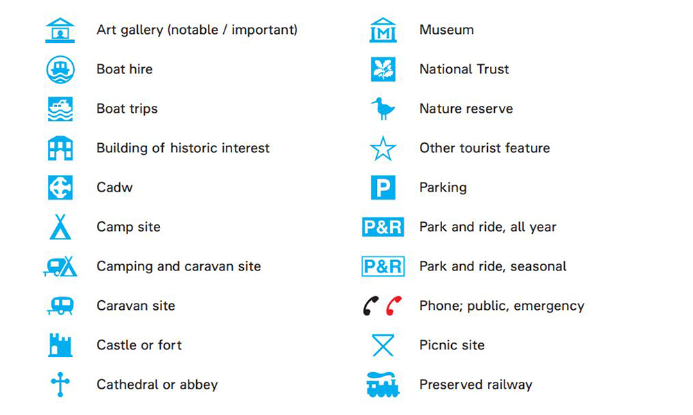
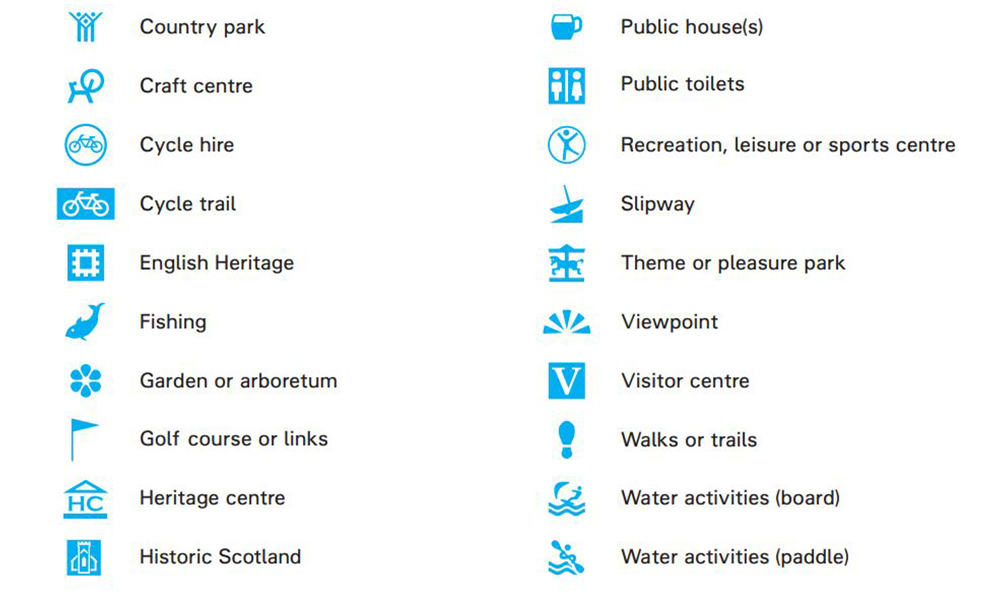
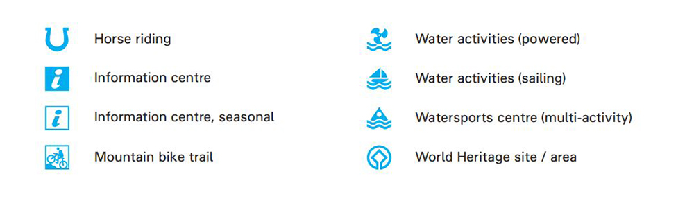
Map symbols for tourist and leisure information
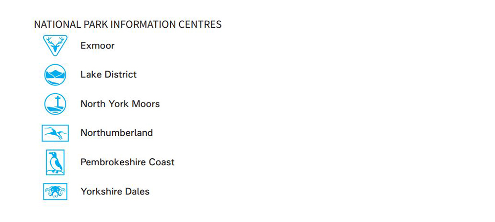
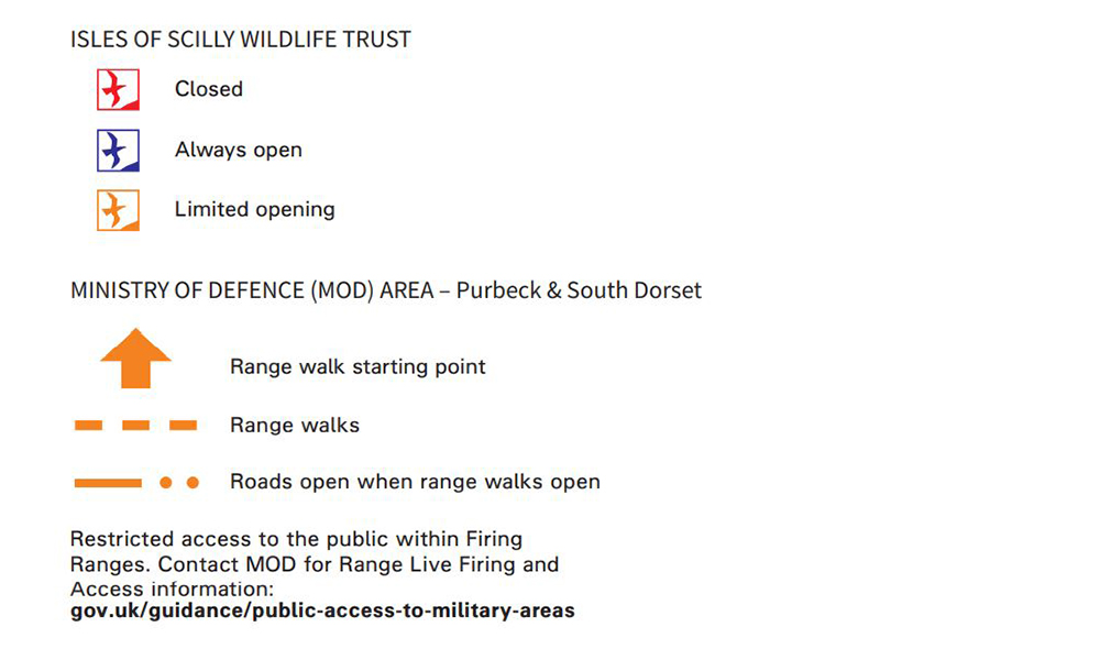
Unique map symbols

Access land (Scotland only)
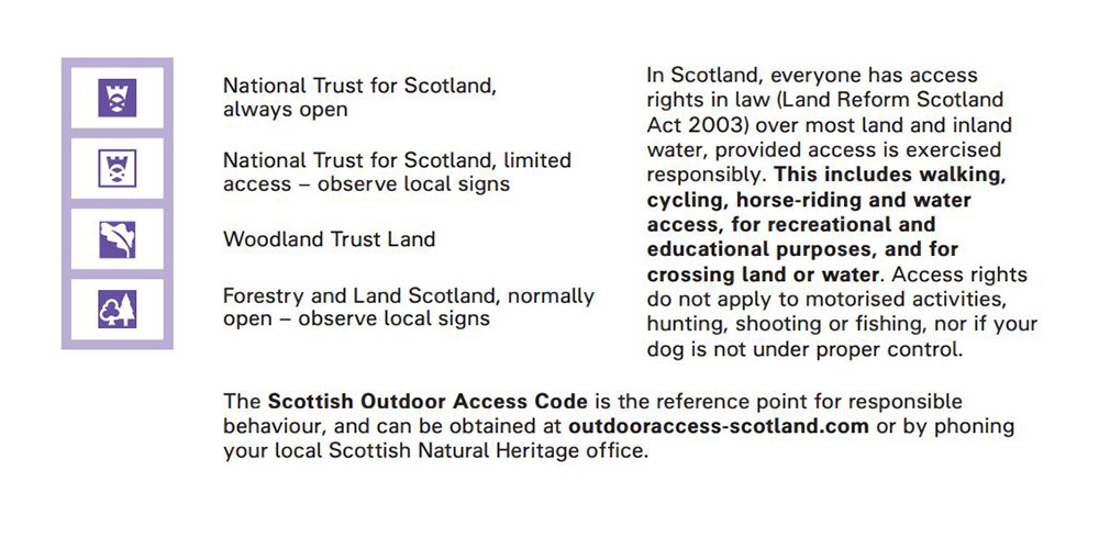
Map symbols for access land in Scotland
Now you know what every map symbol on an OS Explorer map means you can make the most of your next adventure, while impressing your family and friends! Please note, OS Landranger 1: 50 000 maps include some different symbols.
Take a look at our free Map Reading Guides to learn more about map reading.

EXPLORE THE
OS Shop
We are with you every step of the way. Shop our trusted walking and hiking maps and guidebooks so you can explore the outdoors with confidence.
Go to the shop