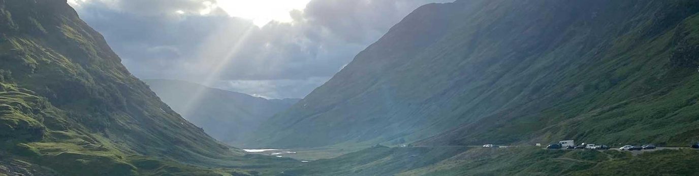
Sometimes you want a bit more than a squashed sandwich followed by jelly babies for dessert. I’ve searched for ten of the top restaurants from the legendary Michelin Guide, and paired them with some brilliant walks from OS Maps to help build up your appetite.
Have you got a walking or cycling route from your favourite restaurant? Why not add it as a public route in OS Maps, and it may get featured in a future article!
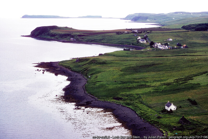
Loch Bay, Isle of Skye
Dining
Loch Bay is a tiny, six table restaurant specialising in local seafood. Nestling in the traditional fishing village of Stein, the building dates back to 1790.
Walking
‘Waternish lollipop’ was created by an OS Maps user, ascending out of the village to the hill peak Cnoc Breac, then following a ridge with views to the north.

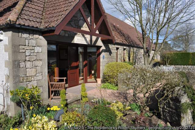
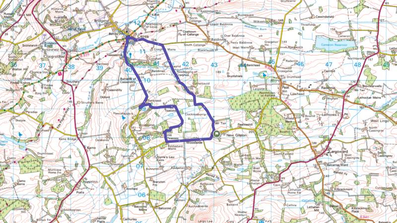
The Peat Inn, Fife
Dining
The Peat Inn is a 18th century coaching in which now offers fine dining and rooms. The food is described as ‘Modern Scottish’, using local seasonal ingredients.
Walking
‘New Gliston Loop’ was added by Walk Fife, and is a pleasant 13km walk from the nearby village of New Gliston. The walk could be extended to end at The Peat Inn by following the single track road.
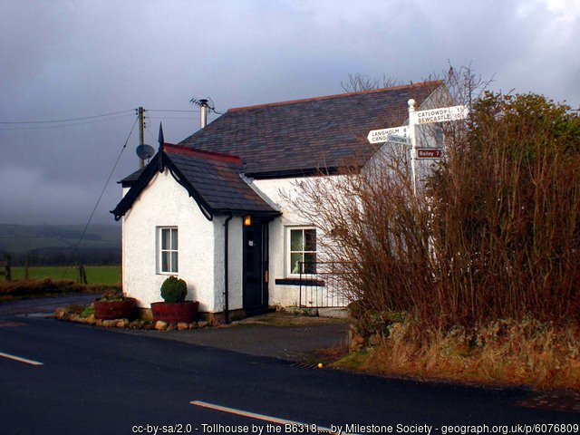
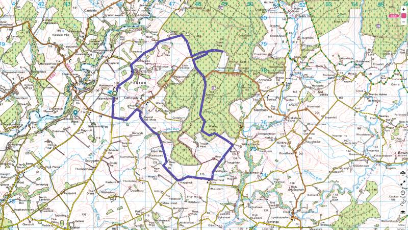
Pentonbridge Inn, Cumbria
Dining
Using many ingredients grown in the walled gardens of the nearby Netherby Hall, the Pentonbridge Inn as another old coaching inn now offering fine dining and rooms.
Walking
‘Warwicksland Circle’ was added by an OS Maps user, and is a longer 20km route using quiet back roads and forest paths. Set out early, and you could reach the appropriately named Wakey Hill in time for morning coffee.
Origins of the Michelin Guides
The Michelin Guides began in 1900 as a free booklet by the French tire-makers André and Édouard Michelin. They created it to encourage driving in France, thereby increasing tire sales. The guide evolved into a paid publication by 1920 with anonymous restaurant inspectors rating their dining experiences, with the best getting the coveted Michelin Star.
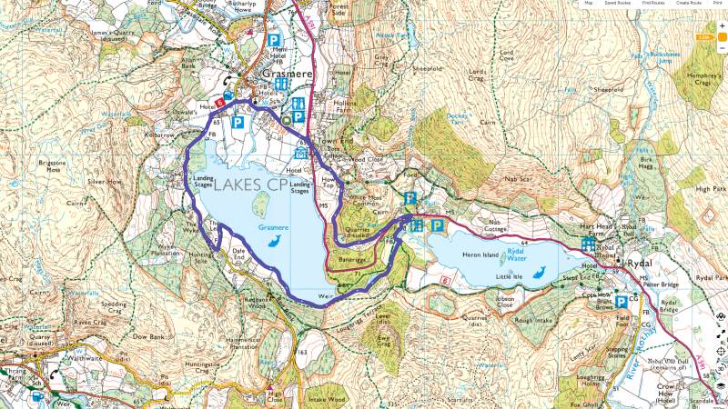
Forest Side, Lake District
Dining
A dramatic slate stone hotel and restaurant, the Forest Side offers ‘Modern British’ dining. Sitting in the heart of the Lake District National Park, there are hundreds of walking, cycling and padding routes nearby.

by Nigel Corby
Walking
‘Lake District: Grasmere’ is taken from the OS Short Walks Made Easy range of guidebooks. It’s a largely level 6km walk around Grasmere, just a short distance from Forest Side.
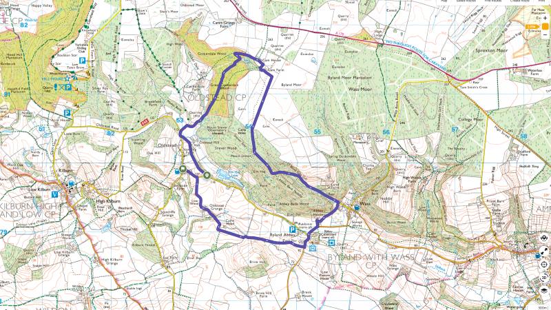
The Black Swan, North York Moors
Dining
Owned and run by the Banks Family, who have lived and farmed around Oldstead, North York Moors National Park for many generations, The Black Swan is a one-star restaurant and inn featuring innovative takes on British classics.
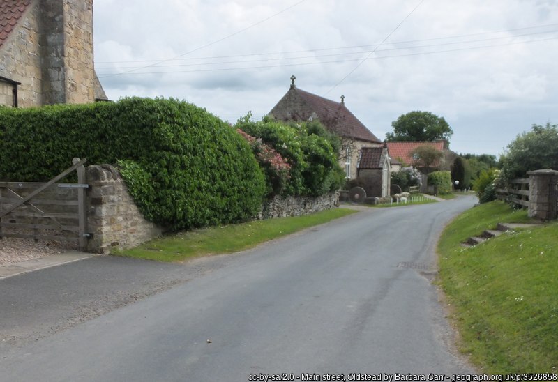
Walking
‘Black Swan Oldstead Walk’ is from a user of OS Maps, and takes in both the southern escarpment of the Hambleton hills with scenic views and also a number of interesting features of historical and archaeological interest..
Sosban & The Old Butchers, Anglesey
Dining
In the heart of Menai Bridge, Sosban & The Old Butchers is an rustic room with Welsh slate walls, sheepskin-covered chairs and hand-painted animal tiles linking back to its origins as a butcher’s shop days. Expect a variety of food based on locally-sourced ingredients.
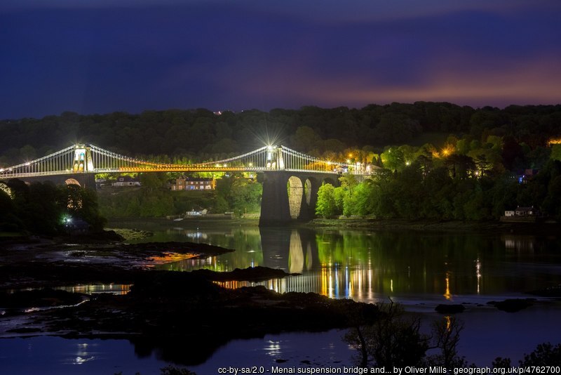
by Oliver Mills
Walking
‘Menai 10km’ is another route created by the public. Looping through the town and then across the Menai Suspension Bridge before heading out to a viewpoint overlooking the Menai Straight, it’s a mostly on-road route with some interesting possible diversions to other rights of way.

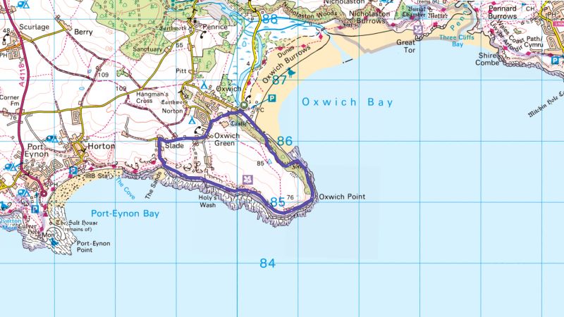
The Beach House, Gower
Dining
A former coal house situated right on the beach in Gower, The Beach House uses fresh produce from across Wales to create a highly seasonal menu. They also host regular guest chefs.
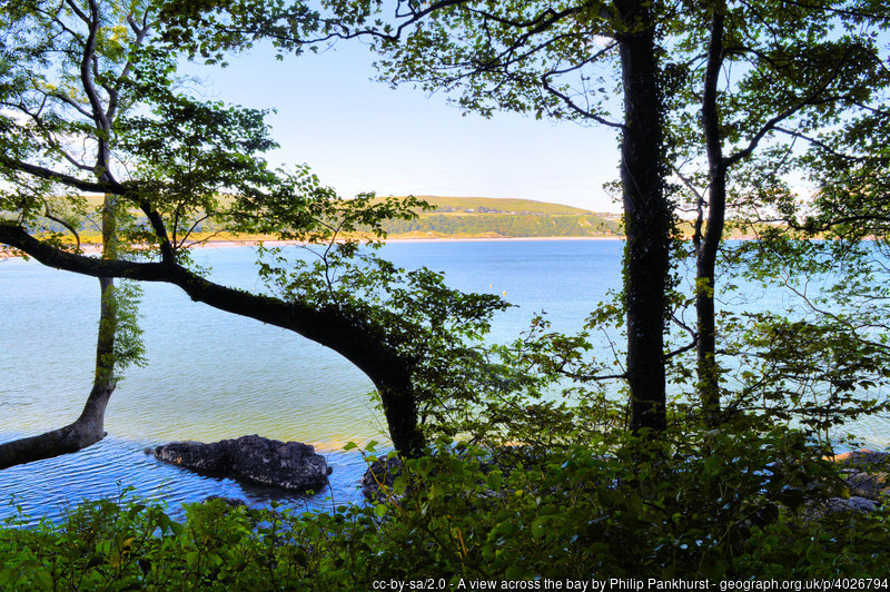
Walking
‘Woodland and Family wars at Oxwich Point’ created by AA Walks takes you out on to one of the impressive headlands of the Welsh coast, using part of the Wales Coast Path. The route name comes from a famous local feud over the salvage rights to a French shipwreck.
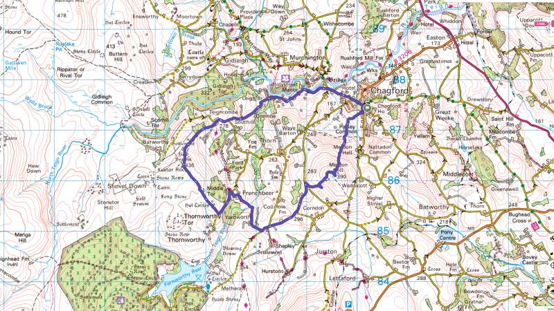
Gidleigh Park, Dartmoor
Dining
A classic country house hotel in Dartmoor National Park, Gidleigh Park is a Tudor-style building set in 107 acres of landscaped grounds, including the River Teign.
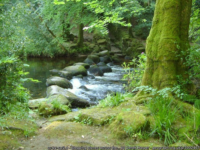
Walking
‘Chagford, Devon’ is a nearby route created by Country Walking Magazine and featured in OS Maps. There’s a mixture of paths, tracks and quiet lanes plus open moorland, with a gentle climb up to Meldon Hill (390m).
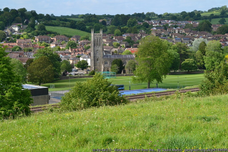
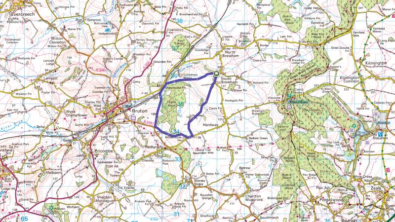
Osip, Somerset
Dining
The Osip is based in a 300 year old country inn in Bruton, Somerset. With low wooden beams and a rustic feel, it has a constantly changing farm-to-table menu.
Walking
‘South Brewham & Cogley Wood’, created by an OS Maps users, explorer local farmlands, and skirts the edge of Cogley Wood. The route starts from South Brewham, a couple of km from Bruton. It’s noted as being muddy, so a change of shoes may be required!

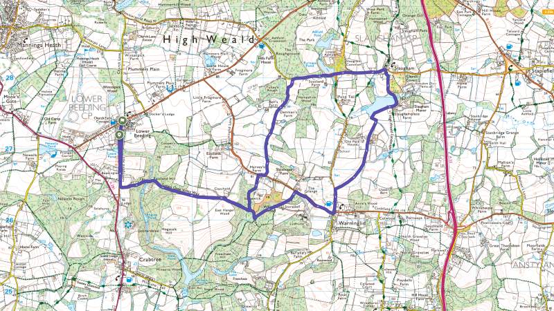
Restaurant Interlude, West Sussex
Dining
Restaurant Interlude is based in Leonardslee Lakes and Gardens, a spectacular restored gardens called “The finest woodland gardens in England” and featuring a mob of wallabies. The food uses many ingredients grown in the gardens.
Walking
‘Long route to the half moon’ start and ends at Lower Beeding, but goes via Slaughham, creating an opportunity for a quick break there too. At 13.7km, it’s mostly level goingcreated by an OS Maps users, explorer local farmlands, and skirts the edge of Cogley Wood. The route starts from South Brewham, a couple of km from Bruton. It’s noted as being muddy, so a change of shoes may be required!
Have you got a favourite restaurant? Why not search for nearby routes using OS Maps to create an experience that enhances both the food and the outdoors?
If you manage a country pub, hotel or restaurant, you can add new walking and cycling routes to OS Maps and share them with your customers by making them public routes.