Outstanding Circular Walks in Cornwall Video Series
Welcome to the next installment in a brand-new series with outdoor enthusiast and storyteller Dan Smedley aka @bimblingbooksbeer. Dan is exploring some of the most scenic and characterful routes from the Outstanding Circular Walks in Cornwall Pathfinder Guidebook.

EXPLORE THE
OS Shop
We are with you every step of the way. Shop our trusted walking and hiking maps and guidebooks so you can explore the outdoors with confidence.
Go to the shopCornish Maps & Guidebooks
Padstow, Stepper Point and Trevone
Pathfinder Walk 18
Distance: 8.5 miles
Start and finish: Trevone Bay
Why walk it: Wild cliffs, the Camel Estuary, the Pepper Pot, quiet farmland, Padstow charm
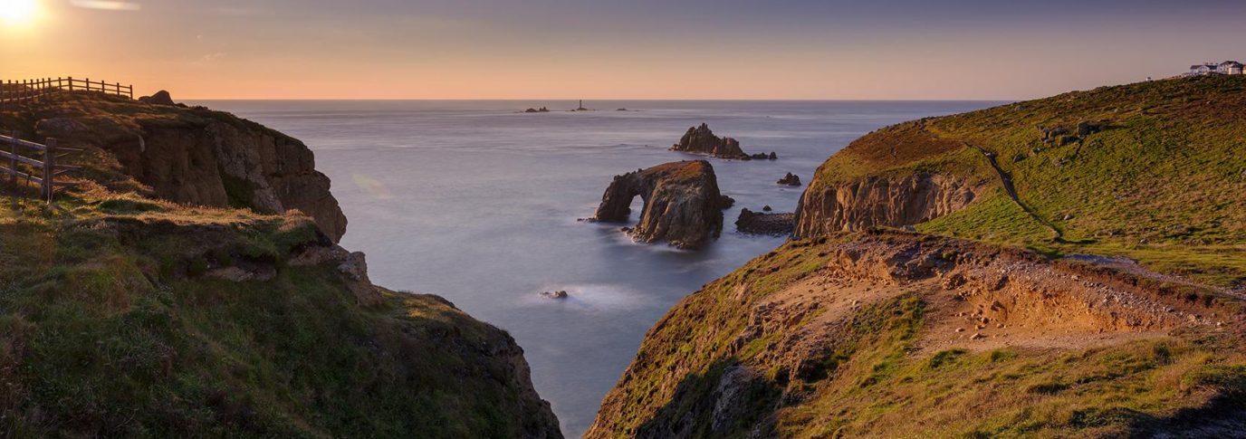
A Walk of Sheer Coastal Grandeur
Not every route needs a deep emotional story behind it. Sometimes the landscape itself is the reason you set out. This walk is exactly that. It is a route built on scale. The Camel Estuary opens up like a living map. The cliffs between Trevone and Stepper Point are dramatic and rugged, and the entire headland feels oversized, with big skies, rolling seas, and huge views in every direction.
When I was younger, Padstow felt like it belonged almost entirely to Rick Stein. It has changed over the years, and this walk shows a much quieter, wilder side of the area, far from summer crowds and busy streets.
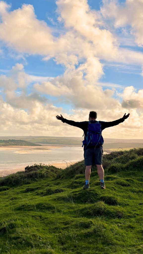
Beginning at Trevone
Trevone Bay is one of the best starting points on the North Cornwall coast. It is calm, open, and sea-level, and the parking is surprisingly reasonable compared to central Padstow. The view back towards Mother Ivey’s Bay is beautiful before you even begin.
Almost straight away you reach the Roundhole, a collapsed sea cave shaped by years of powerful Atlantic swell. It is fascinating to see, but it comes with an important message. Do not attempt to climb down into it. My friends in the Coastguard have had to rescue far too many people who tried. Enjoy it from above and respect the danger.
Climbing to the Clifftops
Once you rise out of Trevone, the path becomes a gentle sequence of rolling hills, grassy fields, and old drystone walls. Please use the stiles where provided. Some of the walls are beginning to collapse because people have climbed over them rather than following the footpath.
The cliffs here are enormous. They feel fractured and fragile, yet somehow still hold firm against the weather. There is a real sense of geological power along this part of the coast.
The bird life is particularly strong on this section. You are likely to see fulmars gliding across the waves, kittiwakes riding the air currents above you, shags perched on rocky ledges, and occasionally a peregrine falcon speeding past with incredible precision.

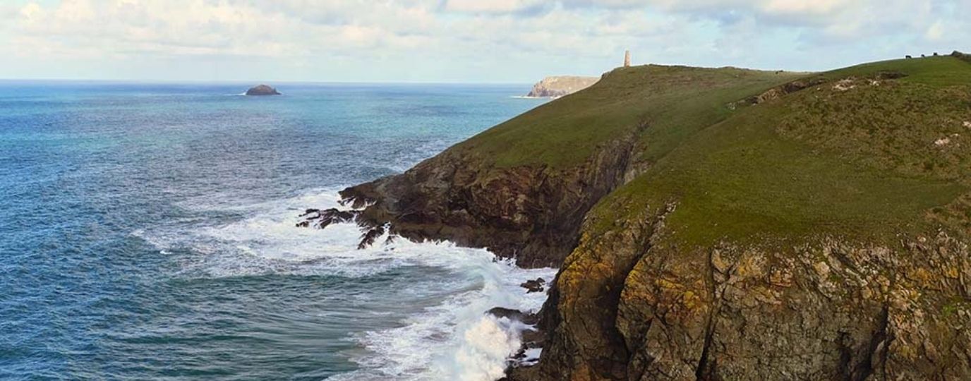
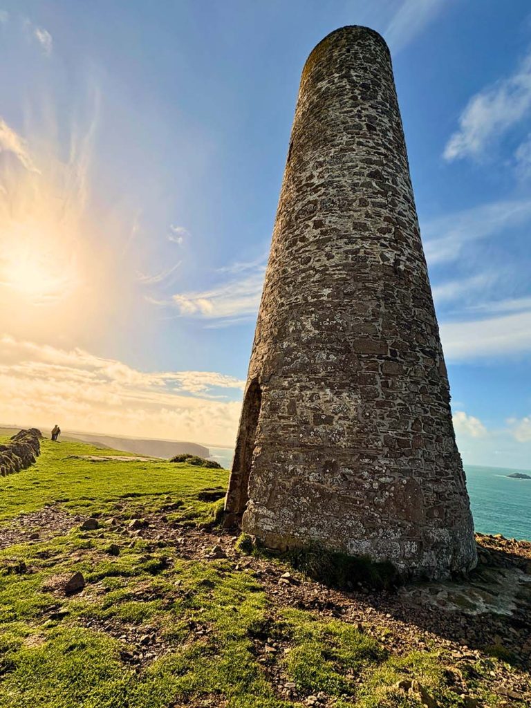
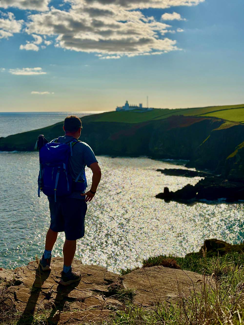
Stepper Point and the Pepper Pot
Eventually the Pepper Pot comes into view. This stone navigation tower has guided ships for many generations. It leans slightly, is weather-beaten, and looks as though it has seen every story the coastline has ever suffered.
From Stepper Point you can look directly over the Doom Bar sandbank, which has caused many shipwrecks over the years. It is striking to stand in such a peaceful spot while knowing how dangerous the entrance to the estuary once was.
On clear days you can see across to The Rumps and further along the North Cornwall coastline, with Tintagel faintly visible in the distance.
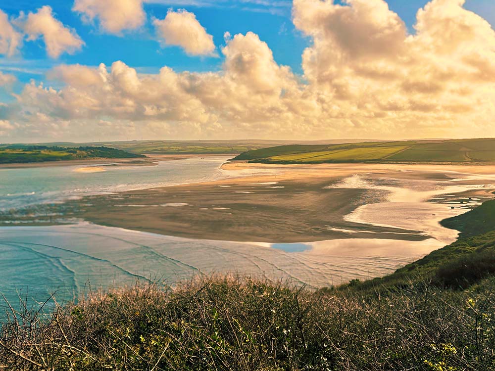
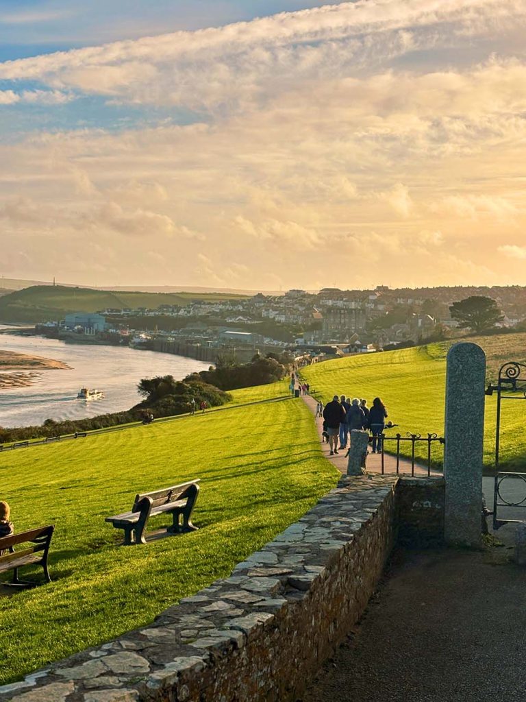
Dropping into the Camel Estuary
From Stepper Point the walk shifts in tone. The cliffs soften, the wind eases, and the path becomes calm, steady walking along the estuary. Low tide reveals wide sand bars and large expanses of sand flats with pale golden colours.

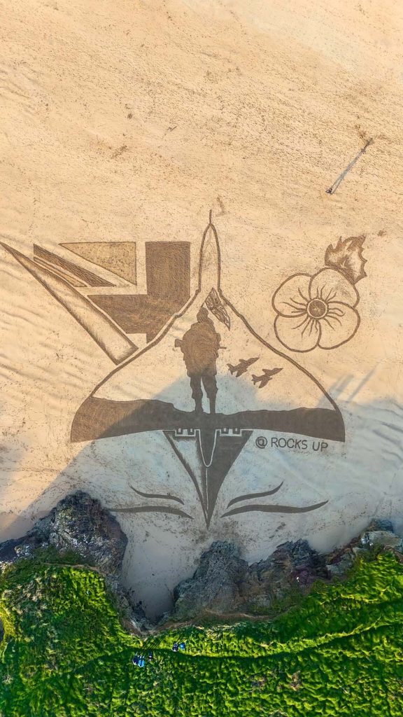
I have walked this route three times now and have never seen the estuary at high tide. At low tide it is incredible. On my most recent visit I came across a large piece of sand art created by Rocks Up for Remembrance. It was a powerful moment, a reminder of what others sacrificed so we can enjoy peaceful days like this. It put a lot of this year into perspective.
Into Padstow
Padstow is a lovely break in the walk, whether you want food or just a rest. The fish and chips are always good, Cough’s Bakery makes excellent pasties, and the Padstow Taproom is my favourite place for a drink and a ploughman’s while checking the Pathfinder guide. Padstow Bookseller is a brilliant independent bookshop and always worth a visit if reading is your thing.
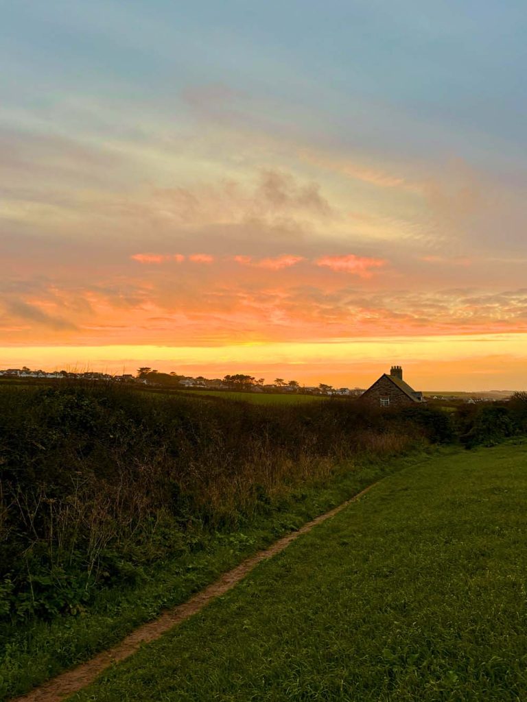
Returning to Trevone
The inland return to Trevone is shorter and quieter than the outward coast path. It follows clear signposts across farmland and eventually brings you back towards Trevone Bay. If you time it for late afternoon, especially in autumn, you may catch one of those sunsets that seem to set the entire sky on fire. It is a beautiful way to end the walk.
Why This Walk Stands Out
It is a route of dramatic cliffs, calm estuary paths, and sweeping views. The Pepper Pot is iconic. The bird life makes the cliffs feel alive. Padstow is the perfect midpoint stop. Trevone at sunset is unforgettable. It is a walk that gives you space, in the best possible way.
The OS Pathfinder Note
The Pathfinder guide made the inland sections very easy to follow and kept the farmland crossings simple. It is the kind of route where having a physical guide with you genuinely helps.
Join me soon for some Bimbling, Books and Beer

By Dan Smedley
Bimbling, Books and Beers
Raw stories & quiet moments for better mental health