Outstanding Circular Walks in Cornwall Video Series
Welcome to the next installment in a brand-new series with outdoor enthusiast and storyteller Dan Smedley aka @bimblingbooksbeer. Dan is exploring some of the most scenic and characterful routes from the Outstanding Circular Walks in Cornwall Pathfinder Guidebook.

EXPLORE THE
OS Shop
We are with you every step of the way. Shop our trusted walking and hiking maps and guidebooks so you can explore the outdoors with confidence.
Go to the shopCornish Maps & Guidebooks
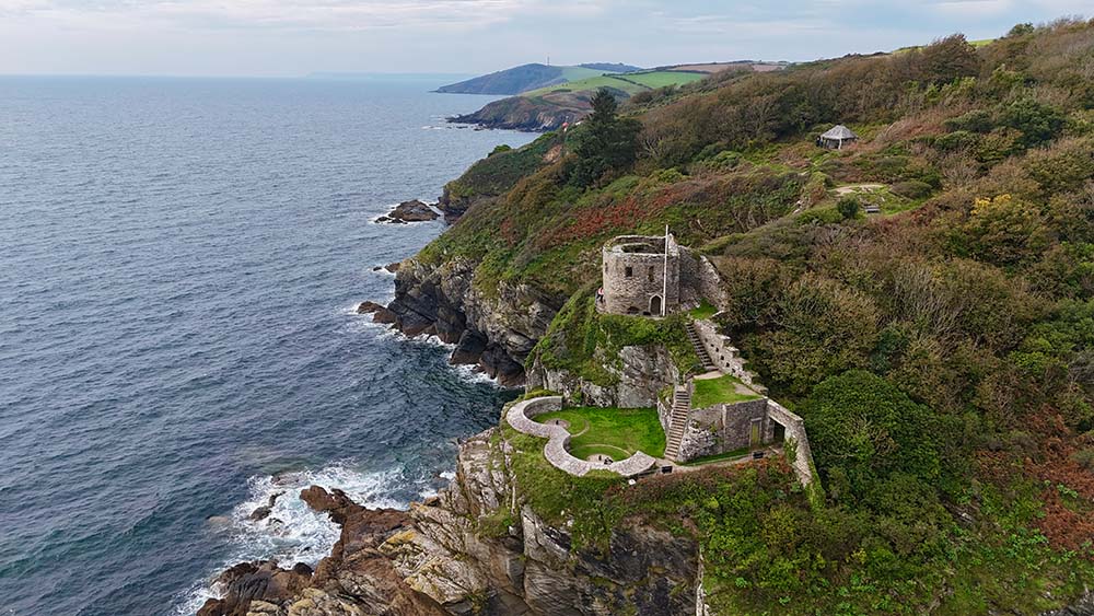
Polkerris, Readymoney Cove & Gribbin Head Circular Walk
Distance: 6.5 miles
Time: 3–3.5 hrs
Difficulty: Moderate
Start/End: Readymoney Cove car park, Cornwall
Some walks change you. For me, the circular route from Readymoney Cove to Polkerris via Gribbin Head did exactly that. It was the walk that birthed Bimbling Books & Beer and, in many ways, helped me find my footing again.
When I first walked it a couple of years ago, my head wasn’t in the best place. I’d had a huge mental-health breakdown and was trying to piece myself back together, one small step at a time. I’d always loved maps and walking, but the Cornwall Pathfinder Guidebook made it feel possible again, easy, enjoyable, and simple to follow when everything else felt complicated. Having the route clearly marked and the notes there in my hand took away the guesswork, which meant I could just breathe, look up, and enjoy being outside.
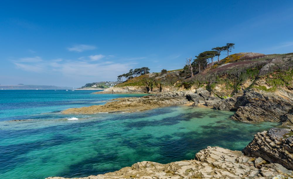
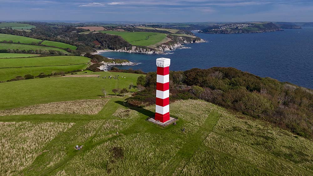
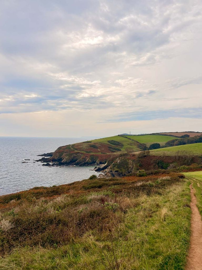
The path leaves the little car park at Readymoney Cove and climbs gently through the trees before opening into those wide Cornish views. Behind you sits Fowey harbour; ahead, the red-and-white daymark tower of Gribbin Head. It’s one of those stretches that constantly changes, woodland, open coast, rolling fields, and every turn gives you a new reason to stop.
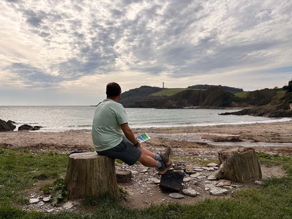
Down near Coombe Farm, there’s a fallen log that’s become a bit of a marker for me. Last year I sat there with the Pathfinder Guide open on my knee, checking the map and half-wondering what I was doing with life. I stayed longer than I meant to, just listening to the waves and the wind in the trees. It’s funny looking back, that pause changed everything. The climb that came next was the real turning point.
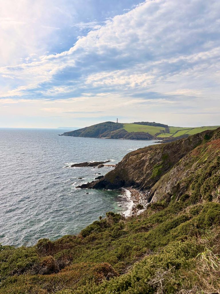
The hill up to Gribbin Head is still as steep as I remember, but it’s one of those climbs that rewards you twice, once when you reach the top, and again when you look back. The tower itself, painted in those bold red-and-white stripes, was built as a daymark for sailors. It’s one of those perfect Cornish details, practical and beautiful at the same time. From the top you can see the sweep of St Austell Bay, the patchwork of fields behind, and if you’re lucky, the shimmer of the sea all the way to Mevagissey. It’s a view that gives you perspective in every sense of the word.
From Gribbin Head, the path drifts down through open meadows towards Polkerris. The sound of the waves gets louder, the smell of salt and gorse fills the air, and before long you spot the harbour wall and The Rashleigh Inn waiting at the edge of the sand.
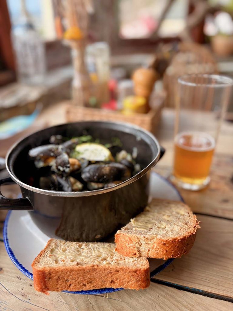
Last year, after sitting at that log for too long, I missed the lunch serving here completely. This year, there was no chance of that happening. I made sure to time it perfectly, and I’m glad I did, because I had the freshest mussels I’ve ever eaten in my life. The food and atmosphere in there are something else. It’s traditional, welcoming, and in every way the definition of a proper Cornish pub. There’s a reason it’s my favourite.
I remember arriving here that first time, windswept, exhausted, completely content. I ordered a pint and sat by the window with The Thursday Murder Club and the Pathfinder Guide beside it. Between the two books, one fiction, one navigation, I realised how much reading and walking had both become part of my recovery. That moment unknowingly birthed two pillars of what would later become Bimbling Books & Beer: the books and the beer.
The walking pillar had already been born on the climb itself, and the reflection one came quietly afterwards, the understanding that movement, space and sea air were medicine. Each of the four parts of the brand began right here, on this single loop between Readymoney Cove and Polkerris.
Leaving Polkerris, the path rises again, gently this time, cutting inland across the fields and joining a stretch of the Saint’s Way. It’s a quieter end to the walk, winding through meadows and farmland before easing back down towards Readymoney Cove. It’s the perfect chance to let everything settle, the food, the views, the thoughts, and just walk in peace.
Somewhere along that stretch last year, I started toying with names for what I was creating, Bumbling Books & Beer or Bimbling Books & Beer. “Bimbling” just felt right. Slower, softer, a word that carried the same calm I was chasing. It stuck, and from there the rest began to take shape.
Coming back to walk it again this year, but this time representing Ordnance Survey, felt surreal, a full-circle moment. I wasn’t walking to escape anything; I was walking to celebrate how far I’d come. The path was familiar but different. I noticed details I’d missed before, sunlight flickering through the trees, kestrels hovering over the cliffs, the quiet rhythm of boots on dry earth.

I still carried the same Pathfinder Guide, pages creased from use, and it reminded me how good it feels to hold a real map rather than rely on a phone, although I can highly recommend the OS Maps app for quick route checks on the go.
There’s something grounding about turning real pages outdoors, it keeps you present in a way that screens never do.
I finished the walk back where it began, the sound of the sea at Readymoney Cove, the same view that once helped me start again. This time, though, I stood there with a quiet sense of gratitude.
If you’d told me back then that I’d one day be walking this route for Ordnance Survey, I’d never have believed you. But that’s the beauty of getting outside. You never know where one small decision, one good walk, might lead.
Sometimes you don’t need to find new paths.
You just need to walk the old ones again, with different eyes.
Find out more about Dan Smedley, Bimbling, Books and Beer