Circular Walks on the Carmarthenshire Coast
The Carmarthenshire section of the Wales Coast Path seems short on a map, but is remarkably convoluted as it works its way far inland around a succession of estuaries, taking the distance to 68 miles / 109km. The tidal estuaries of the Taf, Tywi, Gwendraeth and Llwchwr push walkers inland in search of bridges, though a summer ferry service across the mouth of the Tywi offers a handy short-cut.
From time to time there are extensive sandy beaches, such as those at Pendine, Llansteffan, Pembrey and Llanelli. Then there are long, sinuous, tidal rivers that lead inland to St Clears, Carmarthen and Kidwelly in order to cross bridges, before long walks lead back to the open coast again. Public transport is good throughout this area, including regular buses and trains.
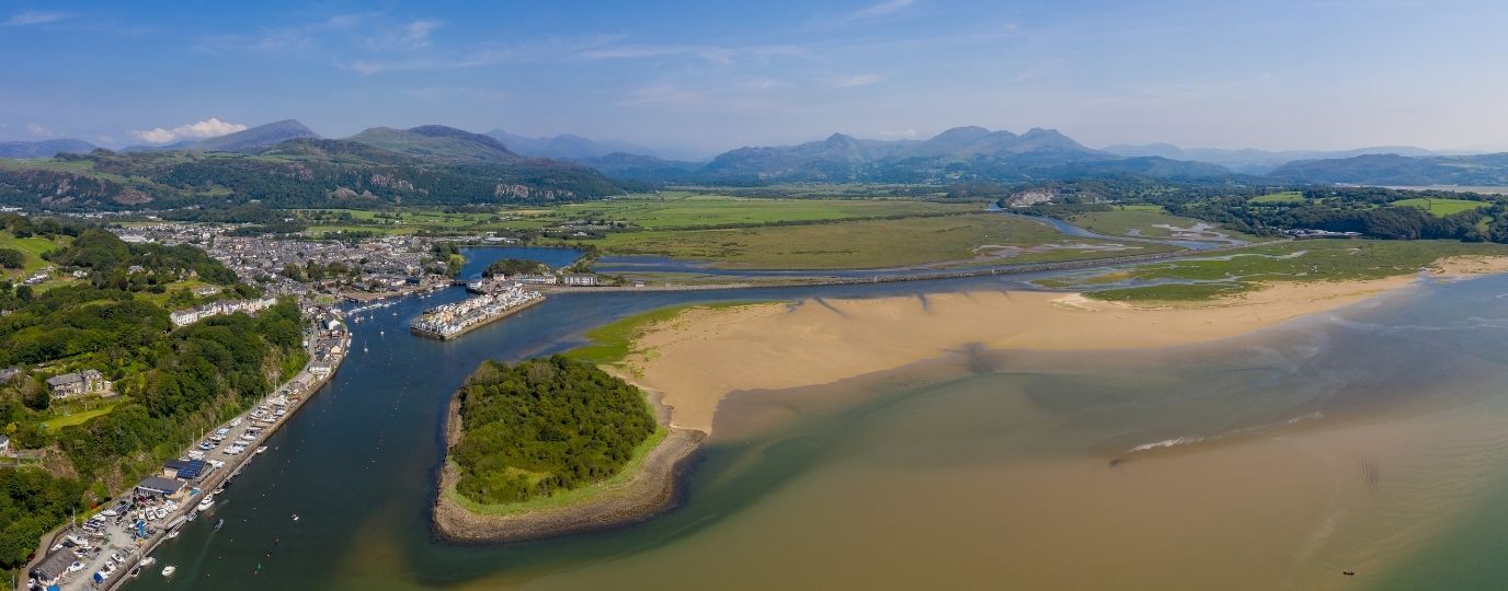
The first village on the Carmarthenshire coast is Pendine, where world land speed records were set on a remarkable sandy beach. Laugharne is dominated by a castle beside the Taf estaury, and has plenty of associations with the poet Dylan Thomas. St Clears preserves a fine motte and bailey close to where the Wales Coast Path crosses a bridge. Llansteffan features a splendid castle overlooking the estuary of the Tywi.
Carmarthen is the oldest town in Wales and its streets are well worth exploring. However, if you take the ferry from Llansteffan to Ferryside, then you won’t visit the town at all. Kidwelly boasts yet another astounding castle, along with plenty of industrial heritage. Pembrey offers a huge sandy beach and a popular country park.
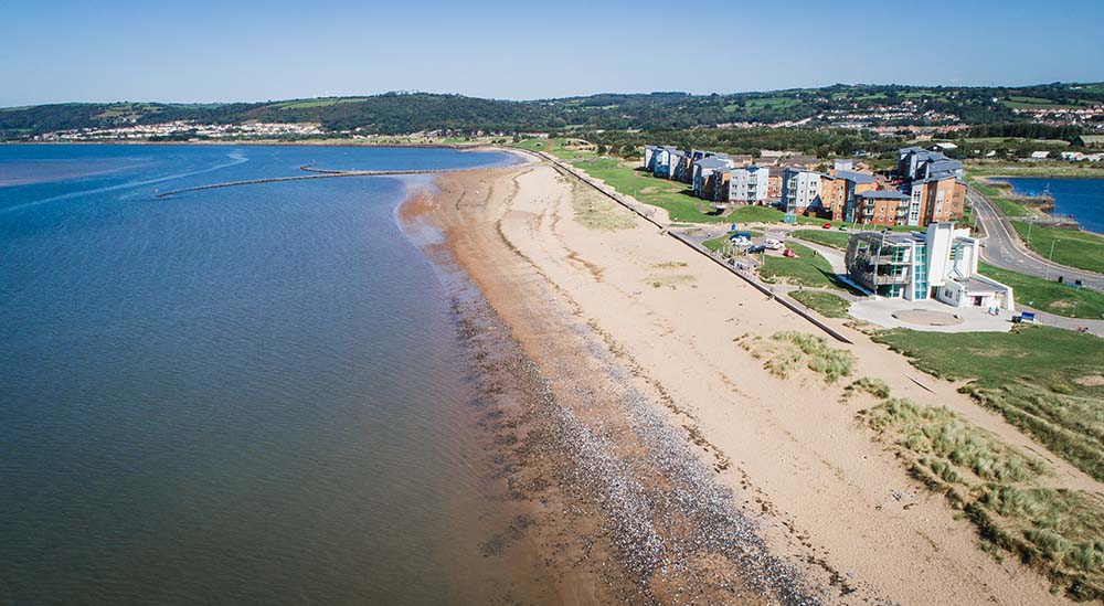
The Millennium Coastal Park stretches from Burry Port to beyond Llanelli, where former industrial sites have been cleared and the land has returned to nature. The National Wetlands Centre offers the chance to observe a wide range of birdlife among reedy pools and woodland, before the Wales Coast Path makes its way around the Llwchwr estuary to Gower.
Pendine Circular Walk
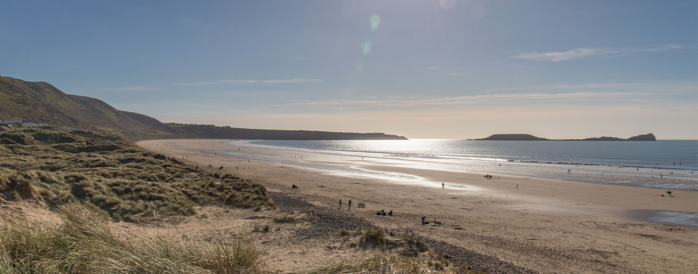
World speed records, training for warfare and religious fervour are features of interest on this short walk from Pendine. Powerful cars set and broke speed records on the firm and extensive Pendine Sands in the 1920s, as detailed at the Museum of Land Speed. The two main contenders and rivals were Malcolm Campbell and J G Parry Thomas.
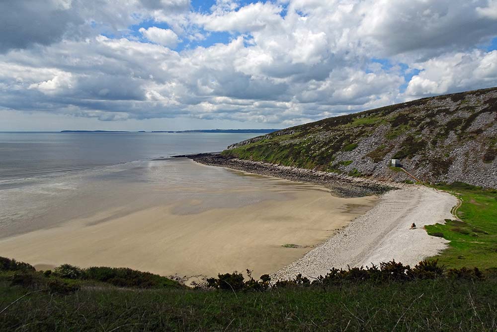
Leave Pendine by climbing steep flights of steps onto Gilman Point to start a walk of 3.5 miles / 5.7km. Although strenuous at the start, the rest of the walk is relatively easy. Enjoy fine coastal views from the headland, then walk down into a valley near the shingle beach of Morfa Bychan. Note a curious concrete wall, which was intended to simulate the type of barriers that American troops would encounter during the D-Day landings in Normandy.
Walk up through the well-wooded valley and note that when a path junction is reached, turning right offers a chance to shorten the walk by 1 mile / 1.7km, otherwise keep left for the full route. Turn right along a road to pass the Green Bridge Inn and note that a path runs parallel to the tarmac road on the way to the higher part of Pendine. St Margaret’s Church retains a substantial portion of its original medieval features.
Walk down the steep road of Pendine Hill, passing the Peace Garden halfway down. Just before finishing the walk, be sure to have a look at the Peter Williams Memorial Chapel. Williams was a well-travelled 18th century preacher who published an affordable Welsh translation of the Bible that made its way into thousands of homes. Read the detailed route description for Pendine (opens in the Wales Coast Path website)
Top Tip
Visit the Museum of Land Speed, which is the prominent modern building, but also check out the original buildings in Pendine that the record breakers and mechanics used as their bases.
Laugharne and Delacorse Circular Walk
Lovely Laugharne has plenty to interest, inform and entertain visitors, and a splendid 2.9 mile / 4.7km walk can be enjoyed. The whitewashed Town Hall is where the Laugharne Corporation meets, founded in the 13th century as a municipal authority, now serving as a local charity. Noticeboards explain about the history and heritage of Laugharne, then sites associated with the poet Dylan Thomas are passed. He drank at Brown’s Hotel and the Dylan Coastal Resort is named after him. Keep left at the resort to follow a path signposted for Dylan Thomas’ Grave, which is marked by a simple wooden cross in a cemetery.
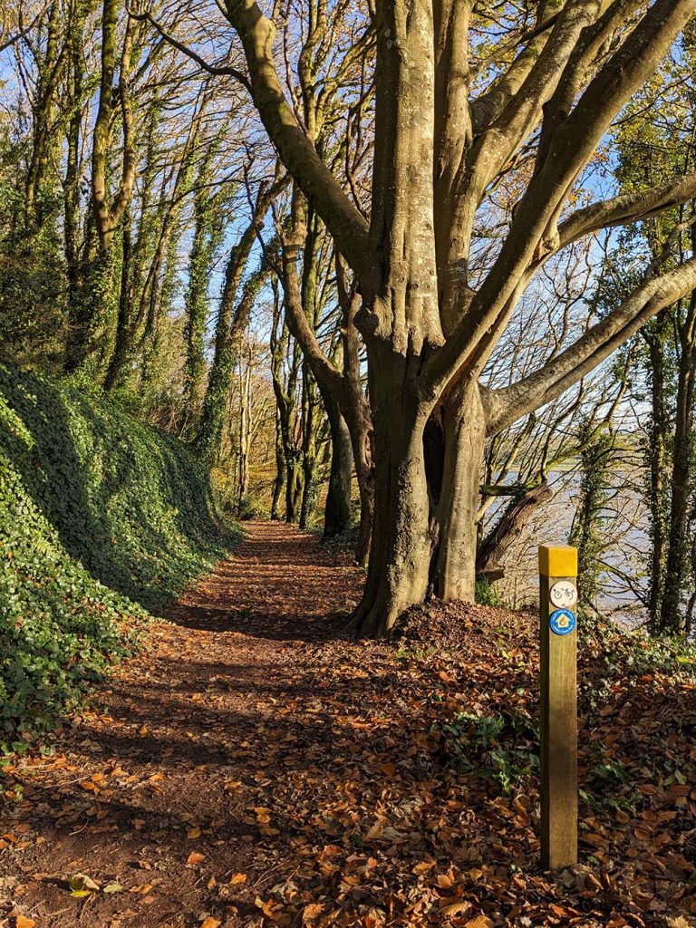
A lane climbs steeply above St Martin’s Church, levelling out at a junction of farm roads where the Wales Coast Path is joined. Keep right and walk down to Delacorse, then continue through fields, bearing in mind that horses and carts once used a nearby tidal ford to cross the Afon Taf. The Wales Coast Path stays on dry land to pass through fields and fine woodland.
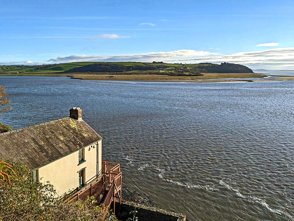
Dylan Thomas is remembered over and over again on the way back into Laugharne. He used to live at the Boathouse, which is open to visitors and enjoys a spectacular view of the Taf estuary. He used to write at the Writing Shed, and he also lived for a time at Seaview, now a private dwelling.
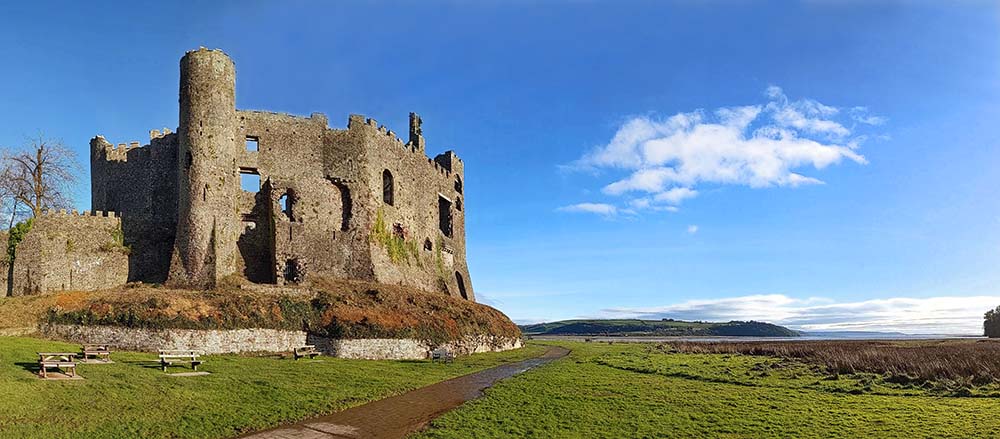
A path runs down from the houses to a saltmarsh, and bear in mind that the marsh can be completely flooded on a very high tide. Most of the time, the path is dry underfoot and passes beneath the towering stone walls of the 13th century Laugharne Castle for a splendid scenic finale to the walk. Read the detailed route description for Laugharne and Delacorse
Top Tip
Read up on the life and works of Dylan Thomas, then seek out places associated with him around town. For an additional stroll along the Wales Coast Path, try the Dylan Thomas Birthday Walk.
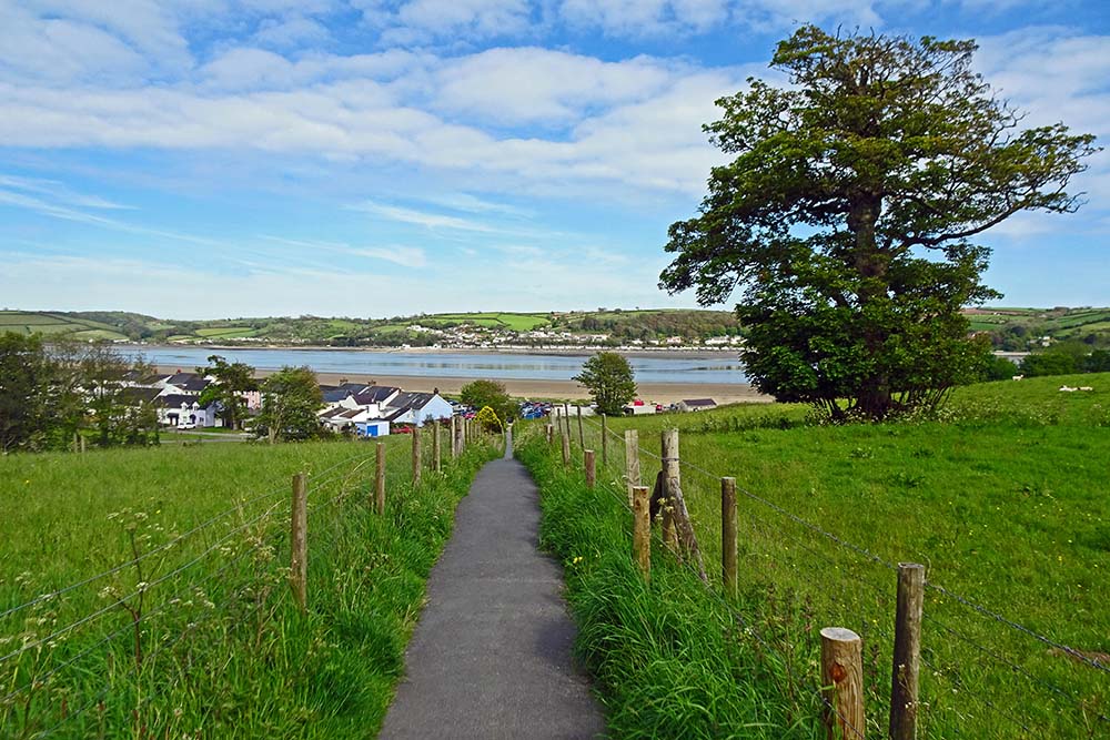
Llansteffan Circular Walk
This scenic and interesting walk is essentially three short loop walks arranged one after another, offering plenty of scope for short-cuts. The full distance is 4.6 miles / 7.4km, starting with a walk along the Wales Coast Path, then following paths a little further inland, searching for interesting historic sites.
Walk along a coastal embankment to leave Llansteffan, continuing through woodland, emerging briefly for a fine view across the estuary of the Afon Tywi at Scott’s Bay. (There is an obvious short-cut inland here.) The coast path continues round the well-wooded Wharley Point, rising to enjoy spectacular views over the estuary of the Afon Taf.
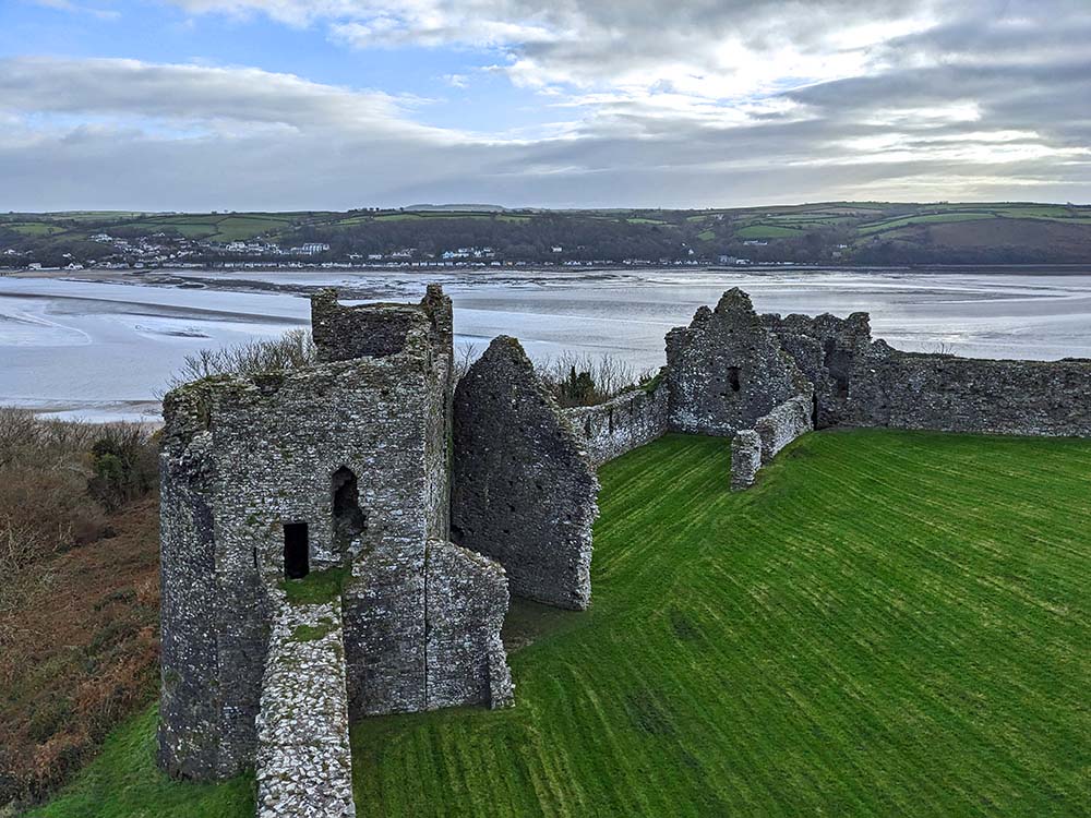
After the coast path heads inland, leave it to follow the farm access road to the traditional National Trust farm of Lord’s Park. There is a brief return to Scott’s Bay, then as the route heads inland again, go through a gate on the left to inspect the ancient St Anthony’s Well. Later, there is an option to make a short detour up to the substantial ruins of the 12th century Llansteffan Castle, where there are plenty of noticeboards pointing out features of interest. It was built on the site of a Bronze Age hillfort.
Walkers can either finish early by returning to the coast, or pass through the village of Llansteffan. St Ystyffan’s Church, built on the site of a 7th century church site, was on a pilgrim route to St David’s. The village was a popular tourist destination for miners from South Wales, with visitors arriving by ferry from the railway station on the opposite side of the Afon Tywi. Read the detailed route description for Llansteffan
Top Tip
Be sure to visit Llansteffan Castle, whose towers offer extensive views around the beautiful countryside flanking the Afon Tywi.
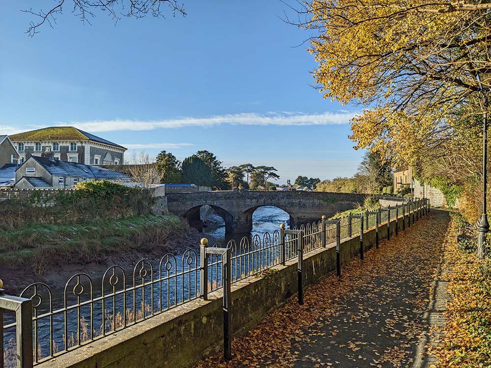
Carmarthen Town Circular Walk
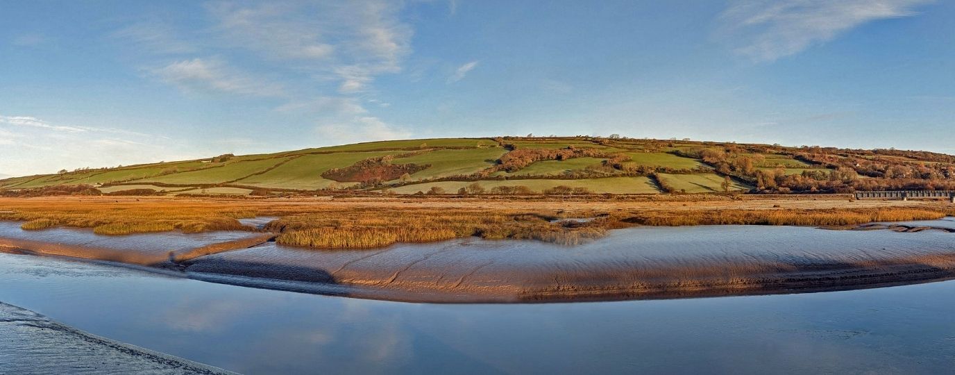
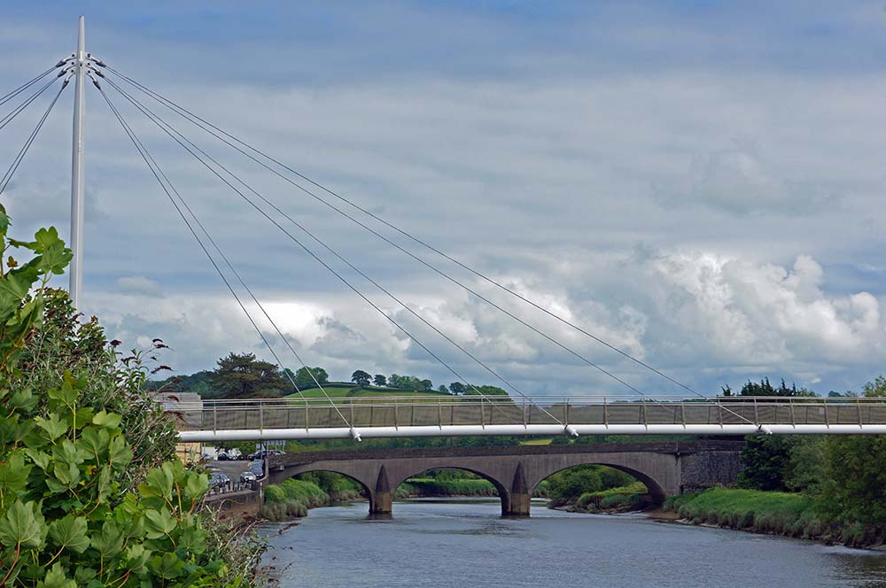
Carmarthen is the oldest town in Wales, where according to legend the wizard Merlin was born in a cave. A Celtic tribe settled before the Romans built a fort around AD75. Although at the tidal limit of the Afon Tywi, an important port thrived for centuries. This 5.9 mile / 9.5km walk includes plenty of history and heritage, as well as nature reserves and a fine woodland. The modern King Morgan footbridge carries the Wales Coast Path across the river.
Follow a path alongside the Afon Tywi and look at a coracle (cwrwgl) display at the Carmarthen Rowing Club. These one-person crafts were used on the river before the Roman era. A suburban wetland nature reserve is passed at Y Morfa, followed by the built-up area of Johnstown, named after John Jones, a 19th century resident of Ystrad. An old byway is shaded by trees on the outer limits of Carmarthen.
After crossing a bridge over the main A40 road the quiet village of Llanllwch is noted for its old church, dating from the 15th century and later restored from ruins. A post-medieval corn mill is passed in a wooded valley while leaving the village. Ystrad Wood is a Woodland Trust property, boasting paths that allow visitors to stay low or climb over the hilltop of Allt-y-Cnap. Nearby Plas Ystrad is a mansion that was recently restored as part of a housing development.
After passing the Carmarthen Leisure Centre the Wales Coast Path is joined and leads through a wetland area, continuing alongside the Afon Tywi. The white-painted Bascule Bridge used to feature a lifting span to allow tall ships to pass to and from Carmarthen. Simply follow the riverside path back into town and feel free to wander the streets to appreciate more of its history. Read the detailed route description for Carmarthen Town
Top Tip
After completing the walk, explorations can continue around the town, exploring the Roman amphitheatre, Carmarthen Castle and fragments of the former Priory.
Kidwelly Circular Walk
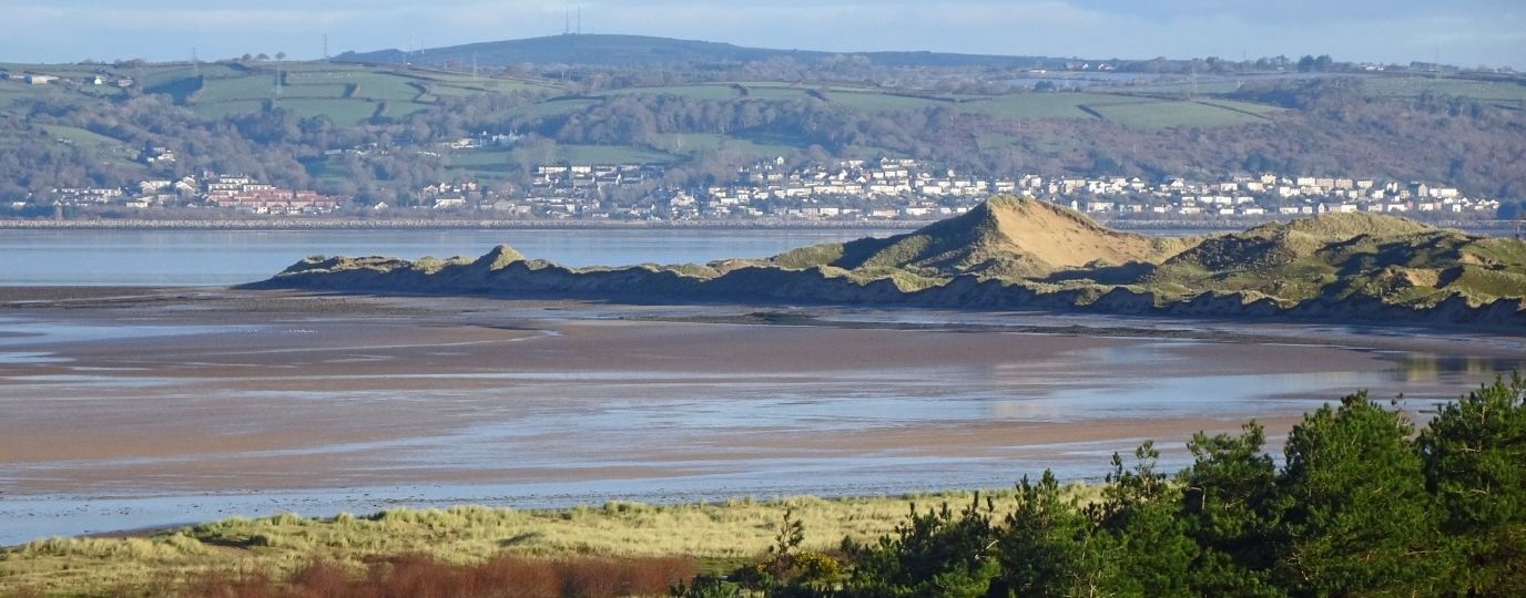
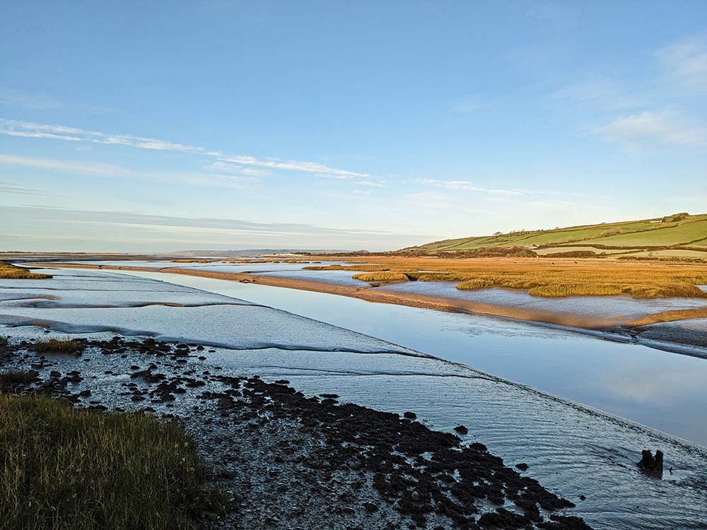
Centuries of history and industrial heritage delight and intrigue visitors to Kidwelly, where interesting features can be discovered on a short and easy 3.9 mile / 6.3km walk. The Wales Coast Path follows roads from the town centre, past the railway station to Kidwelly Quay. This was the sea lock for the Kymer Canal, which was once used to transport the local mineral wealth, but is now a quiet backwater overlooking the extensive marshes and mudflats of Gwendraeth. Read the noticeboards that paint a picture, demonstrating how important this canal was to the area.
Follow the old towpath of the canal, where luxurious growths of reeds screen the remaining water from sight. Glimpses of the canal are available from footbridges along the way, until a railway line cuts straight across it. Follow a path, a track to Caernewydd Farm, then a road as if returning to Kidwelly. However, switch to a bridleway that follows an old railway line from Kidwelly to Gwendraeth Town.
This mineral line served an area of quarries and mines on Mynydd y Garreg, where hard work sustained the people of Kidwelly and enabled their town to thrive.
Follow a road back into Kidwelly and take the time to look at noticeboards along the way, which point out features of historical interest. The eye will naturally be drawn to the sky-piercing spire of the Priory Church. The original Benedictine priory dated from the 12th century and the current building is one of the largest parish churches in this part of Wales.
The imposing ruins of the 12th century Kidwelly Castle are also be seen from time to time, and a short walk around its substantial perimeter walls helps visitors to appreciate its considerable size. Read the detailed route description for Kidwelly
Top Tip
Read the noticeboards that offer abundant details of the history and heritage of the town. Allow plenty of time to visit Kidwelly Castle.
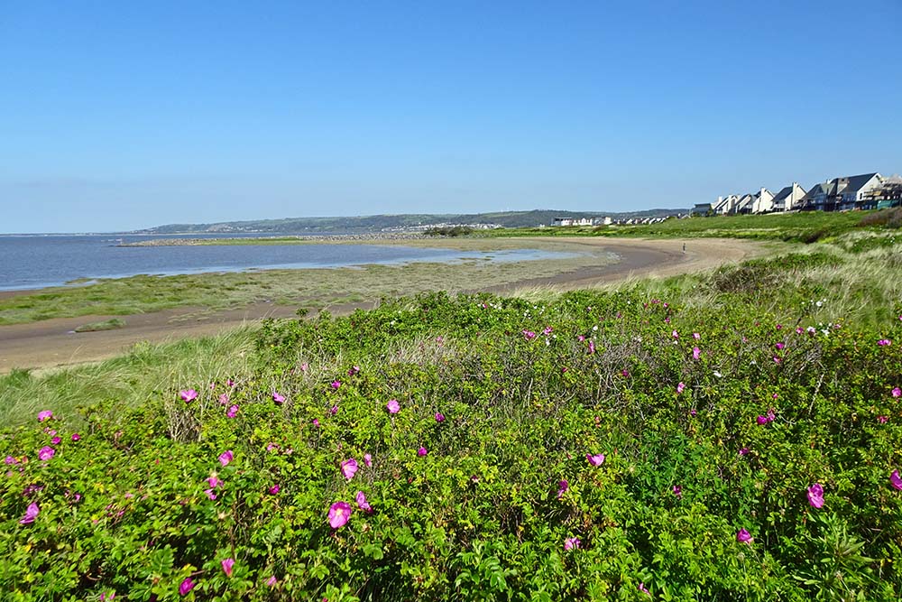
Llanelli Circular Walk
Llanelli’s nickname is Sospan (saucepan), recalling the factories that manufactured most of Britain’s saucepans. The folk-song ‘Sospan Fach’ is associated with the town. The rugby ground, Parc y Scarlets, features saucepans on its goalposts. The industry has been cleared, leaving green spaces and a splendid coast path that now offer a circular walk of 5.5 miles / 8.8km.
Leaving the railway station in Llanelli, follow roads to Seaside, stopping to read noticeboards that explain about history and heritage, and look out for a monument made of saucepans on Marine Street. Seaside is a modern development built alongside the 19th century North Dock, where coal was once exported. The dock gates hold water in place, but would have been opened at high water to allow shipping through the tidal channel of the Afon Lliedi.
The Wales Coast Path follows the channel, then keeps seawards of a modern housing development. Noticeboards explain how this area, Machynys, might have been a monastic settlement, but no firm evidence exists. A large part of the area was heavily industrialised in the 19th century, occupied by tinplate factories and brickworks. An extensive golf course now occupies the space, featuring pools that attract waterfowl.
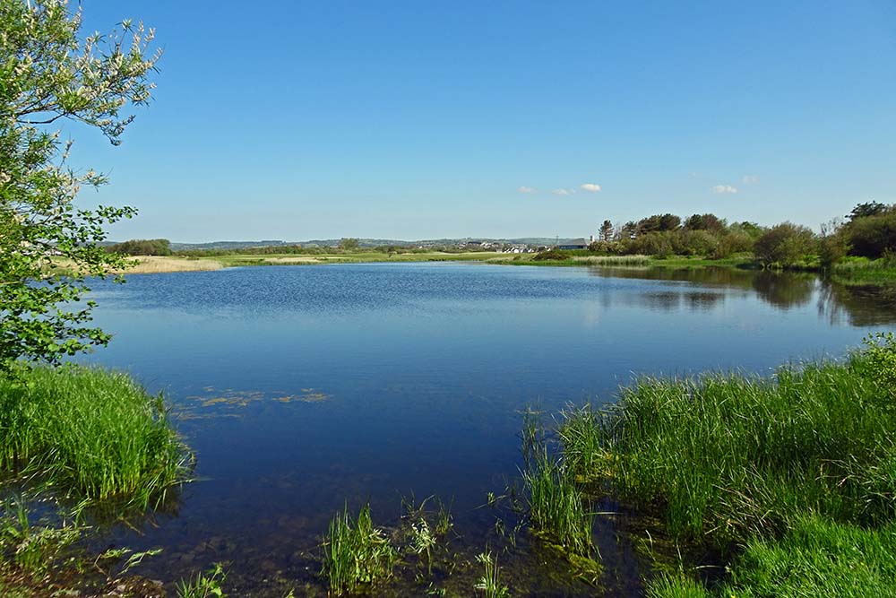
The coast path runs alongside an embankment that blocks views of an extensive saltmarsh. For the sake of a 2km detour, the Wales Coast Path can be followed to the incredibly interesting Llanelli Wetland Centre, where a network of convoluted trails offer plenty of opportunities for birdwatching.
Returning to Llanelli involves following tarmac paths running parallel to busy roads, but there are always broad strips of greenery alongside, in the form of grassland or woodland. On the final walk along New Dock Road, green spaces give way to terraced houses. Look carefully at the designs of the door jambs and lintels, noting the variety of decorative styles employed. Read the detailed route description for Llanelli
Top Tip
Look out for Llanelli Community Heritage Trail noticeboards. A detour to the Llanelli Wetland Centre is highly recommended, but allow plenty of time to explore.
We hope you have enjoyed these Carmarthenshire Circular Walking Routes, it’s great to have a list of routes that are available to those travelling by rail, a fun way to explore the countryside.
There are many more exciting walking routes available to visit across Wales including all of the fabulous Welsh Coast Path Circular Routes.
If you’re planning to explore what Wales has to offer, take a look at our guide to the origin of Welsh place names. This guide will help you with understanding Welsh names, how to pronounce them and meaning behind them, adding a little more context and interest to your adventures.