A Weekend Adventure on the Isle of Skye
OS Product designer Kris Mackenzie recounts his recent trip to Skye, sharing a beautiful short walk from our Skye – Short Walks Made EasyGuidebook along with a rather more impressive summit of Blà Bheinn – the only stand alone Munro on the Isle of Skye. Read on to hear more about this fantastic weekender on the Isle of Skye.
Like all ahead of a Bank Holiday weekend, we want to make the most of our long weekend and our fingers were crossed in the hope of some sunshine. In the run up to this trip I was continuously looking at the weather across Scotland and looking at where the best weather was.
Northwest Scotland was looking ideal so myself and my wife decided to head to Skye in the camper, in search of good weather and bagging another Munro over the weekend. Munros are mountains over 3,000 feet (914.4 in meters) and there are 282 Munros which people bag/tick off.
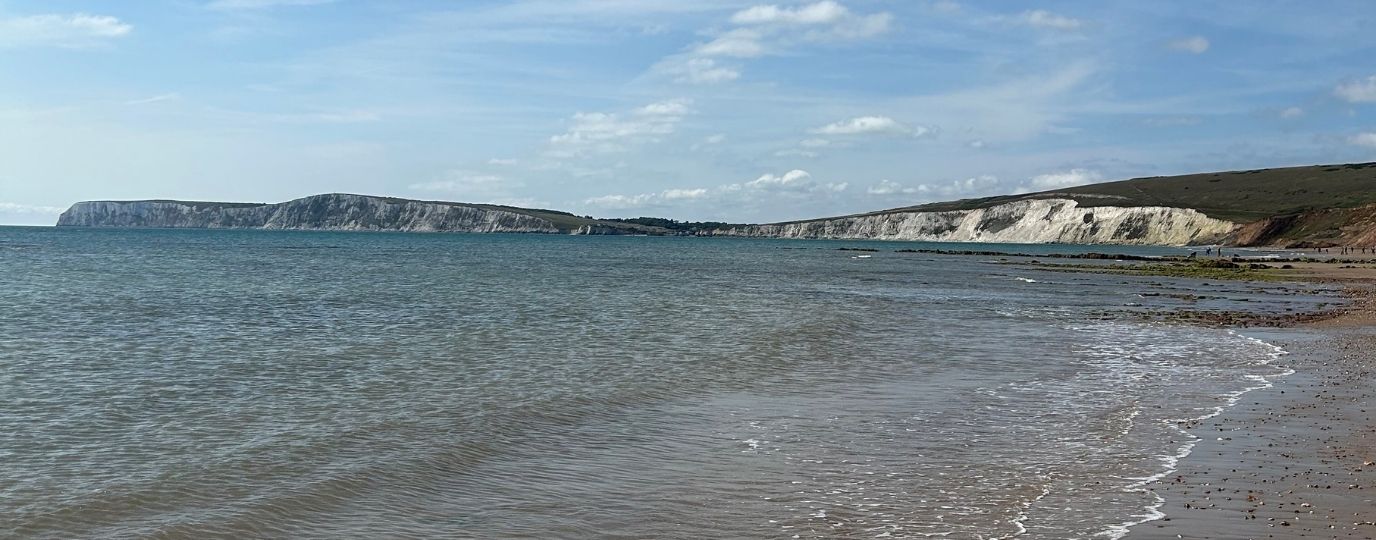
Skye is known for its beautiful and rugged landscape and is the largest island in the Inner Hebrides and connected to the Scottish mainland by a bridge. Skye is famous for its Black Cullin Ridge with 11 Munros. If you want to attempt this ridge it is not for the faint hearted requiring a high level of fitness and scrambling, many hire a local guide to take them up to complete the ridge.
You also need a good weather window to complete the ridge, Inaccessible Pinnacle is well known as it requires an induvial to complete a graded rock climb to reach the top.
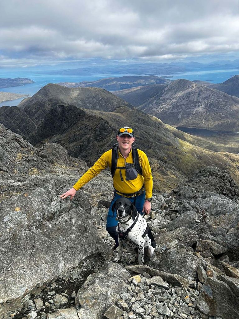
For those who want to complete a Munro with views over to the Black Cullin Ridge you can complete Blà Bheinn (Blaven) the Island’s only stand-alone Munro. The ascent up Blà Bheinn is only to be attempted by experienced hill walkers as its very rocky with plenty scree and finding the right route up can be difficult to locate.
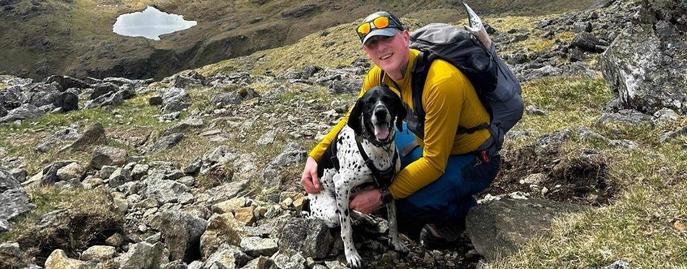
For the Bank Holiday weekend, our main goal was to conquer Blà Bheinn, a stand-alone Munro, with my wife and our dog. We set off from Edinburgh on Saturday morning, planning to make several pit stops along the way to enjoy the scenery and stretch our legs during the 4.5 to 5-hour journey.
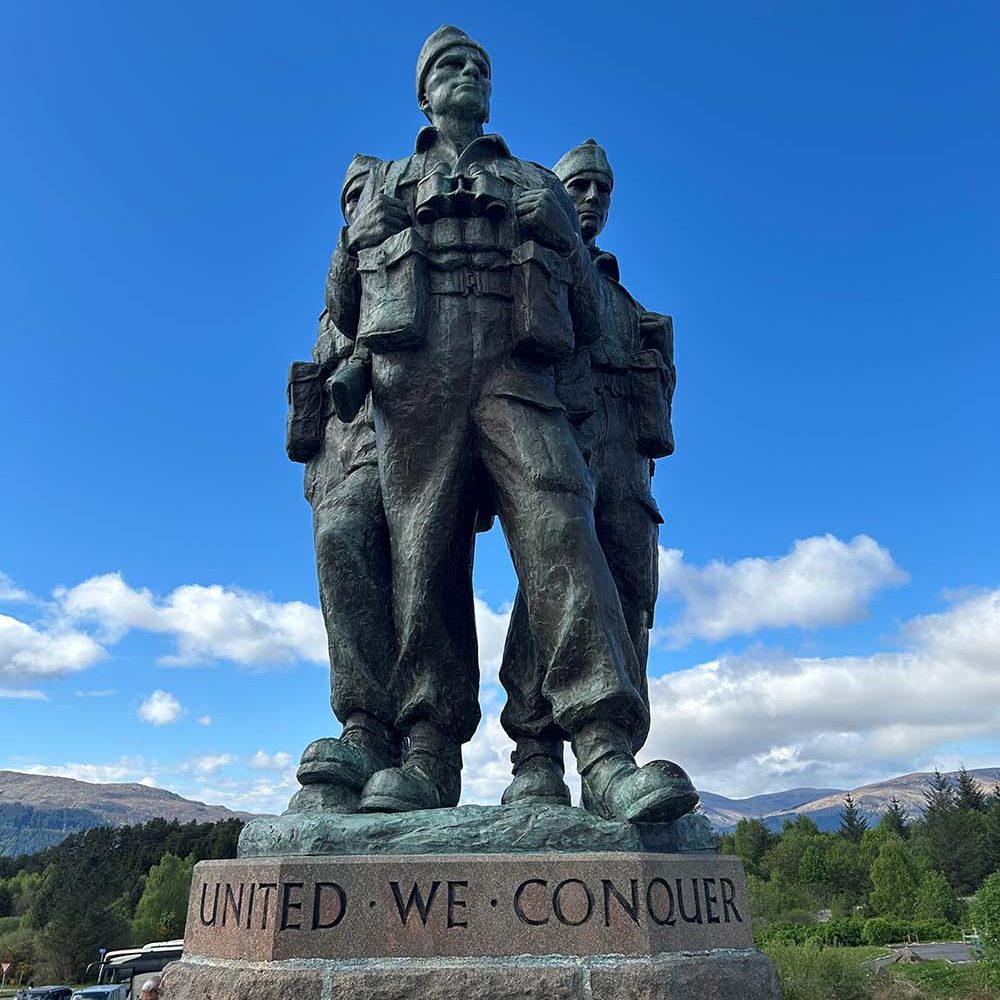
We stopped 1st at Spean Bridge to take in the Commando Memorial and the views of Ben Nevis (GB’s highest peak). The memorial is to commemorate the service and sacrifice of troops during World War 2, Royal Marines Commandos trained at Achnacarry Castle from 1942 just 1 mile away from the memorial. The next pitstop on the way to Skye in the van was the famous Eilean Donan castle, its featured in many movies.
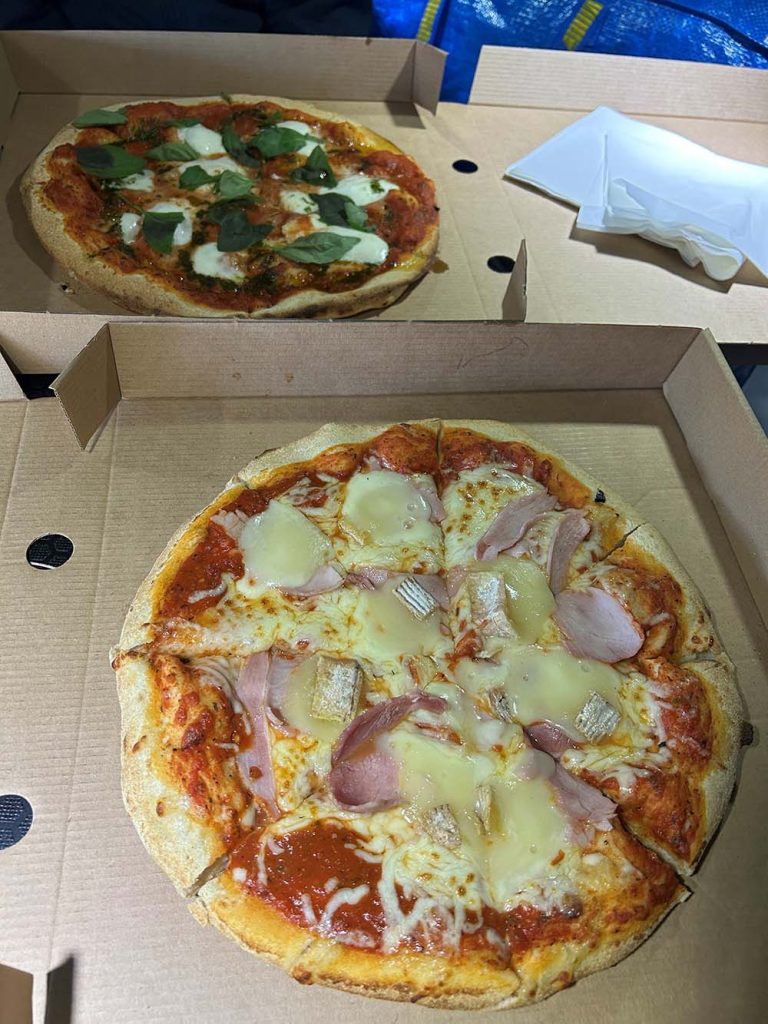
We based ourselves in Broadford for the weekend, a good base for accessing the Cullins and bottom part of the island with good amenities. Once arriving in Broadford and got checked into the campsite we treated ourselves to a couple of takeaway pizzas after the long drive.
Watching The Weather…
After looking at the weather again, Sunday was looking a little breezier. We decided to hold off doing the Blà Bheinn until the Monday as the forecast looked much less windy and more chance of cloud free view at the top of the Munro. Sunday we just planned to do some a couple of short walks on the south part of the island and explore.
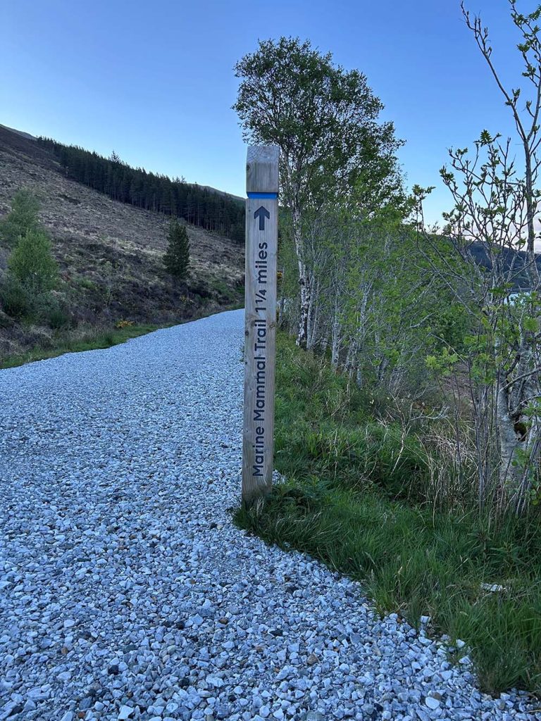
Kylerhea – A Short Walk on the Isle of Skye
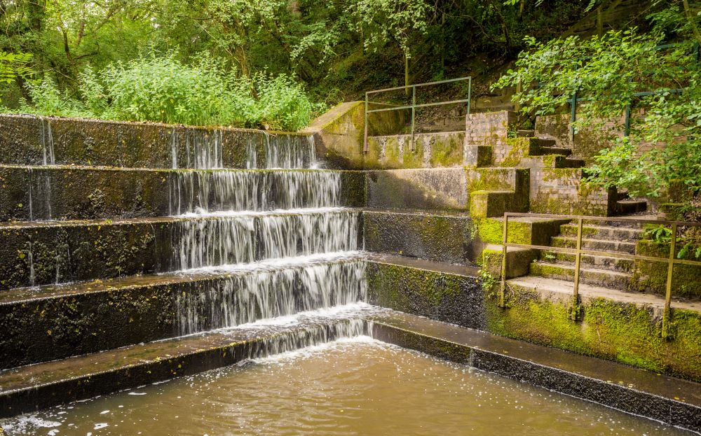
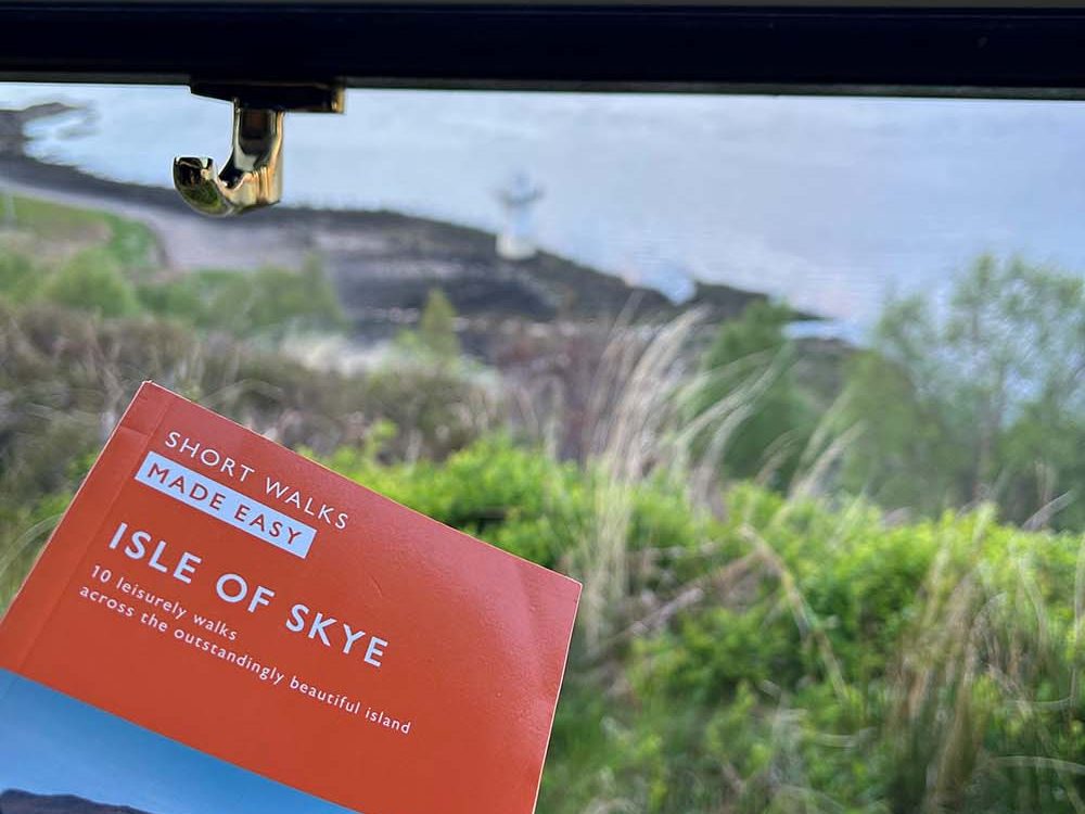
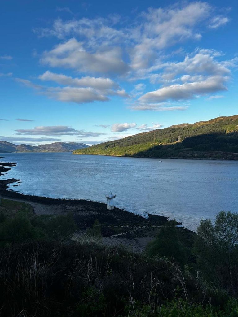
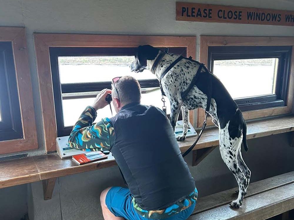
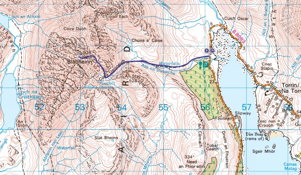
On Sunday one of the walks, we decided to do was Walk 9 Kylerhea from OS Maps Short Walks Made Easy Skye Guidebook, in the hope to spot some marine life, sea otters and seabirds. The walk offered some superb views over the Kyle Rhea narrows back to the Scottish mainland.
This walk has wildlife hide where you can open the windows and wait in anticipation of spotting some wildlife. Unfortunately, it wasn’t meant to be, we did not spot any sea otters, this was my top animal I wanted try and spot.
It was nice walking a route in one the OS guidebooks that I help produce, all our routes in our guidebooks are walked by external authors. This walk is accessible, a compact gravel path ideal for children to walk on or push a buggy/pram down.

EXPLORE THE
OS Shop
We are with you every step of the way. Shop our trusted walking and hiking maps and guidebooks so you can explore the outdoors with confidence.
Go to the shopClimbing Blà Bheinn – A Munro on the Isle of Skye
After a relaxing Sunday evening spent reading and unwinding in the van, we woke up on Monday morning to perfect weather. The sun was shining, and the wind had calmed down. We enjoyed our breakfast outside the van in the sun, it was superb.
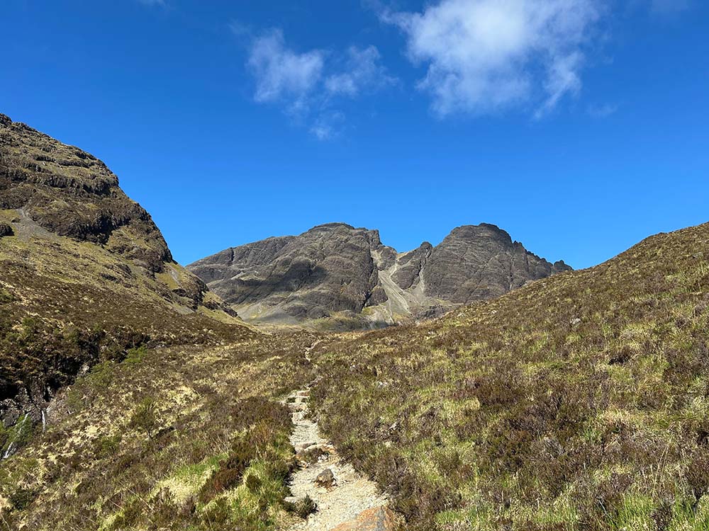
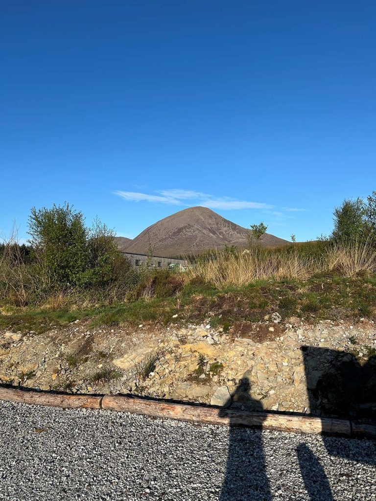
Parking at the base of Blà Bheinn, my wife and I looked up to the mountain which we had to scale, and it looked perfect. Almost pure blue sky with the odd cloud. The 1st part of the route is from the car park to Fionna-choire, shaped like a bowl/corrie on a map. The path is good to this point and then requires some good route-finding skills.
The next part of the route requires going up a scree gully and some mild scrambling and then flattens out a little at the summit. A friend who had completed this Munro before provided me with there GPX file which I put onto my GPS device and copied onto my map. This was extremely useful!
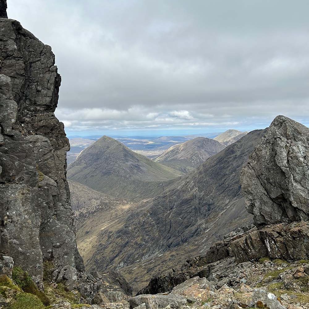
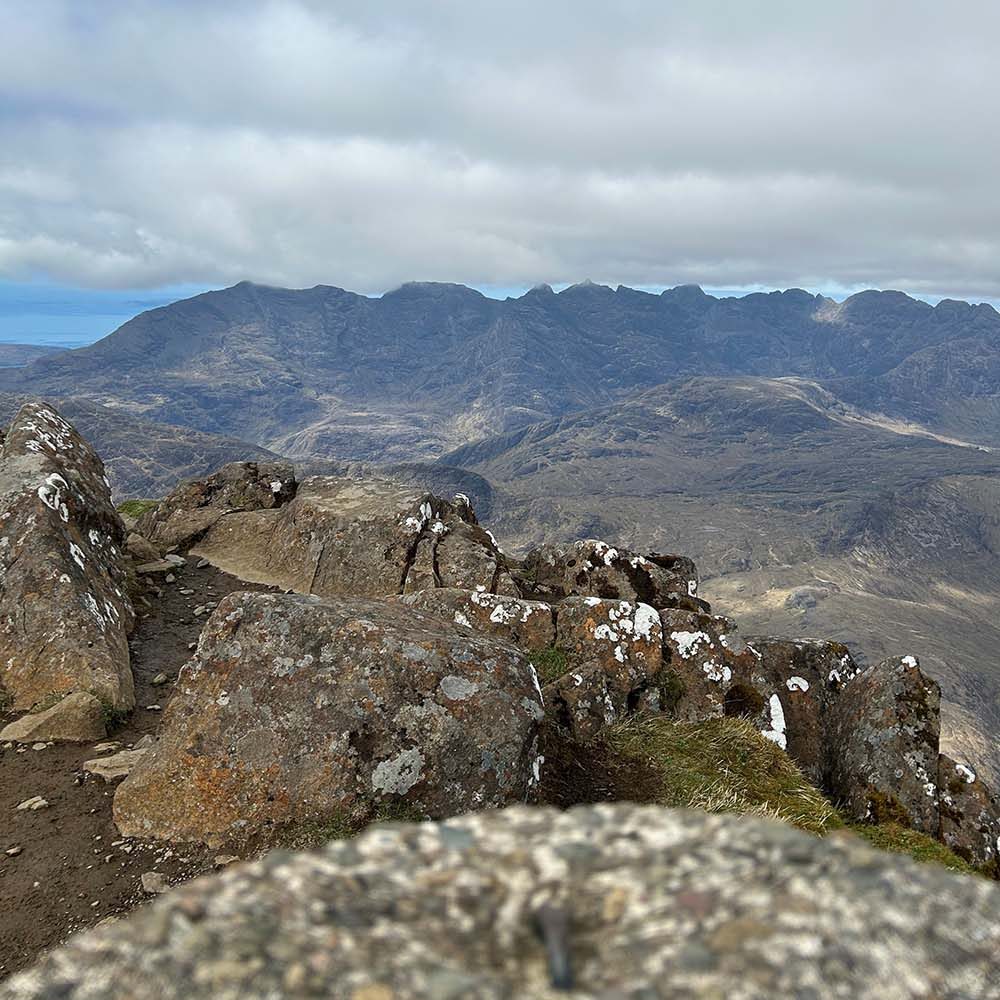
The views on ascent were superb looking out to the Inner Hebrides. Some clouds did come in when we reached the summit, but we did manage to have clear view over to the famous Black Cullin Ridge, we met a group of friends who were looking over to the ridge to spot other friends out with a guide.
We stayed on the summit for around 30 minutes and had our lunch while soaking up the views! Then started our decent back down, being cloud free main the descent much easier as I could imagine doing it in the cloud would make it extremely difficult. Once we got down past Fionna-choire bowl, the temperature was getting warmer, and our feet were feeling hot.
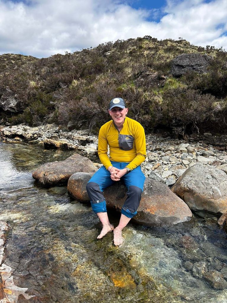
We decided to take advantage of the stream flowing down the mountain to cool off by dipping our feet in. The water was ice cold but felt awesome!
Once we got back to the carpark we were in much need of a cold can of juice and ready to take our boots back off for a break ahead of our long drive back to Edinburgh. We rested up for 20mins soaking up the last views of Blà Bheinn and enjoying our cold drink!
The only pitstop on the way home was at the House of Bruar off the A9 to stretch our legs with the dog and treat ourselves to some well-earned fish and chips. What a wonderful way to end an Easter Weekend!
Blà Bheinn FAQ’s
There are 12 Munros (Scottish mountains over 3,000 feet) on the Isle of Skye, with 11 of them located on the Black Cuillin ridge. Blà Bheinn is the only stand alone Munro.
Blà Bheinn (also known as Blaven) is 929 metres (3,048 ft) – That’s only a few metres lower than Scafell Pike the highest mountain in England.
Kris took and out and back route and started in a car park at the very North end of Loch Slapin, grid reference NG560 215 There is also a popular circular route that starts and finishes at a lay-by near Kirkibost on the B8083, grid reference NG545172. The nearest town is Broadford.
The walk involves a varied mix of terrain, there are gravel tracks, boggy moorland, boulder fields, grassy slopes, steep scree and exposed rocky mountain ridges
As Kris says above – The ascent up Blà Bheinn is only to be attempted by experienced hill walkers as its very rocky with plenty scree and finding the right route up can be difficult to locate.
For the Blà Bheinn walk use OS Explorer OL411 (1:25k), OS Landranger 32 (1:50k) and of course make sure you have the route downloaded on OS Maps.
EXPLORE THE
OS Shop
We are with you every step of the way. Shop our trusted walking and hiking maps and guidebooks so you can explore the outdoors with confidence.
Go to the shop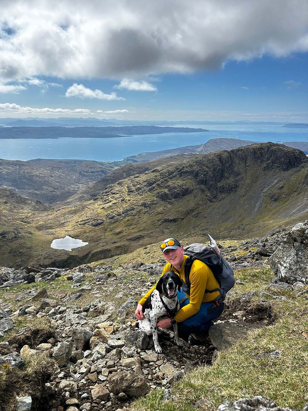
By Kris Mackenzie
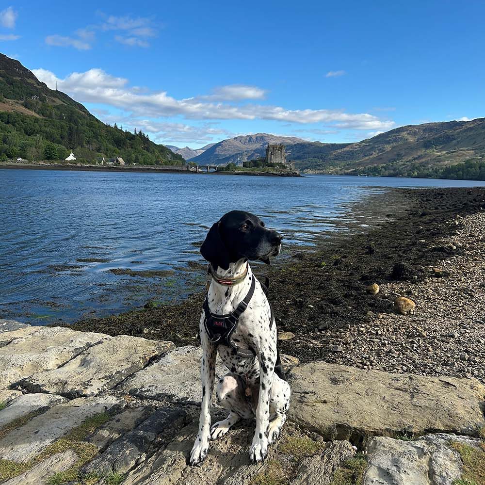
I am a product manager here at Ordnance Survey and I look after everything book related in our physical products team. In my spare time you will find me off spending time outdoors local to home in Edinburgh or somewhere further afield in the Great Britain. I am keen hillwalker, runner, climber & mountain biker, and I am trying to work my way through ticking my Munro’s off in Scotland. In good weather windows you will see me heading off in camper with my wife and dog – Rocky (a German Short Haired Pointer), in search of an outdoor adventure.
See all of Kris Mackenzie’s Guides on Get Ouside