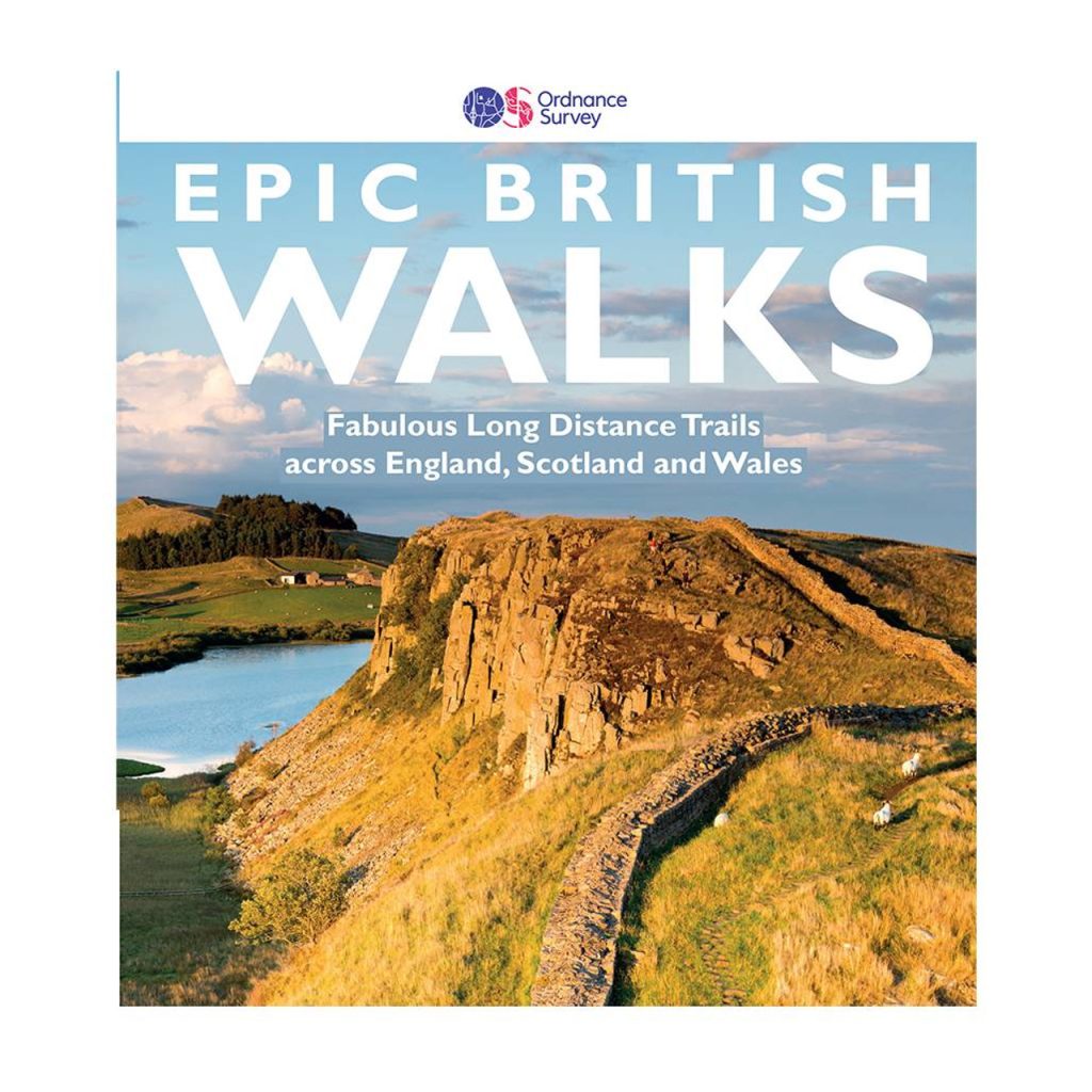
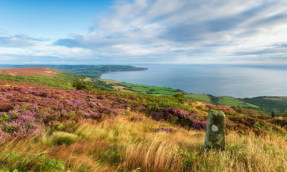
Plan the hike of your dreams
If there’s one thing Britain excels in, it’s long-distance walks. We’ve taken some of the best lesser-known routes from the book, Epic British Walks, to help you plan the hike of your dreams. Find route information and suggestions for day trips.
From the rugged mountains in the Scottish Highlands to the sandy beaches along the Jurassic Coast, Britain’s landscape is far from boring and if there’s one thing Britain excels in, it’s long-distance walks. You only need to look at an OS Map to find an extensive network of footpaths and bridleways. There’s no denying that some routes stand out from the rest. For many, these best British long-distance walks have almost become a rite of passage.
These routes are referred to as England and Wales National Trails, Regional Trails and Scotland’s Great Trails, depending on their location and status. They are long-distance routes which allow you to see the best of Britain and most are well marked and maintained. You can walk them in one go (often referred to as thru hiking) or break them up into smaller day walks if you have less time or less inclination to plod onward day after day.
Learn more about how Long Distance Footpaths are denoted on Ordnance Survey Maps and what it takes to get a long distance footpath designated and shown on our mapping.
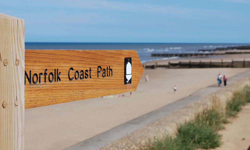
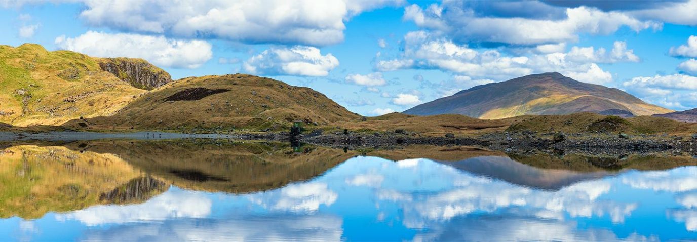
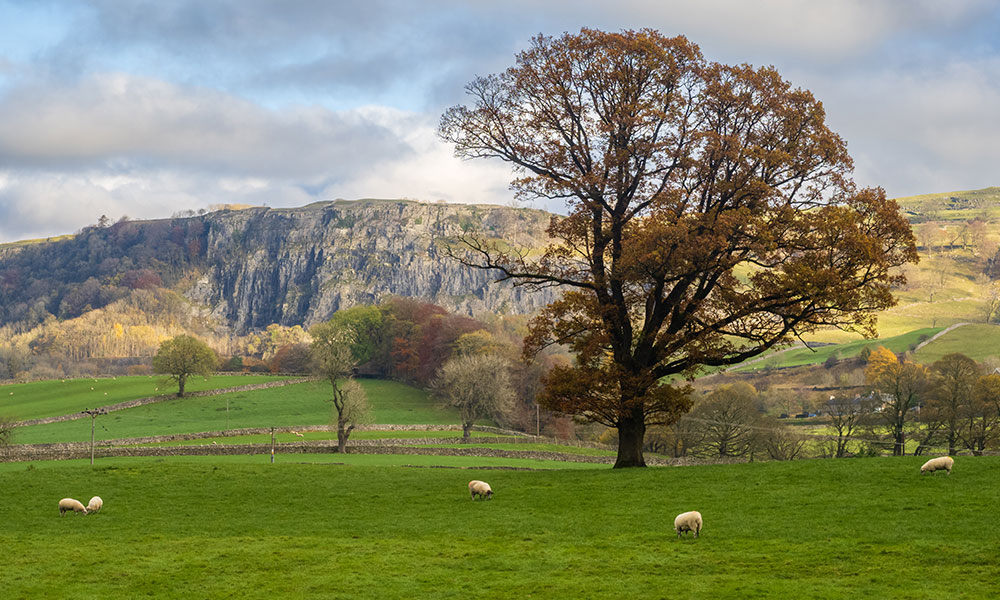
Norfolk Coast Path
Most people have heard of the Pennine Way but there are plenty of other amazing long-distance trails you may not know much about. To help you plan your next walk, we’ve taken some of our favourite lesser-known long-distance routes from the book, Epic British Walks. The book has more detail about each trail including practical information as well as the best sections for weekend breaks and suggested short walks.
1. Cleveland Way
Best for coastal views
Cleveland Way route information
- Distance: 109 miles / 175 km
- Difficulty: 4/5
- Start: Helmsley, North Yorkshire
- Finish: Filey, North Yorkshire
- Trail type: England and Wales National Trails
- OS Landranger Maps for Cleveland Way: 93, 94, 99, 100, 101
Views from the Cleveland Way
The Cleveland Way meanders around the top of the North York Moors National Park, starting inland at the market town of Helmsley before hitting the coast at Saltburn-by the-Sea. As a result, this trail offers an ever-changing landscape, from rich heather moorland to striking coastal cliffs. The varied nature of the landscapes through which the Way passes is such that many days have their own unique characteristics.
Day trip suggestion
One of the highlights of the Cleveland Trail is Mont Grace Priory, a wonderfully preserved medieval Carthusian charterhouses, popular for day trips and short walks like this one.
2. John Muir Way
Best for heritage
John Muir Way route information
- Distance: 134 miles / 215 km
- Difficulty: 2/5
- Start: Helensburgh, Argyll and Bute
- Finish: Dunbar, East Lothian
- Trail type: Scotland’s Great Trails
- OS Maps for the John Muir Trail: OS Explorer 38, 342, 349, 350, 351
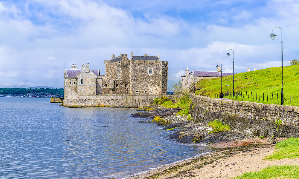
Blackness Castle on the John Muir Way
This coast-to-coast trail across the heart of Scotland celebrates the life and work of John Muir (1838–1914), ‘The Father of National Parks’ in America. The Way, which also accommodates cyclists, traverses the heart of Scotland, exploring places that enshrine the nation’s natural, cultural and industrial heritage and takes in Scotland’s first National Park, the beautiful Loch Lomond and The Trossachs. On route you’ll pass mountains, lochs, canals and coastline from the shores of the Clyde to the North Sea. The hills along the John Muir Way are reasonably tame and amenities well-spaced out, making it suitable for a first long-distance walk.
Day trip suggestion
Blackness Castle is a must-visit when on the John Muir Trail. You can pre-book tickets or just admire it from outside the grounds. This is a nice part of the trail for short walks like this one.
3. Ceredigion Coast Path
Ceredigion Coast Path route information
- Distance: 59 miles / 95 km
- Difficulty: 3/5
- Start: Cardigan, Ceredigion
- Finish: Ynyslas, Ceredigion
- Trail type: Regional Trails
- OS Maps for Ceredigion Coast Path: OS Explorer 23, 198, 199, 213
The Ceredigion Coast Path follows the Welsh Heritage Coast from Cardigan northwards along Cardigan Bay to Ynyslas, near Borth, to the north of Aberystwyth. It crosses a varied landscape that includes the dune system at Ynyslas, high cliffs, sea caves, sandy bays and storm beaches. The Ceredigion Coast Path is now part of the larger Wales Coast Path, but it has managed to keep its individual identity and appeal. There are some testing climbs on route but good transport links and amenities make it easy to break it into manageable sections.
Day trip suggestion
Aberystwyth is a thriving, diverse and vibrant settlement, located nearer the end of the trail and well worth a stop. Just before it (south) is Pen Dinas, an Iron Age hill fort topped with a towering memorial to the first Duke of Wellington.
4. Ribble Way
Best for countryside walking
Ribble Way route information
- Distance: 70 miles / 113 km
- Difficulty: 2/5
- Start: Longton, Lancashire
- Finish: Gayle Moor, North Yorkshire
- Trail type: Regional Trails
- OS Maps for the Ribble Way: OS Explorer 2, 21, 41, 286, 287
Ribble Way
The Ribble Way follows the River Ribble upstream from the Lancashire coast up into the hills above Dentdale and Wharfedale in North Yorkshire. Along the way, the trail encounters tidal marshes, riverside meadows, farmland, limestone gorges, quiet lanes and moorland terrain; it fashions an elegant route from Preston to Roman Ribchester, historic Clitheroe, Settle and Horton-in-Ribblesdale. The Way takes the most delightful passage, making the most out of the beautiful countryside – there’s certainly no shortage of beautiful views.
Day trip suggestion
It’s worth deviating from the route slightly to take a short walk around the Ribblehead Viaduct, a mile west from the Ribble Way. With 24 arches and over 440 yards in length, it’s one of the enduring iconic images of Yorkshire.
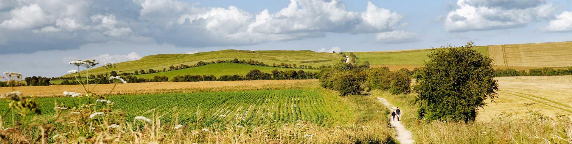
5. Ridgeway
Best for aerial views
Ridgeway route information
- Distance: 87 miles / 139 km
- Difficulty: 2/5
- Start: Overton Hill, Wiltshire
- Finish: Ivinghoe Beacon, Buckinghamshire
- Trail type: England and Wales National Trails
- OS Maps for the Ridgeway: OS Explorer 157, 169, 170, 171, 181
The ancient Ridgeway is one of the older tracks in Britain and was part of the so-called Greater Ridgeway from Lyme Regis in West Dorset to Hunstanton in Norfolk. Like the South Downs Way (another National Trial) most of the route sticks to the ridge up on higher ground, making it a feast for the eyes. The Ridgeway will show you some of the best views in the North Wessex Downs and The Chilterns. Its history is given away by a preponderance of Neolithic long barrows, Bronze Age round barrows, Iron Age forts and white horses (huge stylised figures cut into the chalk).
Day trip suggestion
There is so much to stop and look at along the Ridgeway including the Uffington White Horse, cut into the chalk countryside in the late Bronze Age/early Iron Age. Take a short walk around the chalk figure to fully appreciate it.
6. Speyside Way
Best for wildlife spotting
Speyside Way route information
- Distance: 86 miles / 136 km
- Difficulty: 3/5
- Start: Buckie, Moray
- Finish: Newtonmore, Highland
- Trail type: Scotland’s Great Trails
- OS Maps for the Speyside Way: OS Explorer 57 and 61
The Speyside Way generally follows the course of the famed salmon river and links the Moray coast with Aviemore and Newtonmore in Strathspey, on the northern edge of the Cairngorms National Park. The route meanders through a theatre of spectacular scenery, including coastline, birch woods and pastureland of the Spey, where moors are gradually replaced by uplands. The Speyside Way flourishes with wildlife and is dream come true for nature lovers. Look out for red and roe deer, red squirrels, grouse, ptarmigan and even the endangered Scottish wildcat.
Day trip suggestion
Anagach Woods makes the perfect diversion with several walking paths within it. Situated on the edge of Grantown-on-Spy, Anagach Woods is a charming natural pine forest that provides shelter for capercaillie, so get your binoculars out!
7. London’s Capital Ring
Best for culture
London’s Capital Ring route information
- Distance: 78 miles / 125 km
- Difficulty: 1/5
- Start: Woolwich Foot Tunnel, Woolwich
- Finish: Woolwich Foot Tunnel, Woolwich
- Trail type: Regional Trails
- OS Maps for the London’s Capital Ring: OS Explorer 161, 162, 173, 174
London’s Capital Ring is a 78-mile (126-km) walking route encircling inner and central London and passing through no fewer than 18 of its boroughs. The circuit may be completed as a continuous undertaking but breaking it up in sections will allow time to fully appreciate the abundance of London’s green spaces. If you’re looking to escape the hustle and bustle of the city but don’t have the time to travel, then London’s Capital Ring is the walk for you. You’ll see some of London’s finest scenery and pass through open spaces, commons, nature reserves, ancient oak woodland, remnants of the Great North Wood, and Sites of Special Scientific Interest. London’s Capital Ring is a gentle long-distance walking route suitable for all.
Day trip suggestion
Hackney Wick has dramatically changed in recent years. Still rich in history, it now boasts a vibrant creative flare with an abundance of art galleries, cafes and restaurants. A stroll along the River Lea makes a pleasant day trip.
8. Peddars Way and Norfolk Coast Path
Peddars Way and Norfolk Coast Path route information
- Distance: 131 miles / 211 km
- Difficulty: 2/5
- Start: Knettishall, Suffolk
- Finish: Hopton-on-Sea, Norfolk
- Trail type: England and Wales National Trails
- OS Maps for the Peddars Way and Norfolk Coast Path: OS Explorer 229, 230, 236, 237, 238, 250, 251, 252
The Peddars Way and Norfolk Coast Path National Trail combines two separate trails which run in a great arc from inland village Knettishall Heath to and along the East Coast. Most of the trail goes through the Norfolk Coast Area of Outstanding Natural Beauty, passing sand dunes, reedbeds and tidal salt marshes. The Peddars Way and Norfolk Coast Path National Trail is guaranteed to bring you wildlife, militaria, ancient churches, forests, heaths and river valleys. It’s an easy going walk due to its relatively flat profile.
Day trip suggestion
Look out for Pingo Ponds on route or take a day trip there. Pingo Ponds are a rare type of waterhole found in the Brecks of Norfolk. It’s by far the largest collection in the UK and dates back to the end of the last ice age.
9. Severn Way
Severn Way route information
- Distance: 209 miles / 336 km
- Difficulty: 2/5
- Start: Pumlumon (Plynlimon), Powys
- Finish: Severn Beach, Gloucestershire
- Trail type: Regional Trails
- OS Maps for the Severn Way: OS Explorer OL14, 154, 155, 167, 179, 190, 204, 214, 215, 216, 218, 219, 240, 241, 241
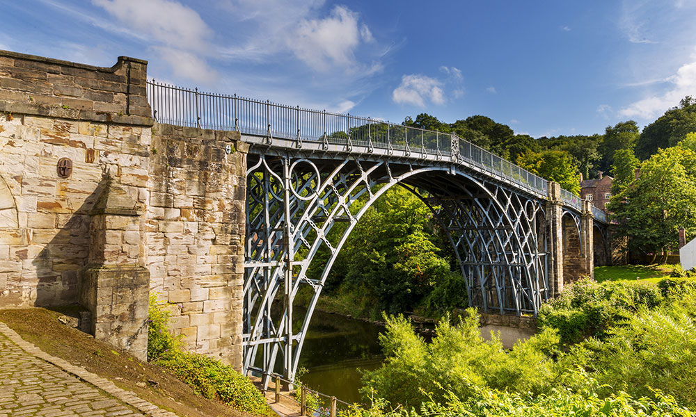
The Ironbridge Gorge on the Severn Way
Getting to the start of the Severn Way will take up half of the first day and by evening you will reach the same point where you set off that very morning. This is certainly no pitfall as these first few miles will take you up through incredible lush forests and wild bogs, where you’ll walk on a platform. It’s mostly all downhill from there, although you will have a couple of inclines to contend with. Most of the Severn Way follows the River Severn but it does loose its company at various points along the first part of the trail. From rugged, boggy, windswept uplands, the Severn Way is a fantastic long-distance route that will take you through history, nature, industry, heritage and architecture.
Day trip suggestion
The Ironbridge Gorge is a UNESCO World Heritage Site and is known throughout the world as the symbol of the Industrial Revolution. There’s a delightful short walk, following part of the Severn Way to admire the Ironbridge close up and from afar.
Two Moors Way
Best for stunning contrasts
Two Moors Way route information
- Distance: 117 miles / 187 km
- Difficulty: 4/5
- Start: Wembury, Devon
- Finish: Lynmouth, Devon
- Trail type: Regional Trails
The Two Moors Way is a delightful coast-to-coast route (south to north Devon) across the moorlands and barren landscapes of Dartmoor and Exmoor National Parks. The route also takes in a lesser-known section of Devon’s finest countryside and even here, there are plenty of hills to keep you busy. The trail finishes at the coast in Lynmouth where you will be greeted by the weather-beaten sea cliffs. The contrast of pastoral expanses, river valleys and high moorland is a combination that brings pleasure and quality, moments of reflection and breezy heights.
Day trip suggestion
Grimspound is a late Bronze Age settlement and consists of 24 hut circles surrounded by a stone. It’s an interesting sight to see and well worth a stop for photos.
If you’d like more information about each route and you’d like to discover more epic walks across Great Britain, then the Epic British Walks book is available from the OS Shop.