What are Grid References?
Improve your map reading skills by understanding how to use and read a 4-figure, 6-figure or 8-figure national grid references. This grid reference finder is suitable for beginners and includes short ‘how-to’ videos.
Finding a Grid Reference Online
The quickest way to find a grid reference of a location is to go to the desktop version of OS Maps. Now, right click on the location to drop a pin – it’s that simple! You should see two letters followed by two sets of five numbers.

If you’re using the OS Maps app then you’ll need to tap and hold to drop a pin and find the grid reference. It will follow the same format as the above. The OS Maps app also has Locate Me to assist with finding a grid reference. Locate Me is a feature which turns your phone into a compass, allowing you to pinpoint your exact location.
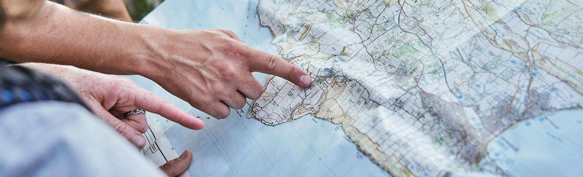
Of course, we all know there’s nothing more reliable than a paper map and compass when venturing into the hills. So, it’s important to know how to find your location (grid reference) on a paper map. This will allow you to let others (like Mountain Rescue) know where you are. To do this, you need to understand the National Grid.
Understanding the National Grid – Eastings and Northings
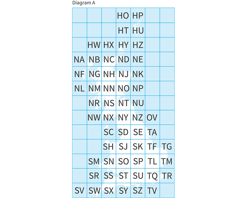
National Grid (Diagram A)
You may have noticed that a series of blue grid lines cover OS maps. These grid lines help you to pinpoint an exact location anywhere on the map. The horizontal lines are called eastings, as they increase in value as you travel east on the map. The vertical lines are called northings, as they increase in value as you travel north on the map.
The National Grid links these lines and provides a unique reference system. This can be applied to all OS Maps of Great Britain, at all scales. Great Britain is covered by grid squares measuring 100 kilometres across and each grid square is identified by two letters, as shown in diagram A.
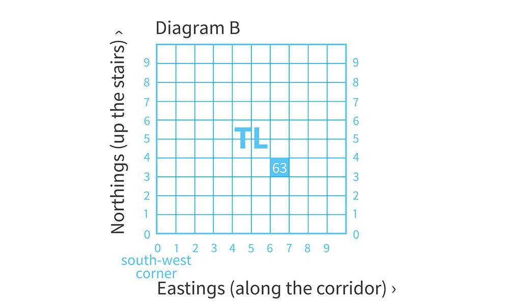
Map grid showing 10km grid squares within TL63 (Diagram B)
On OS maps, these squares are further divided into smaller squares by grid lines representing 10 kilometre spacing. Each square is numbered from 0 to 9 from the south west corner, in an easterly (left to right) and northerly (upwards) direction. You can see this in diagram B.
Using this eastings and northings system you can identify a 10 kilometre grid square. For example, the above image shows TL63. After the letters you can quote the eastings (6) first, then the northings (3).
Top Tip
If you have trouble remembering the order, say “along the corridor, then up the stairs.”
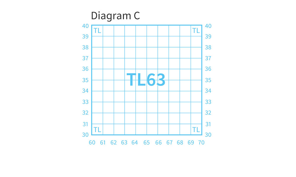
Map grid showing 10km grid squares and TL63 (Diagram C)
On an OS Landranger map you can find the two main grid letters (in this case TL) on the legend or the corner squares of the map. The grid is further divided into 1 kilometre intervals, as shown in diagram C.

EXPLORE THE
OS Shop
We are with you every step of the way. Shop our trusted walking and hiking maps and guidebooks so you can explore the outdoors with confidence.
Go to the shopShop OS Maps!
How Do You Use Grid References to Find Locations?
If you haven’t got OS Maps or you’re using a paper map, it is easy to find a particular place using a grid reference. To start, a 4-figure grid reference is a handy way of identifying any square on a map. Grid references are easy – just remember that you always have to go along the corridor before you go up the stairs.
4-Figure Grid References
To find the number of a square, first use the eastings to go along the corridor until you come to the bottom left-hand corner of the square you want.
Write this two-figure number down. Then use the northing to go up the stairs until you find the same corner. Put this two‑figure number after your first one. You now have the 4-figure grid reference, which looks like the example in diagram D: 6233.
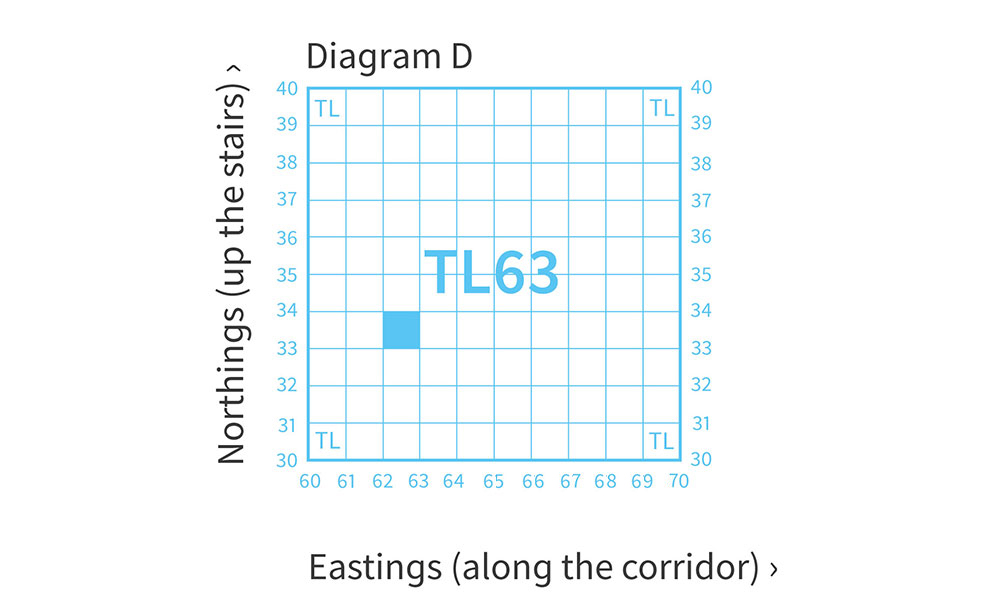
Finding grid square TL 6233 (Diagram D)
How to Take a 4-Figure Grid Reference with Steve Backshall

6-figure Grid References
If you want to pinpoint an more exact place on a map, such as your house, you will need to use a six-figure grid reference. First find the four-figure grid reference for the square and write it down with a space after each set of numbers, like this: 62_ 33_
Now imagine dividing this square into 100 tiny squares, with 10 squares along each side. Still remembering to go along the corridor and up the stairs, work out the extra numbers you need and put them into your four-figure grid reference like this in diagram E: 625 333.
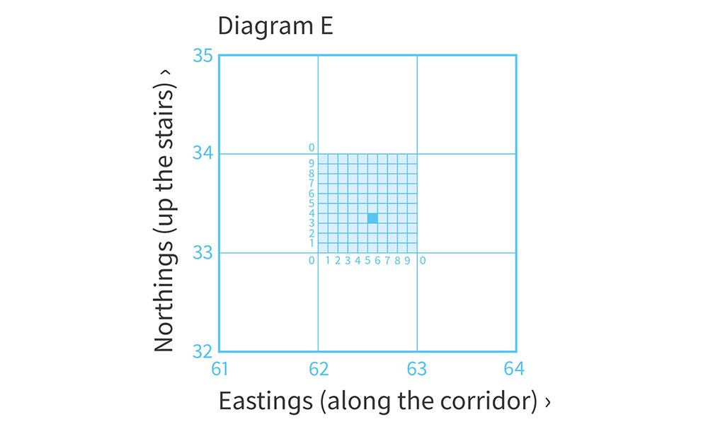
How to calculate a 6-figure grid reference (Diagram E)
Top Tip
When giving directions you can provide even more accuracy to your grid reference by stating a nearby landmark or feature. For example, on the Bembridge OS Explorer map I am at grid reference SZ 644 874, at the crossroads.
How to Take a 6-Figure Grid Reference with Steve Backshall
We hope you found this grid reference finder useful! Put your new skills into practice and get out your OS map to have a go at finding a few grid references.
Check out our Pathfinder guide titled Navigation Skills for Walkers including map reading, and how to use a compass and GPS.
EXPLORE THE
OS Shop
We are with you every step of the way. Shop our trusted walking and hiking maps and guidebooks so you can explore the outdoors with confidence.
Go to the shop