Author and outdoor guide, Geoff Allan shares his 10 best adventures from his book Scottish Bothy Walks.
What is a bothy?
Bothies are typically remote, rural cottages that have lived beyond their original purpose. Many are maintained by the charity The Mountain Bothies Association. Most British bothies are located in Scotland, with a handful in England and Wales.
They all have very basic facilities – you won’t find anywhere to charge your phone here! They are kept unlocked for people to take shelter or stay overnight without charge and make a great adventure.
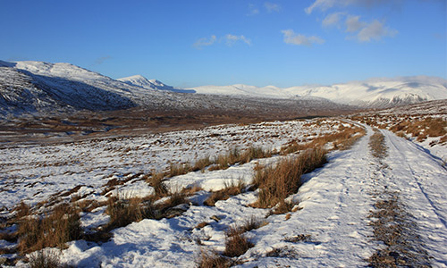
From a short amble up to the Lookout Bothy on the northern tip of Skye, to a two day expedition across the remote moorland in the shadow of the Ben Alder plateau, my aim has been to tempt you out into Scotland’s rugged and beautiful landscape, whatever your level of ability. Here is a list of my 10 best bothy walk in Scotland for every occasion.
1. Best bothy walk for beginners
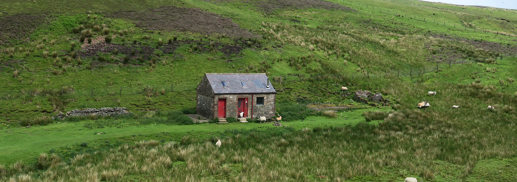
Staoineag Bothy from Corrour Station
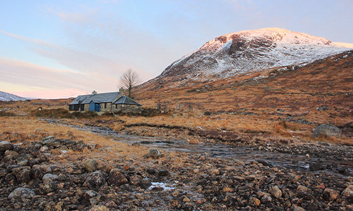
Staoineag Bothy
Distance: 17 km/10.5 miles
Time: 5-6 hours round trip
Walk in 5.25 miles/ Time: 2.5-3 hours
Difficulty: Easy
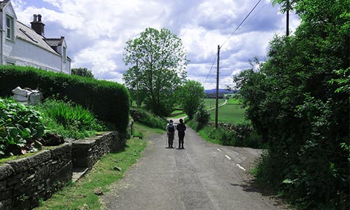
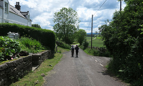
Over the years Staoineag has been a steadfast friend, a place I have returned to again and again. Tucked beneath steep crags on the banks of the meandering Abhainn Rath, (a remote valley north of Rannoch Moor, and east of Glen Nevis), the bothy makes a perfect place to go off-grid, and forget day-to-day preoccupations, despite being near Fort William. The easiest approach to the bothy is via Corrour Station, the only railway stop in the UK not accessible by car. Alighting from the train you are plunged straight into the wilderness, without having to strain every sinew to get there. This saves an extra 10-mile trek from the road end at Rannoch Station (and an even longer trek from Spean Bridge). And although the walk-in from Corrour still provides a healthy challenge, it is manageable in all weathers. The reward is overnight accommodation in a stunning location, with plenty of space and a reliable wood supply along the banks of the river.
Staoineag Bothy
Staoineag Bothy walk
Leaving the platform at Corrour Station (56.7598, -4.6903), head north east, parallel to the railway line, along a path signposted to Spean Bridge. After just over a mile, cross a footbridge over the Allt á Chamabhreac and pick up a wide unmetalled road which leads down to a hydroelectric scheme on the short south side of Loch Treig, completed at the beginning of 2016. Until relatively recently sections of this path were a boggy morass, but thankfully today it is much improved. Continue on around the loch to until you see Creaguaineach Lodge, and just before the bridge take a small path to the left, running along the south side of the Abhainn Rath. Push on for 500 yards across a carpet of coarse heather before being enveloped in a close canopy of silver birch high above the river. Once the Allt Cam nan Aighean has been negotiated, the only stream crossed on the walk in, (normally passable even in spate), the trail gently rises past some impressive rapids, and onto the flats just before the bothy. Although its easy to navigate in daylight, the path around the long meander can be elusive in the dark (5.25 miles 2.5-3 hours).
Staoineag is a special place, and because it is most accessible by train, appeals to a wider cross-section of people, than you would more typically expect to see at a bothy. I’m looking forward to my tenth visit in the near future, and have always taken home happy memories. Returning after an overnight stay be mindful not to miss the last train!
2. Best family friendly bothy walk
Meall a’ Bhuachaille and Ryvoan Bothy
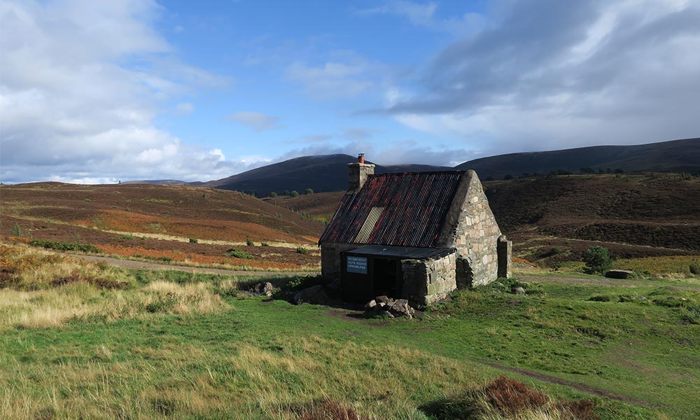
Ryvoan Bothy
Distance: 9km/5.5 miles
Time: (summer conditions) 3-4 hours
Difficulty: Easy
Total ascent: 512m
Classic circular walk in the Cairngorms National Park, through the beautiful Scots pines of the Queen’s Forest to Ryvoan Bothy, followed by panoramic views from the summit of Meall a’ Bhuachaille.
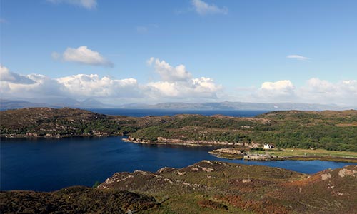
Overlooking the tranquil waters of Loch Morlich in the Glenmore Forest Park, Meall a’ Bhuachaille (Shepherd’s Hill), is the highest point of a line of three, carefully rounded triangular peaks which stand apart from the main Cairngorm plateau, close to the outdoor Mecca of Aviemore. With well-managed paths and simple navigation, the route provides a perfect introduction to the exceptional beauty and raw energy of the high montane habitat that is a unique feature of this vast national park – the largest protected area in the whole of the UK.
The walk starts at the road-end just beyond the National Outdoor Training Centre at Glenmore Lodge (57.1652, -3.6743). Follow waymarkers through the venerable old pines into the narrow confines of the Ryvoan Pass and up to An Lochan Uaine (Little Green Lochan), an enchanting teardrop lake. The genuinely startling turquoise tint of the water is said to be the handiwork of the fairies who wash their clothes in the crystal-clear pool. The lake is a short detour down some steps from the main track, and it is well-worth stopping for a moment’s contemplation before continuing on. Once through the head of the pass take the left hand path signposted to Nethy Bridge where the track forks, and within five hundred yards you reach Ryvoan (Ruighe a Bhothain, Sheil of the Bothy).
Meall a’ Bhuachaille
An Lochan Uaine
After a quick nosey inside the bothy, climb Meall a’ Bhuachaille via a steep, well-made path which zig zags steeply up the mountain’s eastern flank. From the summit the sinuous outlines of Cairn Gorm, and the Northern Corries dominate the view, while below Loch Morlich twinkles far below in the sunlight. Now follow the obvious path off the mountain down to the saddle where the main trail carries on up and along the ridge-line to Craiggowrie. Instead, take the path that heads left down towards Glenmore and eventually enters the forest, then follow a small burn down towards the visitor centre. As the track splits take the right fork down to the roadside, where you’ll find a welcoming café. The return to Glenmore Lodge is a short walk along to the single-track road past the Reindeer Centre.
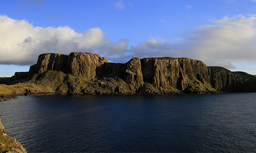
3. Best bothy walk with a view
The Lookout Bothy and Rubha Hunish on Skye
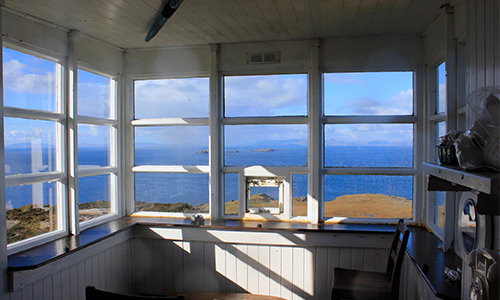
The Lookout Bothy
Distance: 4km/ 2.5 miles
Time: 2–3 hours round trip
Difficulty: Easy
An unmissable journey to the northernmost tip of Skye, Rubha Hunish, via the spectacular Lookout Bothy, taking in panoramic views over the Minch to the Western Isles.
The stunning 180-degree view from the bay window at The Lookout certainly gives the bothy its wow factor. This former coastguard watch station, positioned precariously close to the cliff top above Rubha Hunish, offers a breath-taking panorama from Barra to the Butt of Lewis, and on a clear day the profile of the mainland all the way to Cape Wrath. Below the epic cliffs, the headland of Rubha Hunish appears as a bony finger of rock and pasture jutting out above the waves. Go early in the morning, or stay late, and you may spot otters swimming between the geos, and further out in the depths, dolphins and whales navigating through the Minch. Shags and cormorants fly low above the eddies, and in the summer gannets circle and dive in a remarkable display of aerobatics.
The Lookout Bothy walk
The Lookout Bothy walk
Heading off from the small car park just after the Shulista turn-off on the A855 (57.6842, -6.3257), take the footpath signposted to Rubha Hunish along a low escarpment and up the slope to an obvious depression on the horizon. As you approach the gap, the clean salty tang of the sea permeates the air, and suddenly you are peering down to the dizzying view over the Minch. The bothy is an easy 5-minute walk up the slope to the right, a small, boxy building, refurbished by the Mountain Bothies Association (MBA) after suffering storm damage in 2005.
The interior was faithfully restored to the original design, and glass panes replaced in the epic bay window. Prepare to experience all kinds of weather: shimmering sunlight, castles of cumulus clouds building from the west, rain showers scooting across the water. The canvas changes with every passing moment and it is difficult to tear yourself away. Energised by the views, head back to the gap and scramble down a weakness in the cliffs to Rubha Hunish. The first few steps are a little exposed, but after that the descent is relatively easy. A number of sheep trails criss-cross the headland, one leading to the most northerly point. After exploring the coastline, return up the rocky staircase and retrace your route down to the roadside.
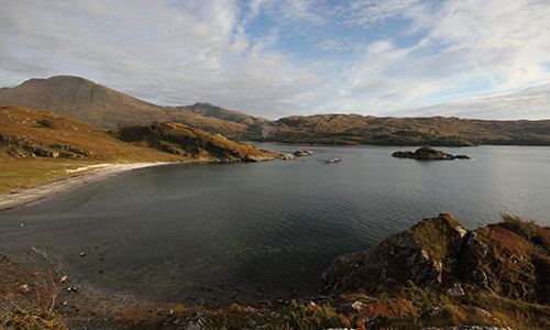
4. Best bothy walk to a Secret Beach
Peanmeanach Bothy
Peanmeanach Bothy
Distance: 11 km/7 mile round trip; (13.5km/8.5 miles for extension to Singing Sands)
Time: 4–5 hour round trip (allow all day if exploring the coast)
Difficulty: Easy
A fabulous outing through Ardnish, a rugged promontory tousled of moorland heath, intimate bays and low tumbling cliffs to Peanmeanach, a ruined beachside settlement with a magical bothy. Wander further along the coast to an enchanting secret beach only revealed at low tide.
The quiet, unassuming peninsula of Ardnish is easily overlooked among the star attractions on the ‘Road to the Isles’, yet walking through this timeless landscape is a real joy with wonderful views at every turn. Looking out over the peaceful Sound of Arisaig, Peanmeanach bothy sits above a lovely, crescent-shaped bay. Though sadly now closed, you cannot help but smile as you reach the bothy door and gaze out across the sound to the distant outline of Ardnamurchan. A mile further west, along a stretch of unspoilt coastline, discover a hidden beach known locally as Singing Sands. The grains of sand here have unique properties – completely round, and of a precise diameter, that generate a low frequency sound when you skip across the surface.
From the lay-by close to Polnish (Lat/Long 56.8874, -5.7080), head through a underpass below the the West Highland Railway Line, then push on steeply uphill, earning increasingly impressive views of Loch Nan Uamh. Bonnie Prince Charlie landed here as he mustered his forces for the battle of Culloden in 1745, and also left from the same spot after the Jacobite Uprising was crushed, fleeing to exile in France. Finally the terrain eases, the path contouring through rocky bluffs and tough moorland grasses before skirting the shallow basin of Loch Doire a’ Ghearrain.
After crossing the outflow stream via a set of stepping stones, the path gently meanders down through an enchanting wooded hollow of birch and rare Atlantic oak, the canopy sculpted into an angled roof by the prevailing westerly winds. Emerging onto a flat marshland of tall reeds, the bothy comes into sight, the boggy terrain to the coast negotiated by an arrow-straight line of sunken flat stones. To continue onto Singing Sands, head west from the bothy, quickly crossing the Allt Loch Doir’ a’ Ghearrain before picking up a faint trail to the ruin of Glasnacardoch. Here the path peters out, so continue on open ground to the coast, over the rocky foreshore to the beach.
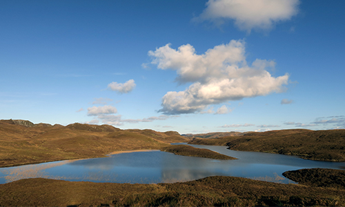
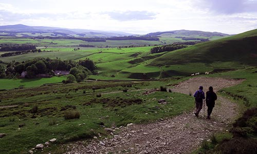
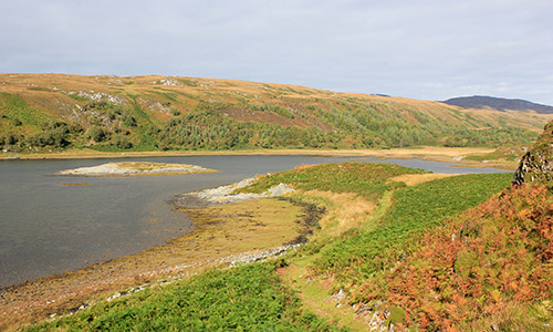
5. Best bothy walk for solitude
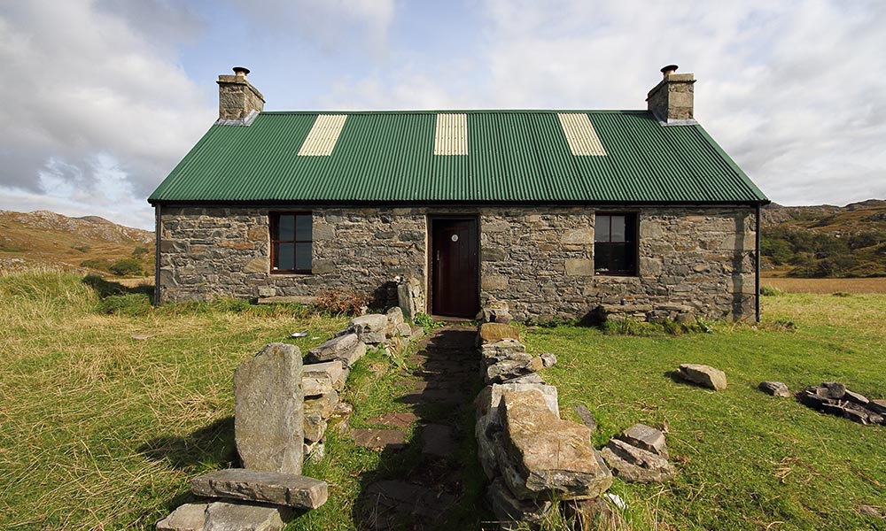
Kilneuair by Loch Awe to Carron Bothy
Carron Bothy
Distance: 17 km/10.5 miles
Time: 5-6 hour round trip
Difficulty: Easy
A meditative journey through solitary upland moor between Loch Awe and Loch Fyne following in the footsteps of early Christian missionaries, drovers and traders.
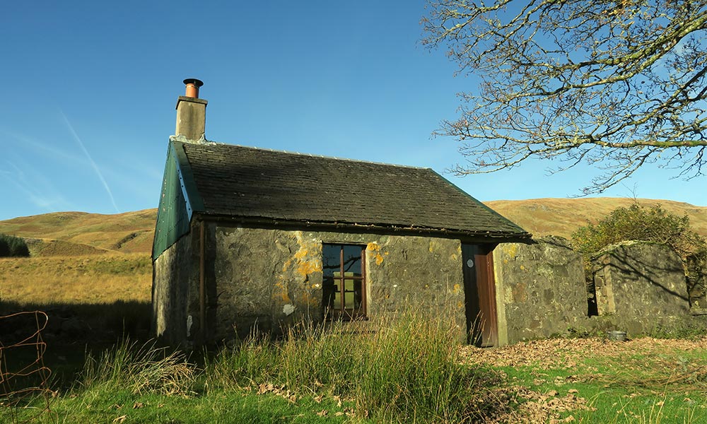
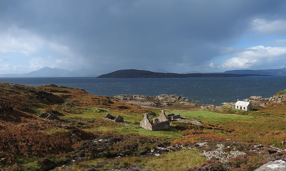
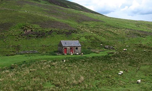
Folded into the gently undulating moorland that separates Loch Fyne and Loch Awe, Carron bothy sits on an old droving road above the River Add, which gives the shelter its Gaelic name Car Abhuinn, meaning ‘winding river’. The cottage is built from the remains of two ruined houses, and there is a slate roof, a long table, fireplace and a small library of books. It rests between two large expanses of forestry, and a new line of wind turbines that poke their heads above the tree line to the west. Despite these encroachments, this is a tranquil spot, where red-throated divers and black grouse share their moorland home with sheep.
Carron Bothy Walk
Carron Bothy Walk
Begin the walk at a small improvised parking spot at Kilneuair by a track leading to Finchairn on the B840 (56.1794, -5.4090). Very quickly you’ll come across a ruined medieval chapel, hidden amongst the bracken behind a copse of birch and sitka spruce. Kilneuair, the ‘Church of the Yews’, is a remarkable find. Dedicated to St Columba, there is historical evidence to suggest that it might be the site of ‘Cella Diuni’, one of Iona’s earliest satellites, built by St Diuni, a disciple of the early missionary. Returning to the track, begin the long, meandering ascent onto the high upland moor to Loch Gainmheach.
Now Climb up through the Bealach Gaoithe (Pass of the Winds), to a swathe of rocky crags, heather and blanket bog patterned with beautifully sculptured hill lochs. After a mile traversing this windswept landscape, descend towards the River Add, skirting the boundary fence of a conifer plantation and down towards the bothy. The peaceful one-room refuge is guarded by two trees, a sycamore and a sitka spruce.
Here the old drove road meets another ancient byway originating at Kilmichael Glassary, close to Dunadd, and the Mòine Mhòr (Great Moss) the sea-bound floodplain of the River Add. A beautifully constructed old stone bridge a few hundred yards from the bothy is the only sign that this lonely glen was a once well-travelled route. Despite the modern man-made intrusions, this is a strangely peaceful spot as the many glowing entries in the bothy book attest. With one more pause for thought, return back over to Kilneuair and Loch Awe.
6. Best bothy coastal walk
Uags Bothy and the Applecross Peninsula
Uags Bothy
Distance: 11km/7 miles (round trip)
Time: allow 4–5 hours, including time spent at the bothy.
Difficulty: Easy
A splendid walk across the remote southern coastal fringe of the Applecross peninsula to Uags bothy, with fabulous views over to the Skye Cuillin and Raasay.
Blessed with the Gaelic name A’ Chomraich, ‘The Sanctuary’, by an Irish missionary in the seventh century AD, the Applecross peninsula, has a long-held reputation as a tranquil and isolated backwater. Crofting communities scattered along the coast were still only accessible by footpath or by boat well into the 20th century, and had a far closer connection to the sea than to the interior beyond the mountains. Perched on a rocky promontory above the tide-line at the southern tip of the peninsula, Uags bothy provides an ideal focal point to explore this magical stretch of coastline. The last remaining dwelling of a small township finally abandoned in the late 1930’s. the Gaelic name for this tranquil spot, Na-h-Uamha, means ‘The Little Caves’.
7. Best bothy walk for a Sunday stroll
Kettleton Byre Bothy and Scaw’d Law
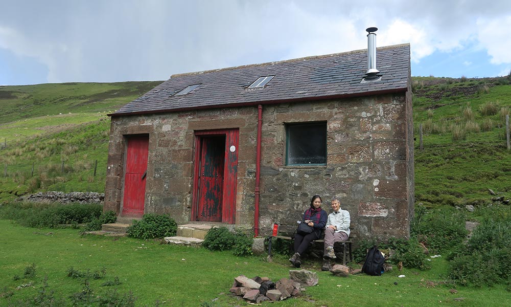
Kettleton Byre Bothy
Distance: 11.8 km / 7 miles
Time: Allow 3.5-4.5 hrs
Difficulty: Easy
Total Ascent: 590m
A circular ramble through the rolling fells above Nithsdale in the southern Lowther Hills via the pocket-sized bothy of Kettleton Byre.
Straddling the old county boundary between Lanarkshire and Dumfriesshire, the Lowther Hills cover a compact area of high upland heath. Powerful glacial meltwaters moulded the landscape into a collection of attractive rounded peaks, hummocks and hollows, as well as steep-sided, quiet glens of understated charm. Set above the fertile floodplains of Annandale and Nithsdale, this is classic Borders sheep country and grouse moor, and a strategic natural barrier traversed by ancient byways and drove roads. Kettleton Byre is a wee shack squeezed into a steep notch above the sleepy hamlet of Durisdeer. The imposing parish church is the kirk for the country seat of Drumlanrig Castle, owned by the Dukes of Queensberry and Buccleuch who rank among the largest landowners in the UK. The east wing of the church contains a remarkable marble mausoleum to the Queensberry ancestors.
Starting from the war memorial next to the village green (55.3152, -3.7443), head back down the hill, then turn left up a track following the boundary wall of the old cemetery. Stroll through the sheep folds by the Hapland Burn, and into the deep notch of Glenaggart. After a slow, steady ascent past the appropriately named Sleepy Cleuch, the track levels and the bothy comes into view. This little refuge is held in great affection, and over many visits I’ve happily read bothy book entries from excited kids, Duke of Edinburgh Award groups and other first-timers. Now ascend Glenleith Fell via Kettleton Farm (now a locked shooting lodge), taking a track left, which cuts across the steep slope of at a more forgiving angle. As the contours relent, tack to the right, skirting round the unremarkable high point of 612m, and descend to the track running between Blackgrain Shoulder and Wedder Law. At the T-junction, turn left towards Scaw’d Law to a point where the track begins to dip down back towards Glenaggart. Here an unmarked path ascends right (not marked on the 1:25,000 map) to reach an old drystane dyke running along the county boundary. Turn left onto a faint path running parallel to the dyke, up to the summit of Scaw’d Law – an unflattering Scots term for a speckled, scabby or patchy hill. On a clear day, the silvery strip of the Solway Firth glistens in the sunshine, and beyond, the mountain tops of the Lake District are just visible on the skyline.
Follow the drystane dyke as it turns sharply L over to Little Scaw’d Law and down to Kirkgrain Hass. At a corner point in the wall, a new track cuts across the slope to the ridge of Durisdeer Rig and back down to the village. An idyllic scene opens up as the track descends: sheep graze peacefully in the fields below, and across the Nithsdale Valley the grey rectangular outline of Drumlanrig Castle sits within carefully manicured parkland. In the final steep descent you can almost reach out to touch the roof tops in the hamlet, before joining the old Roman road back to the kirk. On Sundays from the second week of July to mid-September, afternoon tea is served in the church hall from 2.30 to 5pm.
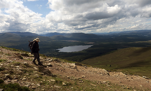
8. Best bothy walk for spectacular scenery
Suilven and Suileag Bothy from Glencanisp Lodge
Suileag Bothy
Total Distance:12 miles/19km
Time: 6-8 hours.
Difficulty: Easy
Total ascent: 797m
One of the finest mountain walks in Scotland, stopping off at Suileag Bothy, located under the shadow of Suilven’s formidable sandstone buttresses. Wonderful views from the summit dome over Assynt’s otherworldly landscape of rugged peaks and ribbon lochs
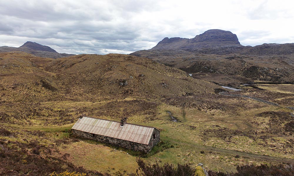
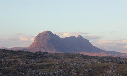
It is easy to be seduced by any of Assynt’s distinctive sandstone peaks, but the striking monolith of Suilven (Sulr Bheinn, Pillar Mountain), and the thrill of its spectacular summit panorama has inspired more prose, poetry and song than any other. Battle-scarred by successive waves of glaciation, the hills here are unique in Scotland, enshrined within Scotland’s first Geopark, which was given UNESCO status in 2006. They lie above an ancient bed of Lewisian gneiss, formed over 3 billion years ago and comprising some of the oldest rocks in the world.
The first object is to reach Suileag Bothy from the walkers car park on the road to Glencanisp Lodge (58.1463, -5.2182). Named from the Gaelic for ‘little eye’ or ‘loop’, the shelter is a long, single storey stone cottage with an impressive view of Suilven’s formidable profile from the front door. Heading on from the bothy, stride towards the foot of Suilven and climb the steep slope up to Bealach Mòr. A palpable sense of anticipation builds as you approach the summit ridge, and the view revealed when you reach level ground does not disappoint.
The sweeping profiles of Cul Mòr, Stac Pollaidh and Ben More Coigach stretch off to the south, beyond the mesmerising curves of Fionn Loch and Loch Sionasgaig, while to the north, there are tantalising glimpses of Foinaven and Ben Hope beyond Quinag’s complex ridge-line. Turn west through a gap in a drystone dyke, and up onto the summit dome, the view of protected wilderness expanding with every stride. There are a couple of rock steps to be negotiated, but nothing too off-putting. At 731m, Suilven’s highest point is lowly, relative to those of Scotland’s legion of Munros, but the mountain punches well above its weight. Return triumphant back to the bothy retracing your steps down the slope, and then on to Glencanisp. Whatever the weather, this is an unforgettable expedition.
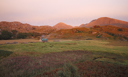
9. Best bothy walk for history and legends
Two day walk to Ben Alder Cottage
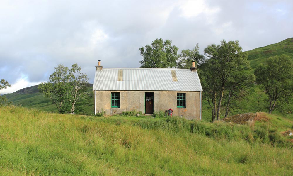
Ben Alder Cottage
Total Distance: 30 km/18.5 miles
Time: 9-11 hours over two days
Day 1: 13.5km/8.5 miles Time: 4-5 hours
Day 2: 16.5km/10 miles Time: 5–6 hours
Difficulty: Moderate
Classic two day expedition through the vast, upland moors in the heart of the Central Highlands staying overnight in atmospheric and reputedly haunted bothy of Ben Alder Cottage.
Since the 1920s, stravaigers and mountain walkers have sought solitude in the empty quarter of the sprawling Grampian Mountains dominated by the Ben Alder Plateau. This exceptional weekend expedition transports you into the heart of this brooding wilderness utilising consecutive stops on the West Highland Railway Line. Ben Alder Cottage has long had a reputation for being haunted, though this never seems to have impacted on its popularity!
Arriving by train at Rannoch Station there is a bookable mini-bus which take you six miles along the B846 to the start of the walk: a signposted forestry track ½ mile beyond the turning to Bridge of Gaur (56.6866, -4.4399). Heading up though the fresh-scented spruce and out onto the open moor you quickly earn your first glimpse of the undulating, granite-capped plateau in the far distance. This view becomes even more impressive as you reach the southern edge of Loch Ericht and begin the journey along the shoreline to the bothy. Ben Alder Cottage lies above a semi-circular bay below the mountain’s southern flank, a cheering sight after a solid few hours walking (8.5miles, 4-5 hours). The cottage was originally named after Joseph McCook, who resided here with his family at the turn of the 20th century. Once he retired, the head stalker concocted some terrifying tales in an attempt to frighten away unwanted visitors took refuge in the empty building. Its ghostly reputation grew over the years, though there was no basis to the original stories.
Be sure to start out early for the journey to Corrour station so you do not miss the evening train. Head up the stalkers’ path up to the pass on the plateau’s southern flank and descend to the Uisge Labhair. After crossing the river follow an obvious trail down to the beautiful tree-lined Loch Ossian. Continue round the loch and onto the station (10 miles, 6 hours). The warm embrace of the Station House Cafe is a fine reward for your endeavours, open from Easter to the end of October, before you catch your train home.
10. Best bothy walk for wilderness and wildlife
Jura’s remote coastal refuges walk
Total Distance:17 miles/ 27km
Time:12 hours over three days
Walk in/Walk out 3.75miles /6 km Time: 2–3 hours
Day 2: 9.5 miles/15 km Time: 5–6 hours
Difficulty: Challenging
Exceptional three-day round trip taking in two beautiful bothies along the remote, uncompromising northern shoreline of Loch Tarbert on Jura. A haven for wildlife, this rugged landscape is among the finest in Scotland.
The westward-facing seaboard of Jura has been scoured and sculpted into a procession of quartzite cliffs, sea-stacks, caves and raised beaches that are as remote and inaccessible as any in Scotland. A world away from the metropolis of Glasgow (barely 50 miles as the crow flies), it is home to a large population of red deer and wild goats that roam the open moorland. Golden eagles, hen harriers and buzzards soar above, while along the foreshore otters and grey seals share the rocky skerries with cormorants and guillemots. Only four permanent buildings remain intact along the entire coastline, three of them bothies. For the intrepid adventurer, setting out across this wild, untamed landscape will be a true voyage of discovery, and I could not recommend it more highly.
From the small lay by just beyond the tiny hamlet of Tarbert (55.9787,-5.8397), head west across the mudflats at the outflow of Loch Tarbert and negotiate a patchwork of peat bog and tussock grass down to the coast. Progress is aided by intermittent deer tracks which criss-cross the hillside. Finally spy the Cruib bothy tucked in the corner of a secret cove. Expertly renovated in 2012, the bothy’s communal room would not look out of place in a hostel, with a sleeping platform, armchairs, and a heaving bookshelf above the fireplace (3.75 miles, 3 hours).
Suitably rested, set out for a circular day trip to Ruantallain Bothy full of expectation. Pick up an all terrain vehicle ATV track leading west over the moor and onto the rugged promontory where the bothy lies hidden behind a low bluff. This is truly a show-stopping location. The view south is framed by Loch Tarbert and the Paps of Jura, and wandering out to the point there is a rare view of Colonsay, the last stop before Newfoundland. Ruantallain is a throw-back to a bygone age, crammed full of antique furniture and crockery left from the 1950’s, and lit only by a tiny south-facing window. You could stay here a night too, but it is far easier to explore the coast unencumbered with a heavy rucksack. Head back to Cruib bothy via the coast giving time to explore the numerous hidden caves and sweeping raised beaches scattered along the coast (9.5 miles, 6 hours round trip). After a second night, return reluctantly back to civilisation, making a firm promise to return.
Whether your visiting one on a walk or staying overnight, British bothies make a great adventure. Help take care of our bothies by following the bothy code and leaving no trace.
If you’d like to discover more bothies, including those in England and Wales, head over the The Mountain Bothies Association website and use the location map.
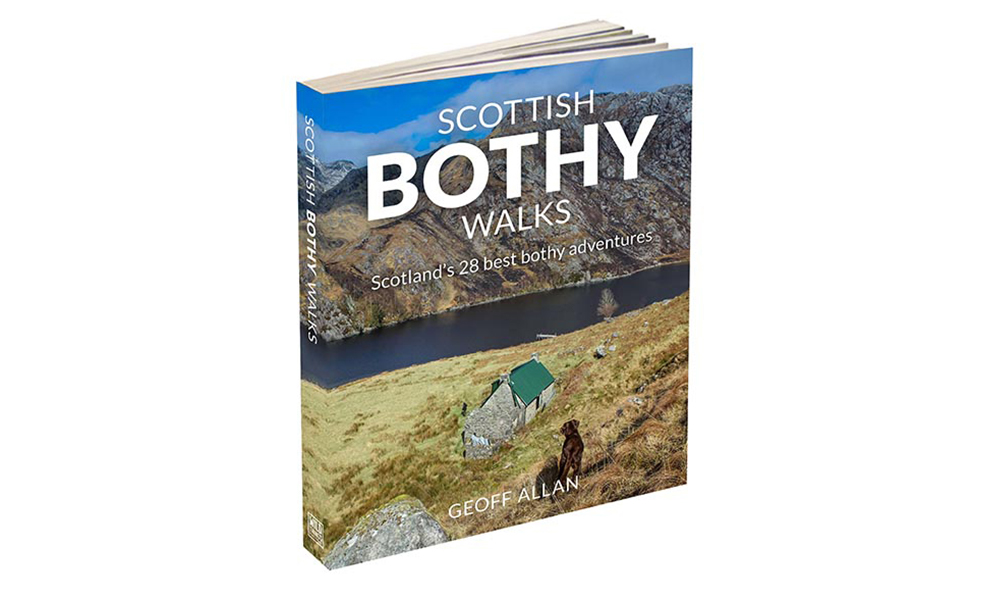
About the book
Scottish Bothy Walks: Scotland’s 28 best bothy adventures by Geoff Allan (Wild Things Publishing, £16.99) is available for 20% discount and free P&P with code OS21 at www.wildthingspublishing.com