OS GetOutside Champion, Scott McAlister, explores Malham Cove and Gordale Scar in the Yorkshire Dales, voted in at number 3 on ITV’s Britain’s favourite 100 walks.
Like most of the Great outdoors loving population I was recently glued to the TV Screen watching Britain’s favourite 100 walks. Malham Cove and Gordale Scar in the Yorkshire Dales was voted in at number 3. I first did this walk back in 2009 before my love affair with the Lake District really began. By the way, the Lake District has five walks in the top ten, so my affair is justified!
Seeing the beautiful scenery of this route on the TV brought back many happy memories for me, for this is where my passion for the outdoors really began after reading a book on the Yorkshire Dales that I picked up from a charity shop. Watching the walk back on TV, it was time to plan another visit for myself!
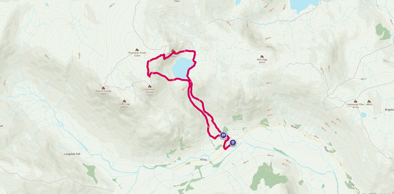
Janet’s Foss SD 911 633


This 10km circular route starts and ends in the picturesque village of Malham and takes in three points of interest that I was really looking forward to seeing again!
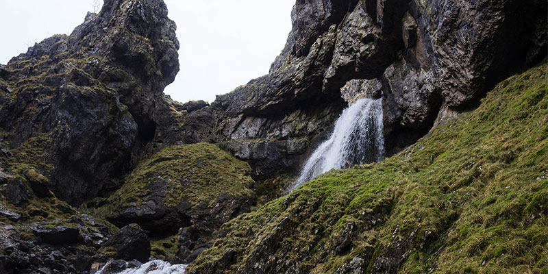
The first, Janet’s Foss is the stuff of legends! Located at grid reference SD 911 633, this mystical waterfall is said to be the home of Jennet, Queen of the Fairies. It certainly has a magical feel to it as you leave the open dale and head into the lush green woodlands that leads to the fall. Take time to have a bite to eat and a brew as you marvel at this beautiful little waterfall and its emerald green pool.
On leaving the Foss, it is a short walk North over the bridge to the Gordale Scar campsite grid reference SD 913 635. The mood changes here, gone are the thoughts of dainty little fairies skimming across the water, this feels prehistoric, like a scene from Jurassic Park, as you head into the Scar with its imposing limestone cliffs rising 100 metres either side of you! However, at time of print there has been no known dinosaur sightings, so you should be safe!!
Gordale Scar SD 913 635
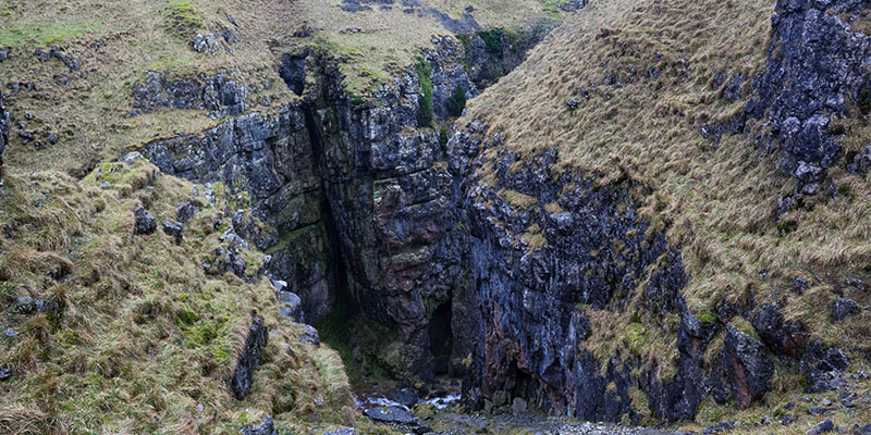
The gorge was formed by water from melting glaciers, or a cavern collapse during the last ice age 10,000 years ago. This route involves a short scramble at the head of the gorge that leads up to the path above the ravine. Take care if you attempt this as the rock is very wet and slippery. I had my dog with me and decided it was not safe to carry on this way.
After a quick check of the Ordnance Survey Explorer OL2 map, an alternative route was found which involved a steep ascent of New Close Knotts. This is an unmarked path but the wall leads the way to the top and is easy to follow. Continue to follow the wall on the unmarked path until you pick up the marked footpath again.
You have the option here to backtrack slightly to head down to the waterfall, take care as the stepped path is again wet and slippery from the fine spray of the falls.
Malham Tarn SD 894 661
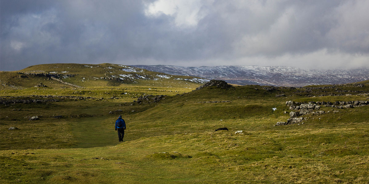
Back on the path head North Westerly for approx 3km over open moorland until you reach Malham Tarn at grid reference SD 894 661. The Tarn is a glacial lake, and at 377 metres is the highest Marl lake in the UK. Owned by the National Trust it is an area of conservation. Another great place for a brew!

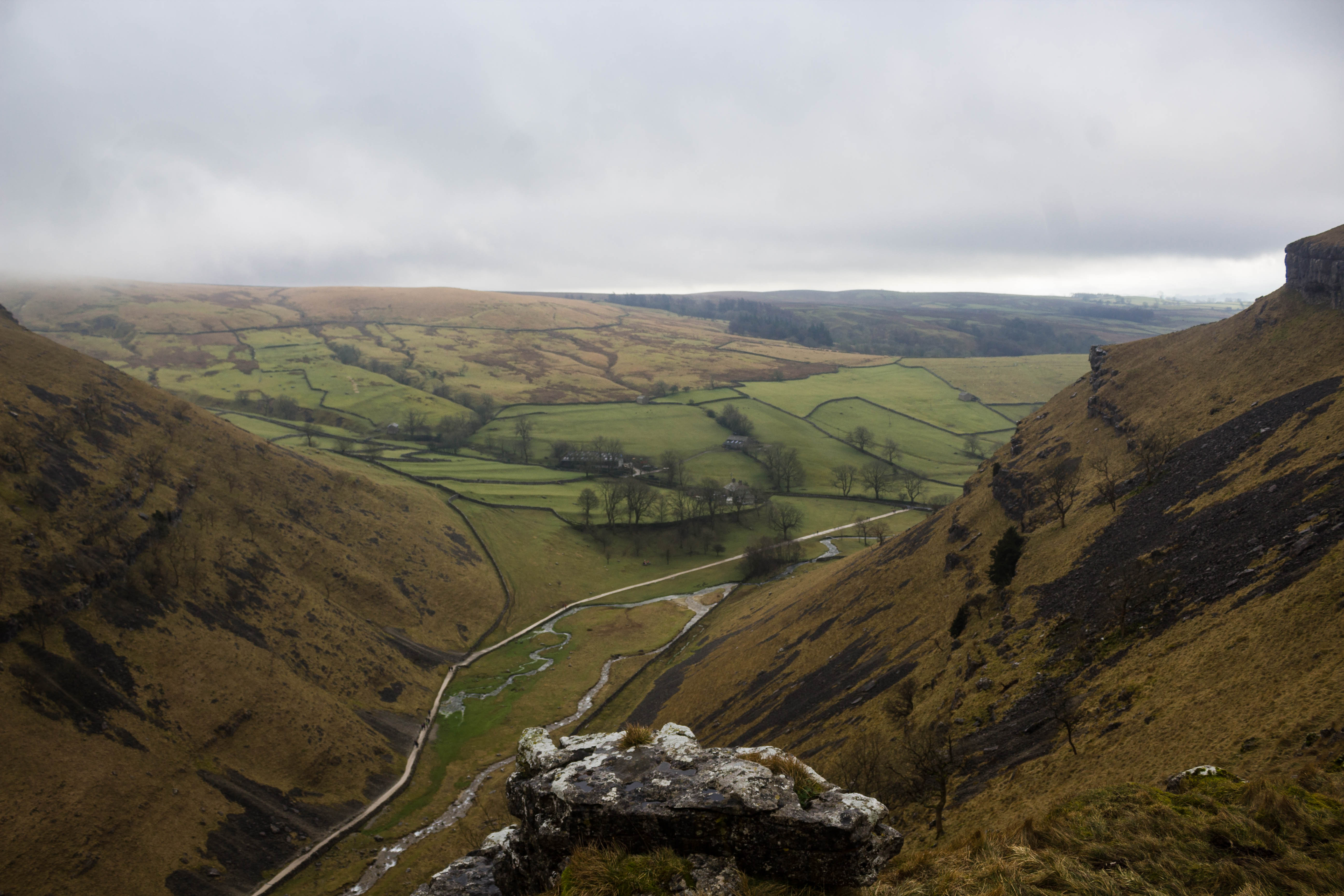
Malham Cove SD 897 641
Head South on the Pennine Way national trail path to the final point of interest, Malham Cove, grid reference SD 897 641. You will arrive at the top of the cove and its impressive Limestone pavement.


The cove was formed by a large ice age river 300 metres wide that dropped at this point 260 metres to the ground below.
On December 6th 2015, the waterfall began to flow again, making it the highest single drop waterfall in England, albeit for only a few hours. There is a stepped path at the right-hand side leading down to the floor of the cove. From the bottom looking up the cove looks even more impressive. A truly geological marvel!
From the cove it is a well-marked path to the village to end your walk. Be sure to find refreshments at the marvellous Buck Inn public house. They do a gorgeous fish finger sandwich!
You can find all of the routes for ITV’s Britain’s favourite 100 walks here.