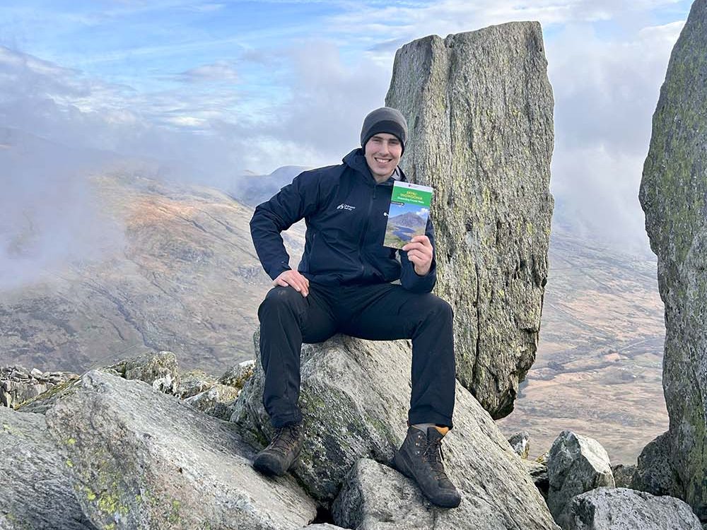
OS Champion Alex Jackson recently put a route from our Eryri Circular Walks Pathfinder Guide to the test. Alex followed our guide up the North Ridge of Tryfan in the Glyderau Mountain Range, Eryri (Snowdonia). Take a look at his fantastic pics and his advice for taking on this impressive grade 1 scramble.
Eryri (Snowdonia) Outstanding Circular Walks – Walk 15, Tryfan North Ridge
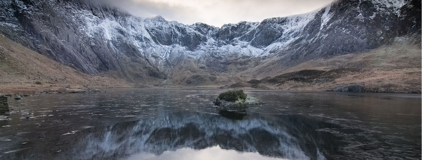
Start – Ogwen valley
Height gain – 1,755 feet (535m)
Route terrain – Rock and rocky paths throughout
Parking – Along A5, shore of Llyn Ogwen
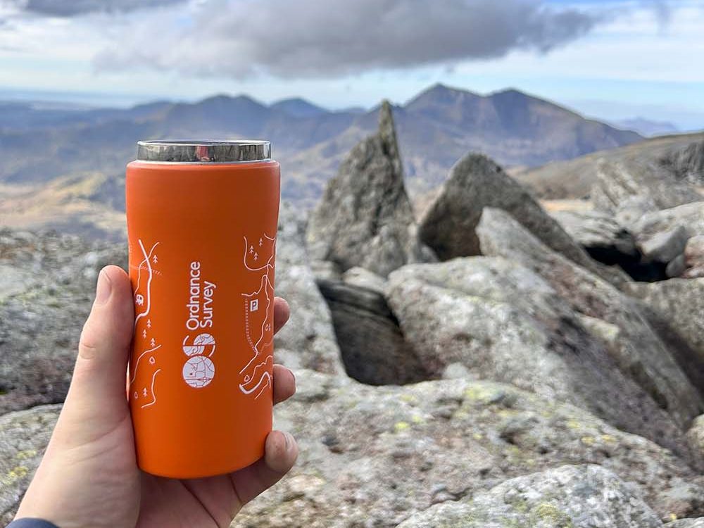
OS maps – Explorer OL17 Snowdon/Yr Wyddfa
Is Tryfan North Ridge Difficult?
Heading up Tryfan is not for the faint-hearted. You should be a confident scrambler before you try this route. There are multiple sections of steep ground where a fall could be damaging. That said it is one of the finest scrambles in Eryri. So if you have the right skills and conditions then go for it!
Be Prepared!
When heading up Tryfan’s North Ridge, preparation is key. You need to wear the correct footwear and clothing for the conditions. Check weather reports for ice, which will require winter skills experience. There could be ice on this route as late on as Apri. It’s North facing so remember even if it’s a beautiful sunny day if you start early you will be in shade, so ensure you have warm layers and gloves.
I’ve been up Tryfan this way 3-4 times and I don’t think I’ve gone the same way. Picking your own route makes the scramble exciting and fun.
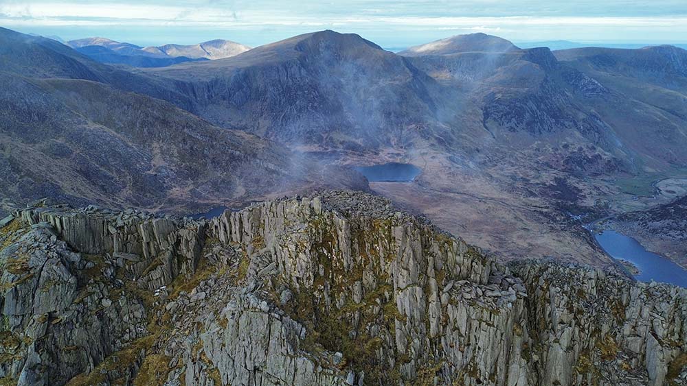
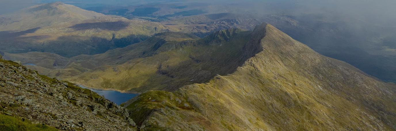
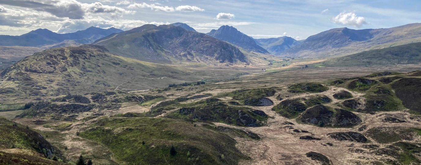
The views from Tryfan offer amazing views of the surroundings of Dyffryn Ogwen (Ogwen Valley)
The challenge on this route up Tryfan’s North Ridge is the scrambling and sometimes even climbing.
Navigating through GPS up the North Ridge is something you can’t really do. I always try to stay central to the rock face. Sometimes I head up to look out for a path. Other times, I familiarise myself with the surroundings to then head another way.
Once you get to the top of Tryfan you’re facing Adam and Eve. If you’re feeling brave enough, you can hop up on top. You could even jump between them. I’m not that brave though!
You get amazing views from the Glyderau, to Y Garn and the rest of the Dyffryn Ogwen (Ogwen Valley). Tryfan is one of my favourite mountains to climb. Every time I’ve done it, I’ve bumped into someone and completed the whole route with them.
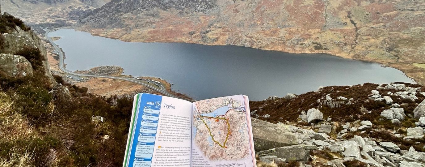
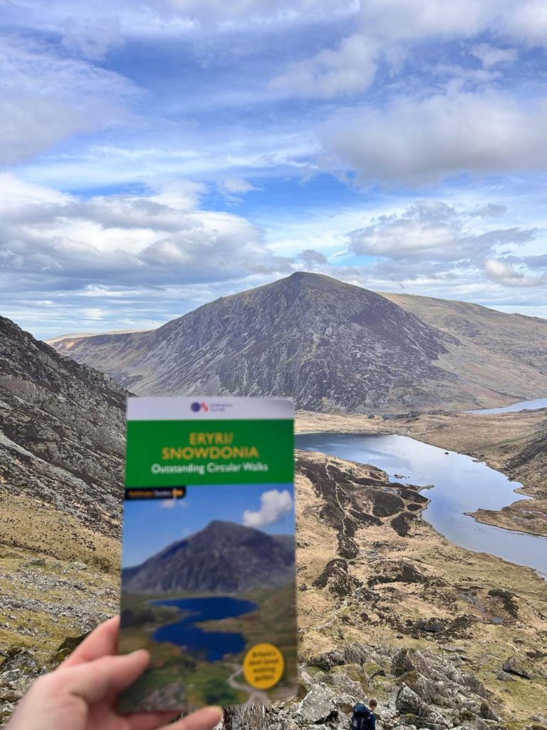
The guidebook definitely helped my ascent of Tryfan. From the start it clearly describes the route you need to take. When you’re there, it’s very easy to visualize.
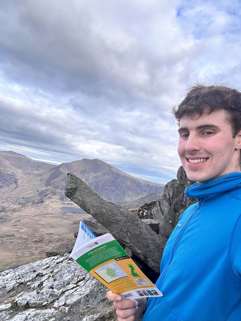
The Pathfinder route will guide you up the mountain, describing “famous” rock features like the Cannon stone.
Each waypoint on the route has tips with great advice to stay safe on the mountain. A map alone can’t provide this. This added information helped me enjoy the route even more. All the thinking has been done for me. All I have to do is turn up and enjoy the scrambling.

EXPLORE THE
OS Shop
We are with you every step of the way. Shop our trusted walking and hiking maps and guidebooks so you can explore the outdoors with confidence.
Go to the shopIf you have enjoyed this Pathfinder Route Review be sure to follow Alex’s adventures on his Instagram @_.alexjackson
EXPLORE THE
OS Shop
We are with you every step of the way. Shop our trusted walking and hiking maps and guidebooks so you can explore the outdoors with confidence.
Go to the shopShop Eryri OS Maps & Hiking Guidebooks
See More Eryri National Park (Snowdonia) Articles
Yr Wyddfa (Snowdon): Routes to the top
There are many routes to the top of Snowdon (in Welsh ‘Yr Wyddfa’) with some big paths that can get crowded and some lesser-trodden trails. Here’s all you need to know about the routes up Snowdon.
Best Beginner Hikes in Eryri (Snowdonia)
Beginner hikes in Eryri! Hilary Pullen, North Walian and Editor of Get Outside has picked some great beginner hikes to try in Snowdonia!
Eryri National Park (Snowdonia)
Peaks, paths and lakes for great walks, climbs and fishing.