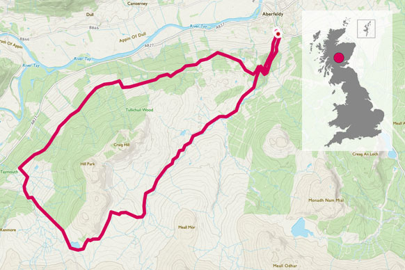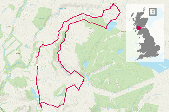
Take in the trig point on top of the brilliantly named Doughnot Hill in the Kilpatrick Hills north of Glasgow.
NS 425 760
The Kilpatricks are situated close to many urban settlements yet offer amazingly easy access to the beautiful countryside. On a fine day, the views over Dumbarton, Clydebank, Glasgow, along the River Clyde and to the open sea are stunning and I love the contrast of wildness and “built-up-ness”.
It always surprises me how empty these hills are and how few people seem to know about the countryside right on their doorsteps. The Kilpatricks are only a 30-minute drive from north Glasgow yet they feel wild and remote.
This 10.8km route starts at the car park at historic Overtoun House. After following a well-laid track for a short while, the route goes though a strange shaped gate (you have to see it to believe it!) to access more open countryside.
The path heads over grassland and starts to rise quite steeply. Helpfully, steps have been built into steeper sections and if I am running the route I usually slow to a fast walk up. The path continues to rise and then follows more of an undulating terrain, still generally gaining height.
It’s worth stopping every so often to look back at the view over the wider countryside and towards the river.
I have rarely come across more than a few people while running and walking this route and if it’s just my whippet and myself it feels delightfully freeing. I do enjoy spending time on my own in the hills.
If I am running with a friend it’s difficult to chat as we head uphill so I am left with my own thoughts, which are usually decreasingly stressed the further I climb! I enjoy that sense of a relaxed mind that only comes from running or walking somewhere beautiful.
3.38 km
Doughnut Hill summit is 375m and is reached after a section of wet bog and open moorland, then a final steeper rise over heather and grass. It is rare that this area dries out so be prepared for wet running trainers or wear waterproof boots and gaiters.
It’s not a long hill climb but from the trig point it feels deliciously remote, and as if you might be the only person for miles around.
If the skies are clear, the views over the many local hills and out towards the mountains of the southern Scottish mountains are superb.


It’s possible to retrace your steps to get back to the car park although I prefer to make a circuit. Heading over wet and boggy ground again the route heads southeasterly to reach the edge of a small reservoir. It then climbs again into forestry before you pop out suddenly on the top of crags in the wider Woodland Trust area called Laing Craigs.
5 km
The crags offer more wonderful views to your right as you walk or run along the tops. The path is sometimes close to the edge but never feels dangerous.
At the start of the crags I pick up marker posts painted with a white ring. These can be followed along the crag tops and down towards a farm called Middleton. As you descend, the countryside starts to feel more urban again although not overly built up.
8.88 km
A path accessed via a new gate and around around three edges of a field finally takes you to a wide track that then meets with a quiet public road. From here the final section is along a tarmac road back to the car park.
It’s not a long outing but it has a lot of ups and downs and can be rough underfoot. It is usually more than enough to restore feelings of outdoorsy happiness and perfect for a work-day afternoon or a weekend morning.
10.88 km NS 425 760
10.88 km / 7 miles