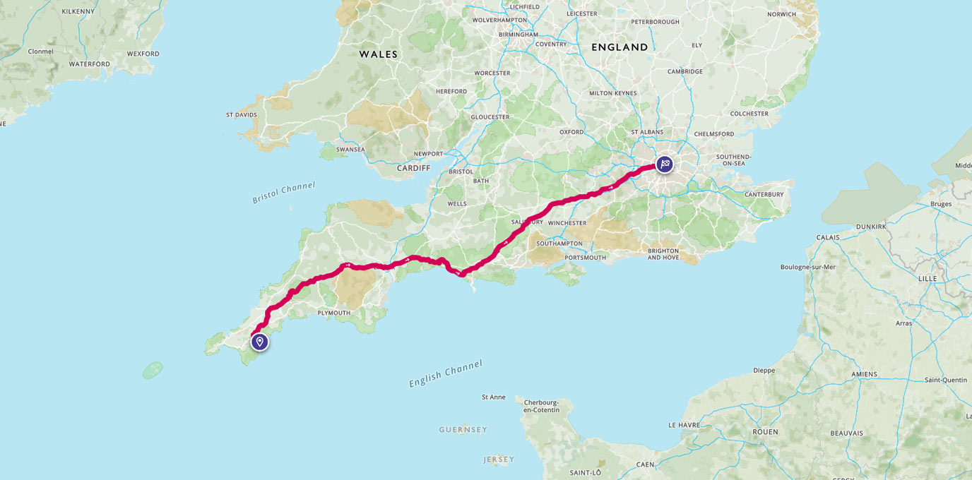
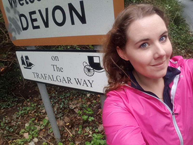
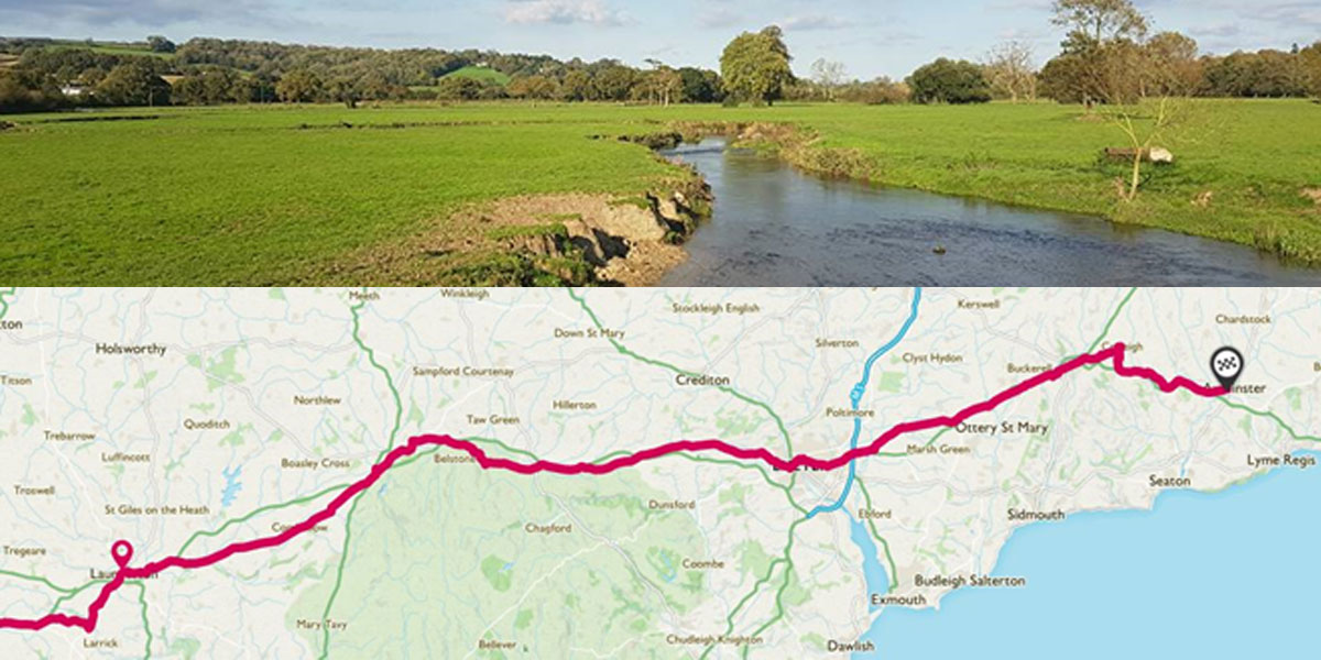
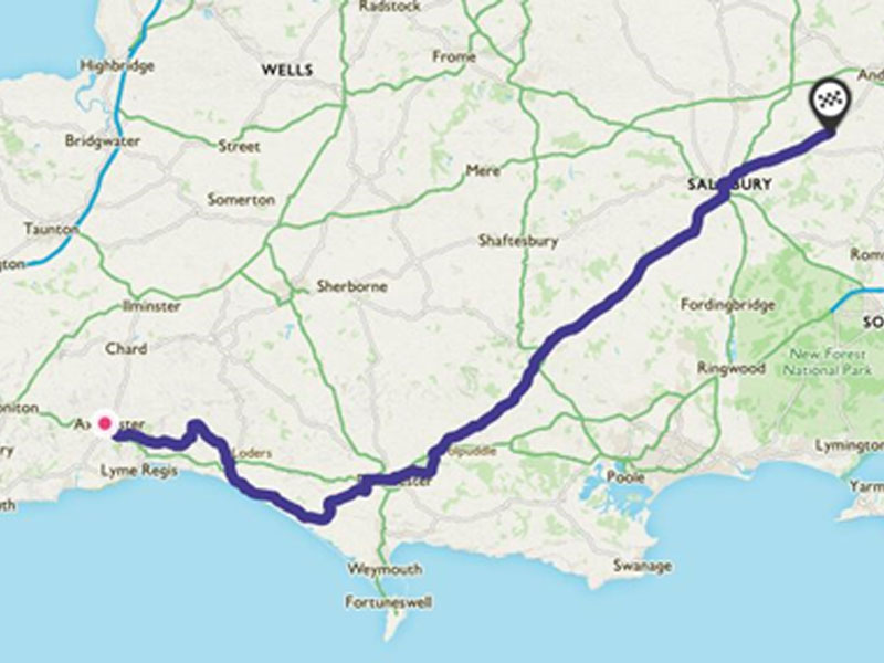
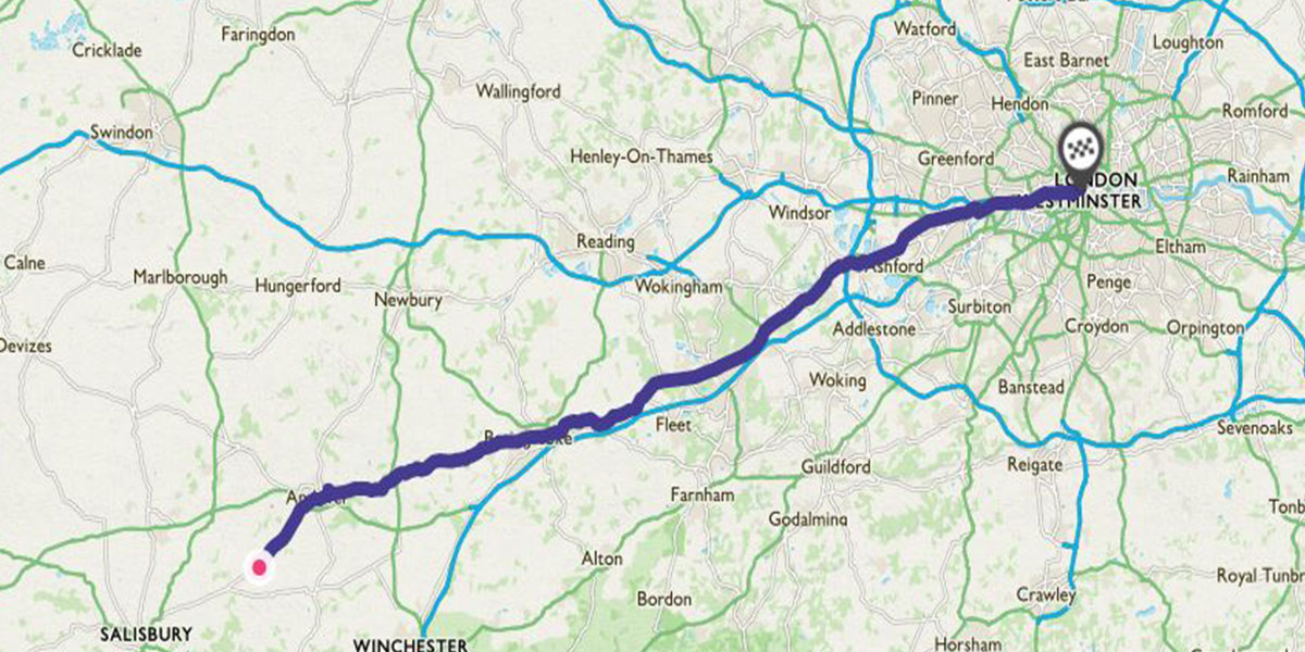
Taking on 288 miles/461km of cycling, Kate Jamieson takes us on her adventure from Falmouth to London along The Trafalgar Way.
Many of you will have seen my previous Trafalgar Way posts, but people have been asking for as much information in one post as possible, so here we are. A brief overview!
When I decided to cycle The Trafalgar Way, I was a little apprehensive, to say the least.
After taking part in the Trafalgar 200 anniversary celebrations as a young Sea Cadet in 2005, I had always planned to walk the route one day, but deciding to cycle it brought in a host of new, challenging factors…
- The furthest I had ever ridden on a bike was about 8 miles.
- I didn’t like cycling.
- I didn’t really have a suitable bike.
All somewhat problematic when you’re planning to cycle from Falmouth to London…
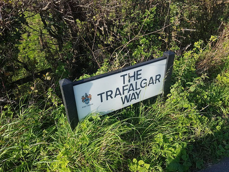
What is The Trafalgar Way?
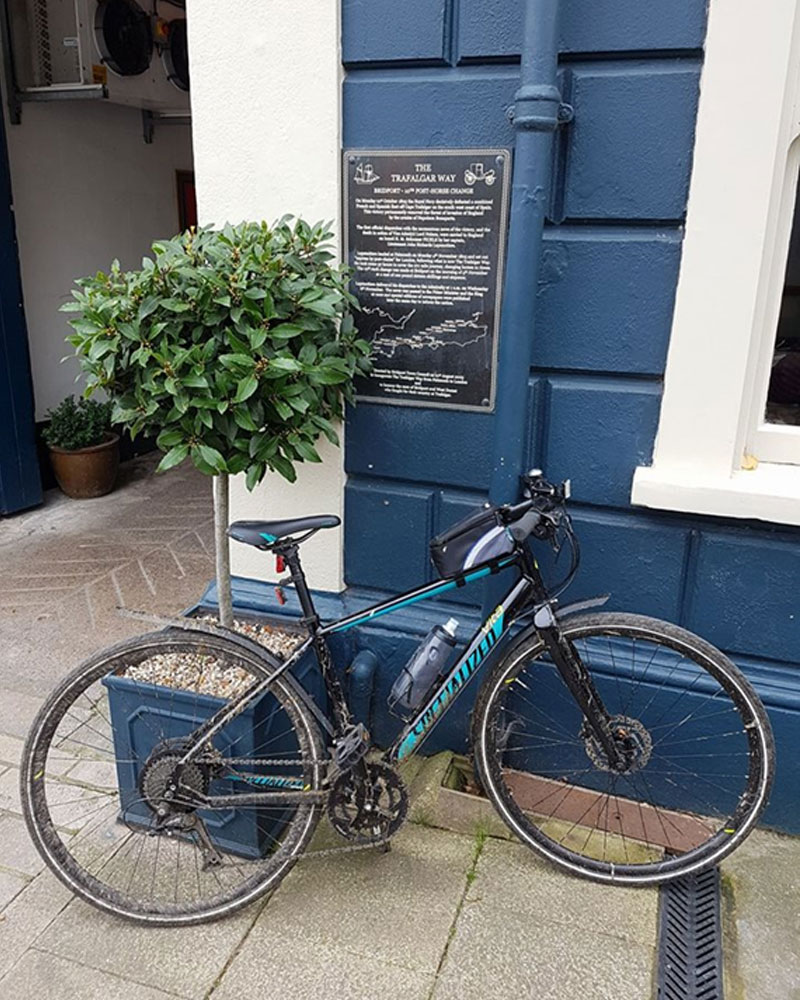
The Trafalgar Way is the route that was used to carry the dispatches with news of victory at the Battle of Trafalgar from Pendennis Point, Falmouth to the Admiralty in London. Lieutenant Lapenotière of HMS Pickle reached Falmouth on November the 4th and rode the 271 miles to London “express in a post chaise and four” taking 37 hours and costing £46.
He changed horses 21 times along the way and his account of expenses (saved in the Admiralty records) shows where he changed horse and how much it cost at each stop.
The route he took was the main Falmouth to London coach road and so each segment was between 10 and 15 miles.
In 2005, this journey was commemorated and plaques were posted along the route at key locations, giving details of the journey and of people in the area who fought with Nelson at the Battle of Trafalgar.
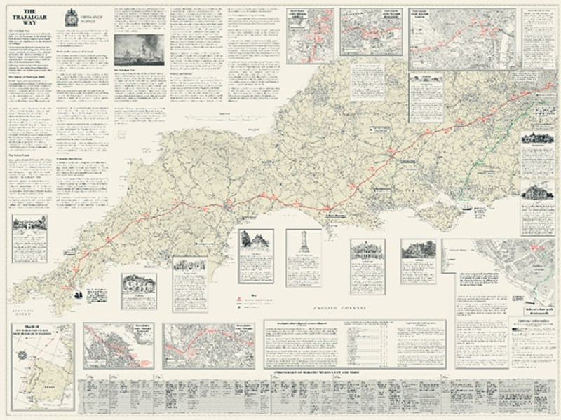
Conveniently, for my planning, Ordnance Survey actually created a commemorative map for the event, which I used to plan my route!
I decided to cycle the route in October last year, in order to finish on Trafalgar Day. I went out and bought a bike that was far superior to my brother’s hand me down mountain bike, which I was riding at the time, and hopped on!
I did no training whatsoever, aside from cycling the 2 miles to and from work and so when the start came around, I felt a little unprepared… and it showed as I pedalled away from Pendennis Point to be faced with some wonderful liquid sunshine and those famous Cornish hills!
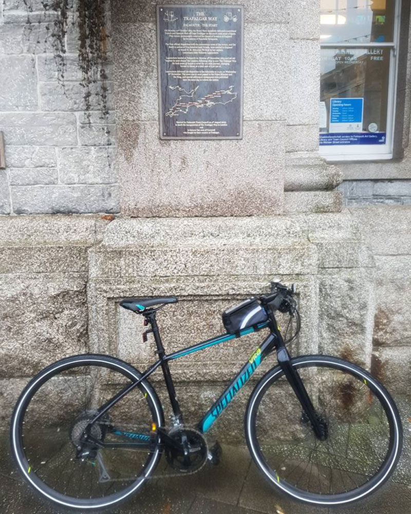
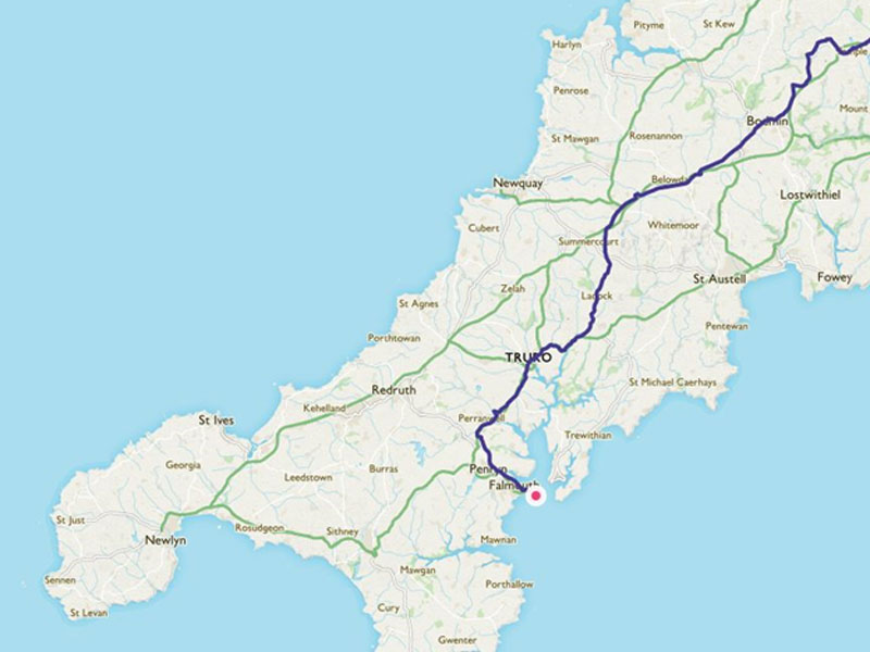
From Pendennis Point, we headed in to Falmouth, through the winding town streets until we reached the official start point of The Trafalgar Way.
Cycling out of Falmouth and in to Penryn, we found the next plaque on the side of the Town Hall with ease. From here we walked down a side alley, back to the coach road and headed up Truro Hill out towards the A39 and Truro.
We didn’t cycle the full A39 (which covers the old coach road) as the conditions were awful in the rain, and it’s very busy, so we cut along next to it, using my trusty OS Maps app!
Eventually, after an unavoidable couple of miles on the A39 we cut off to Old Carnon Hill and along the old coach road in to Truro, to reach the plaque at Lemon Quay. From Truro, we took the B3275 out towards Ladock and on to Fraddon.
It’s a long straight run on a continual incline but there are markers all along this section of the road, from when it was used for coaching, and it was preferable to the A39.
Again, I tried to stick to the route as best I could, but sometimes using more suitable roads for cycling.
From Fraddon, we headed out along the old coach road through Indian Queens, past the Screech Owl Sanctuary and Gnome World (yes, that is a real thing) and basically cycled parallel to the A30 for the majority of the ride to Bodmin.
Anyone who knows me, knows I love hiking up hills but it when it comes to cycling up them?
Not a fan…
I was determined not to get off and push and so as slowly as I was cycling, I made it up the long, slow hill in to the town. At one point I think the bus behind me all but stopped… thankfully he waited patiently until he could get past me safely. We found the next plaque very easily next to the Shire Hall.
We continued out of Bodmin along the Camel Trail, partly because I hadn’t cycled any of it and it’s beautiful, but also because again it avoided a very nasty section of dual carriageway in terrible conditions! The fog was thick and heavy over Bodmin Moor.
Once into Launceston, you head in to the town centre and the plaque is on the front of the White Hart Hotel in the main square. From here you cycle out through Southgate Arch, the last remaining medieval gateway into Launceston, which dates from the time when Launceston was the only walled town in Cornwall.
From Launceston you head to Lifton. This is the shortest leg so far at around 2.5 miles and if you’re reaching Launceston in the middle of the day (or at any time really) there’s a brilliant farm shop en route. They sell some of the best pasties (despite being in Devon) and have a restaurant/shop etc… It’s a good spot to break up a ride if you need to! You then cycle down the same road for around 1 mile, in to the village to reach the next plaque on the side of the Arundel Arms.
Ah, those famous Devon hills… The hills in Cornwall were mostly short, sharp climbs but in Devon they seem to be long, slow hills that go on forever. The first of these is on the road out of Lifton and you have another couple along the road to Bridestowe!
From Bridestowe, climb out of the village and head out towards the A30, you have to ride along for around 1/2 a mile and then take the turning off that’s signposted Meldon.
Those of you who like Tor bagging on Dartmoor will know this well as the turning for the reservoir close to Yes Tor and High Willhays, but instead of turning right, you head left and drop down a brilliant hill in to Okehampton.
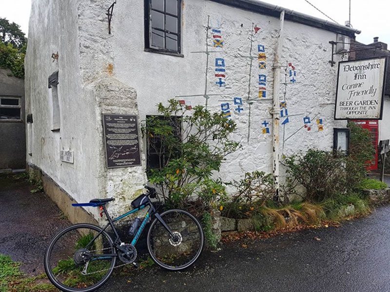
From Okehampton, it’s a fairly level ride out, before you drop down in to Sticklepath. On the main road you will come across The Devonshire Inn, easily spotted by having Port & Starboard lights by the front door. Opposite the main pub you can’t miss the outbuilding which has been painted with Horatio Nelson’s famous signal given at the Battle of Trafalgar – “England expects that every man will do his duty.”
The chaps in the pub in Bridestowe forewarned me about the hill that climbs out of Sticklepath, so I knew it was coming at some point, and they weren’t wrong… Two false summits later I finally reached the top and after a speedy water stop, I headed off to Crockernwell. After Crockernwell, you head out to Tedburn St Mary and on to Nadderwater.
From Nadderwater you head down Redhills and Okehampton Road, across the Exe Bridge and up Fore Street in to the Exeter city centre.
Heading out of the city, you turn off in to Clyst Honiton, which as it turns out is also known as Honiton’s Clyst. Just to confuse matters…
Thankfully I had my trusty OS map and app.
Also, in case like me, you were wondering… Clyst means clear stream.
From Clyst Honiton, you head back out on to the main road and turn right, past the huge Lidl distribution centre and Skypark. You’ll pass through a number of villages including Cranbrook and Rockbeare. Head out in the direction of Wimple and Fenny Bridges before climbing in to Honiton.
From Honiton, we decided to avoid this very busy stretch of the A35 and diverted off towards Cotleigh before dropping down the valley, to the railway line and climbing up again to rejoin the A35.
This then heads straight down in to The White Hart Inn in Wilmington before heading on to Axminster.
After reaching Axminster I set off in the direction of Bridport. I was met at Cooks Lane by Craig, a keen Royal Navy cyclist I follow on Twitter, who kindly agreed to ride the section from Axminster to Hardy’s Monument with me, despite me telling him how slow I would be!
After a bendy lane and a couple of hills which killed me, we headed down a very muddy farm track near Whitchurch Canonicorum, before dropping down through Dottery in to Bridport.
Again, the technical route for The Trafalgar Way is along the A35 but it was super busy, and there’s no point putting yourself in danger! This was a great route which took us away from the main road, but obviously if you’re happy to cycle busy A Roads, then go ahead.
We headed through Bridport Town Centre which was heaving (market day… oops!) and found the plaque on the side of The Bull Hotel.
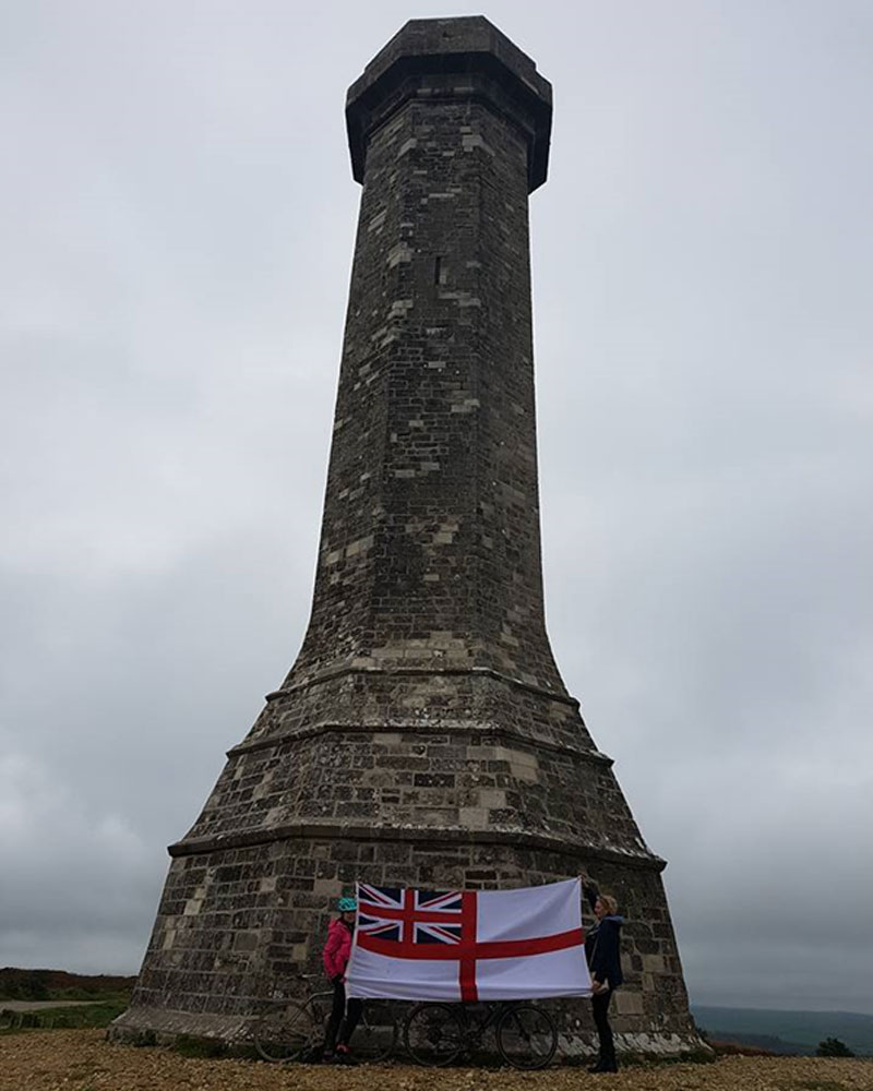
Again, the technical route along The Trafalgar Way heads directly along the main road from Bridport to Dorchester, but given that just outside of Dorchester, on top of the hill, sits a monument to HMS Victory’s very famous Captain at Trafalgar, Thomas Masterman Hardy, the diversion had to be made…
From Abbotsbury you head through the pretty little village of Portesham, before starting a climb up a lovely hill with a 17% gradient… I have no shame in admitting I made it about half way before I had to get off and walk because it was faster!
As some of you will know I took one of HMS Victory’s ensigns up Kilimanjaro, it also came to Pendennis Point with me and so it was brought out again here!
Thankfully, what goes up must go down, and after saying goodbye to my fellow cyclist for this leg as he blasted back to Bridport, I whizzed off down the hill towards Poundbury and in to Dorchester. From Dorchester, I headed out to Puddletown. Puddletown is famous for being the village which provided the inspiration for the village of Weatherbury in the novel Far From The Madding Crowd by Thomas Hardy (the author, not the naval Captain).
From Puddletown you head out along the A345 and this is basically the road you follow all the way to Blandford Forum.
Heading out of Blandford, again on the A354, you head out through Pimperne and past a number of mile markers until you reach a bus stop at Woodyates. The A354 is a very long, straight road, but as you come in to Salisbury you start to climb before heading back down in to the City.
I chose to divert slightly off the main road because it was a very busy Sunday and I knew that cutting through the Cathedral Close would be a nice way to get in to the city centre.
From Salisbury I headed out in the direction of Andover, past Porton Down and via Nether Wallop. Cycling in to Andover on the A343 from Nether Wallop, you head in to the main town centre (there are some nice cycle routes).
From Andover, I headed out along the B3400, through Hurstbourne Priors, Whitchurch and Laverstoke and cycle past the Bombay Sapphire Gin Distillery.
Tempting as it was to pull in, I managed to exercise restraint. Predominantly because it was about 10 in the morning and I needed to get to Overton!
Continuing along this long straight road, you head in to Basingstoke.
The official route follows the A30 out of Basingstoke, but as it was stop start traffic I diverted off through Old Basing and Newnham, joining it again in Hook. You cycle through the very pretty village of Hartley Wintney and in to Hartford Bridge, where the White Lion pub is now an antique dealership.
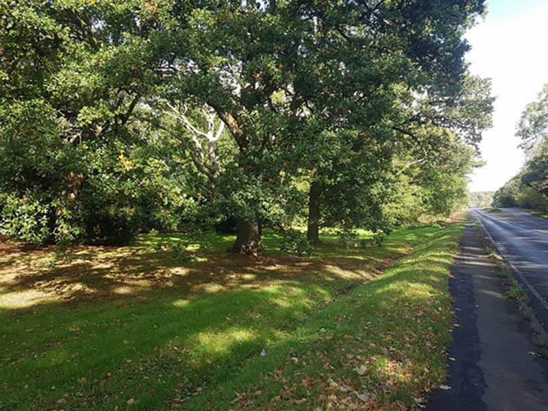
From Hartfordbridge I continued to follow the A30 across Hartford Bridge Flats and Yately Wood, before heading in to Camberley.
This is where it started to get busier on the roads, but thankfully there were a lot of pavements which were dual use cycle paths.
I headed through the town, past the Royal Military Academy, Sandhurst and on to Bagshot, my next stop. As you drop down in to Bagshot, veer off to the right in to the town centre. On the Jubilee Lamp in the square (easily spotted).
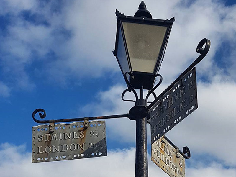
The route from here is very easy to follow as it’s simply the A30, all the way to Egham, through Sunningdale, Englefield Green and towards the town centre. Out of Egham you come to a large roundabout with the M25 running over it, follow the cycle paths underneath it and head in to Staines.
The leg between Staines and Kew was not the prettiest, you cycle along paths to the side of the A30, past Heathrow Airport and a lot of Hounslow trading estates. But, and here’s the bonus, it’s totally flat & smooth tarmac so you can get some good speed up.
It was here that I left the A30 and joined the cycle routes along the side of the A4, through Hatton, Osterley and as far as the roundabout for the A3002 in to Brentford, which I followed on to the High St and Kew Bridge Road.
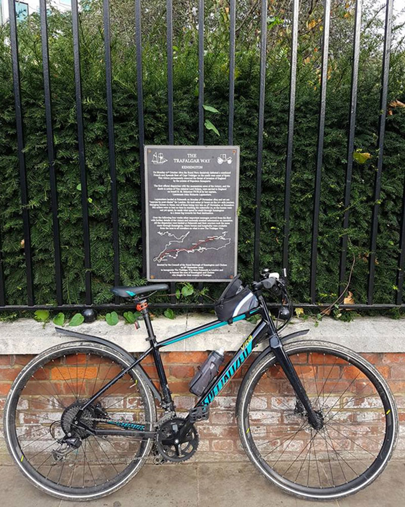
From Kew, you follow the A315 through Chiswick and in to Hammersmith officially. However, we drove up to complete this final leg and parked at RIchmond before cycling along the river and crossing over in to Hammersmith to the next stop, The Salutation Inn.
From here, we cycled along the A315 and continued along Hammersmith Road until it became Kensington High Street.
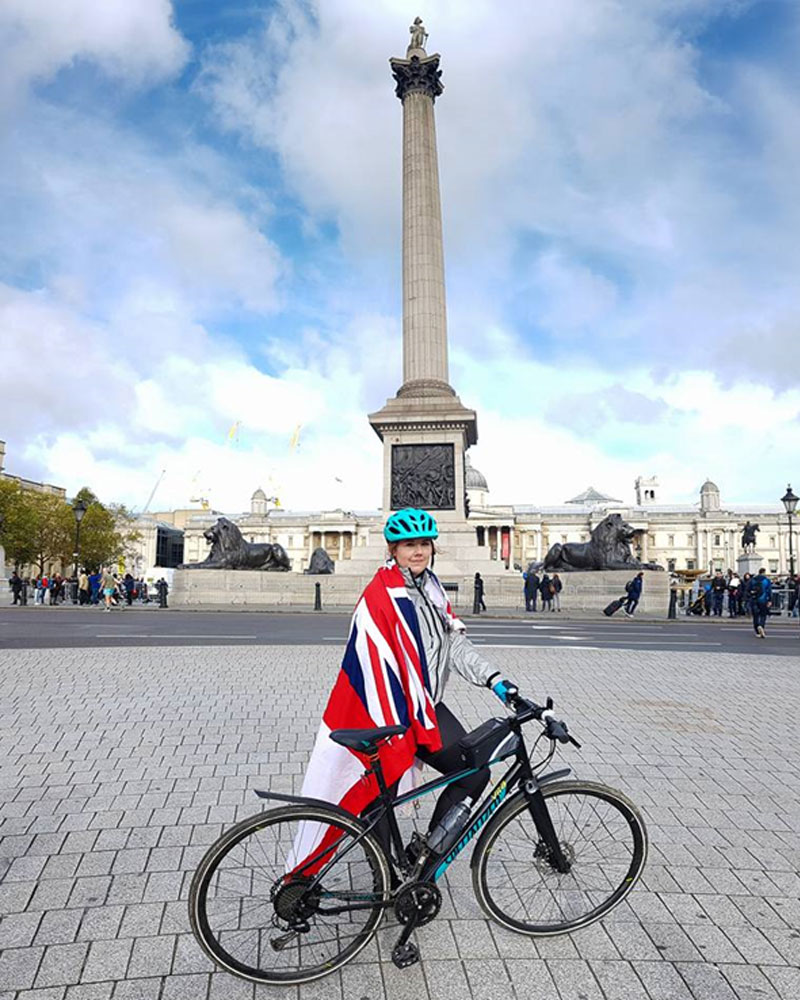
We joined the South Carriage Drive and cycled past the Albert Memorial, through the park, and came out at Hyde Park Corner. We then cycled over the roundabout to the Wellington Memorial, past Buckingham Palace and down the Mall, through Admiralty Arch.
Head out of Trafalgar Square and down Whitehall, and on the side of the old Admiralty Buildings is the final plaque!
I’d made it!
288 miles.
36 hrs and 40 minutes hours of cycling.
6517.7m elevation.
Sore thumbs. Tired legs.
I was here…
I’ve gone from being the person who whinged at cycling 8 miles on the Isle of Wight to the person who has cycled from Falmouth to London.
On top of that?
I now have a new hobby and try to GetOutside on my bike as often as I can!
I’m a big fan of setting yourself a challenge and escaping your comfort zone, so however big or small your challenge is, get out there, GetOutside and get going!
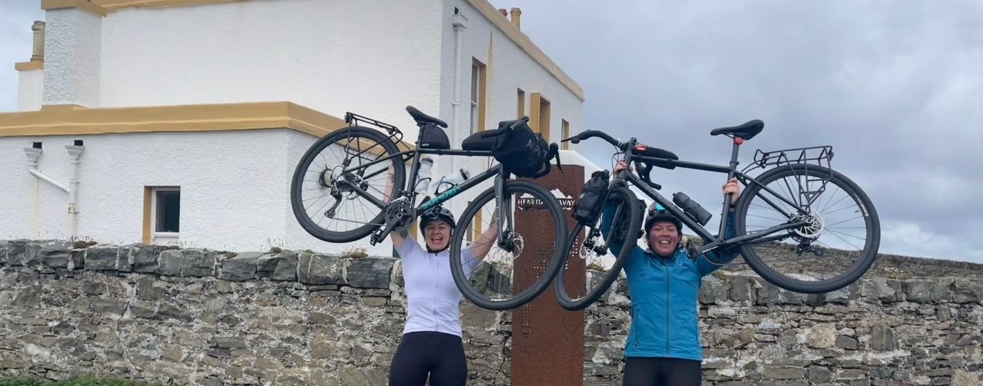
My next cycle trip is Sword Beach to The Seine, following the route of the 12th Devonshire Regiment post D-Day.