Pen-y-ghent is the perfect hill with which to give young children a taste of an outdoor challenge.
The circular walk to the summit from Horton-in-Ribblesdale is under six miles – perfect for little legs or when the days are short and time is squeezed.
SD 807 725
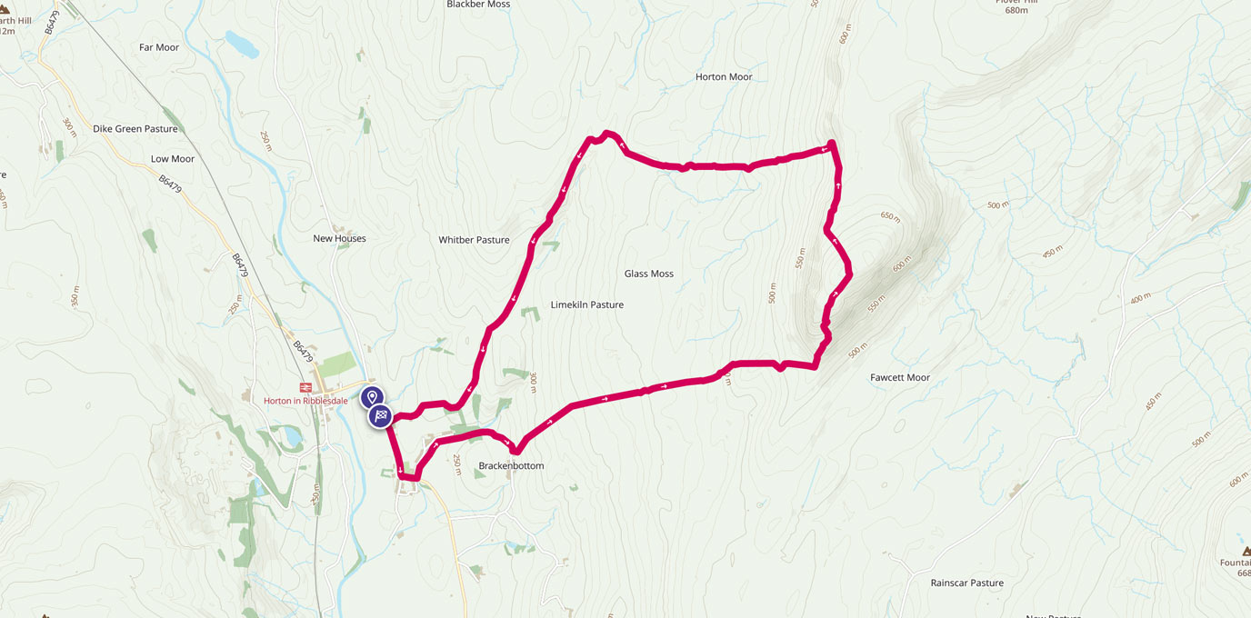
The walk begins in the small village of Horton-in-Ribblesdale next to the babbling river Ribble (which I remember catching Cray Fish in many years ago when on Scout camp). There’s a pay and display car park to the north of the village and very close to the Pen-y-Ghent Café, the official start point for the Yorkshire Three Peaks Challenge (a 12 hour walk taking in Pen-y-ghent, Whernside and Ingleborough).
For the purpose of this walk up Pen-y-ghent, the café will be the start and finish point.
Turn right out of the café and head south along the main road and past the Golden Lion pub on the corner as the road turns through 90 degrees. Continue past the small cemetery and then over the small stream via the road bridge. Now take the lane on your left (the stream should be on your left) and follow the road passing the quaint little village school (on your right) and past several holiday cottages. Take a moment to glance left across the stream and enjoy the sights and sounds. Encourage your young walkers to do the same, maybe even to close their eyes for a minute to just listen and enjoy the moment of quietness and natural sounds of the countryside.
1.2 km
Continue uphill along the lane, out from under the trees, as your route takes a south-easterly direction and away from the stream. Views of Pen-y-ghent should greet you as you ramble up towards some farm buildings. Just before reaching the first of the buildings, look for way marker posts on your left that will take you on a perpendicular direction (North East) and along a dry stonewall. The going will now get a little steeper as you begin walking directly towards the magnificent Pen-y-ghent.
The weather conditions can make this hill change in character: dark, moody and ominous on an overcast day, wild and formidable on a wet and windy day, threatening and scary on an icy winter’s day, or delicious and inviting on a calm, sunny day.
With this in mind – and knowing how the weather in the hills can change quickly – make sure you attempt this walk with plenty of layers, waterproofs and hats, appropriate footwear, food and drinks and with the correct OS Map and compass – of course.


1.5 km
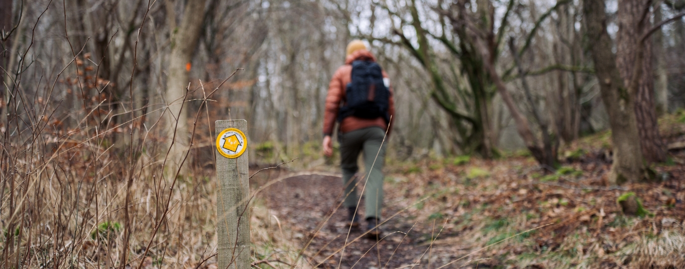
From here and up to the summit, the path is now well signposted, and in places a gravel track has been laid to prevent erosion of the peat bog from the many walkers that complete this walk each year. On the way to the summit there are a few small escarpments to enjoy; ideal places to give young walkers some scrambling practice.
Remember to glance back occasionally to view Horton and look for Ingleborough (roughly to the West) and Whernside (North West-ish). Also try and spot the aqua-coloured lake at the Hanson Aggregates quarry.
As you approach the ‘nose’ of Pen-y-ghent your route takes you over a stile to join the Pennine Way, heading north-west-ish and towards the summit via a fun and exhilarating scramble. On the steeper sections of the scramble, encourage youngsters to have three points of contact and to take it steady and not to rush as it can be slippery. The going can be tough for little legs, so give plenty of motivation and encouragement. When we are feeling a bit weary or daunted by a challenge we sing the old 80’s song ‘When the going gets tough, the tough get going.’ Try it, it might work for you!
3.6 km
After the steep scramble, the path flattens out and creeps North East to the summit, where the trig point (and storm shelter) will greet you. If the weather is good, take in the 360-degree panoramic view. Give your young walkers plenty of high 5’s and insist that they must touch the trig (the unofficial rule of ‘bagging’ a hill/mountain). Praising youngsters efforts and determination at this point is a good idea and helps develop character and resilience, and helps reinforce the idea that the sense of achievement makes all the effort and hard work worthwhile.
Getting off the hill is straightforward, head over the stile beside the storm shelter and downhill following the Pennine Way. After an initial descent in a north-westerly direction, the path veers north and along a natural gradient. The path is well marked.


5.2 km
As you drop down this path, you are looking for a tall, wooden post. This marks the point where the original Three Peaks path would head off towards Whernside. You need to take a sharp left turn to head West towards the village of Horton (nestled in the valley below) down the clearly marked (and walked) path.
6.8 km
Stay on this path following the Pennine Way posts signed for Horton-in-Ribblesdale as it descends into the village to join the footpath of the B6479. Turn right and walk for 5 minutes along the road back to the Pen-y-Ghent Café, ideally in time to enjoy a large mug of Yorkshire Tea in the cosy café. The café is a fascinating place in itself as there are photographs and information about the Yorkshire Three Peaks challenge.
Hopefully this walk will have given your young walkers the appetite for more hill walking, and who knows, perhaps one day they will return to complete the 12 hour Three Peaks Challenge. I remember completing Pen-y-ghent as an eight year-old and have since completed the Challenge a few times and walked the three peaks individually on a few occasions with the family. I’ve even taken a group of inner city kids up Pen-y-ghent (an experience of a different kind).
Pen-y-ghent certainly has a sense of awe about it, and a ‘draw’ that can’t really be explained. It’s a special place with mountains of charisma, and therefore one of our all-time favourite family hikes.
9.45 km SD 808 724
9.45 km / 6 miles


