Moel Siabod Circular via Daear Ddu Ridge
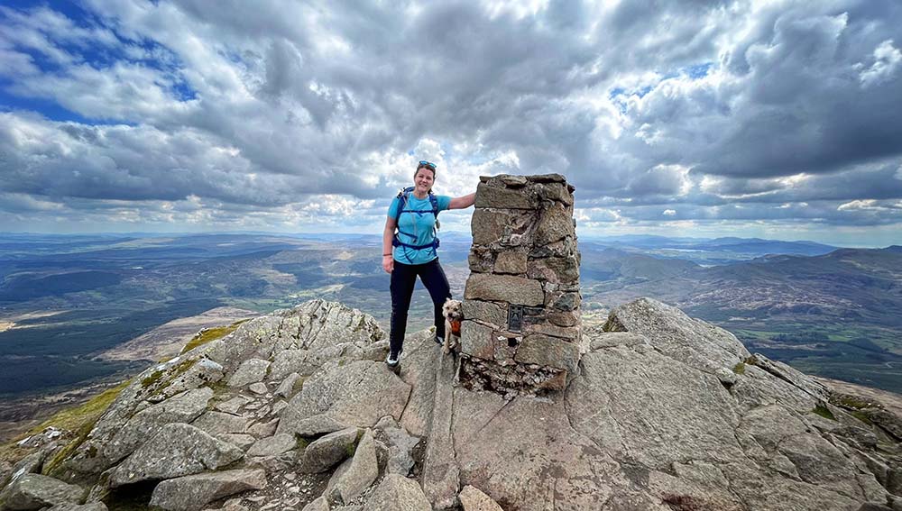
Welcome to Moel Siabod. 140ft short of being a summit in the Welsh 3000’s challenge means it’s slightly quieter than some of the other local summits. It’s also the only summit that you can see 13 of the 14 Welsh 3000’s from.
The Daear Ddu Ridge is a popular route up Moel Siabod’s eastern side. It can be challenging and you should be prepared du to it being a grade 1 scramble, but it’s highly rewarding. As a hands on experience, the scramble can be fun and enhance the adventure of your walk. The ascent via the ridge is around 300m over 1km of terrain.
Technical: This is a grade 1 Scramble via Daear Ddu Ridge. It is suitable for everyone, however there is some exposure and no visible path at times once you’re on the ridge.
Map OS Explorer Conwy Valley OL17
Parking: Bryn Glo carpark. Bryn Glo A5, Capel Curig, LL24 0DT
Waypoint 2: Exit the Carpark
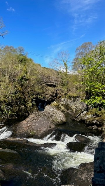
Exit the carpark, turn right, cross the road and continue up the road until you come to a bridge over the river.
Waypoint 3: Cross the Bridge
Cross over the river and continue along the tarmac road
Waypoint 4: Tarmac Path
The farmer has helpfully spray painted ‘path’ on the road to keep you on the recognised footpath
Waypoint 5: Keep on the path
Keep on this new path rather than taking the more obvious tarmac road past the farmers house
Waypoint 6: 1st gate/stile
You will come to your first gate/stile and it also has a handy dog gate. Carry on past the holiday cottages on your left
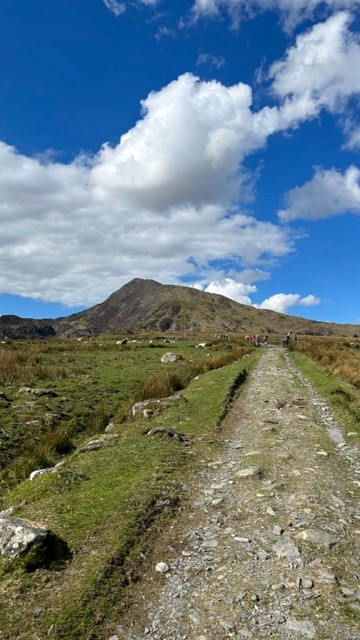
Waypoint 7: 2nd gate/stile
Take in the fabulous view of Moel Siabod. You’ll come to another gate/stile with a dog gate
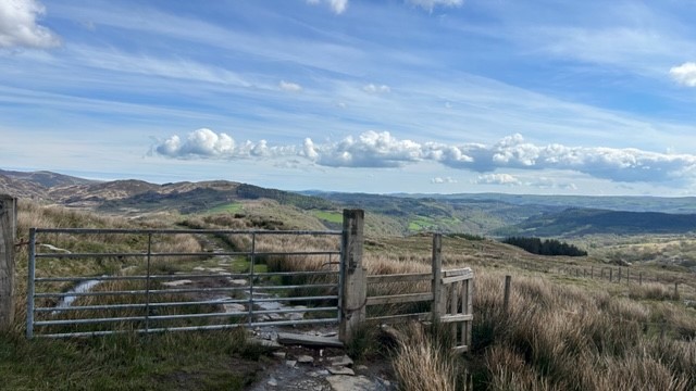
Waypoint 8: Final gate/stile
Waypoint 9: Lake
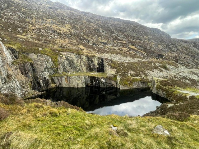
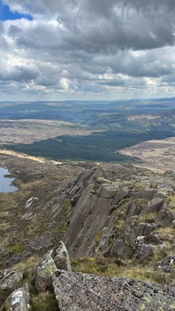
Waypoint 10: Disused quarry
Keep the small quarry lake on your right. A handy spot for a snack break
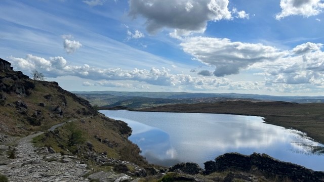
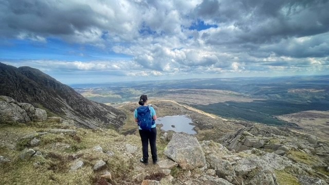
Waypoint 11: Llyn y Foel
It can get very boggy around this lake so pick your way around it very carefully to avoid ending up with wet feet.
Waypoint 12: Start of the Ridge Path
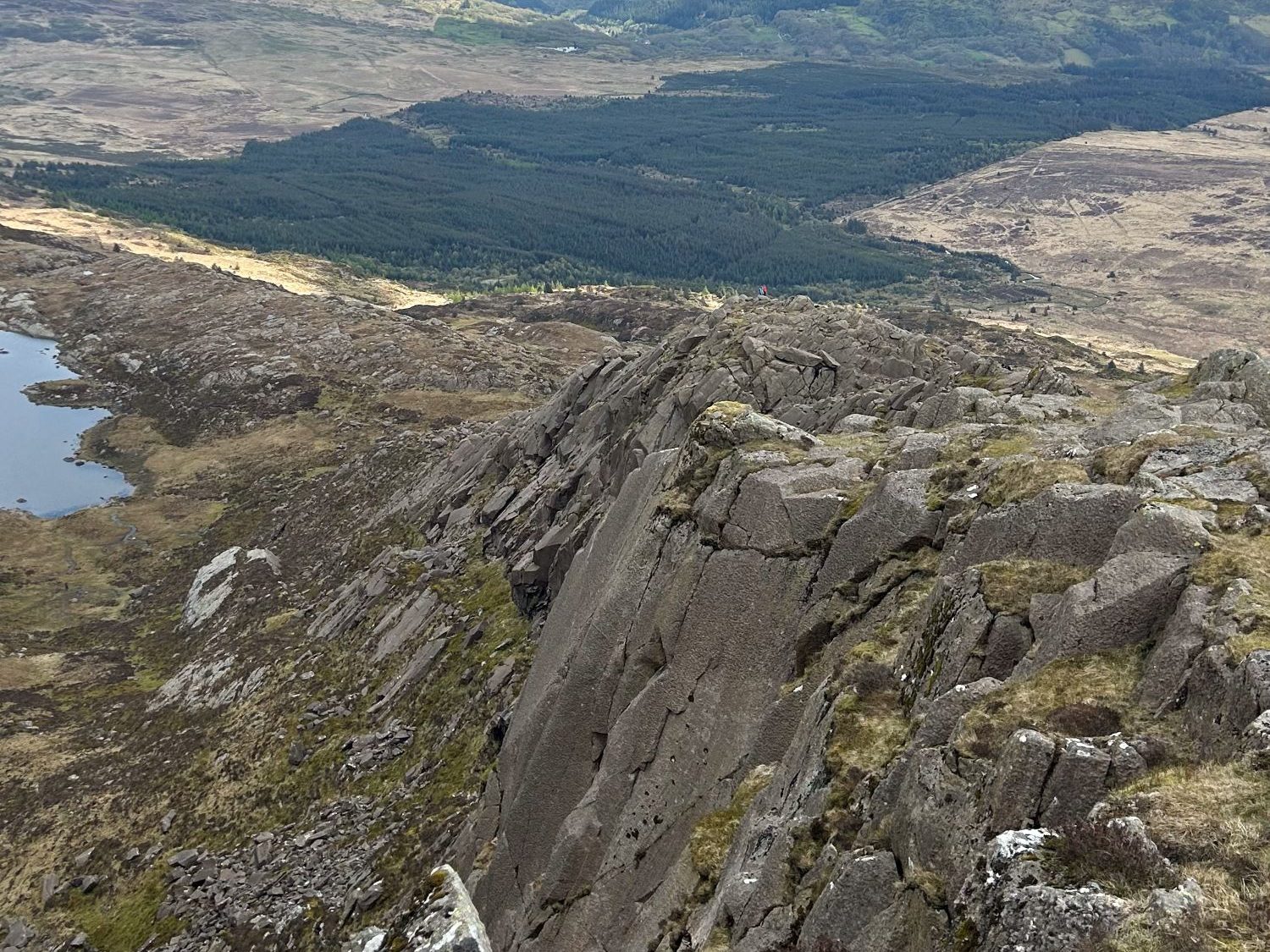
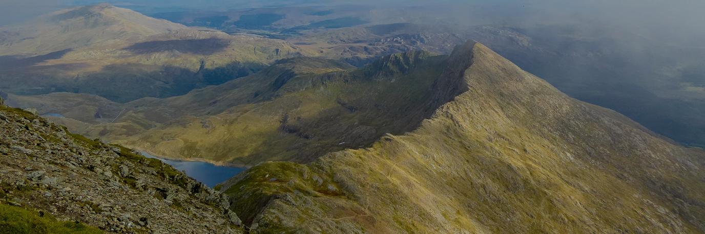
You will see the natural route up the Daear Ddu Ridge. Move further to the left and the scramble becomes slightly easier. Note that the Daear Ddu Ridge is classed a grade 1 scramble, so finding the easiest route will always help!
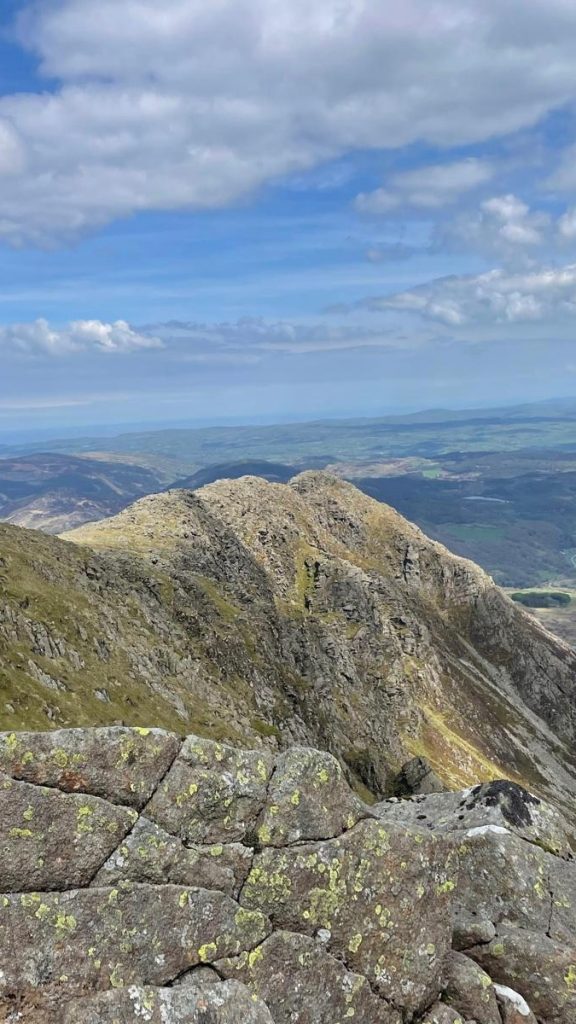
Waypoint 13: Daear Ddu Ridge
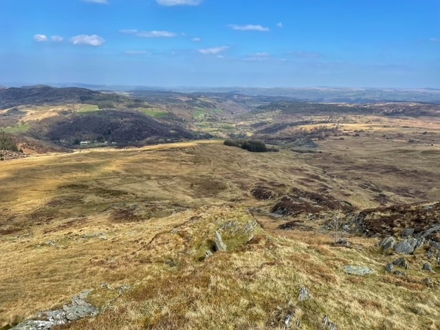
Remember to enjoy the views! Daear Ddu Ridge offers some one of the best viewpoints, and you can see Snowdon Horseshoe, the Glyderau, and the Carneddau mountain ranges.
Waypoint 14: Nearly there
As you finish your final scramble the summit trig will come into sight
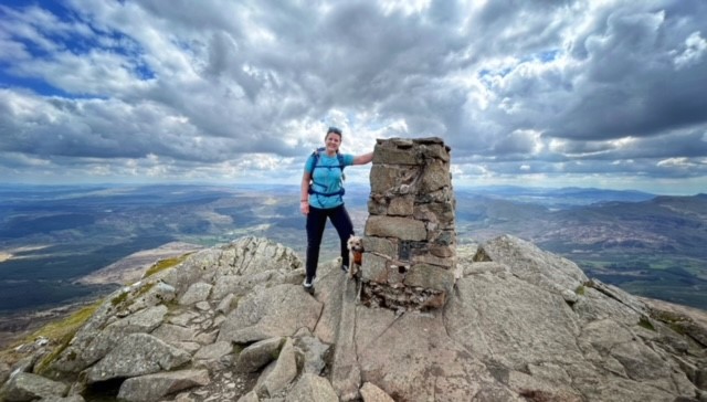
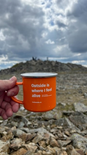
Waypoint 15: The Summit
Moel Siabod. The only summit you can see 13 of the 14 Welsh 3000’s from
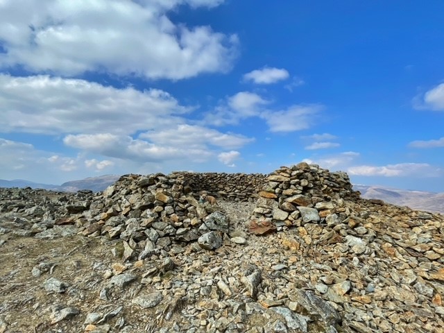
Waypoint 16: Summit Shelter
The perfect lunch spot
Waypoint 17: The start of your descent
Continue over the rocky boulders, the North East Ridge will be above you on your right hand side.
Waypoint 18: Stile
Waypoint 19: Find your path
You’ll be well on your way down now, keep the ridge on your right hand side
Waypoint 20: Path
A mixture of natural and man made path
Waypoint 21: Take your time
There are still some steep sections here and the rocks can become very wet and slippy
Waypoint 22: Follow the route
You’ll soon recognise your route from earlier and you can now retrace your footsteps back to the carpark
SH 7354 5709
9.5 km / 5.9 miles
Note from the Editor
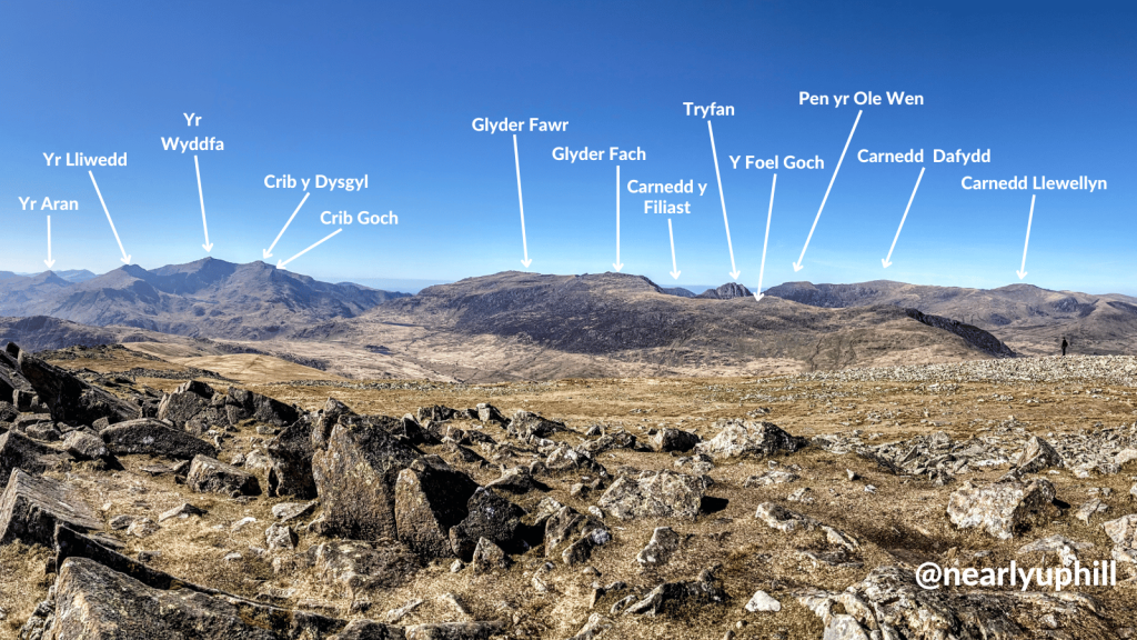
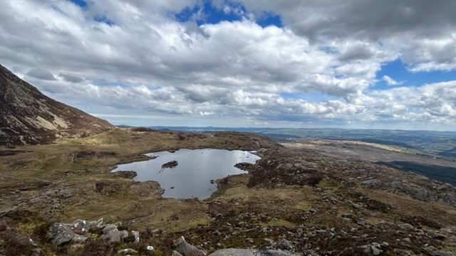
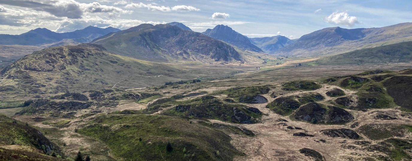
I was delighted when Lisa sent me over this fabulous Moel Siabod Route, it’s an absolute favourite of mine. I took this pic from the view from the summit of Moel Siabod a few years ago and thoroughly enjoyed spending time labelling the peaks after the walk. As Lisa says it shows just what spectacular fun you can have peak spotting lots of the Welsh 3000’s on this great route. It’s a perfect hike for beginners looking to try out a bit of scrambling.
Hilary x

EXPLORE THE
OS Shop
We are with you every step of the way. Shop our trusted walking and hiking maps and guidebooks so you can explore the outdoors with confidence.
Go to the shopShop Eryri OS Maps & Hiking Guidebooks
See More Eryri National Park (Snowdonia) Articles
Yr Wyddfa (Snowdon): Routes to the top
There are many routes to the top of Snowdon (in Welsh ‘Yr Wyddfa’) with some big paths that can get crowded and some lesser-trodden trails. Here’s all you need to know about the routes up Snowdon.
Best Beginner Hikes in Eryri (Snowdonia)
Beginner hikes in Eryri! Hilary Pullen, North Walian and Editor of Get Outside has picked some great beginner hikes to try in Snowdonia!
Eryri National Park (Snowdonia)
Peaks, paths and lakes for great walks, climbs and fishing.
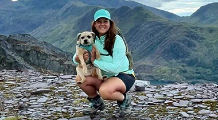
By Lisa Wells
I live in North Wales and I am a qualified Mountain Leader. I am passionate about protecting the area I live in for future generations and work as a volunteer with the Snowdonia National Park and the Ramblers. I run Well Being Walks for women. The ethos behind ‘Women Only Walks’ was born from my love of the outdoors and wanting to share that love in a supportive and fun way. My border Terrier, Billy is always right next to me on my days out and his love of the outdoors means we are the perfect match. Find out more about OS Champion Lisa Wells.