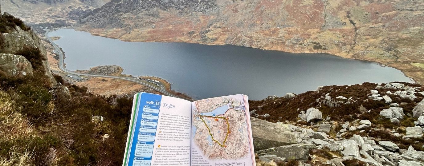
Moel Siabod is a lonely mountain in Snowdonia (Eryri) National Park, whose trig point sits almost 900m high, above Betws-y-Coed and Capel Curig. The routes up can be easily varied to cater for a mixture of needs and abilities, and are always beautiful, with views of 13 of the 14 highest peaks in Wales from the summit on a clear day – without even turning your head! Good parking and a cafe readily available at its base, makes Moel Siabod a brilliant day out, time and again.
SH 735 571
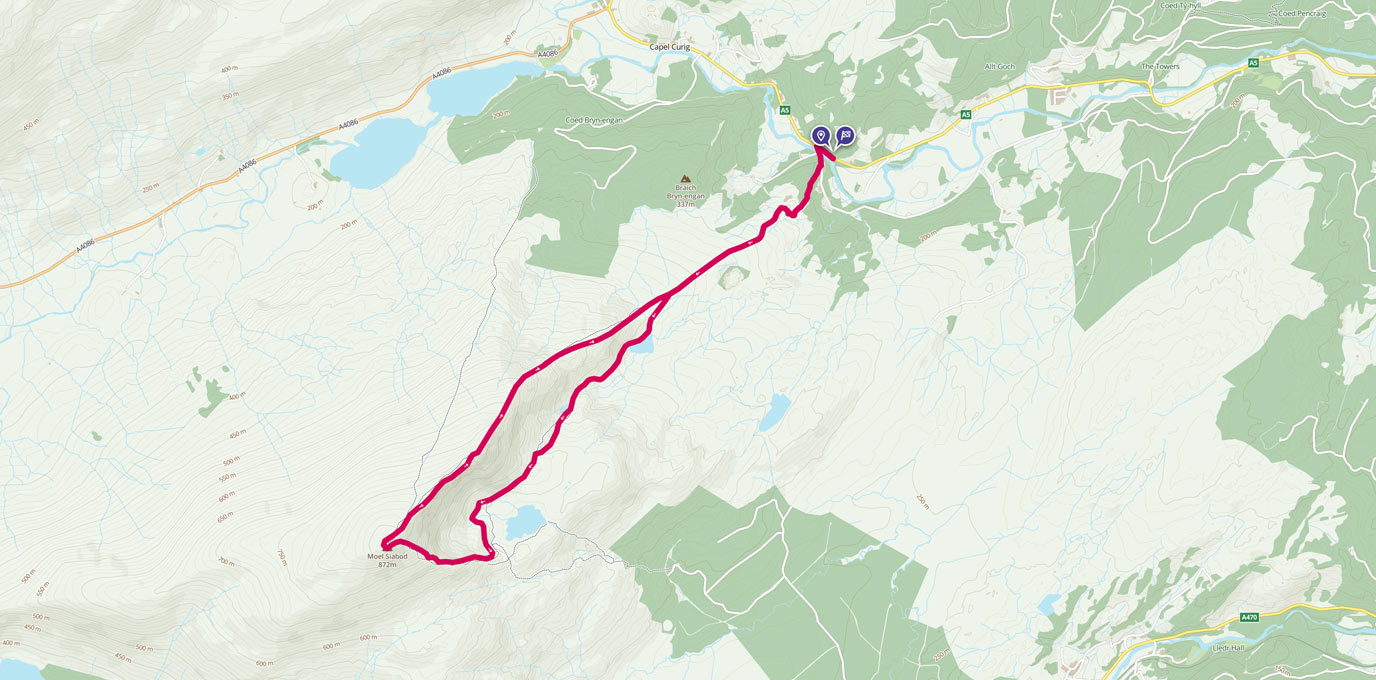
The celebration of a 60th birthday in our family meant that a group of 9 people, of varying ages, abilities and experiences, spent a wonderful weekend in Snowdonia exploring the mountains. The main attraction of the weekend was a leisurely walk up Moel Siabod, with a stop for lunch along the way. It began at the lay-by opposite the cafe in Pont-Cyfyng, near Cyfyng falls. We followed the road to the bridge, and crossed the afon Llugway, gazing at the rushing water and stunning waterfalls it produces before following the road up the hill, around the farmhouse via the footpath and past the holiday cottages.
The road itself ends at the holiday cottages, but sticking to the left hand-side of the continuing footpath, with the sheep and their lambs for extra company, brought us to waypoint 1. Though not necessarily clearly marked by signs, the footpath itself is reasonably obvious and easy to follow, and it soon brought us to the first of three lakes. Nestled between these lakes are various areas of disused quarries and old miners huts, which were simply fascinating to take a look around, and gave us the excuse to admire the lakes (or even take a very refreshing wild swim!) for longer than we otherwise may have. This was waypoint 2.
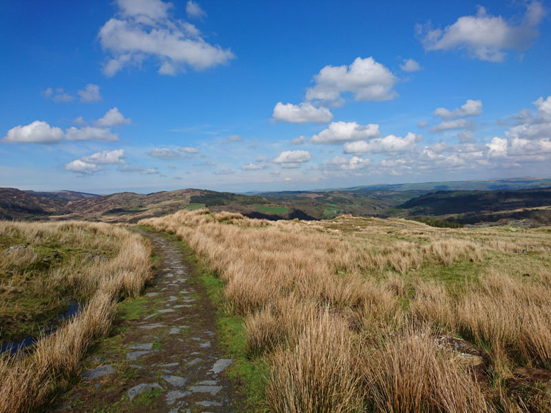
Waypoint 1 – the path
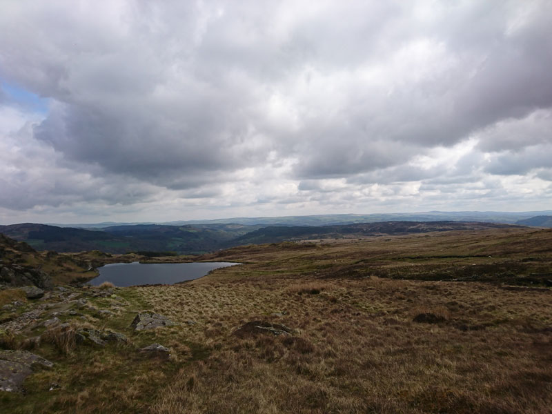
Waypoint 2 is the second of the lakes
SH 717 555
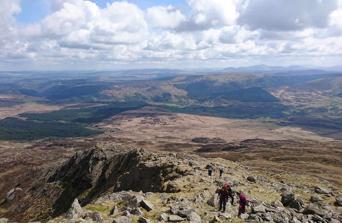
Having stopped for a lunch break in the sunshine at the third lake, the ridgeline of Daear Ddu was finally in full view, and we all felt eager to be climbing up its slopes and scampering over the rocks. Rounding the corner so that we were now perfectly orientated with the ridgeline, we began our ascent at waypoint 3.
One of the best things about this part of the walk, is that you can make it as difficult as you want to, by scrambling and climbing directly over the rocks, rather than picking your way carefully along the path (although the path does get more difficult to see at this point, it is still there!). This meant that the walk catered for the different ages and abilities that featured in our group. Turning around occasionally to see the changing perspective of the landscape we had just come from continually took our breath away.
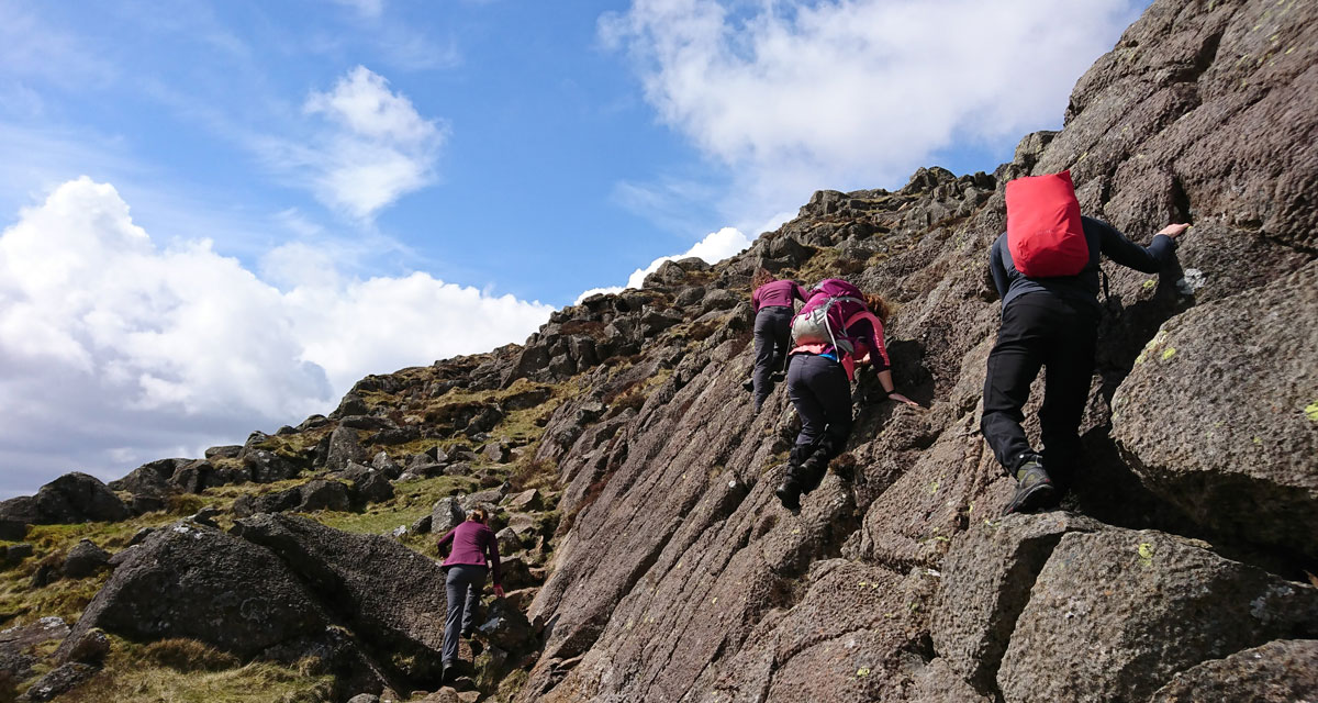
Waypoint 3 is the start of the scramble up the ridge. An easier path is to the left.
SH 711 547
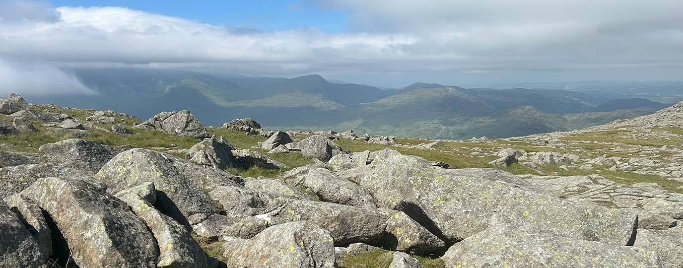
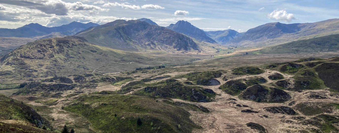
All too soon however, the ascent of Daear Ddu was over, and we had made it to the trig point at the summit, waypoint 4. The views from here were even more stunning than those we had just left behind, and we had fun recognising some of the infamous mountains that could be seen from the relative isolation of Moel Siabod’s peak.
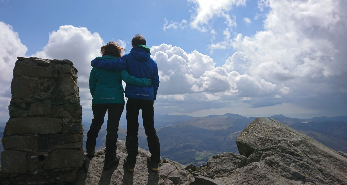
Waypoint 4 – the summit. Enjoy the view!
SH 705 546
With the wind in our hair it was time to head back to the lay-by where we had parked, but this time along the ridge of Moel Siabod itself. Again, this allowed for varying difficulties depending on need and ability, with almost a 50:50 split between rock-hoppers and trail toppers. Soon the ridgeline finished near to where the path turned off towards the lakes at the beginning of the walk, waypoint 5.
SH 722 561
From here it was an easy stroll back down the hill past the cottages, across the bridge and along the road to the cars. A well deserved ice cream stop in the cafe across the road saw us ready for the evening of family chatter and boardgames that lie ahead.
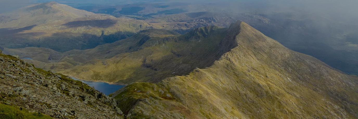
Another look at the view from Moel Siabod
9.2km SH 735 571
9.2 km / 6 miles
If this route looks perfect but you’re a little unsure if it’s right for your first hike, read our Hiking For Beginners Guide

EXPLORE THE
OS Shop
We are with you every step of the way. Shop our trusted walking and hiking maps and guidebooks so you can explore the outdoors with confidence.
Go to the shopShop Eryri OS Maps & Hiking Guidebooks
See More Eryri National Park (Snowdonia) Articles
Yr Wyddfa (Snowdon): Routes to the top
There are many routes to the top of Snowdon (in Welsh ‘Yr Wyddfa’) with some big paths that can get crowded and some lesser-trodden trails. Here’s all you need to know about the routes up Snowdon.
Best Beginner Hikes in Eryri (Snowdonia)
Beginner hikes in Eryri! Hilary Pullen, North Walian and Editor of Get Outside has picked some great beginner hikes to try in Snowdonia!
Eryri National Park (Snowdonia)
Peaks, paths and lakes for great walks, climbs and fishing.