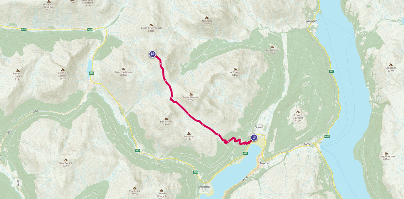
Start exploring the Munros with this 9 mile walk around the highest point, Beinn Ime.
NN 294 048
Start the walk in the pay and display car park at NN 294 048. This will cost you £1 for the day. We arrived on this walk with no coins, but thankfully a nice mountain biker dug deep and paid for our parking as long as we passed on the favour. We did so, and I would recommend spreading the love!
Cross the A83 and follow the forest path that zig zags up the side of Moadh Liath. This is a well-trodden route with clearly marked signposts for Ben Arthur and Beinn Narnain. After 1.5km, you will reach the dam for Allt a’ Bhalachain which is a handy place to stop for a tea break after the steep ascent through the forest.


1.5 km
Follow the path ahead for a further 2km, past the Narnain Boulders until it forks after Lochan a’ Chlaidheimh. Take the right hand fork and contour round to the gate at NN 261 070. Continue on this rather muddy path as it heads up Beinn Ime for a further 1 3/4 km until you reach the top of Beinn Ime. Take a break and take in the view: to the north you have Glen Coe and Ben Nevis in the distance; to the east there is the Trossachs National Park and Ben Lawers; and, to the south you have views of Goatfell on Arran and Aisla Craig in the distance.


7.1 km
To return back to the car park, you can either retrace your route or, if you have time, combine either an ascent of Beinn Narnain or Ben Arthur on your way back down.


14.2 km NN 294 048
14.2 km / 9 miles