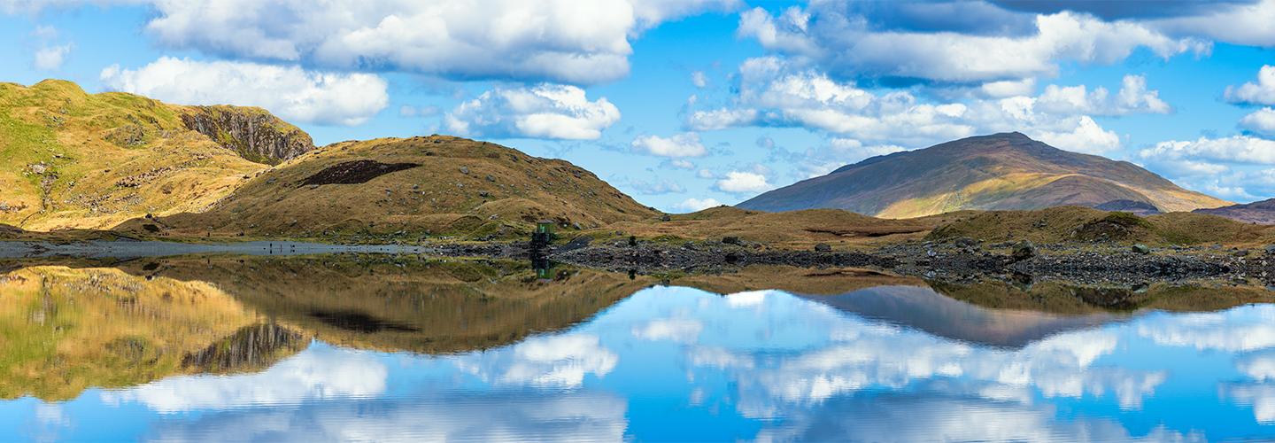
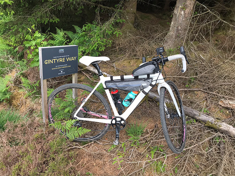
he Kintyre way; 100miles of waymarked, unexplored natural beauty in the Kintyre peninsula that stretches from Tarbert to Machrihanish. Known for being a long-distance walking path, recent changes mean it’s now rideable too.
Setting off on the Kintyre Way I was off into the unknown! I had read a few articles online to say it was MOSTLY rideable, and a quote on the Kintyre Way website…
…with recent changes, the Kintyre Way is becoming established as a challenging and interesting route for cycle cross and mountain bike enthusiasts
I’m sold – Challenging and Cyclocross is the same sentence – my favourite!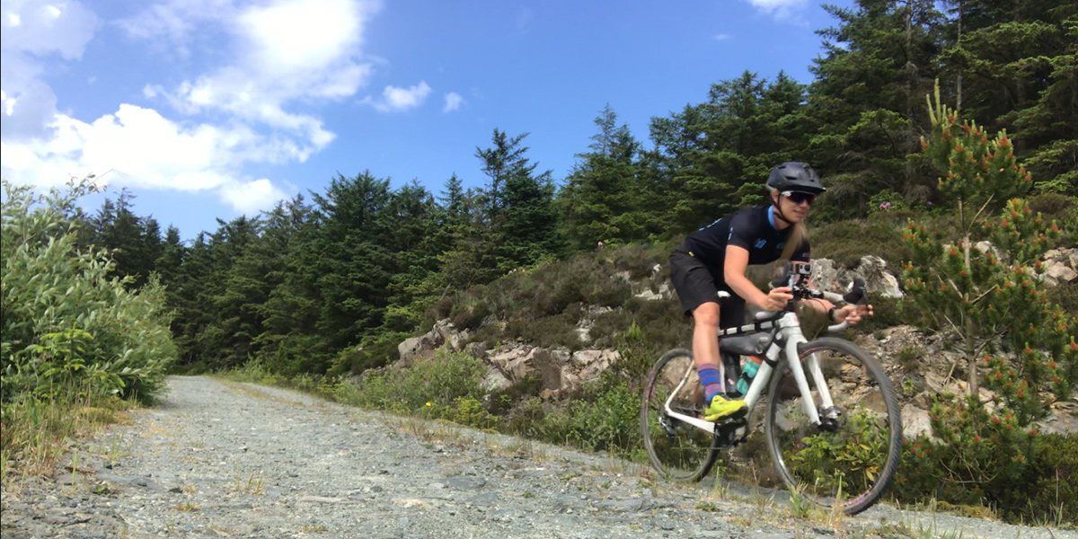
With limited time I chose to do the route over 2 days and miss out the first (Tarbert to Claonaig- 11miles) and last sections (Southend to Machrihanish- 16 miles) – these had been mentioned as boggy land or road so I felt I wasn’t missing anything. Covering just the backbone of the route I would cover 74 miles and 4700ft of elevation.
Day 1- 37 miles, 3500ft elevation gain
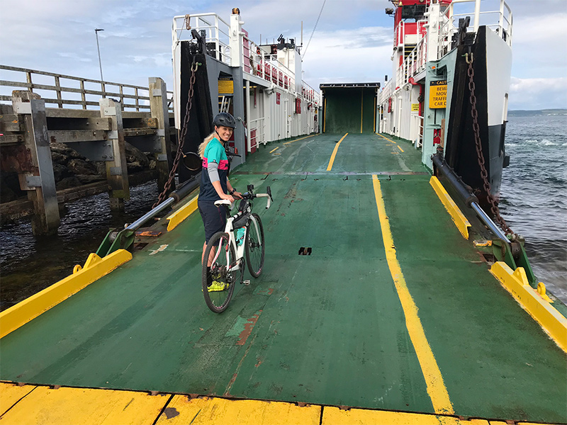
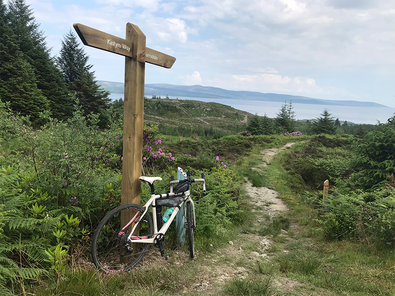
After cycling the circumference of Arran on the Friday I caught the 0930 Lochranza to Claonaig ferry on the Saturday and set off from the ferry slipway, picking up the blue Kintyre way signposts straight away- this was what I was hoping for- a well signposted route and 90% of the way was like this, markers every mile; Useful for me when my Garmin froze! I followed the road for just over a mile up a steep road climb before breaking off into the Achaglass forest.
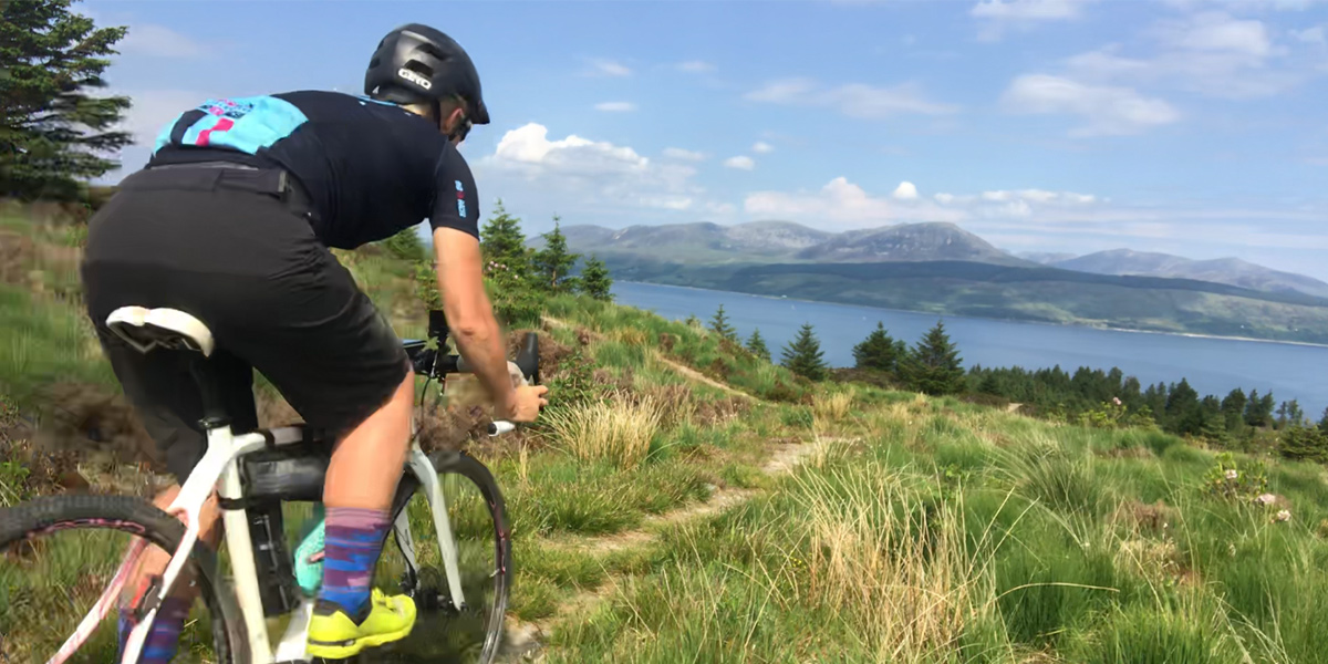
The smile this route put on my face instantly was priceless- within 4 miles I’d already seen 2 deer, an eagle taking off from the grasslands with his freshly caught breakfast and was experiencing some superb demanding tracks. Stopping to rest and hydrate at the top of the first off-road section the views looking behind were incredible. Stunning views of the Kilbrannan sound across to Arran; watching the Calmac ferries cross back and forth and putting yesterday’s ride around Arran into perspective.
OS Maps route: Day 1, Part 1
Paths were bone dry due to the amazing weather but looked like they would be very boggy in the winter; so that’s worth bearing in mind if you plan this route. The tracks were demanding in parts with a mix of unsurfaced paths, moorland with short steep gradients and bridge crossings, but so much fun and nothing was beyond the capabilities of my cross bike.
The scenery crossing from East to West was stunning; I was continually blown away by the views as they just got better and better!
After a fantastic woodland descent, I popped out on the road at Clachan. The section from Clachan to Tayinloan is described on the Kintyre way website as “long stretch of sandy / rocky beach and unsurfaced/foreshore path” looking on my OS map it was literally along the shore.
But I could get to the next section along the main road so I pumped my tyres up a little and road along the A83 to the Calmac (Taylinloan to Ghigha) ferry to stop for a brief rest, an ice-cream and to fill my water bottles. The heat was exhausting and I’d nearly drank all my water.
I read about my next section- 16 miles, Tayinloan to Carradale- over the moors; another section that crosses over the peninsula, this time West to East and it sounded a little easier than the first 11 miles. By the time I set off again I was in the mid-day blazing heat, riding up the dusty fire roads to the Deucheran Hill onshore windfarm reminded me of riding in Greece. The service roads went on forever, but meant I was covering ground much quicker than the morning section.
After a fast descent on gravel and road after the windfarm I started getting into the wild sections again and the views were spectacular, with a few punchy climbs I was soon onto the last few miles of the day. What a way to finish the day- dusty loose single-track, with a few tight switchbacks all the way down to Carradale by the sea.
Being on the narrow peninsula means the sea is never far away and feels more island like than mainland. A puncture near the end was slightly frustrating, but inevitable riding this kind of track at the speed I was doing on skinny tyres.
OS Maps route: Day 1, Part 2
I stayed at Carradale bay Holiday park, conveniently this is on the route and has its own beautiful beach to swim which was needed after the hot hard day I’d had.
When fixing the puncture from the last descent, unfortunately I couldn’t get my tyre to seat back on the rim with my small pump, luckily, I’d seen a bike shop 100m up the road so that would be first stop tomorrow.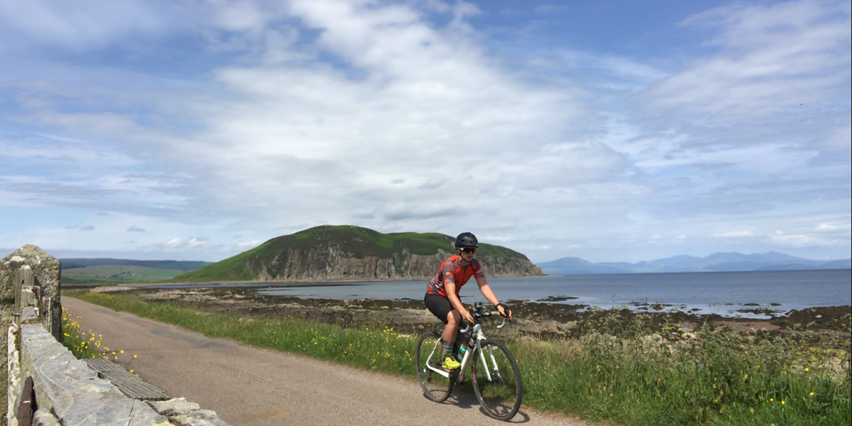
Day 2 – 37 miles 4200ft elevation gain
First stop, Carradale Bikes and Buggies! The bike shop wasn’t open but the café next door was and the wonderful ladies got me a track pump out of the shed so I could get my tyre seated.
On the road again… Literally- the first few miles were along the rocky shore line and beach so I gave this a miss and took the B842 to Torrisdale Castle where I joined the Kintyre way route -through well-kept castle grounds, up to the Gin distillery (I managed to avoid stopping for a cheeky taste!) and then onto open forest roads again.
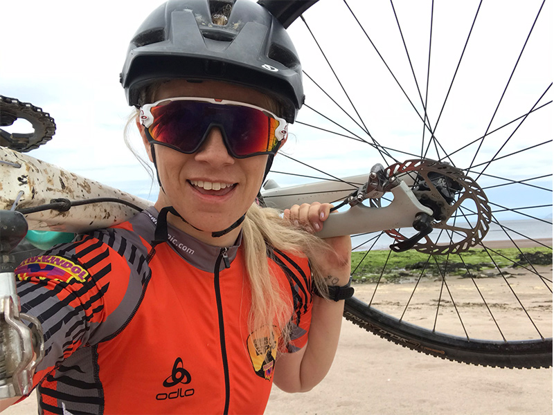
A short section of un-rideable steep track where I had to carry my bike leading onto another service road up to 270m above sea level to more incredible views. Suddenly the service road stopped and the trail took a dive of the edge, through forest land down steep (sometimes very steep) dusty single-track and descended 140m over 2.5 miles- this track would not have been out of place at a mountain bike race, never mind on a cross bike.
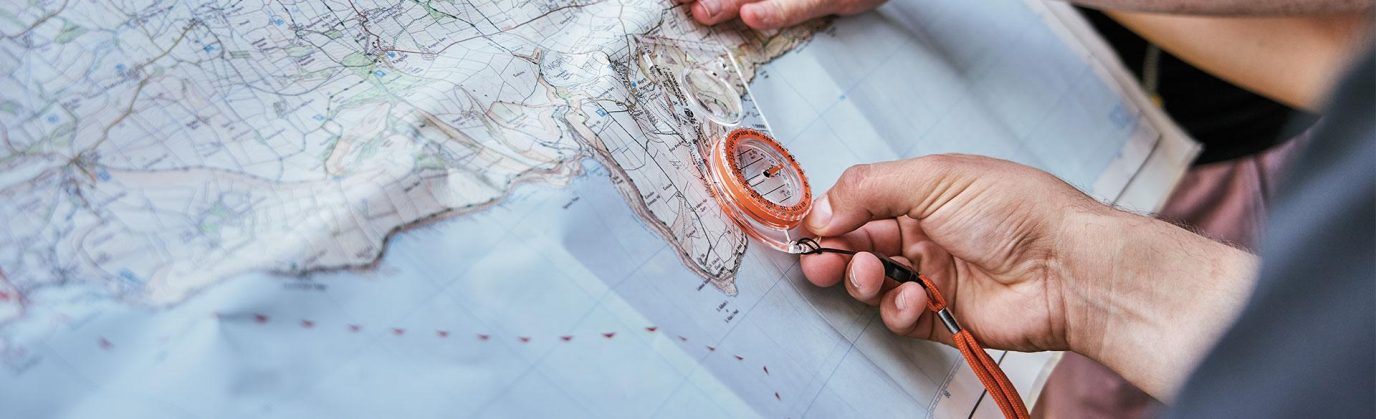
I was blown away and the morning of climbing endless forest roads and pasture land was all a blur! WOW! My hands hurt from the rocky ground and no suspension but I was still wearing a HUGE grin after that descent. After a small stream crossing the signs disappeared for a few miles but I trusted my instinct along with a paper map and carried on the paths I thought to be right.
To my relief I was correct. Unfortunately, my Garmin had frozen earlier in the day and thought I was still on the beach in Carradale. (always take back ups!) More dusty forest track took me round to Loch Luusa, on gravel tracks to join the minor roads that lead to Campbell town.
OS Maps route: Day 2
A late lunch stop to refuel it was time for the last section. Campbeltown to Dunaverty, which, if on a mountain bike would have been a real let down! I’m pretty happy to be riding road on my cross bike but since the rest of the route had been through such a diverse range of tracks and trails; following single-track road, for 11 miles, known locally as the Leerside was just a bit dull. Obviously, the views were again just stunning, looking over to Arran, Ireland and the Ayrshire coast but it was just tarmac.
The lure of Pizza on the finish at my parents’ motorhome and the sight of gravel paths distracted me away from reading the map and route description on reaching Polliwilline Farm.
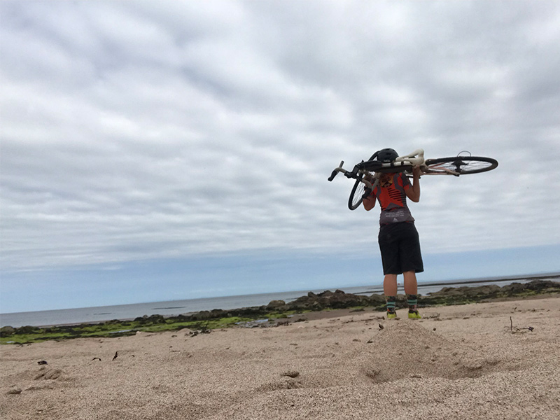
Still following the blue posts I ended up on one of the “rocky/Shoreline” sections. Carrying my bike over man sized boulders/ sandy beaches and sand dunes was not the way I envisaged finishing my ride.
Managing to pick up roads again by diverting off through a campsite and back on the main road I made it to South end just in time for my Pizza!
The Kintyre way was so much more of an adventure than I expected; seeing nothing but wildlife and postcard worthy views on the path over the 2 days, carrying my bike through over grown wild grassy sections, crossing coast to coast over the tops and through forests, just me alone with my bike and a Map….total bliss! My kind of adventure! I will be doing this again but probably just Claonaig to Campbeltown and either the ferry direct back to Ardrossan or a bus back up to Claonaig ferry.
As I said at the start, I went into this blind and knew nothing other than the short briefs of each stage and by looking at the OS Maps. From the Maps I could see which bits were trail/road/doubletracks, this coupled with the sheer “convenience” of setting off straight from the Ferry terminal was my reasoning for travelling North to South; I made the correct decision- this meant I climbed the double track and descended the sweet single-track for the most; if you are biking not hiking- be sure to travel north to south for full enjoyment.