The UNESCO World Heritage site of the Jurassic Coast features some of the most impressive geological features in Britain. Discover 10 of the best with GetOutside Champion, Martin Curtis.
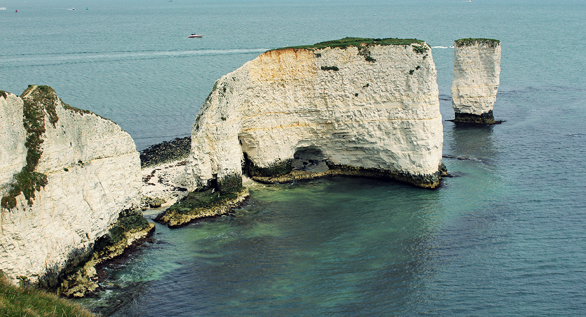
Old Harry Rocks, Dorset
Found at the eastern end of the Jurassic Coast, formed by chalk and late cretaceous in age (66 million years old) this headland use to be connected to the Isle of Wight. Erosion by the sea has created the stacks we see today. With easy access from Studland on the Coastal Path this is a must visit if you come to the Jurassic Coast. But be beware… local legend has it that Harry Paye, who was an infamous Poole Pirate used to hide behind Old Harry and lay in wait for passing merchantmen… so keep your booty safe and stay away from the cliff edges!
Old Harry’s Rocks
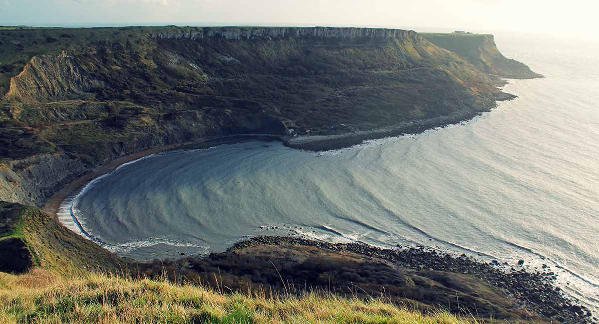
Chapman’s Pool, Dorset
With a history of shipwrecks this is a stunning bay near Worth Matravers. The rocks here are Jurassic in age and are formed from the upper parts of the upper Kimmeridge clays and capped with Portland stone. Walking along the path on Emmetts Hill gives you amazing views across the bay and towards Houns Tout. It will take you a while to get around the bay here as the Coastal Path heads in land before returning to the base of Houns Tout. Watch the steps here, it is a tough climb and they are very steep.
Chapman’s Pool
Gad Cliff, Dorset
This cliff can be found on the South West Coastal Path as you head west out of Kimmeridge Bay. The uppermost layers of Gad Cliff are formed by the Purbeck beds and the Portland limestones. These lay above a layer of Portland sands and Kimmeridge clay at its base. Angled at roughly 30 degrees this cliff line packs a punch in the Jurassic Coast’s twisted landscape.
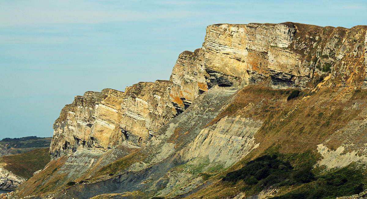
Gad Cliff
Mupe Rocks, Dorset
This rock formation can be found at Bacon Hole on the Coastal Path which is at the base of Bindon Hill, Lulworth. The rock strata of these rocks are the same as Gad Cliff. When on the Coastal Path this is the ideal location to stop and enjoy the views back towards Gad Cliff.


Mupe Bay
Lulworth Cove and Durdle Door, Dorset
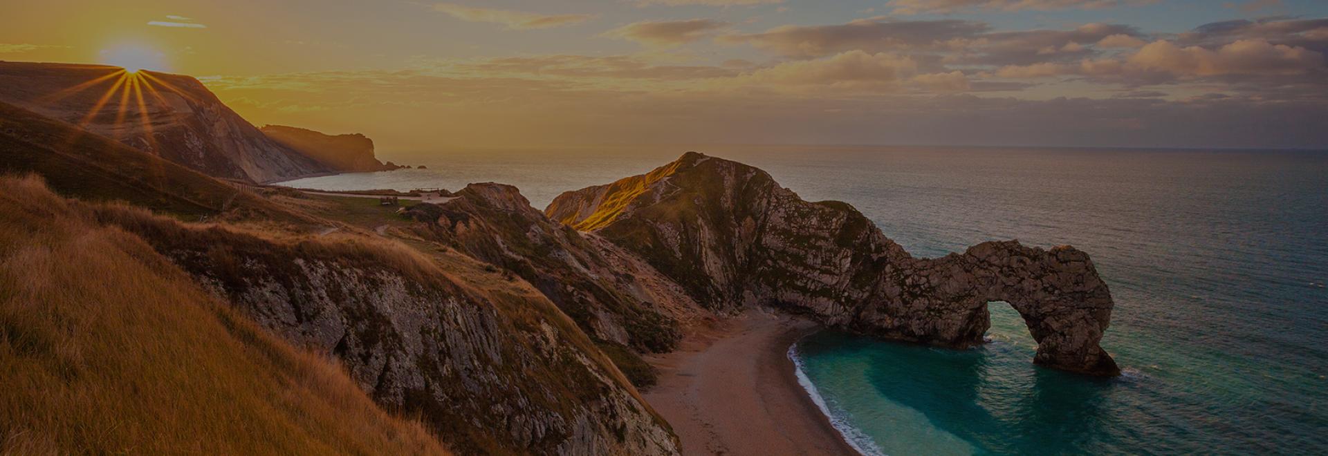
Lulworth Cove has formed from a breach through the tough Portland limestone rock layer at the mouth of the cove. Wave diffraction has caused its unique shape as the waves bend into an arced shape when forced through the cove’s mouth. Stair Hole can be found next door to Lulworth Cove and is the start of another cove similar to its neighbour. At this location you’ll also find the Lulworth Crumple, layers of rock folded and twisted by continents crashing together millions of years ago. Further west along the path you’ll arrive at Durdle Door… a naturally formed limestone arch. Durdle Door is formed from rock strata that runs parallel to the coastline. These bands are almost vertical. This band is the same one that is found at Lulworth Cove and erosion has created the arch we see today.
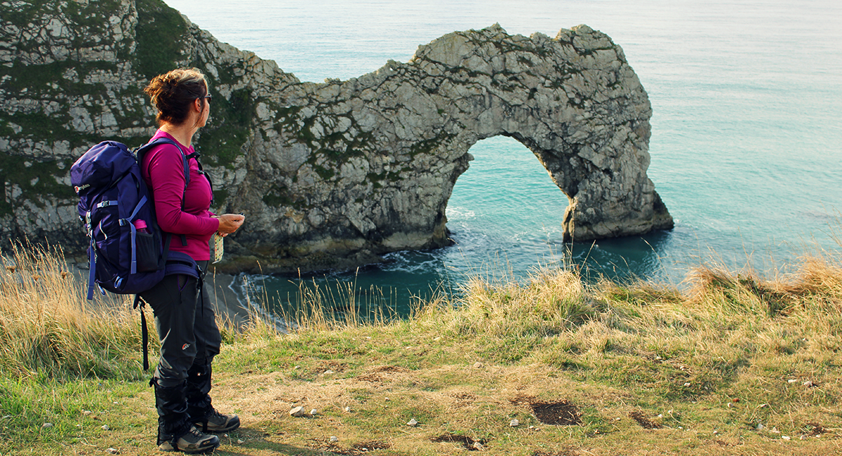
Durdle Door
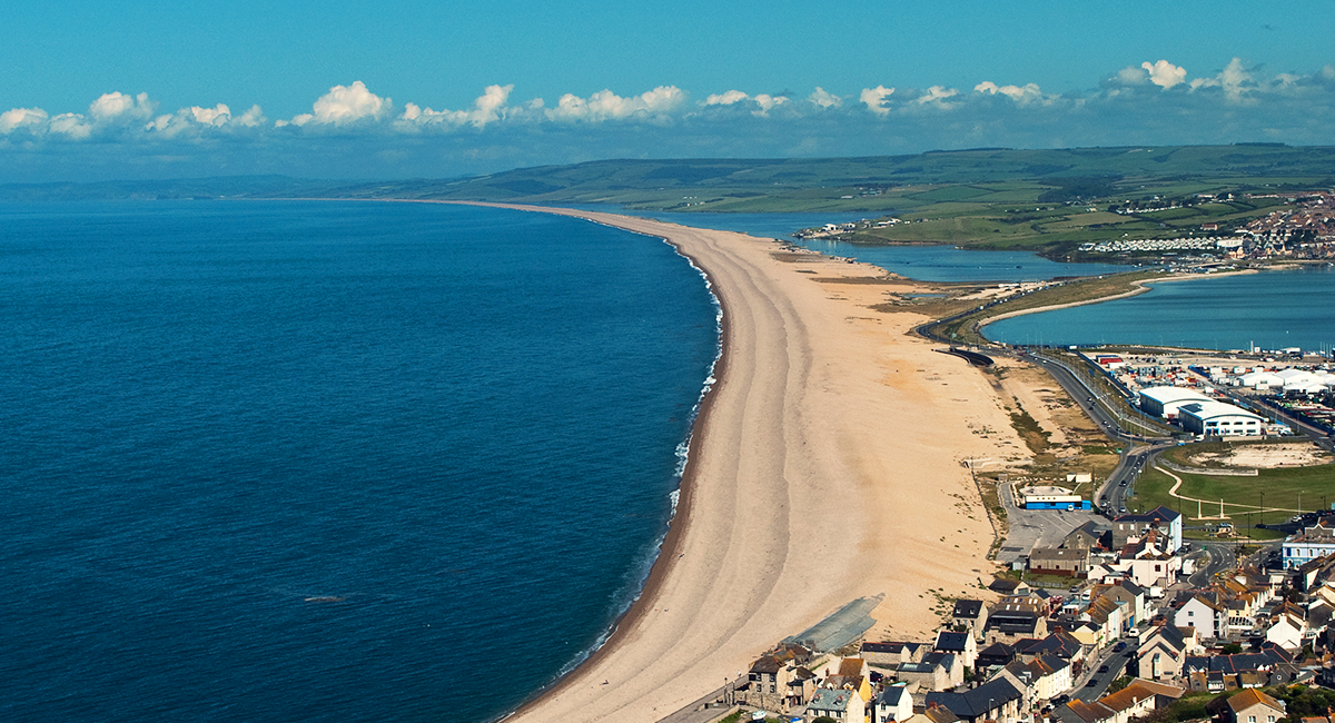
Chesil Bank, Dorset
This naturally formed bank is easily seen when walking the Coastal Path. It is in fact a barrier beach which has “rolled” landwards, joining the mainland with the Isle of Portland. The bank is nearly 18 miles in length, 200 meters wide and around 15 meters high. Behind it you’ll find a stretch of water called the Fleet Lagoon, here they tested the Bouncing Bomb in World War II. Steeped with history and a Site of Special Scientific Interest, it’s easily seen from the Coastal Path.
Golden Cap and Charmouth, Dorset
At 191m, Golden Cap is the highest point on the south coast. The South West Coastal Path takes you right over its summit and delivers the best views the Jurassic Coast has to offer. Looking east and west from this point reveals a third of life on earth from the geology in the cliffs you see below you. Further along the path you’ll reach the fossil hunting mecca of Charmouth… the cliffs here offer the best fossil hunting location on the south and is a popular location for holiday makers and avid fossil hunters.
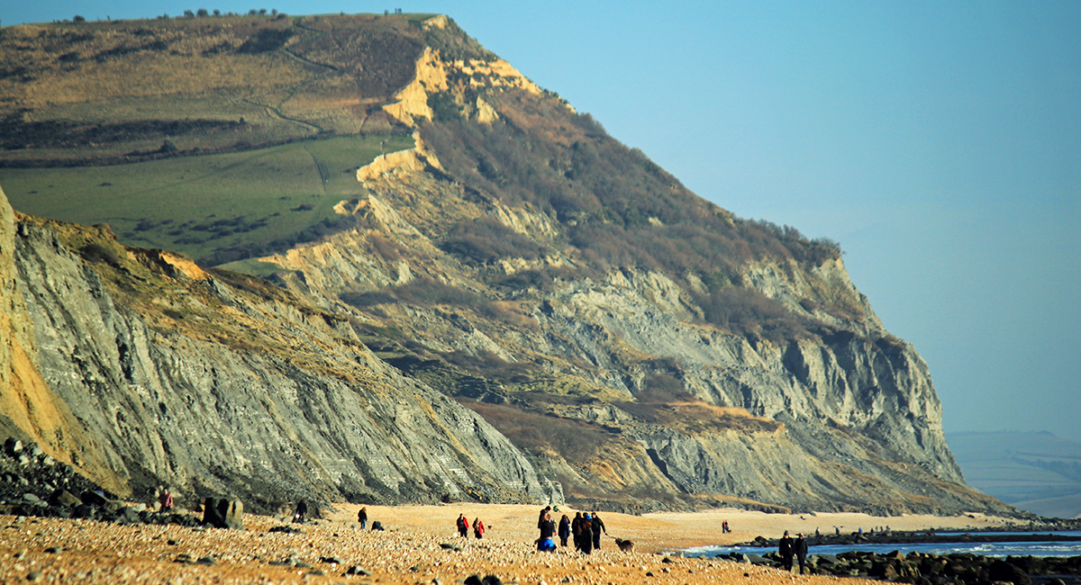
Golden Cap
Lyme Regis Undercliffs, Dorset
The Undercliffs form one of the biggest natural landslides in Western Europe and it is a nature reserve. The Coastal Path travels along its entire length of around 8 miles and its remoteness offers a tranquil walk. It has become an unusual habitat for plants and birds but access off the Coastal Path is not permitted due to its nature reserve status and the dangerous terrain. You can only access the reserve from each end.
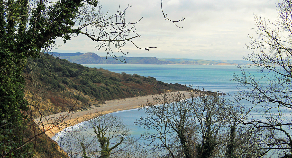
Lyme Regis
Hooken Landslide, Devon
This landslide is found along the Coastal Path between Beer and Branscombe in Devon. In 1790 a huge slump caused a 10 acre section of chalk cliffs to drop and move seaward. Now reached via a steep path on the eastern side and cliff top near Beer a walk through here will complete any visit to the Jurassic Coast.
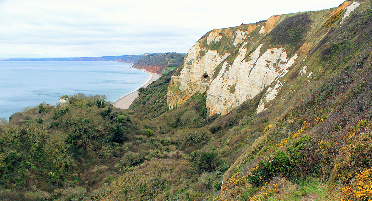
Hooken Landslide
High Peak & Ladram Bay, Devon
High Peak is the last big hill on the Jurassic Coast heading west. At 157 meters and partially eroded, its cliff face highlights the desserts sands from the Triassic period. Showcasing the oldest rocks from the Mesozoic era, these rocks are around 220 million years old and contain rare fossils of creatures passed. High Peak is a short climb off the Coastal Path. Ladram Bay below is home to some of the best rock stacks that can be found along this stretch of coastline. A walk along the South West Coastal Path from here will take you to the end of the Jurassic Coast.
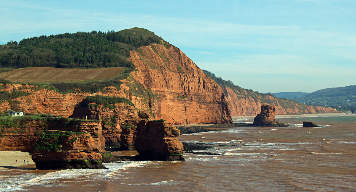
Ladram Bay
