Meet OS Guidebook Author Sue Viccars
Sue Viccars has spent her life exploring and writing about the landscapes of southwest England, combining a childhood love of the outdoors with a career in publishing and guidebook writing. With a background in geography and archaeology, and years as a commissioning editor for outdoor titles, she brings both expertise and passion to her work. In this interview, Sue shares her process, from studying OS maps and walking routes with a voice recorder, to the satisfaction of when a route “works”. She also shares her advice for new walkers and reflects on how outdoor access has changed over time.

EXPLORE THE
OS Shop
We are with you every step of the way. Shop our trusted walking and hiking maps and guidebooks so you can explore the outdoors with confidence.
Go to the shopSee all of Sue's OS Guidebooks!
What sparked your passion for the outdoors and how did you become a freelance outdoor writer?
I have always preferred being outdoors to being cooped up inside! When I was a child I had a pony and spent long days exploring the local countryside with her. After studying geography and archaeology at Exeter University I worked for a map publishing company in London (working on a tourist guide to Devon and Cornwall) before moving to Dartmoor for a job in the editorial department at David & Charles publishers in Newton Abbot. I was the commissioning editor for all outdoor subjects (walking, climbing, equestrian, countryside, landscape) for many years before going freelance in 2000. While at D&C I had joined the Outdoor Writers and Photographers Guild, and through that contact I started getting commissions to write walking books and articles, mainly (but not exclusively) in southwest England.
Can you tell us a little bit about the process for writing one of your guidebooks and which part you enjoy the most
I really enjoy the whole process, from studying the OS map and working out potential routes, to going out and walking the route and taking images (and finding that – often than not – that they ‘work’!). I record my walks on a handheld digital recorder, then play it back to myself and type it up to produce notes, which are then reduced down to meet the terms of the particular commission in terms of word count and format. It’s a very satisfying process that really helps to ‘embed’ the route in my memory.
What are your top tips for people starting to get into walking and hiking?
Don’t stint when it comes to paying out for a decent pair of boots and – if you do a lot of walking, don’t be surprised if they only last a couple of years. It may be expensive (over and over again), but it’s worth it.
Ditto when it comes to waterproof top and bottoms.
Don’t underplay the importance of acquiring good navigation skills. Learn how to read a map; digital devices are great, but if everything fails and you are ‘in the middle of nowhere’ you will have to resort to map and compass. Take personal responsibility for your safety on the hill; don’t rely on others, however skilled they may appear.
Do you have a favourite of the books you have written for OS? What made it so special to create?
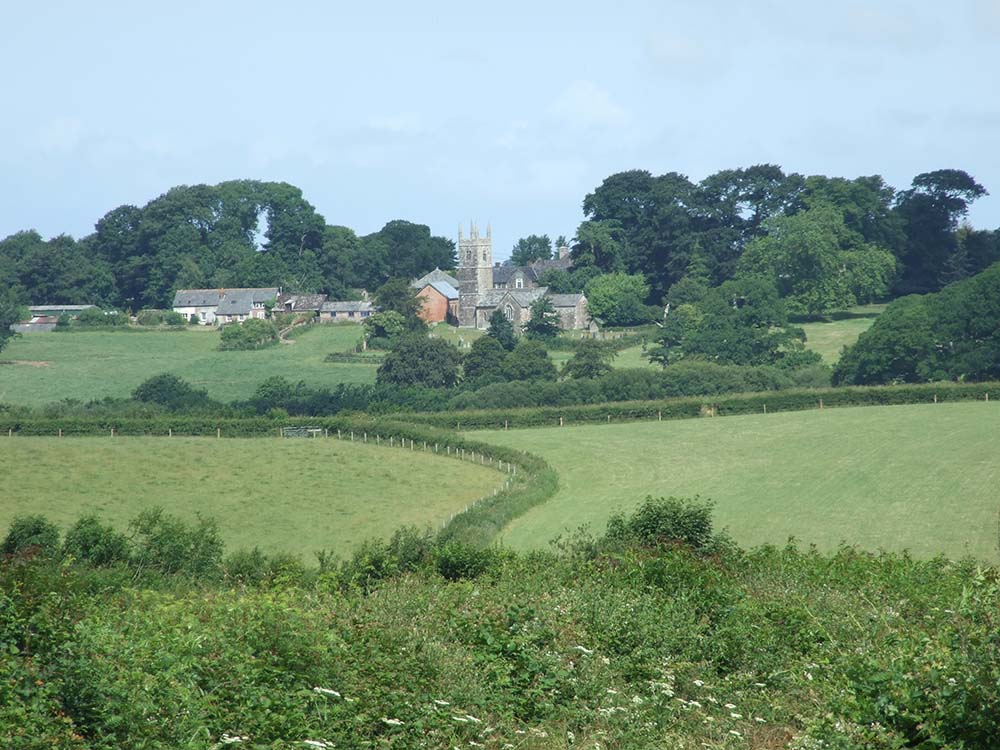
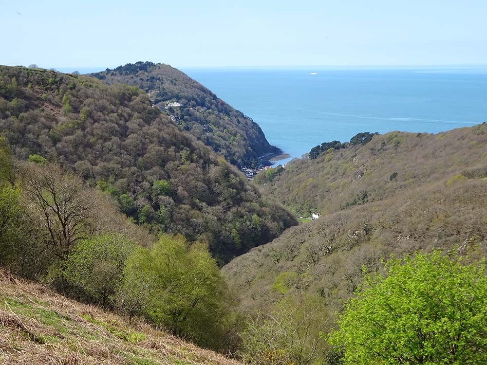
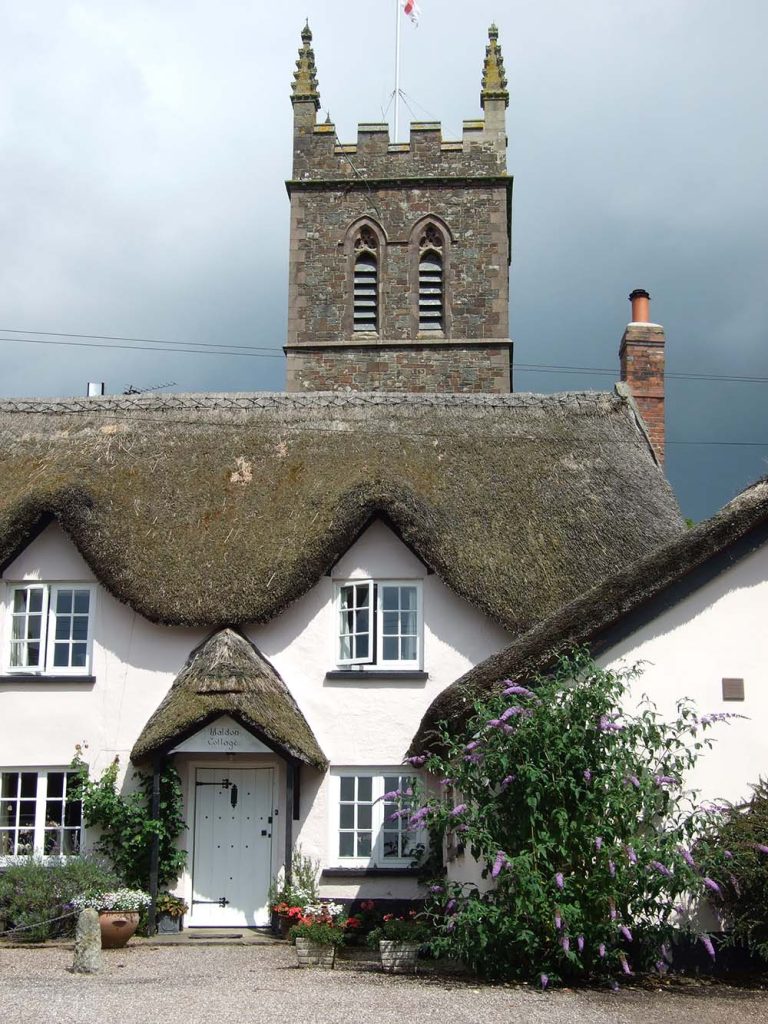
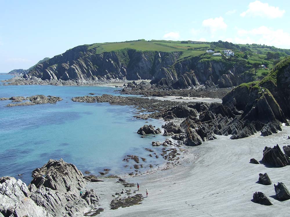
I think it’s Pathfinder North and Mid Devon. Devon’s heartland – a 30-mile-wide strip between Dartmoor and Exmoor – is so little walked that when I was researching the book every excursion was a real adventure! It’s marvellously quiet and off the beaten track: ‘proper’ Devon. And when you are given the chance to combine that area with the glorious north Devon coast – including a large chunk of Exmoor – you end up with a book filled with 28 superb walking routes. It was a wonderfully satisfying project to work on an I am very proud of the end result.
What do you use to help with plotting routes and navigating? Do you use paper maps, or have you fully transitioned to digital tools like OS Maps and GPS?
When I receive a new book commission I get out all the relevant OS Explorer paper maps and study the area in detail, and start plotting possible routes, making sure to get as good a spread a possible (depending on the detail of the particular commission). It’s good to be able to see the overall picture. Then I examine each route in detail via OS mapping online, print it out and take it with me when I do the route. I find it helps to mark up specifics on the print out – a spectacular view, an important grid ref, and so on (especially on a very windy day, when my voice recording may get a bit muffled). It’s reassuring to have ‘paper and pen’ back up. When out on the route I tend to use the OS Maps app to check my exact location: and this is particularly useful when it comes to recording a route across common or open access land, when the rights of way on the OS Explorer rarely match the walkable line.
Have you noticed any changes in how people engage with the outdoors since you started writing guides?
Don’t get me started. Since the pandemic there are many more people out there who are treating the countryside – the National Parks in a particular – disrespectfully, and who seem to think that they can do what they like when out (fly camping, lighting fires, leaving their rubbish behind). It has revealed a complete lack of respect for our countryside, flora and fauna, and our protected landscapes are under assault. Add to that the fact that there are now something like 12+ million dogs in the UK… sadly not all dog owners are responsible when it comes to clearing up poo or controlling their pets when encountering sheep etc. Obviously millions of people enjoy the outdoors responsibly, but there does seem to have been increase in a general sense of entitlement.
And then there are drones…!
Where can we learn more about you and follow your adventures online?
Through the Two Moors Way Facebook page, and occasionally the Exmoor Magazine Page. I’m quite private about what I do, and like nothing better than going off to explore another corner of the southwest peninsula on my own. But I have more than 20,000 photos and am wondering if it might be a good idea to start up my own social media channel to share what I am lucky enough to get up to. Watch this space!
If you’re interested in hearing from more of our wonderful Pathfinder and Short Walks Made Easy Authors head to our Authors Hub.
By Hilary Pullen
Meet Hilary, Editor of Get Outside – the Ordnance Survey Blog. Hilary is based in North Wales and loves hiking with her dogs in the mountains of Eryri and Bryniau Clwyd, you can find her on Instagram @nearlyuphill and read her guides to walking in North Wales on her blog. Drop her an email hilary.pullen@os.uk if you are interested in posting an article on Get Outside.