Running in Squares
If anyone had asked me last year how well I knew my local area, I would have answered “Extremely well”. After all, I’ve lived in the area for 55 years and have a love of the outdoors.
Turns out I was wrong.
It took one map and a book to teach me that lesson.
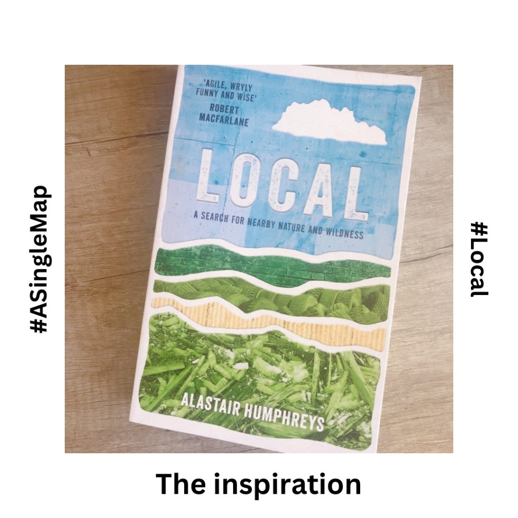
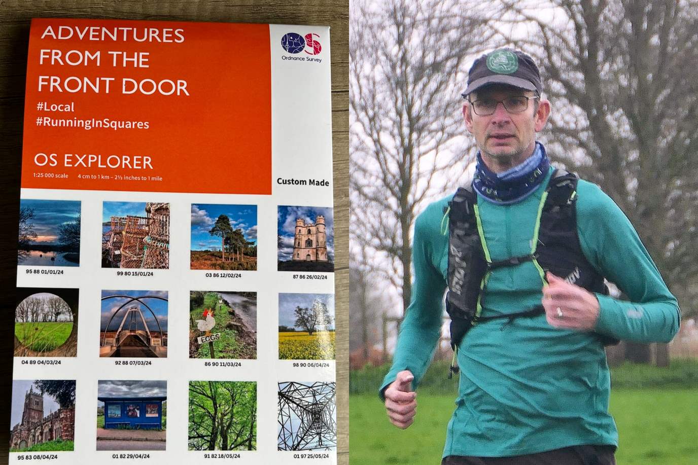
The turning point started in October 2023 when Alastair Humphreys’ book ‘Local’ caught my attention. In it, Alastair describes how he spent a year exploring his local map, one kilometer square at a time. I learned that Alastair used a bespoke 1:25,000 Ordnance Survey map as the basis of his exploration. Well that was news. I had no idea how easy it was to purchase such a thing. I went straight onto the Ordnance Survey website, typed in my postcode and it wasn’t long before a 1:25,000 20km x 20km map centred on my home arrived in the post.
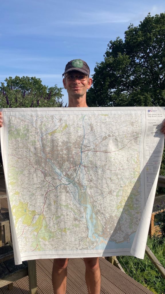
I’m an active member of The Green Runners, a community of runners committed to making changes for a greener future. The idea of exploring my map would be in keeping with our How We Travel pledge to reduce travel carbon emissions. Adventures from the front door are a great way of reducing our carbon footprints. And so I landed on the plan:
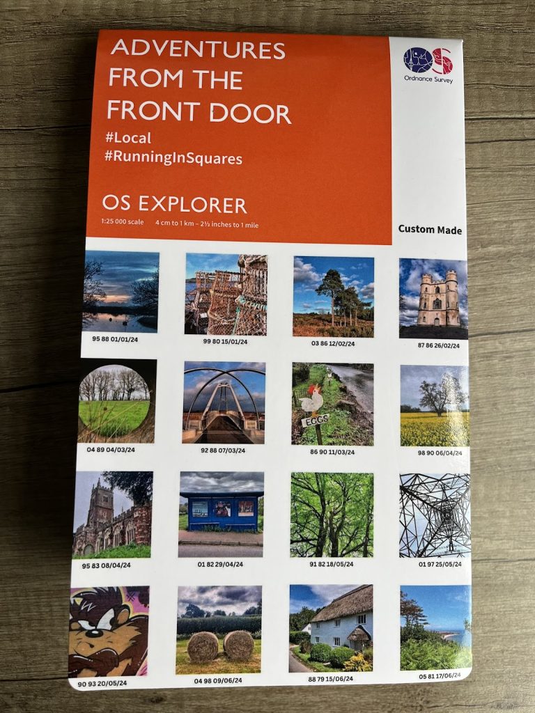
To run through the 400 1 km squares in a 1:25.000 OS map centered on my home in Topsham, Devon; starting and ending each journey from my front door, no cars or public transport.
It doesn’t sound too hard if you read it quickly.
The key to my challenge lay in planning, poring over my map working out efficient routes, working out how I could access each and every 1km square. Turns out that two squares are in the middle of the Exe Estuary, with a further three offshore in the English Channel. Well beyond my swimming abilities, I reduced my target to 395.
Exploring my local area took on a whole new dimension in 2024. As I ran I had in mind those straight red grid lines that divided up my map, picturing them stretching across the landscape. My bespoke paper map was reserved for planning at home. While out running, I would use my digital OS map, watching my position on the map to spot when I had crossed into a new square.
And once in that new square I was then on the lookout for a photograph opportunity. I illustrated my adventures by taking an image per square. Square images of course. My adventures took on a new twist as I would try to find different ways to illustrate each new square I crossed on any given run – a view of the hills, footpaths across fields and along shadowy hollow-ways, close up shots of insects and flowers, pictures of churches and sign posts.
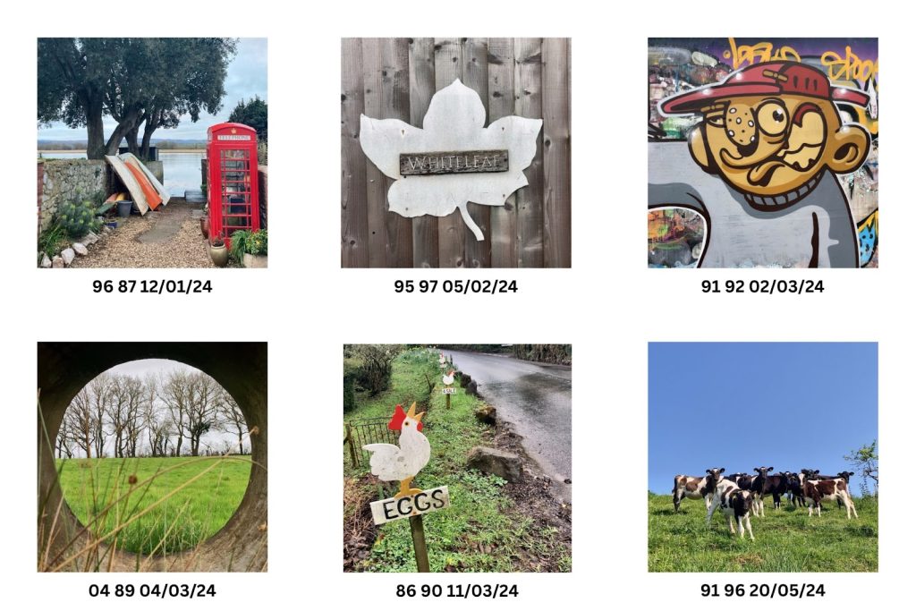
The photographs then evolved into a diary in which I would try and capture the essence of the run. A means to capture the conversations with people I met, a record of the wildlife I observed and the history that I researched after the event.
Exploring my map has taken me to places I’d never been to before, despite living here for so long. As an example, I’ve passed a signpost to Sowton Village many times before. But I’ve not been inspired to visit as a nearby industrial estate takes its name from the village, while the village itself sits in a corner of Devon hemmed in by a motorway and dual carriageways. It turns out that Sowton Village is charming with a small church, manor house and farm houses. The pathways that lead through it also provide me with a new way to run north from home up the Clyst Valley. I’ve revisited the village since that first square hunting run and intend to return to explore some permissive footpaths I stumbled upon.
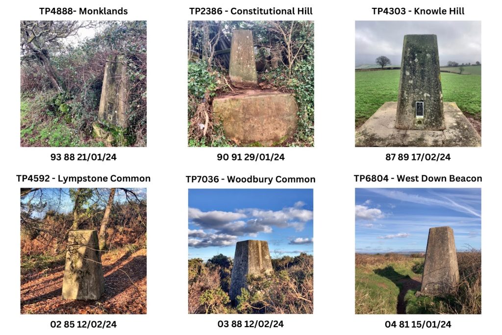
I devised additional challenges within my overall challenge to keep things interesting. Afterall, I had soon run through all of the squares around my home. I decided to visit all of the pillar trig points once I’d located all of the small triangles on my map and I took photographs of each and every Devon Wildlife Trust Reserve. I have in mind to run along all of the footpaths in the 20 x 20km boundary. There cannot be many left to run along.
If you love maps like I do (and my guess is you love maps if you are reading this article) then a challenge similar to mine will help translate your map into the physical landscape. I love nothing more than connecting the landscape, spotting places I’ve visited previously in the distance such as suddenly realising that I’ve crossed a particular field on that far hill on another day out hunting squares.
I finished my challenge on 17 June having run 1,070km and climbed 14,875m. I exceeded my target and traveled through 399 of the 400 squares (I adapted my rules and allowed myself to take two ferries, one down the estuary and the other along the coast – I had to run to and from the ferries of course). There remains just one square that I could not reach. My ferry slid passed it, the square just a 100 meters or so off starboard.
Of course, I’ve not stopped exploring my map. I’ve found new reasons to step out of my front door and explore. Since 17 June, I’ve been traveling around the very edge of my map (in sections – it would be one very long run otherwise), getting as close to the perimeter thin red grid lines as possible.
I’ve also been filling in my Strava heat map. Strava is an app that records the routes I’ve run and it enables me to produce a map of all of my 2024 activities. This has resulted in a red square of squiggles across my corner of Devon. My desire is to fill in as much of that square as possible with red lines. There’s always more to find. I’m not done yet. My single map has a lot more to give.

So why don’t you purchase your own bespoke OS map and see what lies outside of your front door?
Resources
Local by Alastair Humphreys LOCAL: A Year Exploring a Single Map – Alastair Humphreys
Bespoke OS 1:25,000 map Custom Made Personalised maps | Paper and Framed prints (ordnancesurvey.co.uk)
Help in locating trig points TrigpointingUK
Devon Wildlife Trust reserves Nature Reserves | Devon Wildlife Trust
Obsidentify app for identifying bugs, beetles, flies and more
Merlin app for identifying bird songs
The Green Runners www.thegreenrunners.com
Instagram & Threads @martinelcoate
Bluesky @melcoate.bsky.social
EXPLORE THE
OS Shop
We are with you every step of the way. Shop our trusted walking and hiking maps and guidebooks so you can explore the outdoors with confidence.
Go to the shopBy Martin Elcoate
Martin is a recreational runner living in Devon, UK. He runs to explore his local area, enjoying long days out in the Devon hills. Martin works behind the scenes for The Green Runners on campaigns, social media and promoting ways in which we can make a difference in the face of the climate emergency. His pledges include continuing not to eat red meat, speaking up to promote The Green Runners & calling for action in relation to the climate emergency.
