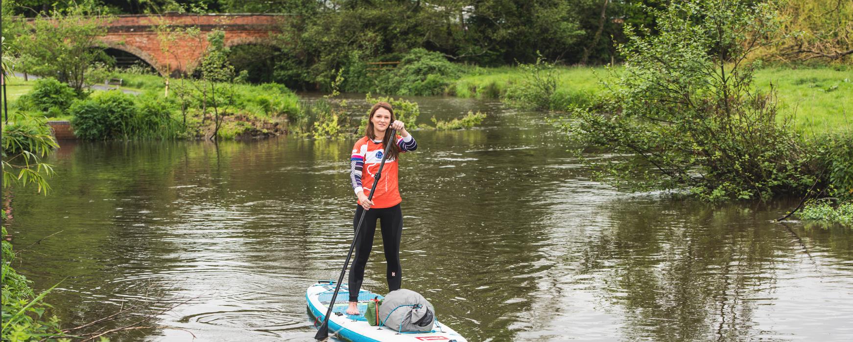
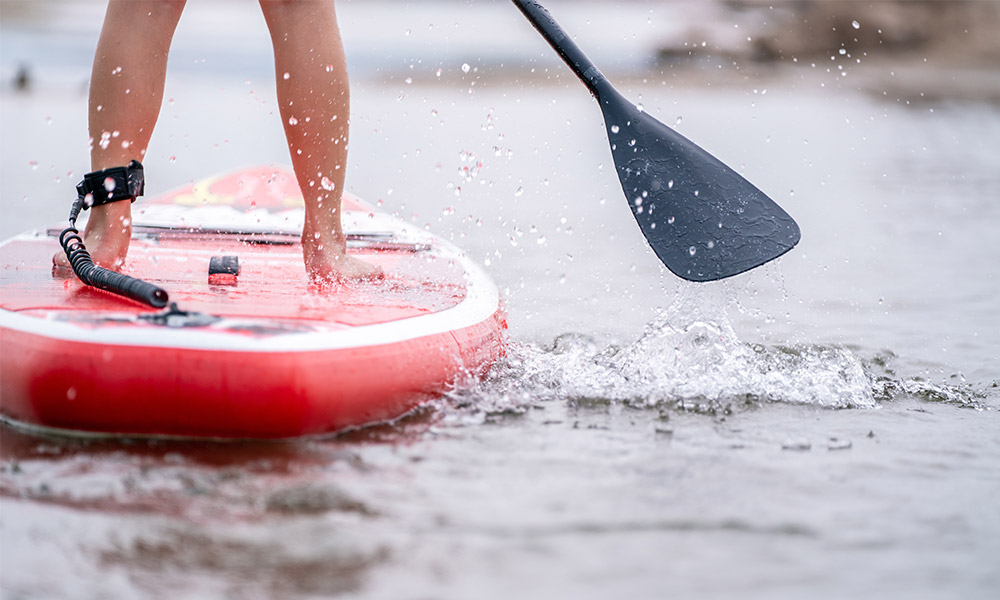
First person to SUP the length of Britain
Lizzie Carr was the first person to paddle board the length of Britain’s canals. Find out more about the route she took and learn how to find more SUP, kayak and canoe routes in OS Maps.
Padding Britain’s canals
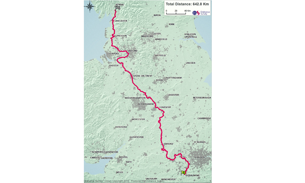
Starting from Godalming in Surrey, Lizzie paddled 20km each day for more than 20 days to work her way up towards Kendal in the Lake District. As the first person to complete this incredible feat Lizzie not only challenged herself physically but challenged everyone to #GetOutside and make the most of this beautiful country, its waterways and the surrounding countryside and city-scapes.
Protecting our waters
She also took a more serious message with her to protect these areas; plastic pollution is an increasing issue that is causing problems for wildlife that, if left to continue, could ruin the beauty, peace and natural diversity of the areas for future generations.
“Our canals are iconic pieces of history that provide a presence of calm and tranquillity in urban settings. They are easily accessible all over the country, but they are currently under threat from plastic pollution and debris that, if we don’t address soon, will compromise the beauty and quality of our experiences along the canals”, says Lizzie.
Read more about Lizzie’s work with plastic patrol.
The paddle route
During her challenge, Lizzie paddled through some of the most iconic parts of the country as she travels north; from the river Wey up through Oxford before entering the Stoke on Trent canal, then on towards the river Douglas before reaching the river Ribble and the Ribble Link. She was the first paddle boarder to be granted access to this part of the water network which marked a great turning point for stand-up paddle boarding (SUP), which at that time was a relatively new sport.
Lizzie’s paddle boarding route through Britain’s canals – use the links below for individual route segments
Lizzie’s paddle boarding route through Britain’s canals – use the links for individual route segments
View the route on OS Maps
| Stage | Route | Link |
| 1 | Godalming – Woking |
Click here |
| 2 | Woking – Windsor |
Click here |
| 3 |
Windsor – Hurley
|
Click here |
| 4 | Hurley- Reading |
Click here |
| 5 | Reading – Didcot |
Click here |
| 6 | Didcot – Oxford |
Click here |
| 7 | Oxford – Upper Heyford |
Click here |
| 8 | Upper Heyford – Claydon |
Click here |
| 9 | Claydon – Rugby |
Click here |
| 10 | Rugby – Coventry |
Click here |
| 11 | Coventry- Nuneaton |
Click here |
| 12 | Nuneaton – Tamworth | Click here |
| 13 | Tamworth – Rileyhill | Click here |
| 14 | Rileyhill – Stone | Click here |
| 15 | Stone – Kidsgrove | Click here |
| 16 | Kidsgrove – Northwich | Click here |
| 17 | Northwich – Lymm |
Click here |
| 18 | Lymm – Leigh | Click here |
| 19 | Leigh – Sollom | Click here |
| 20 | Sollom – Bilsborrow | Click here |
| 21 | Bilsborrow – Lancaster |
Click here |
| 22 | Lancaster – Stainton | Click here |
Whether you’re looking to take on your own epic on-the-water challenge or just want to paddle somewhere new, you can find hundreds of recommended paddle routes in OS Maps. Remember to follow British Canoeing’s Paddlers Code to help protect our waterways and stay safe.