One of the best coastal walks in the UK
The Northumberland Coast Path offers some stunning coastal walking. The 62-mile (100km) waymarked route is the best way to experience this beautiful, varied landscape. Broken down into stages, here’s everything you need to know in order to walk the path. .
Northumberland coast
The Northumberland coast is best known for its wide, sweeping beaches, backed by high sand dunes. Amidst this striking landscape is the evidence of an area steeped in history, covering 7000 years of human activity. There are a host of conservation sites, including two National Nature Reserves, with a great variety of wildlife.

David Steel walking the Northumberland Coast Path
The Northumberland Coast Path follows this stunningly beautiful coastline for 100 kilometres (62 Miles) from Cresswell in the south to Berwick-upon-Tweed in the north. Alongside sandy beaches, over rocky headlands, past dramatic castles and through attractive coastal villages, the route offers a constantly changing landscape which is a pleasure to explore.
Walking the Northumberland coast has been a lifelong dream. Sometimes our dreams do not meet our great expectations, but I am pleased to confirm that this was not the case.
There are six stages to the walk each of these having their own characteristics and feel. Details of each stage and the route in OS Maps can be seen below.
Follow the route with OS Maps
OS Paper Maps Required:
- OS Explorer 325 – Morpeth and Blyth
- OS Explorer 332 – Alnwick and Amble
- OS Explorer 340 – Holy Island and Bamburgh
- OS Explorer 346 – Berwick-upon-Tweed
Each section (stage) of the route in OS Maps can be found below.
Stage 1 – Cresswell to Warkworth
11 miles / 18km
The delights of this stage are the number of nature reserves along the route, with the ever present 8-mile-long beach of Duridge Bay to keep you company.
This section starts in Cresswell, a small village of the Northeast coast (Video 1:40). You can either follow the waymarked route through the dunes or take to the beach.
Continuing north, the walking is very gentle, along the well-marked route. Passing many nature reserves on the way, including Cresswell Pond Nature Reserve (Video 4:20), Druridge Pools, East Chevington Nature Reserve, Druridge Bay Country Park (Video 6:30) before finally passing Hauxley Nature Reserve (Video 5:45). During this stage of the walk the true tranquillity of this stretch is experienced, with a great mixture of walking (paths, trails, and beach) mixed with the wildlife, fauna and flora.
As you leave Hauxley, continue north pass Amble Dunes, Coquet Island on your right (Video 9:00). Amble roof tops become visible ahead (Video 10:00). The route through Amble takes you along the pier, through the quayside and past the marina.
Heading inland, after leaving Amble, follow the River Coquet towards Warkworth. As you enter Warkworth, Warkworth Castle is ahead of you (Video 12:30). It is worth taking some time to explore the medieval Town of Warkworth and all it has to offer, including Warkworth Castle, river walks and the town itself.
Stage 2: Warkworth to Craster
13.5 miles / 22km
This section has so much to offer and is truly rewarding. Dramatic medieval towns, coastal grasslands, estuary walking, the former smuggling den of Boulmer, picturesque sandy bays and rocky headland.
Starting from the beautiful market town of Warkworth and head north over the ancient bridge, towards Warkworth Beach. After reaching the beach you’ll have a great view of the dunes and beach. Continue heading north, with the golf course on your left and the dunes to your right, with Alnmouth in the distance (Video 5:00). The route then heads inland around the estuary, on dedicated paths.
Arriving at Alnmouth, you’ll cross the River Aln and walk down the northern side of the estuary (Video 8:00) before arriving at Alnmouth (Video 8:30). It is worth taking some time to look around the village, which dates back to c1152. Leaving, continue north along some lesser-walked costal paths on our way to Boulmer (Video 13:00), which is a former smuggling den.
Quaint coastal villages on route
Leaving Boulmer, you’ll pass many bays and coves, crossing the footbridge (Video 14:50) at Iron Scars. Eventually you’ll reach Cullernose Point (Video 16:50), where you’ll see Craster a mile ahead and the conclusion of stage 2 of the walk from Cresswell to Berwick-upon-Tweed.
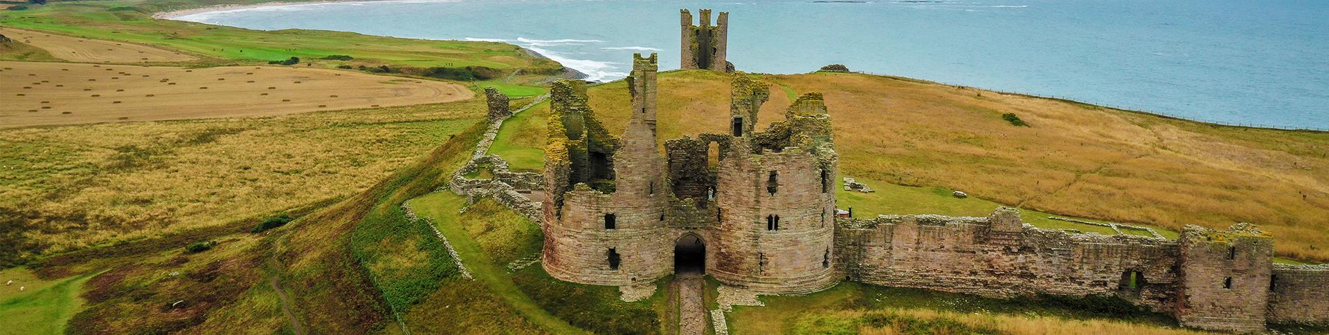
Stage 3: Craster to Seahouses
11 miles / 18km
This section is a true delight as you’ll visit ancient ruins, castles and numerous coastal and fishing villages. There is some truly breath-taking scenery on this walk so don’t forget to look behind you as well.
Starting from the beautiful fishing village of Craster, walk north along the coast towards Dunstanburgh Castle (Video 3:00), dating back to the 14th Century. Take in the tranquillity of the route before passing the village of Embleton and reach the Newton dunes (Video 5:40), with some amazing views. Stroll through the Newton Pool Nature Reserve (Video 6:30) before reaching Newton by the Sea (Video 7:30). If you fancy a quick break, you can visit the Ship Inn pub but be careful, you may never want to leave!
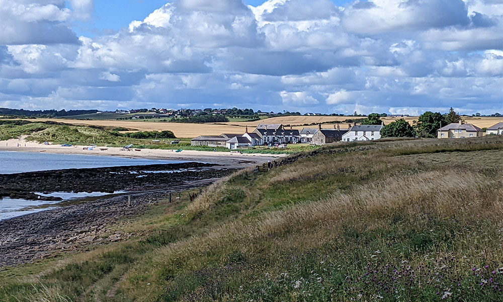
At Newton Point you’ll come across beautiful beaches which are rarely populated. Beadnell is a hub for water sports (Video 9:15) and worth a stop if you have time. Keep heading north and you’ll reach the bustling fishing village of Seahouses (Video 11:00).
There is so much to enjoy about this section of the Northumberland Cost Path you will be surprised at how quickly you reach the end, wishing for it to continue.
Stage 4: Seahouses to Belford
11 miles / 18km
On reaching Bamburgh, you have plenty to see and do (Video 05:40 to 07:05); it is worth stopping off to enjoy the delights of this charming village. We leave Bamburgh by The Wynding and head towards the golf club, where there are some outstanding views of the three-mile beach and Bamburgh Castle. As you emerge from the golf course, you’ll reach a stunning vantage point (Video 08:40). The route now takes you past Budle Bay and the Lindisfarne National Nature Reserve before going inland and across the rolling fields untill the market town of Belford.
Stage 5: Belford to Fenwick
7.7 miles / 12.3km
This stage of the route really mixes things up. As it moves away from the coastline, you’ll experience some fantastic fell walking, picturesque woodland walking and distant views across the coast. Make sure you visit St Cuthbert’s cave.
Leaving the market town of Belford, the path heads inland and picks up some meandering fells towards the beautiful, wooded paths at Virgin Hills. Shortly after this you’ll each a fantastic vantage point (Video 5:00) which you should stop to admire before continuing on to St Curthbert’s Cave (Video 6:40). From this point to the end this stage you’ll pick up the path of St Curthbert’s Way. Continuing along the path you’ll come to Shiellow Woods (Video 7:50) and start a very pleasant, wooded walk down into Fenwick.
Stage 6 Fenwick to Berwick-upon-Tweed
12.5 mile / 20km
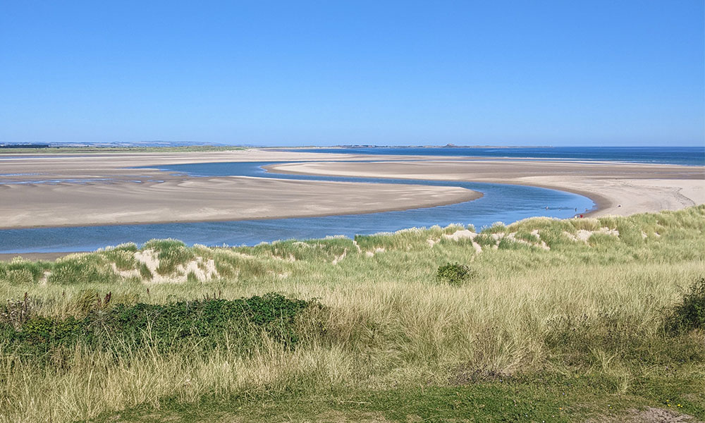
This final stage of the Northumberland Coast Path presents some of the most remote and tranquil walking along the path. As you leave Fenwick you’ll have to cross the A1, the biggest road you’ll encounter on this route. Take great care when crossing the road. Follow the dual signed path (Northumberland Coast Path and St Cuthbert’s Way) to the stunning Holy Island causeway.
At the road crossing to Holy Island (Video 5:50), continue north along the coast, through marshland and over the estuary bridge (Video 7:30) before picking up the dunes again, and the beach which continues to the horizon. It’s worth taking your time through Cocklawburn Dunes Nature Reserve and Cocklawburn Beach (Video 10:20).
You’ll eventually depart the craggy cliff top coast path as you head down to Spittal and the mouth of the Tweed estuary. As you walk up the southern side of the estuary, you’ll cross the historic Berwick Bridge. After crossing the bridge, turn right onto the quayside towards the anchor, and the conclusion of your walk.
I had a great feeling of joy that I had completed the walk after mentally planning the trip for so many years. Then there was sadness that this fantastic walk was completed. I suppose one day I will have to retrace may steps.
Top tips for walking the Northumberland Coast Path
1. Never forget to keep looking behind you, the views are equal and sometimes better than you may expect.
2. Don’t be too quick to leave some of the villages and points of interest; it is worth digesting what they have to offer.
3. I would suggest walking from south to north. As the sun always shines in the northeast (well mostly) and having the sun behind you has many advantages.
4. Don’t be afraid to use buses and public transport, when planning your route. The walk and bus services are well linked up.
5. Above all, enjoy what the route has to offer.
We hope this has given you an insight into the beautiful Northumberland Coast Path so you can start planning your own walk. You can choose to walk this route in one go or if you don’t have the time or the stamina, break it up into manageable sections above. Every one of the six stages make a fantastic day walk.