Neath Port Talbot Circular Walks
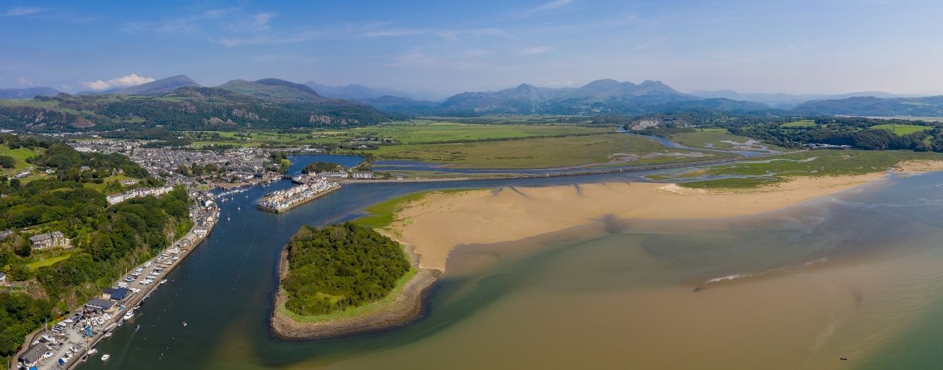
This section of the Wales Coast Path is very short at only 15 miles / 25km, and it is also one of the most urban and industrial parts. However a choice is available; either to follow the route closest to the coast, which is often very built-up, or to take a variant route a little further inland, avoiding most of the built-up parts. Either way, this section starts by following the disused Tennant Canal away from Swansea, then the Wales Coast Path appears to get tangled up among motorway and main road flyovers and underpasses, crossing the Afon Nedd on a busy road bridge to reach Briton Ferry.
There is a parting of the ways at a busy roundabout spanned by a footbridge. To stay on the main coast path, a blue signposted route follows a cycleway through the Baglan Energy Park, later linking with a promenade walk beside the popular Aberavon Sands. The route continues along residential streets, then runs alongside a stretch of Harbour Way – a main road that passes close to a vast steelworks site at Port Talbot. Residential roads continue through Margam.
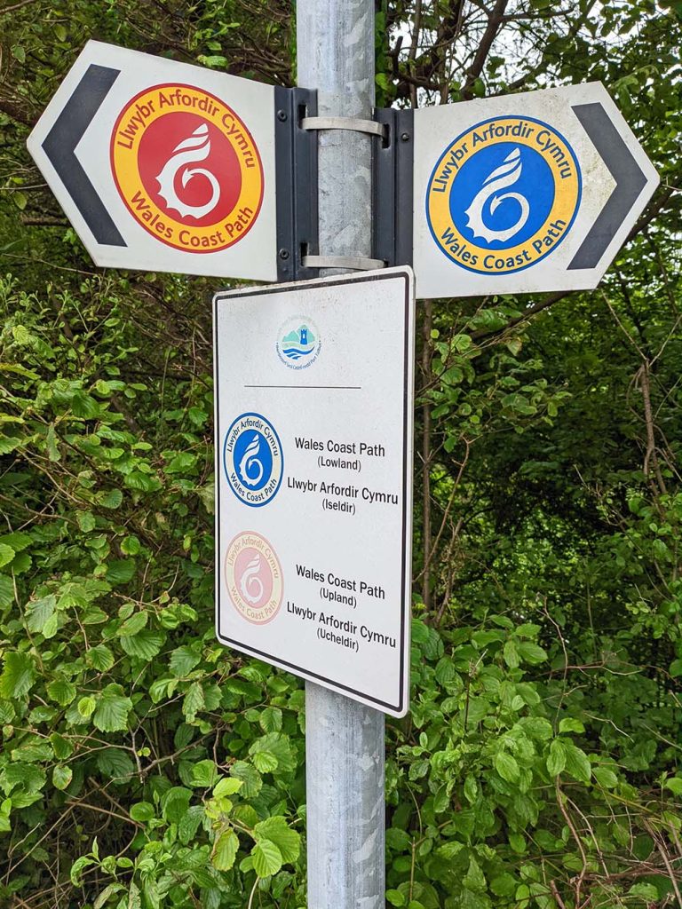
For those who aren’t keen to walk through the urban and industrial areas, a red signposted route offers an alternative route a little further inland, passing through woodland and farmland before climbing onto Mynydd Dinas for extensive views around Swansea Bay and across the sea to Somerset and Devon.
After passing close to Port Talbot the route traverses the lower slopes of Mynydd Brombil, close to the roar of traffic on the busy M4 motorway. The route climbs the wooded Graig Fawr for wide-ranging views, then descends through the popular Margam Country Park, which could be explored further. The variant route re-joins the main coast path at the big Margam Interchange junction.
Baglan & Port Talbot Circular Walk
The Wales Coast Path offers two options between Baglan and Port Talbot – one coastal and one inland – and these are easily linked into a circular walk of 10.9 miles / 17.6km. Yes, it’s very urban and industrial, but there is an amazing sandy beach, a surprising amount of green space and wonderful wide-ranging views from Mynydd Dinas, stretching all the way from Wales across the Bristol Channel to England.
The first task is to leave Port Talbot, which is done by following cycle paths alongside the busy road of Harbour Way, going under and over footbridges before making a beeline for the beach. Aberavon Sands features a broad promenade path, a broad green and gardens, with occasional sculptures, restaurants and cafés. When the time comes to head inland by road, a surprisingly long grassy strip is available alongside for walkers, then another green space is found around Ysgol Bae Baglan. A cycle path is followed through the Baglan Energy Park, which is mostly flanked by grassy areas, bushes and trees.
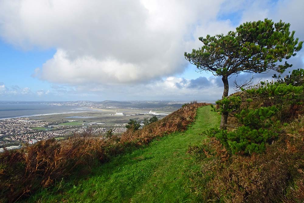
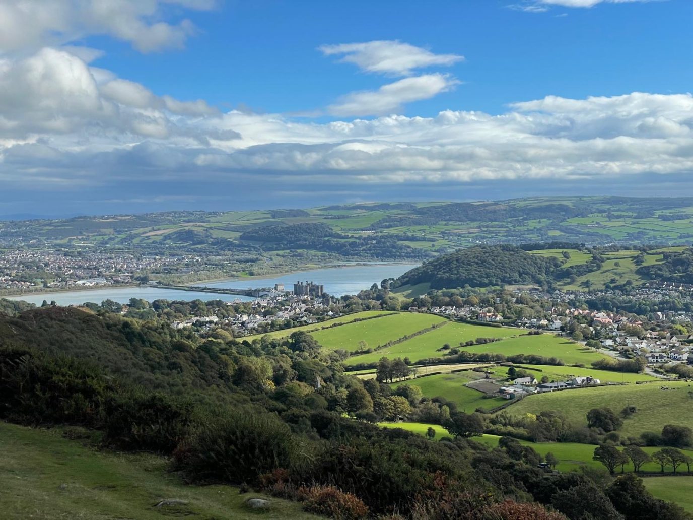
Switch from the blue Wales Coast Path signposts to red signposts to follow a variant route inland at Baglan. A woodland path and a housing estate give way to a track climbing onto Mynydd Dinas, for an amazing panorama around Swansea Bay. This takes in Mumbles Head, Swansea, Port Talbot and its steelworks, with Somerset and Devon in view far across the sea. A path drops steeply to Mountain Road and the pedestrianised centre of Port Talbot gives way to the railway and bus stations.
Top Tip
Look out for steel heritage features around Port Talbot in the form of buildings, monuments, sculptures and artwork. See how many places you can identify in distant views, with the aid of a map.
Port Talbot & Margam Circular Walk
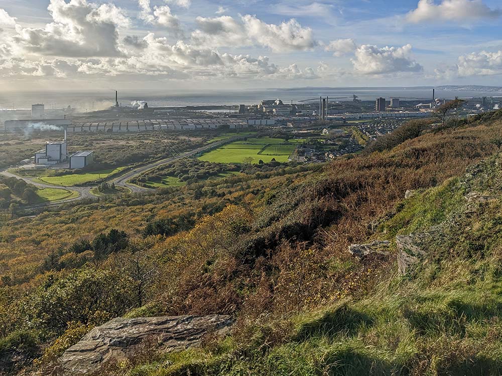
The Wales Coast Path offers two options between Port Talbot and Margam, but as a vast steelworks occupies the coast, both routes lie further inland. They are easily linked to create a circular walk of 8.9 miles / 14.3km. The centre of Port Talbot is pedestrianised, and beyond it an inland variant of the Wales Coast Path passes beneath concrete columns supporting the busy M4 motorway.
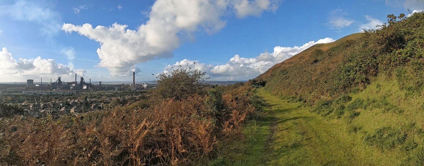
Watch carefully for signposts and markers to be led across the lower slopes of Mynydd Emroch and Mynydd Brombil. This route reveals the true scale of the enormous steelworks that was founded in 1901. It certainly makes for some interesting photographs!
A short-cut is possible from Brombil to Margam, but it is well worth staying on course and climbing through woods to enjoy an extensive panorama from the top of Graig Fawr. The view encompasses Swansea Bay and looks across the Bristol Channel to Somerset and Devon. The descent through woodland leads through the popular and interesting Margam Country Park, based around a splendid castle.
By all means leave the route and explore the castle, grounds and gardens to your heart’s content.
The blue signposts of the main Wales Coast Path are encountered at the big M4 motorway junction of Margam Interchange. A cycleway gives way to roads through housing estates, passing a few green spaces on the way back to Port Talbot. The town is reached via Harbour Way, which has a fine cycleway alongside.
Top Tip
With time to spare, include a visit to Margam Country Park. If that takes too much time, then catch a bus back to Port Talbot instead of completing the final urban walk.
We hope you have enjoyed these Neath Port Talbot Circular Walking Routes, it’s great to have a list of routes that are available to those travelling by rail, a fun way to explore the countryside.
There are many more exciting walking routes available to visit across Wales including all of the fabulous Welsh Coast Path Circular Routes.