Explore Manchester’s Green Outdoors
Manchester offers countless opportunities for a walk in fresh air and nature without going far from the city. From peaceful canal-side strolls to benches tucked into leafy parks, there’s no shortage of places to pause and take in the surroundings.
The city is home to a wide variety of green spaces each offering a different way to experience a walk through greenery. Whether you’re looking for a quiet moment in the heart of town or a longer walk through woodland and wetlands, there’s something for every pace and preference.
These escapes in and around Manchester are accessible by public transport, making them easy to reach for a spontaneous afternoon or a planned weekend outing. A few spots lie a little further afield, perfect for those seeking a more adventurous day trip. With walking trails, wildlife, waterways, and even sky gardens, Manchester’s green spaces invite you to explore the outdoors in a city that’s constantly evolving to encompass more natural locations.
If you’re unable to visit Manchester, for similar walking inspiration in and around other UK city centres, take a look at other locations in our city walks series:
Where are the best city walks in Manchester?
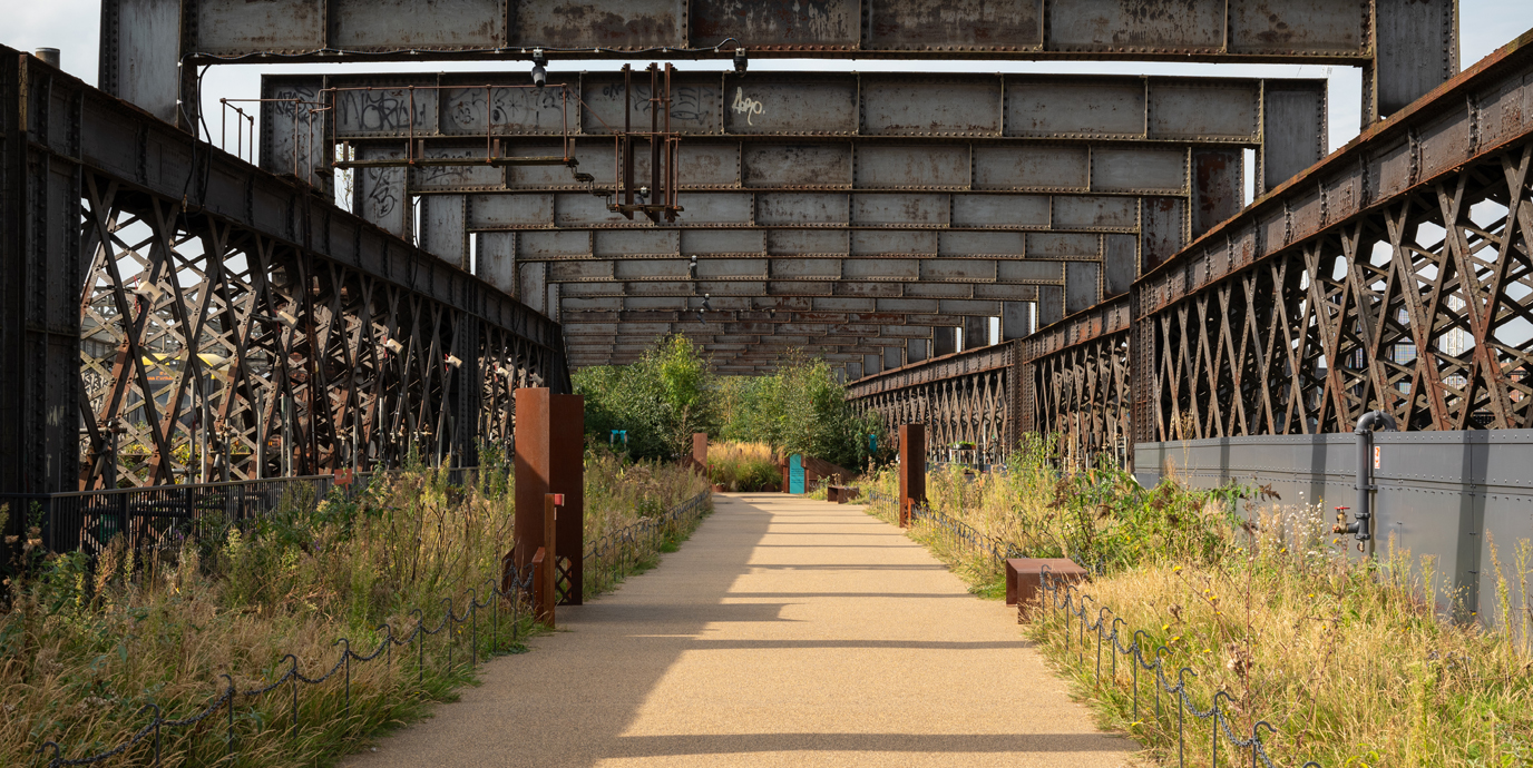
Castlefield Viaduct
Nearest bus stop: Barton Street (Stop WO) or Deansgate
Nearest tram station: Deansgate-Castlefield
Suspended above the historic heart of Manchester, the Victorian-era steel Castlefield Viaduct has been reimagined as a unique elevated garden space.
Originally built in 1892 by Heenan and Froude, the engineers also responsible for Blackpool Tower, the 330-metre-long Castlefield Viaduct once carried rail traffic to the Great Northern Warehouse until its closure in 1969. After decades of disuse, the National Trust transformed the structure into a “sky garden” in 2022, initially as a temporary pilot. Its popularity, however, led to the decision to make it a permanent fixture, with a new section due to open in summer 2026.
Currently, 120 metres of the viaduct are open to the public, offering a peaceful space for walking, pausing, and connecting with nature. The garden features over 3,000 plants, including wildflowers, shrubs, and trees, with sections designed by local organisations to reflect Manchester’s industrial and ecological heritage. The project is part of the National Trust’s Urban Places Programme, aiming to increase access to nature in city environments.
While the section to walk is currently only short, it is a worthwhile stroll through the unique greenery and Manchester’s heritage. With its blend of history, horticulture, and community engagement, the Castlefield Viaduct offers a fresh perspective on urban green space.
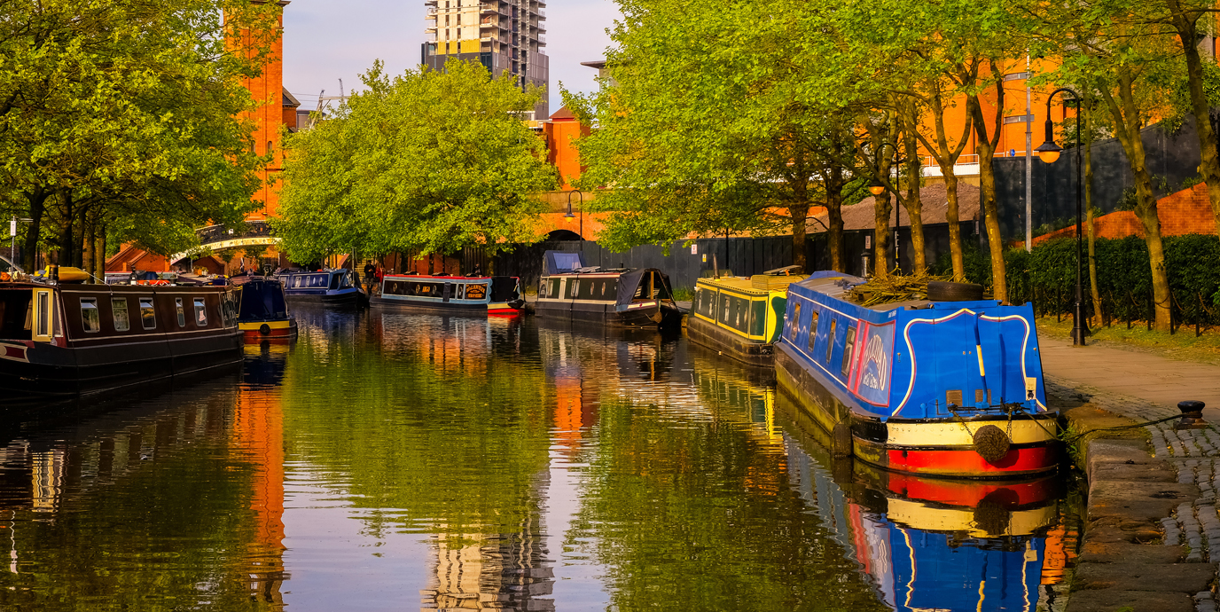
Manchester’s Canals
Nearest bus stop: Deansgate (Rochdale Canal), Manchester Piccadilly (Ashton Canal)
Nearest tram station: Deansgate-Castlefield (Rochdale Canal), New Islington (Ashton Canal)
A walk along the canals offers a unique way to experience Manchester’s rich industrial heritage and urban nature. The historic Rochdale Canal and Bridgewater Canals offer ideal opportunities for a stroll through the centre of the city, while the Ashton Canal provides an escape to Ashton-under-Lyne.
For a walk in the centre of the city, the Castleford area, once the beating heart of the city’s cotton trade, is now a tranquil yet vibrant space where history and greenery meet. You can follow the Rochdale Canal Tow Path past restored mills and warehouses, some dramatically built over the canal to form tunnel-like sections. A series of beautiful bridges punctuate the walkway, including the ornate Castlegate Viaduct and the modern Merchants Bridge, each offering striking views and architectural contrast.
The canal walk also features the Rochdale Nine Locks, a historic series of locks that drop the canal from Piccadilly to Castlefield, now Grade II-listed and still in use by boaters. These locks, along with the cobbled streets and viaducts overhead, evoke the city’s industrial past while offering a peaceful setting for walking, photography, and wildlife spotting.
For a walk that takes you to the edges of the city, the Ashton Canal stretches nearly seven miles, offering a scenic and historically rich route for walking and cycling. the canal serves as a green corridor through a mix of urban and natural landscapes, passing through areas like Ancoats, Droylsden, and Fairfield. Along the towpath, you can encounter locks, bridges, and remnants of industrial architecture, as well as wildlife such as ducks and herons.
With the canals stretching across the city, you can easily pick and choose where you’d like to walk from. Take a look at the canals to pick the best route for you.
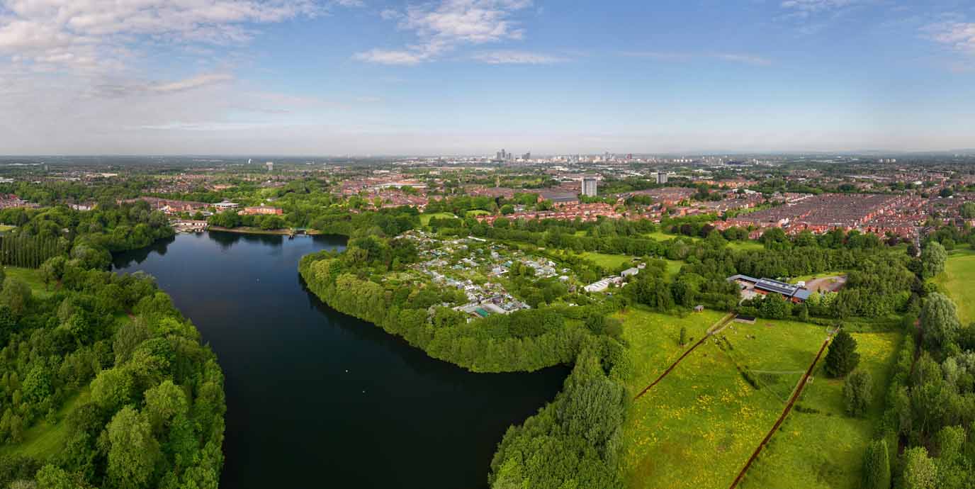
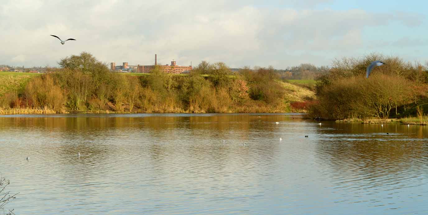
Debdale Park & Gorton Resevoirs
Nearest bus stop: Clumber Road
Nearest train station Ryder Brow
Set in the Gorton area of Manchester, the expansive 45-acre Debdale Park is one of the city’s largest inner-city parks and a prime destination for outdoor recreation.
Originally developed around two reservoirs, Gorton Lower and Gorton Upper, built in the 1820s to supply water to Manchester, the land was transformed into a public park after World War I and expanded further after World War II. Today, the park offers a variety of walking routes through ornamental gardens, wooded areas, and around the reservoirs, which are popular for licensed fishing and provide a peaceful setting for spotting urban wildlife.
Debdale Park is especially family-friendly, featuring a dedicated play area for children under 12, a multi-use games area, and a skate park. For those seeking more adventurous activities, the adjacent Debdale Outdoor Centre offers watersports such as dinghy sailing, kayaking, canoeing, and windsurfing, as well as indoor climbing and orienteering. The park also connects to the Fallowfield Loop, a shared-use path that follows a former railway line and is part of the UK National Cycle Network, making it ideal for longer walks or bike rides across south Manchester.
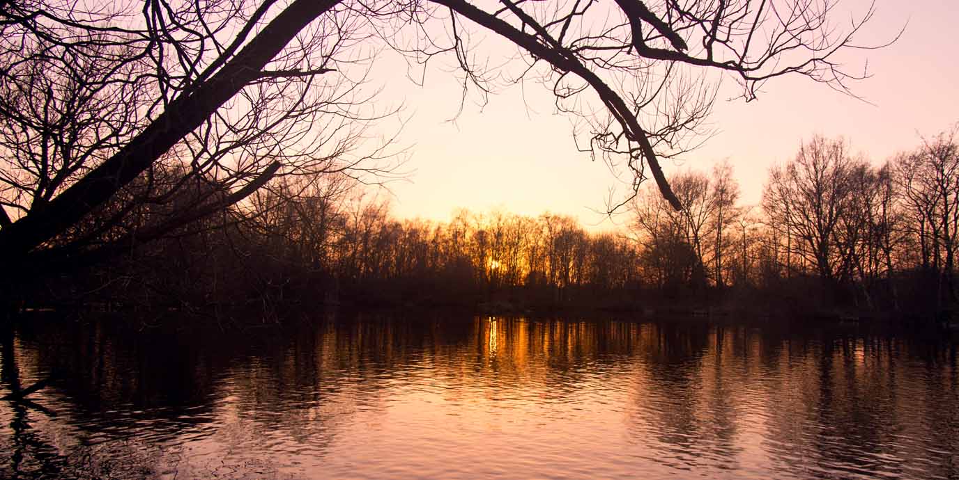
Boggart Hole Clough
Nearest bus stop: Grange Park Road
Nearest train station: Moston
Covering 190 acres in the Blackley area of Manchester, the vast woodland and country park of Boggart Hole Clough is one of the city’s most atmospheric green spaces perfect for walking.
The term clough refers to a steep-sided wooded valley. As such, ravines and gullies shape the park’s landscape, cutting through ancient woodland that dates back to the Bronze Age, Historically, the area was part of Blackley Deer Park and later became a public park in 1894, with broad walks and naturalistic landscaping. Today, it’s designated as a Local Nature Reserve.
Walking trails wind through dense woodland, past fishing lakes, and along Boggart Hole Brook, offering a peaceful escape and opportunities to spot wildlife. The park includes a children’s play area, athletics track, and facilities for boating, fishing, and orienteering.
Local folklore names the park after a boggart, a mischievous spirit said to haunt the area and cause minor chaos like curdling milk or hiding objects. Keep an eye on your walk in case you spot it!

EXPLORE THE
OS Shop
We are with you every step of the way. Shop our trusted walking and hiking maps and guidebooks so you can explore the outdoors with confidence.
Go to the shopKersal Wetlands
Nearest bus stop: Blossom Way
Nearest train station: Salford Crescent
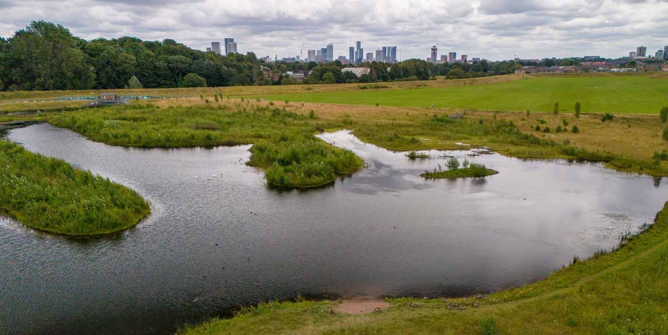
Once the site of the historic Manchester Racecourse, this area has been transformed into the Kersal Wetlands.
The wetlands are a 90-acre nature reserve and flood management zone beside the River Irwell in Salford. The project was designed to reduce flood risk while creating a haven for wildlife and a green space for public enjoyment. Today, the wetlands feature a mix of reedbeds, ponds, wildflower meadows, and woodland, offering a rich habitat for birds such as herons, kingfishers, and cormorants.
You can explore a walking route around the wetlands that winds through open and exposed terrain, with sweeping views of the Manchester’s city skyline. The paths are well-maintained and accessible for walkers, runners, cyclists, and families with pushchairs or wheelchairs.
The area connects to nearby Kersal Dale and Kersal Moor, extending the opportunity to enjoy ancient woodland and more secluded trails. Kersal Wetlands showcases how city spaces can actively support environmental resilience and outdoor recreation through a blend of urban nature, historical significance, and biodiversity.
Werneth Low
Nearest bus stop: Spring Avenue
Nearest train station: Hattersley (East) Woodley (West)
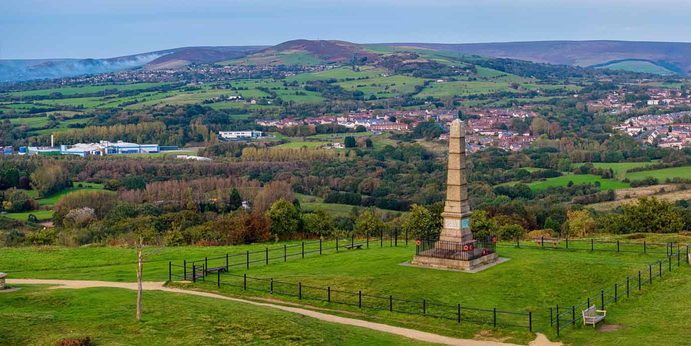
Located just under 10 miles from Manchester city centre, Werneth Low offers some of the most spectacular views of the city and surrounding landscapes, along with beautiful walks.
Spanning 200 acres, the area is part of the Pennines and provides panoramic vistas that, on clear days, stretch as far as the Welsh mountains and Liverpool. Historically, the land was purchased in 1920 by the Hyde War Memorial Committee as a tribute to the 710 local men who died in World War I, and it has been preserved ever since as a public green space.
Werneth Low is a haven for walkers and nature lovers, with a variety of trails that pass through open fields, wooded cloughs, and historic sites such as the Hyde War Memorial. Wildlife is abundant, including ground-nesting birds that are protected during breeding season. The terrain is mostly gentle, though some paths ascend to the hilltop, rewarding you with sweeping views across Greater Manchester and beyond. The park is ideal for peaceful strolls, dog walking and dramatic photography.
Sale Water Park
Nearest bus stop: Poplar Road (West), Temple Road (South)
Nearest tram station: Sale Water Park
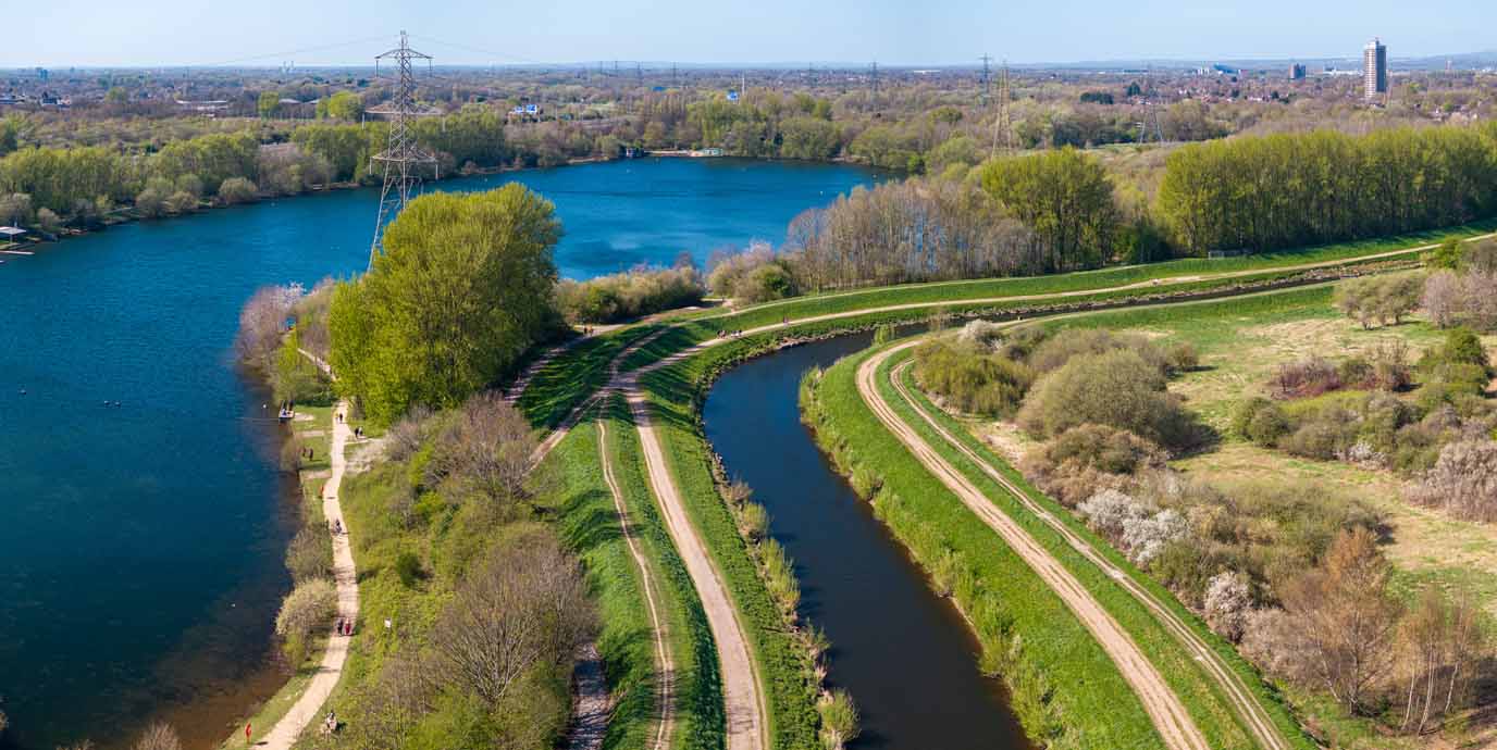
Set in Trafford, just south of Manchester, the 152 acres of Sale Water Park offers a rich mix of lake, woodland, meadows, and riverside paths ideal for a city walk.
The centrepiece is a 52-acre artificial lake, created in the 1970s by flooding a gravel pit excavated to build the M60 motorway embankment. Today, the park is a popular destination for walking, birdwatching, and watersports, with flat, accessible trails that loop around the lake and connect to the River Mersey and Jackson’s Boat Bridge.
In the northeast corner lies Broad Ees Dole, a managed wetland developed in the 1980s to support birdlife that couldn’t thrive in the deeper lake waters. This area is now a designated Local Nature Reserve and a Site of Biological Importance, attracting species such as common snipe, lapwings, and kingfishers. While there are no paths through the Dole itself, you can observe wildlife from the perimeter trails.
EXPLORE THE
OS Shop
We are with you every step of the way. Shop our trusted walking and hiking maps and guidebooks so you can explore the outdoors with confidence.
Go to the shopReddish Vale Country Park
Nearest bus stop: The Link (Stop B) (East), Houldsworth Square (Stop B) (West)
Nearest train station: Brinnington BNT (East), Reddish South (West)
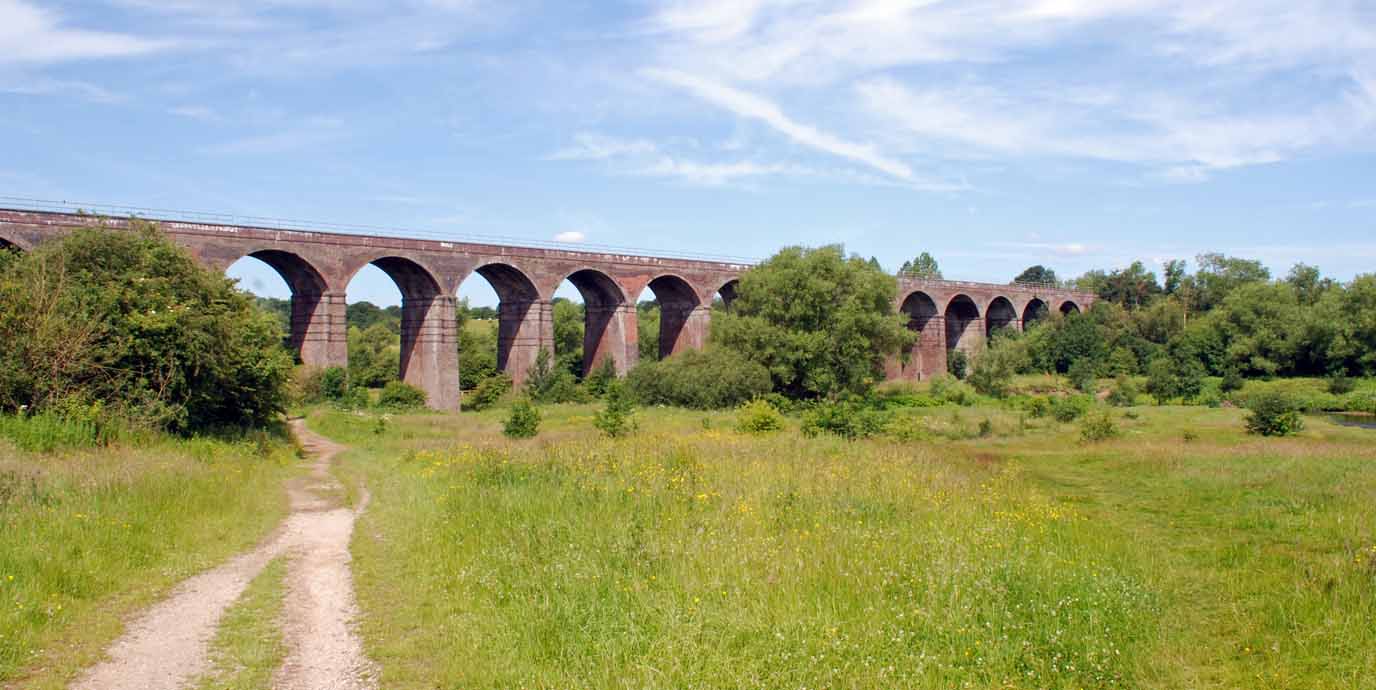
Spanning 161 acres in the Tame Valley near Stockport, Reddish Vale Country Park offers a rich blend of natural beauty and industrial heritage.
Once the site of a calico printing works, the area has been transformed into a Local Nature Reserve. It features woodlands, wildflower meadows, and mill ponds that now support a wide variety of birdlife including herons, grebes, and kingfishers. You can explore the park’s history and ecology through an audio tour or walk the ‘Heritage Wander’ trail, which highlight its transformation from a key Manchester industrial site to green haven.
Reddish Vale is ideal for walking and outdoor activities, with several well-marked trails including sections of the long-distance Midshires Way and Trans Pennine Trail. These paths connect the park to wider regional routes, making it a great starting point for extended hikes or cycle rides.
The terrain includes peaceful riverside paths along the River Tame, wooded tracks, and open meadows with skyline views. The mill ponds also offer opportunities for fishing, and the nearby Reddish Vale Farm adds a family-friendly element with petting animals and countryside experiences.
Daisy Nook
Nearest bus stop: Daisy Nook Country Park
Nearest tram station: Ashton West
Set in the Medlock Valley and covering around 100 acres, Daisy Nook offers a peaceful walking retreat just a short distance from Manchester city centre.
Originally known as Waterhouses, the area was renamed Daisy Nook in 1855 after a fictional rural idyll described by Lancashire poet Ben Brierley. The park is centred around the disused Hollinwood Branch Canal and features a network of waterways. This includes the picturesque Crime Lake, which was formed accidentally in 1795 due to a canal construction landslip. This lake was famously painted by L.S. Lowry in 1942, and his depiction of the park during a Good Friday fair became one of his most celebrated works, achieving the highest auction price of any of his paintings.
Daisy Nook is ideal for walking and wildlife spotting, with trails winding through woodland, meadows, and along the canal. The area is rich in birdlife, making it a popular spot for nature enthusiasts. You can enjoy an audio tour to enhance their experience and learn about the park’s history and ecology. The terrain is varied but accessible.
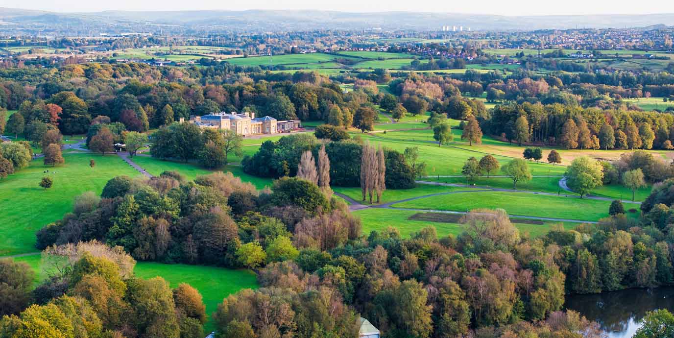
Heaton Park
Nearest bus stop: Heaton Park Metrolink (Stop C) (West), Victoria Avenue (East)
Nearest tram station: Heaton Park
Covering 600 acres, Heaton Park is the largest municipal park in Europe and a cornerstone of Manchester’s outdoor heritage.
Originally the private estate of the Egerton family, the land was purchased by Manchester Corporation in 1902 and opened to the public. At its heart lies Heaton Hall, a Grade I-listed 18th-century country house designed by James Wyatt in 1772. The hall’s neoclassical architecture and hilltop location offer panoramic views of the Manchester skyline, and it occasionally opens for public tours.
The park is ideal for walking and outdoor activities, with a mix of formal gardens, open parkland, woodland trails, and a boating lake. Families can enjoy the Heaton Park Animal Centre, which is free to visit year-round, and the Heaton Park Tramway Museum, which preserves Greater Manchester’s tram heritage with restored vehicles and a short operational line. The city regularly host guided walks and orienteering events, making it a great destination for educational outings or a full day in the fresh air.
Where can you find more nature walks in Manchester?
There are plenty more natural places to explore in and around Manchester for the perfect city walk. If you’re looking for further inspiration, consider venturing to a few lesser-known but equally rewarding green spaces such as:
- Fletcher Moss Park & Botanical Gardens – a peaceful blend of formal gardens and riverside woodland, perfect for a relaxing stroll.
- Prestwich Forest Park – a vast green space offering woodland trails and wildlife spotting just north of the city.
- Chorlton Ees Nature Reserve & Water Park – a tranquil haven of meadows, wetlands, and lakes ideal for birdwatching and gentle walks.
- Outwood Trail and Park – a scenic, tree-lined trail along a former railway route, great for walking and cycling.
- Clayton Vale – a hidden gem with riverside paths, woodlands, and mountain biking trails in East Manchester.
Do you want to go a little further than Manchester for a walk?
Beyond Manchester, north west England has countless outdoor opportunities for those seeking their next adventure. If you’re looking to step from a city stroll into a countryside hike, prepare yourself and take a look at our suggestions for inspiration of where to go:
- Peak District – a breath-taking national park of rolling hills, rugged moorlands, and charming villages ideal for hiking and exploring.
- Dovestone Reservoir – a serene waterside walk surrounded by dramatic hills and woodland trails on the edge of the Peak District.
- Edale – a picturesque valley village and gateway to iconic hikes like Kinder Scout and the Pennine Way.
- Saddleworth Moor – expansive moorland offering panoramic views, peaceful paths, and a rich sense of history.
- Forest of Bowland National Landscape – a designated Area of Outstanding Natural Beauty with rolling hills, quiet valleys, and remote walking trails.
- Marsden Moor – sweeping moorland with dramatic views, rich wildlife, and historic walking routes near the Pennine Way.