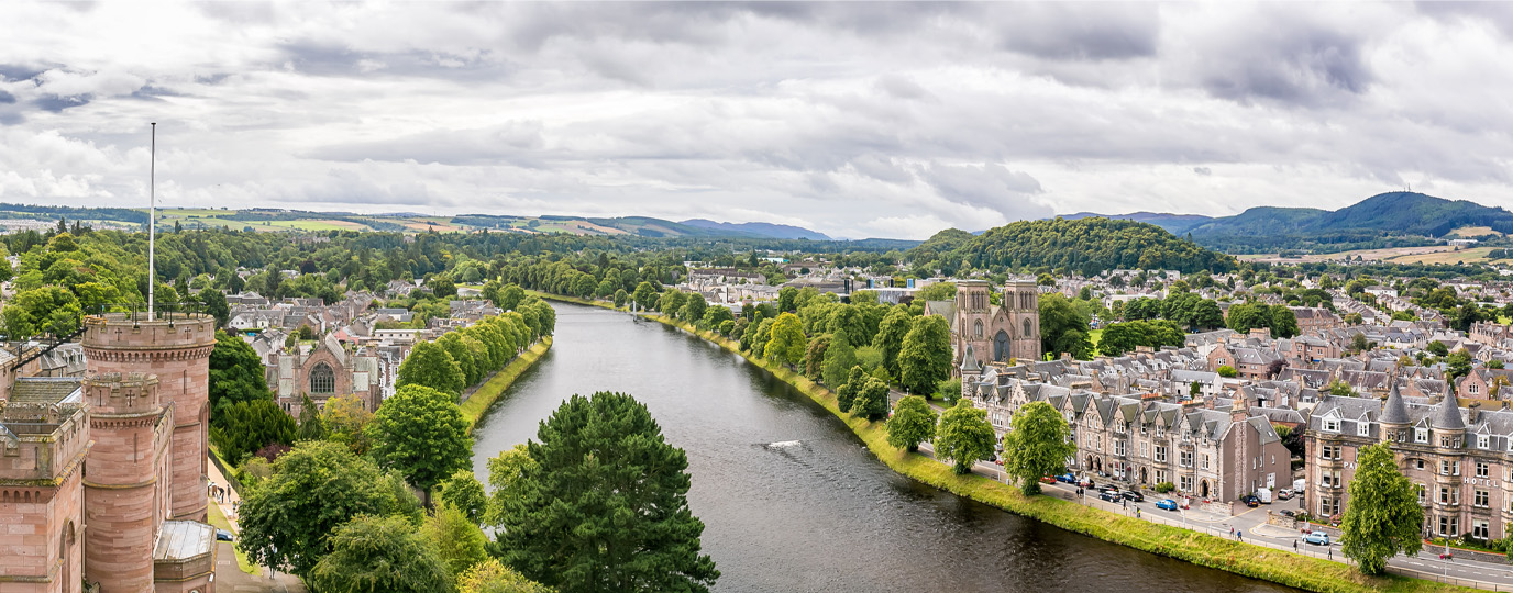
Inverness City’s Scenic Walking Routes
The city of Inverness offers a wide range of walks to explore the natural beauty of Scotland’s Highland capital. You’ll find plenty of locations perfect for a relaxing stroll, from leafy green spaces to scenic riverside paths along the River Ness. These walks provide a peaceful escape right in the heart of the city, ideal for soaking up fresh air and Highland charm, be it on a lunchbreak or over an afternoon.
If you’re willing to venture a little further, the edges of Inverness open up even more opportunities. All within a short bus ride away, you’ll discover tranquil lochs, forest trails, and rugged landscapes that showcase the region’s wilderness. Whether you prefer green spaces or varied waterside walks, Inverness is a gateway to nature that invites you to explore at your own pace.
If you can’t quite reach Inverness, for similar walking ideas in and around cities near you, take a look at other locations in our city walks series. Below are a just few of the cities included in our series:

Where are the best city walks in Inverness?
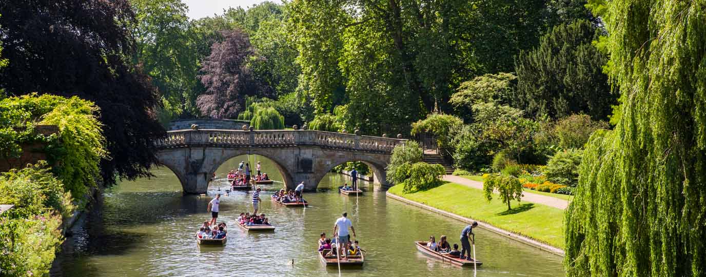
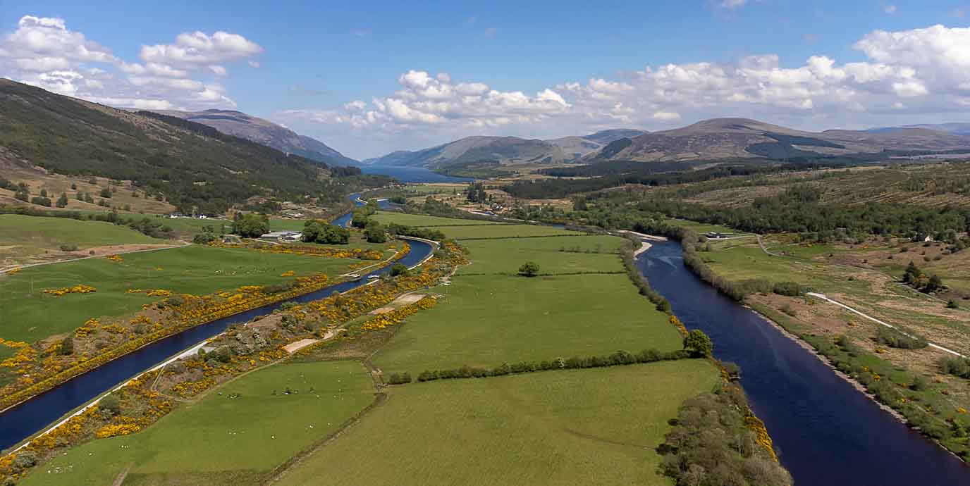
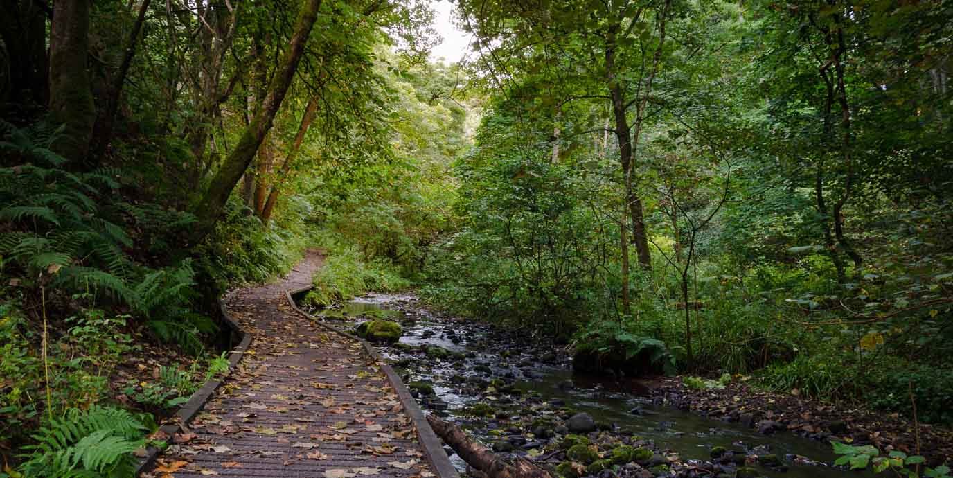
River Ness & Ness Islands
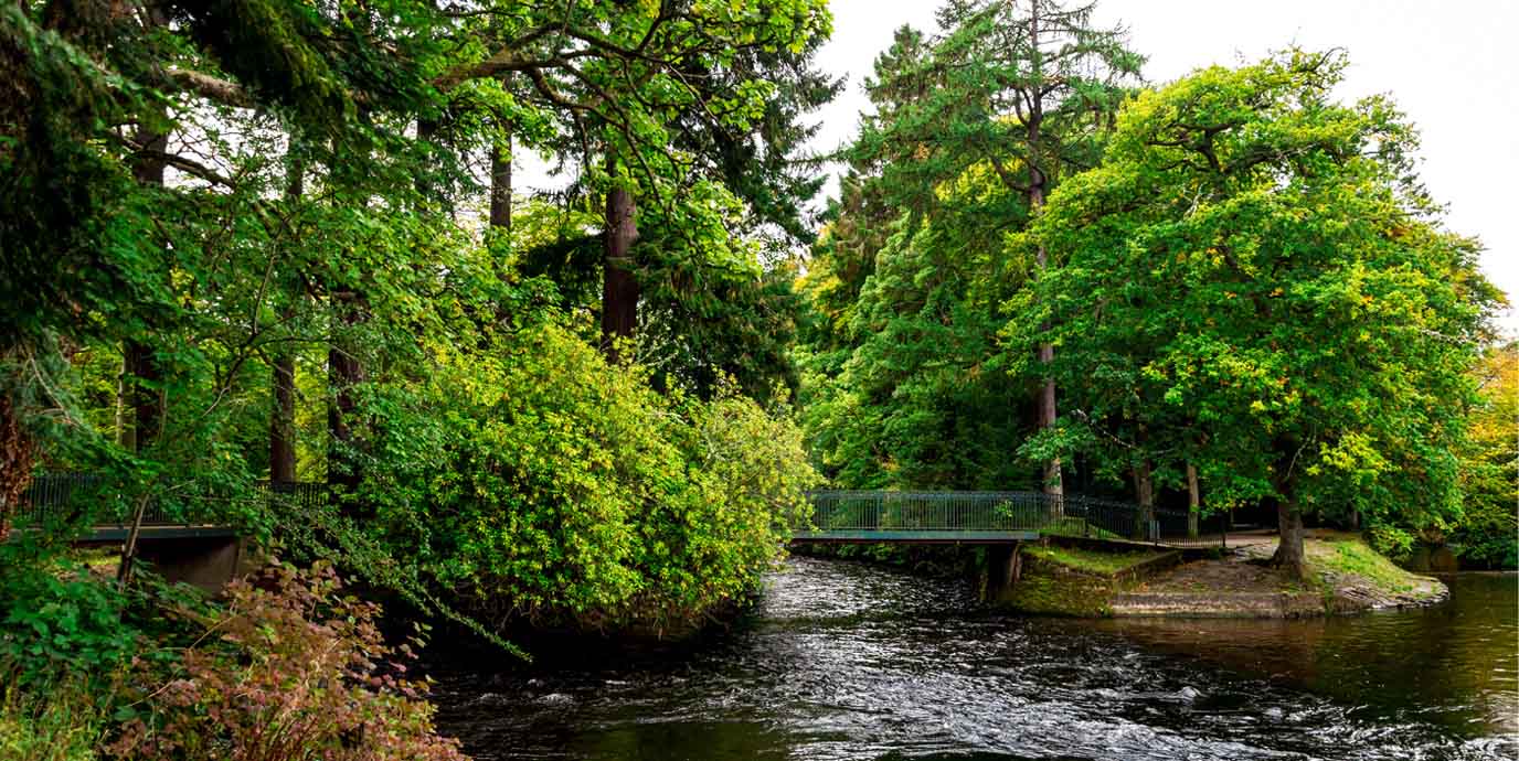
Nearest bus stop: Ness Islands
Set against the backdrop of Inverness, the River Ness flows gracefully from Loch Ness through the city, offering a tranquil escape just minutes from the bustling centre.
Along its banks, you can enjoy scenic city walks that combine natural beauty with glimpses of local heritage. You can often spot seals near the city bridges, while salmon fishing is a common during the season. Mature trees and vibrant floral gardens line the riverbanks, creating a peaceful setting for leisurely strolls and relaxation. Inverness Cathedral and the War Memorial add historical interest along the way, blending culture with nature in a uniquely Highland setting.
Nestled in the middle of the river, the Ness Islands provide a charming green oasis connected by Victorian-style suspension footbridges. Winding paths lead through towering Scots pines and past carved benches and sculptures, offering plenty of opportunities to pause and enjoy the fast-flowing river. The islands are ideal for walking, whether you want a short loop or a longer route that feels far removed from city life. Wildlife such as otters, wildfowl, and even deer can sometimes be seen, making this area a haven for nature lovers.
Tomnahurich Hill
Nearest bus stop: Cemetery Gates
Tomnahurich Hill rises prominently above the River Ness, just over a stones throw from Inverness city centre.
. Its name comes from the Gaelic tom na h-iubhraich, meaning “hill of the yew wood,” and the site has long held cultural significance, even hosting horse races before its conversion into a cemetery. The Victorian cemetery dates back to 1864, with numerous monuments and burials
Today, the hill is a peaceful green space with mature woodland and historic monuments, offering a blend of natural beauty and heritage. From its summit, which reaches about 70 metres, you can enjoy sweeping views across Inverness, the Moray Firth, and the Ness Valley, making it one of the city’s most scenic landmarks.
If you’re seeking a break from the city, Tomnahurich Hill provides an excellent opportunity for walking and nature appreciation. Paths wind through the wooded slopes and cemetery grounds, creating a tranquil environment where you can spot birdlife and enjoy seasonal foliage. The ascent to the top is relatively short but rewarding, with options for gentler inclines or steeper sections. The summit plateau offers a quiet spot to pause and take in the panoramic views across the city.
Oldtown of Leys Garden
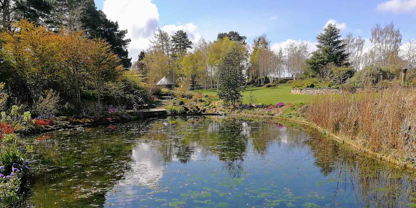
Nearest bus stop: Holm Farm Road
Set on the southern edge of Inverness, the three acres of Oldtown of Leys Garden offers a serene escape with sweeping views over the city and the Moray Firth.
Established in the early 2000s on land that was once part of a working farm, Oldtown of Leys Garden was created as a private project that has since become a cherished public space. Its design incorporates a rich variety of features, including ponds, a rockery, a stumpery, and vibrant seasonal plantings that ensure year-round interest. Spring brings rhododendrons and azaleas, summer bursts with herbaceous borders, and autumn showcases colourful trees and shrubs, while winter highlights evergreens and structural elements.
The garden provides an ideal setting for leisurely walks and quiet contemplation. Winding paths lead through landscaped areas dotted with seating spots and hidden corners perfect for relaxation. Wildlife such as ducks add to the natural charm, and the tranquil ponds create a soothing atmosphere for visitors. The space is dog-friendly, making it suitable for families and nature lovers alike.
Craig Phadrig
Nearest bus stop: Turning Circle
Rising above the western edge of Inverness, the wooded hill of Craig Phadrig was once home to a hill fort dating back to the Iron Age.
Craig Phadrig is believed to have been a stronghold for Pictish kings and tradition holds that St Columba visited here around 565 AD during his mission to convert the Picts. From its elevated position, the hill commands views across the Beauly Firth and the surrounding Highlands, making it both historically and strategically important.
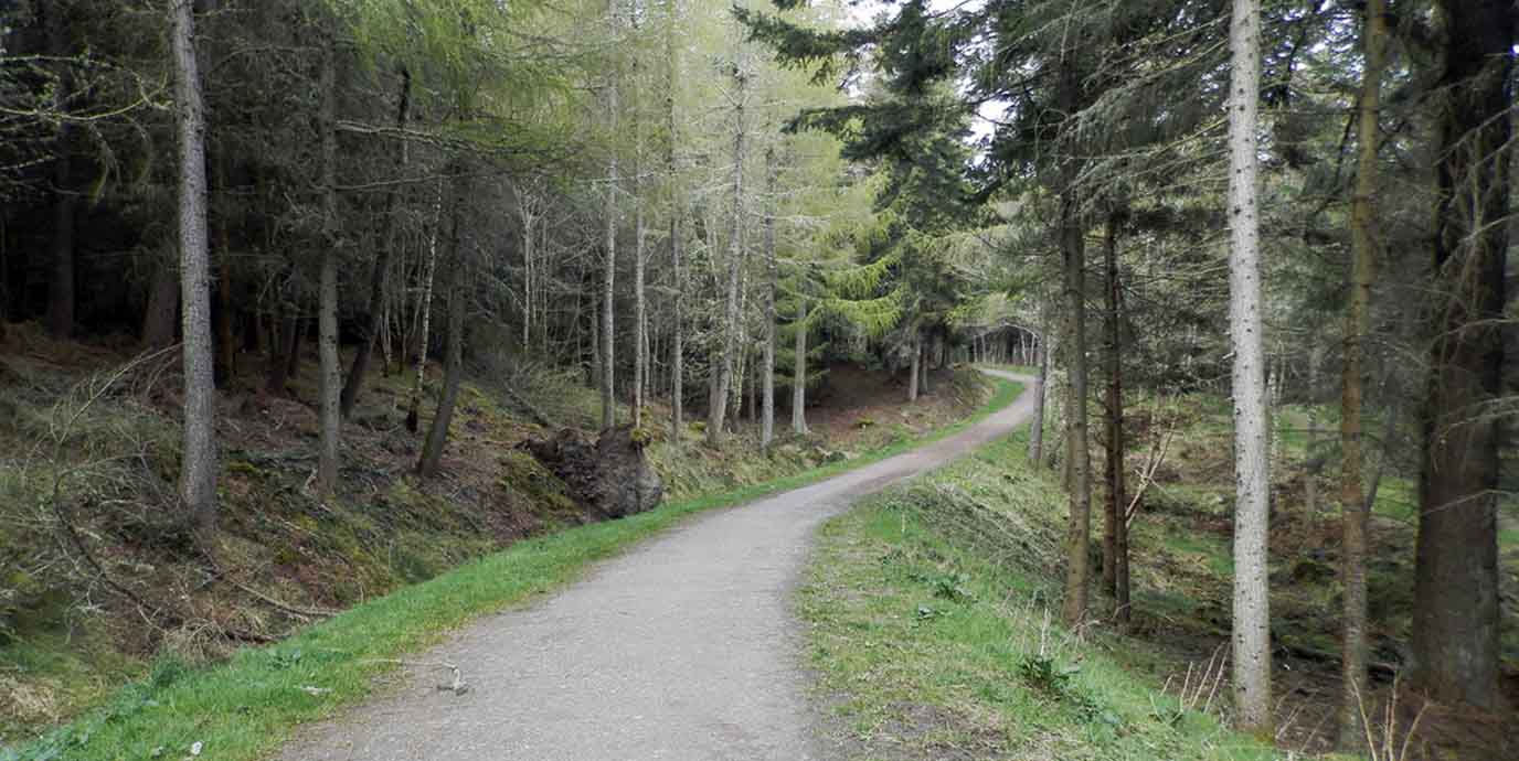
For a beath of fresh air, Craig Phadrig provides an inviting setting for walking and nature appreciation. Forest trails wind through mature woodland, leading to the summit where panoramic vistas reward the climb. The paths vary from gentle slopes to steeper sections, making the area suitable for both leisurely strolls and more energetic walks. Wildlife such as birds and seasonal wildflowers add to the experience, while benches and open spaces offer spots to pause and enjoy the scenery. Its proximity to Inverness makes it easily accessible, yet the peaceful atmosphere feels far removed from the city.

EXPLORE THE
OS Shop
We are with you every step of the way. Shop our trusted walking and hiking maps and guidebooks so you can explore the outdoors with confidence.
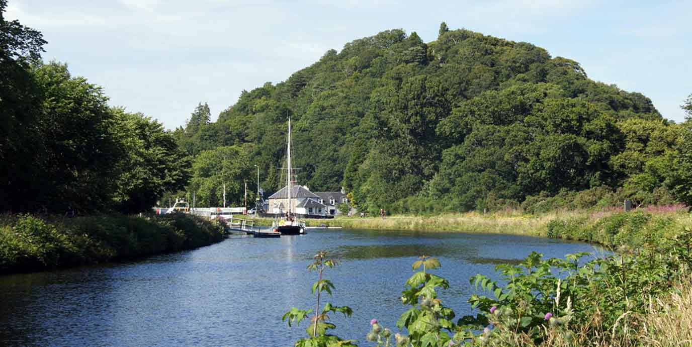
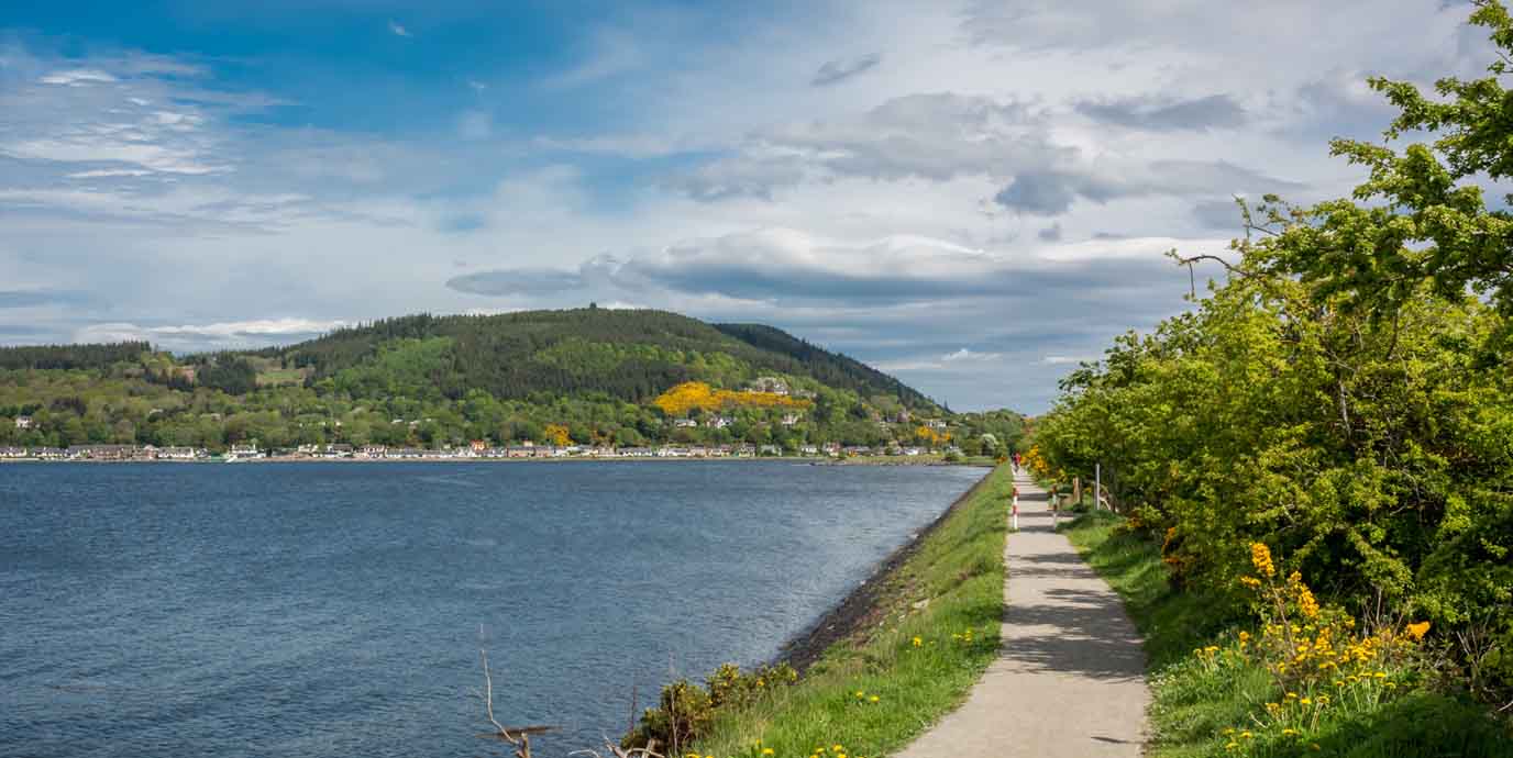
Go to the shopThe Caledonian Canal
Nearest bus stop: Inverness Torvean Park & Ride (for walking north or south)
Stretching through the Great Glen, this historic waterway links Inverness on the east coast to Fort William on the west, creating a navigable route across Scotland.
Conceived by engineer Thomas Telford and completed in 1822, the Caledonian Canal was built to provide a safer alternative to the treacherous sea passage around Cape Wrath. Only about a third of its 60-mile length is man-made, with the rest formed by natural lochs including Loch Ness. Today, the canal is celebrated as a Scheduled Ancient Monument and remains a striking example of 19th-century engineering, featuring 29 locks and several swing bridges.
Within Inverness, the canal offers excellent opportunities for walking along its towpaths. Level paths provide a peaceful setting for leisurely strolls or longer walks, with views of boats navigating the locks and wildlife along the water’s edge. The route is ideal for nature lovers, offering glimpses of Highland scenery, seasonal flora, and birdlife. Its proximity to Inverness makes it easily accessible, and the tranquil atmosphere of the canal contrasts beautifully with the surrounding hills and lochs.
Muirtown Basin
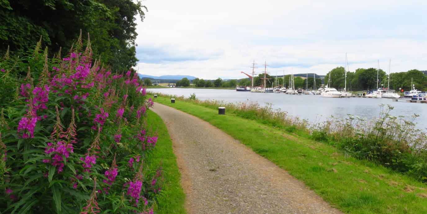
Nearest bus stop: Muirtown Terrace
If you’re looking for something closer to Inverness’ city centre than a stretch of the Caledonian Canal, the Muirtown Basin offers a peaceful waterside setting ideal a shorter, accessible walk.
Originally designed in the early 19th century by engineer Thomas Telford as a second harbour for Inverness, the basin never fulfilled its intended role due to the rapid increase in ship sizes. Today, it serves as a marina, with boats moored against a backdrop of historic canal features such as the Muirtown Locks and the swing bridge. The area retains a sense of heritage while providing a calm environment away from the bustle of the city.
The basin and its surrounding towpaths offer excellent opportunities for walking. The level paths along the canal are suitable for all abilities, making them perfect for a leisurely stroll or a longer walk that takes in views of the water and passing boats. Wildlife spotting is a highlight here, with chances to see waterfowl and enjoy seasonal changes in the landscape. The open space and gentle pace of life around the marina create a relaxing atmosphere, ideal for anyone seeking fresh air and a scenic walk in Inverness.
Merkinch Local Nature Reserve
Nearest bus stop: Turning Circle (North)
Bordering the Beauly Firth and the Caledonian Canal, the Merkinch Local Nature Reserve is Inverness’s only Local Nature Reserve and a haven for wildlife.
Designated in 2007, Merkinch Local Nature Reserve occupies land that was once industrial, with shipyards and ironworks dominating the area in the 19th century. Over time, nature reclaimed the marshes and tidal pools, creating a rich mosaic of habitats including saltmarsh, reed beds, and scrubland. Today, the reserve spans more than 50 hectares and plays an important role in conservation and education, offering visitors a glimpse of how urban and natural environments can coexist.
With its stunning views and plenty of open space, the reserve is ideal for walking and wildlife watching. Well-maintained paths and boardwalks wind through marshes and along the water’s edge, providing a peaceful setting for a short stroll or a longer exploration. Birdlife is abundant, with herons, cormorants, and wading birds commonly seen. If you’re lucky you might also spot roe deer or even an osprey. Benches placed throughout the area invite moments of rest and quiet observation, while the proximity to the Caledonian Canal adds scenic variety.
EXPLORE THE
OS Shop
We are with you every step of the way. Shop our trusted walking and hiking maps and guidebooks so you can explore the outdoors with confidence.
Go to the shopDores Beach
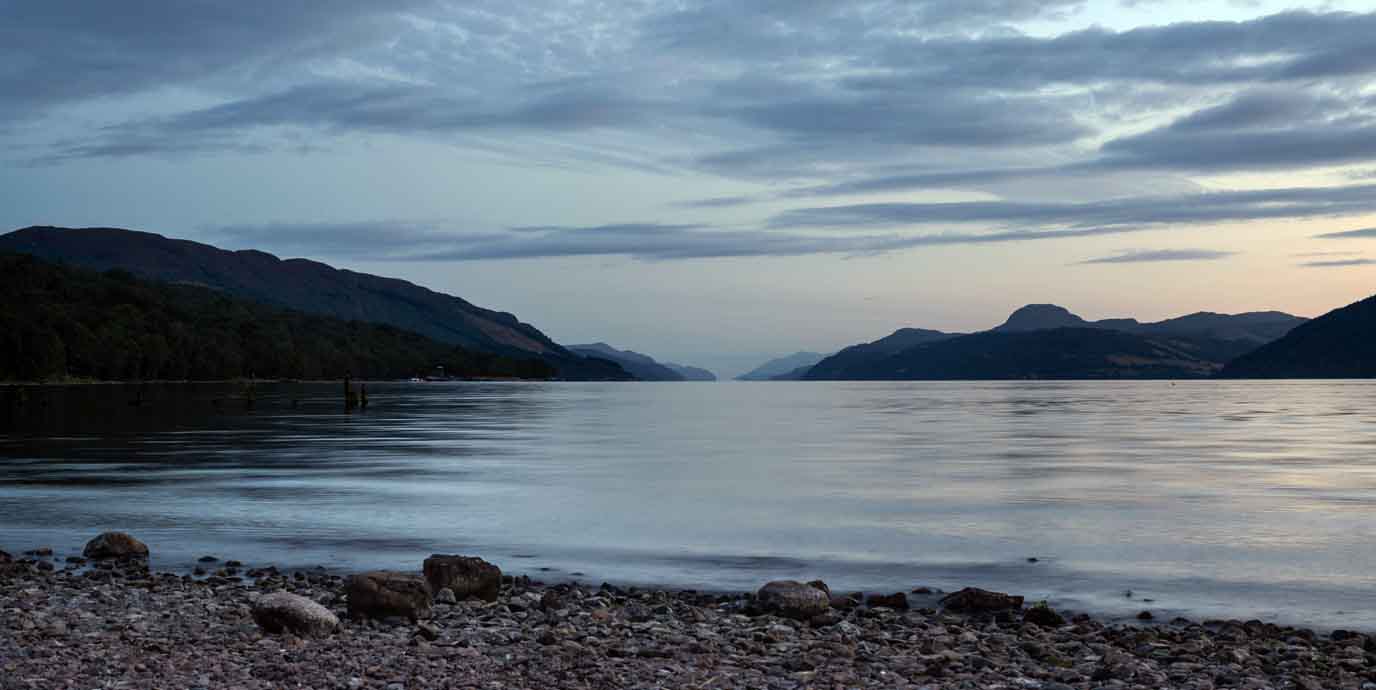
Nearest bus stop: Dores Inn
Set on the north-easterly end of Loch Ness, Dores Beach offers a tranquil escape just a short and easy bus ride from Inverness.
The shingle beach provides sweeping views across the famous loch, making it an ideal place to pause and take in the dramatic Highland landscape. Historically, the area has long been a gateway for those exploring Loch Ness, and today it remains a popular vantage point for visitors hoping to catch a glimpse of the legendary Loch Ness monster.
With its stunning location, Dores Beach is perfect for a leisurely walk along the lochside, where the fresh Highland air and open views create a calming experience. The beach itself is a good location for paddleboarding, and nearby Torr Woods offers woodland paths that skirt the edge of the water, adding variety to your walk. Heading toward Aldourie Pier gives you another perspective of the loch, and the combination of shoreline and forest makes this area a wonderful way to immerse yourself in nature while staying close to Inverness.
Fairy Glen
Nearest bus stop: Fairy Glen Car Park
Tucked away on the Black Isle near Rosemarkie, this enchanting woodland glen is a short bus ride from Inverness, making it a perfect trip for nature lovers.
Known as Fairy Glen, the area is steeped in local folklore, with tales that fairies once kept the burn clean for villagers. Today, the glen is managed as an RSPB nature reserve, preserving its rich biodiversity and tranquil charm. You will find a lush landscape of mossy trees, wildflowers, and two picturesque waterfalls hidden among the greenery, creating a magical atmosphere that feels far removed from urban life.
For outdoor activities, Fairy Glen offers an inviting setting for walking and wildlife watching. Well-marked paths wind alongside the burn, crossing wooden bridges and boardwalks, with occasional steps and gentle slopes that add variety to the walk. For wildlife, look out for dippers, wagtails, and even red squirrels if you’re lucky. The soothing sound of running water and the cool shade of ancient trees make this an ideal spot for a leisurely stroll or quiet contemplation.
After exploring the glen, you can extend their outing with a visit to nearby Rosemarkie Beach, a beautiful sandy stretch perfect for relaxing by the sea or enjoying coastal views.
Chanonry Point
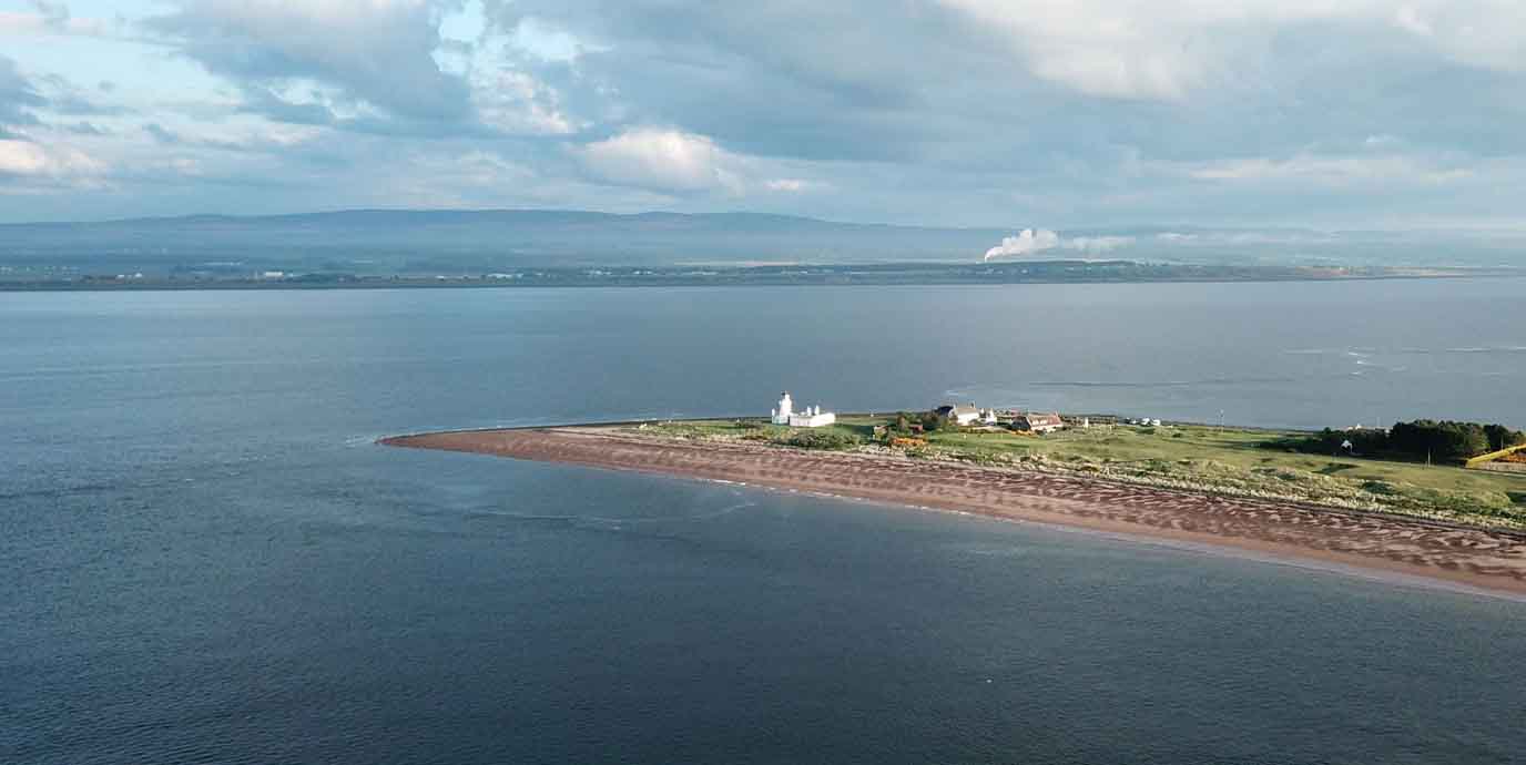
Nearest bus stop: Chanonry Park
To extend your visit to Rosemarkie, head out to Chanonry Point, which extends into the Moray Firth and is renowned as one of the best places in the UK to watch bottlenose dolphins from the shore.
Chanonry Point has a rich history, marked by its 19th-century lighthouse designed by Alan Stevenson and its earlier role as a ferry crossing, which operated until the mid-20th century. The area also carries a touch of folklore, being associated with the Brahan Seer, a legendary Highland prophet. Today, the point attracts visitors for its sweeping coastal views and its unique position opposite Fort George, offering a blend of natural beauty and cultural heritage.
For fresh air within proximity of Inverness, Chanonry Point is ideal for a leisurely walk combined with wildlife spotting. The shingle beach and surrounding paths provide a tranquil setting, and the chance to see dolphins feeding just metres from shore is a highlight, especially around a rising tide. Birdlife and marine activity add to the experience, making it a rewarding destination for nature lovers.
With its coastal scenery, fresh air, and high likelihood of dolphin sightings, Chanonry Point offers one of the most memorable walking experiences near Inverness.

Where can you find more nature walks in Inverness?
Inverness and its surrounding area has plenty more walking opportunities if you’re looking for a break from the city. For inspiration a short bus or train ride away, take a look at one of the following green spaces as an alternative:
- Bught Park – a spacious riverside park perfect for leisurely walks and enjoying open green areas.
- Botanic Gardens – stroll among vibrant plant collections and peaceful garden paths in a tranquil setting.
- Bellfield Park – a charming spot for short walks with tree-lined paths and a relaxed atmosphere.
- Whin Park – ideal for family-friendly walks with scenic ponds and playful green spaces.
- Ord Hill – a rewarding woodland walk with panoramic views over the Beauly Firth and Inverness.
- Craig Dunain Hill – a quiet hill walk offering forest trails and sweeping vistas of the surrounding Highlands.
- Abriachan Forest – woodland trails with panoramic Highland views and a peaceful, nature-rich setting for walkers.
Do you want to go a little further than Inverness for a walk?
Beyond Inverness, the Scotland has countless outdoor opportunities for those seeking their next adventure. If you’re looking to step from a city stroll into a countryside hike, get ready for adventure and take a look at a few ideas of where to go next:
- Dundreggan Rewilding Centre – explore rewilded landscapes with peaceful trails through native woodland and wildlife-rich habitats.
- Rogie Falls – a short, scenic walk to dramatic waterfalls and suspension bridge views over the Black Water river.
- Nairn Beach – enjoy long, sandy stretches perfect for breezy coastal walks with stunning Moray Firth vistas.
- Cairngorms National Park – follow vast mountain trails and forest paths offering some of Scotland’s most spectacular hiking experiences.
- Loch Ness – lakeside walks with iconic views and tranquil paths steeped in Highland mystery and beauty.
- Great Glen Way – a long-distance route linking lochs and glens, ideal for immersive multi-day walking adventures.