Advice from Mountain Rescue
OS Champion Phillipa Cherryson spends a day with the Brecon Mountain Rescue Team for some pointers on hill walking safety for beginners.
Brecon Mountain Rescue Team (MRT) is made up of highly-trained volunteers. The team provides a search and rescue service across parts of South and Mid Wales, including South Wales’ highest peak Pen y Fan. I spoke to Jess Moon Bowen, from Brecon MRT, to ask her advice on hill walking safety and what to do before tackling your first mountain.
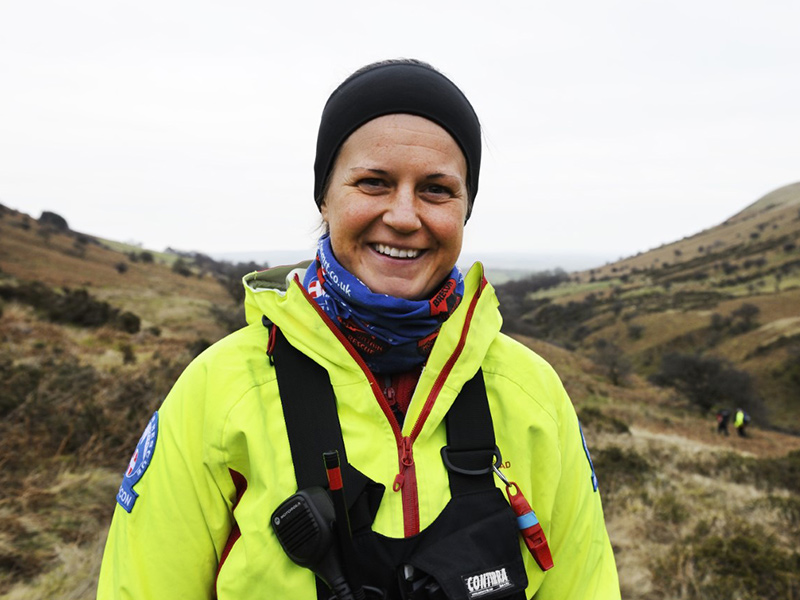
Jess Moon Bowen, from Brecon MRT. Photo credit: Nigel Millard
Prepare for the mountains
Q: If you are heading out to the hills or mountains, what should you do before you go to stay safe?
Be prepared. Before you go, check the mountain weather forecast. The Met Office has a mountain weather forcast which tells you what the weather will be like on the summits – it can be very different to the closest towns. Look at the forecast for the whole day and pay attention to the wind speed and the `feels like’ temperature as it is often a lot lower than the suggested temperature and will give you a good indication of what it will feel like on the mountain top. If the weather forecast isn’t good, with rain or high winds, be prepared to change your route, even if this upsets a long-planned adventure.
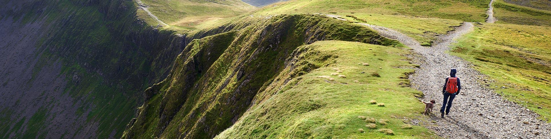
Know your route. Consider the time of year, terrain and the abilities of your party and plan your route accordingly. If you are in a group, plan it for the weakest member of your party and for the weather forecast. Remember the highest peaks will always be there for another day.
Ensure your phone is fully charged, enable ‘location services’ and register your number with emergencySMS.org.uk. Many accidents happen at the end of the day, when both you and your phone are low on energy.
Leave details of your planned route in a safe place or with a family member, friend or neighbour. Include start and finish points, estimated return time and contact in case of emergency.
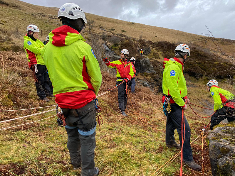
Brecon MRT training session
Learn to navigate
Q: Do you still need to know how to use a map and compass as everything is available on GPS or Apps now?
Even though a GPS or the mapping apps on your phone are great bits of kit, try to avoid relying on them completely. If your battery goes flat, they break or you can’t get a signal then you are on your own. We recommend taking a paper map and a compass and knowing how to use both.
Ordnance Survey maps are the best in the world and cover the whole of the UK. The 1:25,000 Explorer series will give you all the detail you need, but make sure you know how to read the map before setting out. You can find free basic navigation and map reading guides online to get you started.
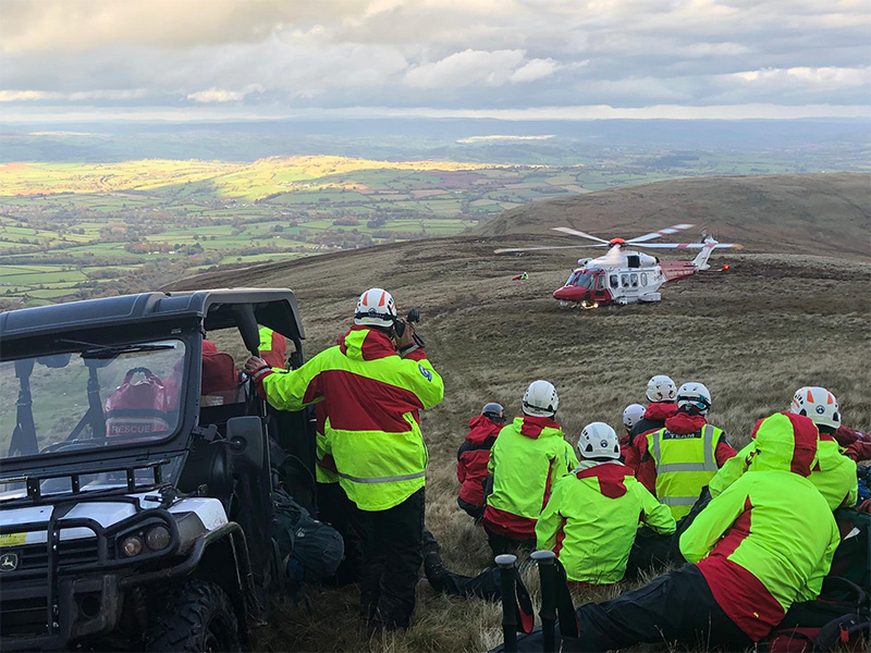
Brecon MRT helicopter
Take essential kit
Q: What should you take?
Waterproof clothing and footwear with a treaded sole. Don’t forget a hat and gloves even in summer.
In your backpack carry spare warm clothing, a map and compass, head torch with spare batteries, whistle, mobile phone, first aid kit including essential medication. Don’t forget to carry enough food and drink for your planned trip and a bit more in case.
In winter in the mountains take an ice axe and crampons and be sure you know how to use them. You can attend courses in winter skills and they are well worth it. Also take a survival bag as it could save your life.
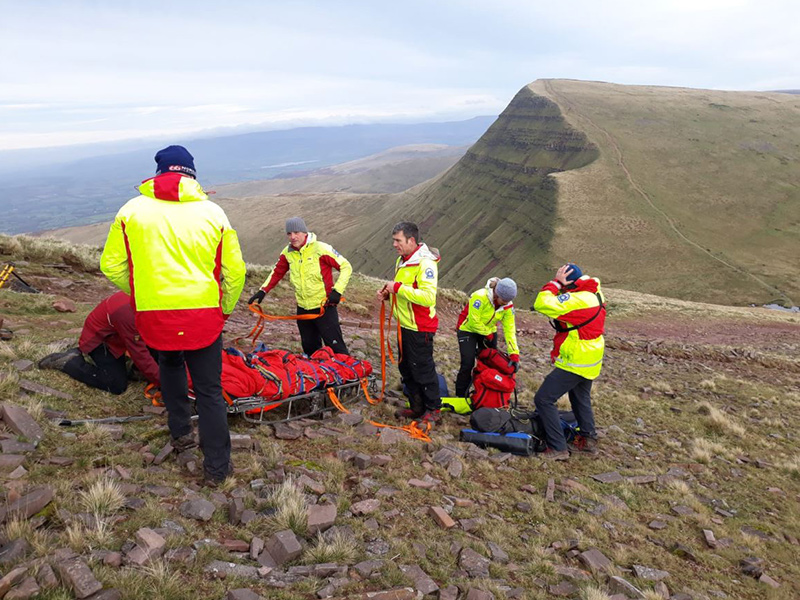
Brecon MRT training on the mountain side
Safety first
Q: How can I keep safe on the hill?
Keep an eye on the weather. Be prepared to turn back if conditions turn against you. Keep your group together and let the slowest in your party determine your pace. Eat and drink well during the day to keep your energy levels high and stay hydrated. If you go out alone stick to your planned route, so that if something goes wrong people know where to find you.
Handling emergencies
Q: What if something goes wrong?
Don’t panic! Don’t immediately get out your phone and dial 999 unless it’s a medical emergency. We’ve all got a bit lost from time to time and we are better people for it. Try to work out where you are, use any visual or navigation aids available and if you see any other walkers ask them for help. It’s not the end of the world if you walk down a route you hadn’t planned to.
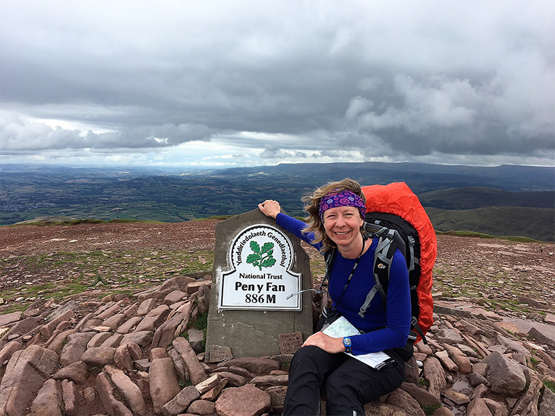
Phillipa at Pen-y-Fan
Contacting Mountain Rescue
Q: How do you call Mountain Rescue?
You will need to tell us where you are and the best way of doing that is giving us the 6-figure grid reference. You can work that out from your map or else use the free OS Locate App. Read this guide to finding grid references. If you don’t know where you are, look around to spot geographical features – streams, waterfalls, cliffs, anything that could help rescuers find you.
Call 999 and ask for the police. Then ask for Mountain Rescue. You will need to tell the team the number of casualties, their names and ages, the nature of the injury, illness or your predicament and your location if you know it, with your six-figure grid reference. Don’t change your position until you have spoken to a member of Mountain Rescue.
If you haven’t enough signal to make a phone call you may be able to use the emergency SMS service. Text 999 and send. Then type Police followed by the details of what has happened and your location.
The whole process can take several hours. Please don’t expect Mountain Rescue to whisk you off the mountain in a helicopter, especially in these current conditions. Most rescues are carried out on foot. While you are waiting remember to keep you and the casualty warm – people can become hypothermic in summer too.
For more information on what to do in an emergency, read more from Mountain Rescue and familiarise yourself with their Adventure Smart advice.
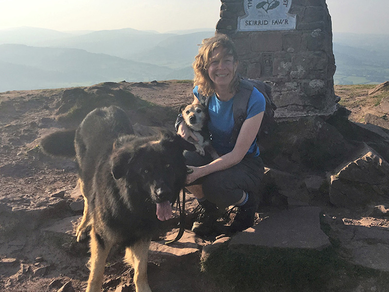
Phillipa at the summit of the Skirrid
Phillipa’s advice for beginners
When I started walking by myself in the mountains and even now when I am exploring new areas, I always go online and do my research first. You can find out loads of information about mountain routes.
To start with I always looked for routes which had clear paths and avoided any which warned they would be difficult underfoot or required navigating pathless mountain tops!
Then when I decide upon a route I plot it on OS Maps to find out how long it will take me to walk. I also do a virtual fly through so I can see exactly what the terrain looks like – are there are any steep drops or tricky descents!
Finally, I will check the weather and choose a day which has light winds and clear conditions forecast. A route which is simple in the sunshine is very different when the cloud comes down and you can’t see your hand in front of your face.
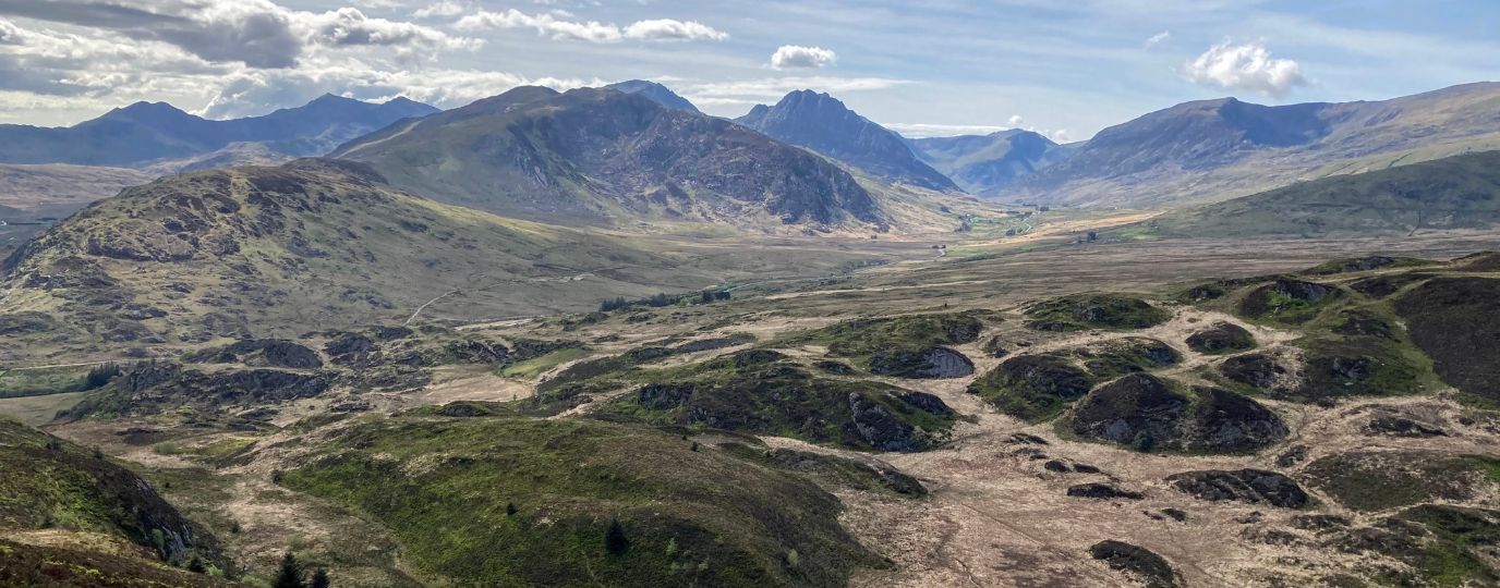
Here are two walks in the Brecon Beacons National Park which are ideal for those starting out:
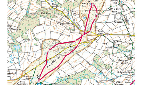
Mynydd Illtyd Common, near Brecon. It’s a circular walk on a high level common up to the remains of a hill fort. It has amazing views across to the peaks of the Central Beacons but has clear paths and facilities on hand at the park’s visitor centre.
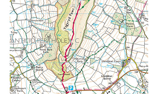
The Skirrid (or Holy Mountain), outside Abergavenny, is like a mountain in miniature. A clear path leads up through woodland onto the open mountain and then you follow the ridgeline to the trig point. Great views across Abergavenny and onto the Black Mountains.
Remember,
- Are you confident you have the knowledge and skills for the day?
- Do you know what the weather will be like? Check it here.
- Do you have the right gear?