Llyn Peninsula Circular Coastal Walks
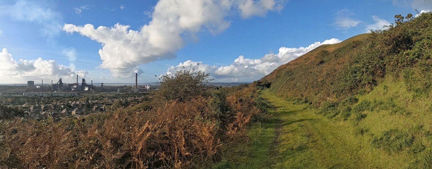
The Gwynedd section of the Wales Coast Path is the second longest, covering 180 miles / 289km. More brand new stretches of coast path were created here than anywhere else along the coast of Wales. New coast paths were established on large National Trust properties on either side of Bangor. Coastal access around the Llŷn peninsula has been vastly improved and extended, allowing walkers to enjoy rugged cliff scenery that simply wasn’t available in the past.
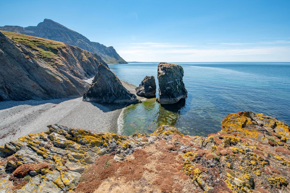
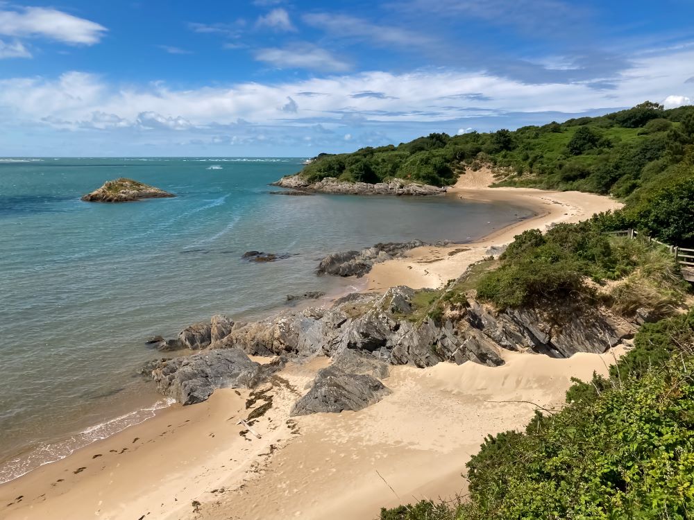
The route is easy and low-lying as it passes Bangor and Caernarfon, but things change beyond Trefor. The hilly Llŷn peninsula sees the Wales Coast Path climbing to its highest point, at almost 350m on Bwlch yr Eifl, between two rugged hills. Spectacular scenery is enjoyed along breezy clifftop paths, where there are plenty of rocky headlands, hidden coves and sandy beaches.
The end of the Llŷn peninsula looks out to Bardsey Island, where a visit is well worth the extra effort. A succession of splendid little towns and villages are passed and each has its own character and points of interest. Aberdaron, Abersoch and Llanbedrog give way to the resort of Pwllheli. Criccieth and its ancient castle give way to the planned Victorian town of Porthmadog. A short detour could include a visit to the whimsical Italianate village of Portmeirion, and delightful steam trains might be spotted on the way to Penrhyndeudraeth.
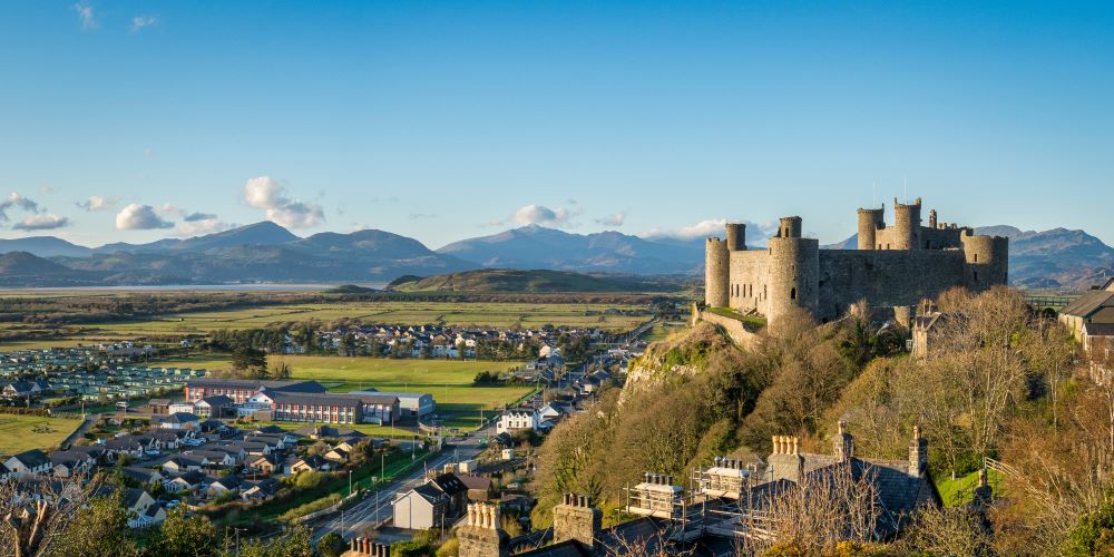
Marshland and farmland lead to Harlech and its impressive castle. Shell Island is a remarkable location for a campsite before a beach walk leads towards Barmouth. The coastal railway and main coast road leave little room for a walking route, so the Wales Coast Path passes through elevated farmland on its way to Tywyn. After a fine beach walk to Aberdyfi, the estuary of the Afon Dyfi pushes walkers far inland, following the Panorama Walk over hills, eventually finding a bridge to Machynlleth.
Abergwyngregyn Circular Walk
Abergwyngregyn marks the start of a 7.3 mile / 11.8km walk of two halves. The first half is a level and easy walk alongside Traeth Lafan, which is notable for its nature reserve and is popular with birdwatchers. The Isle of Anglesey and Puffin Island are seen across the sea. The second half of the walk ventures onto the foothills of the Carneddau range, traversing the lower slopes of Moel Wnion.
Leaving a coastal car park near Abergwyngregyn, a stretch of the Wales Coast Path follows a track close to a shingle beach, where the marshland and mudflats of Traeth Lafan entertain birdwatchers. It is necessary to crunch along a shingle beach before a grassy path continues along the coast, passing lengths of interesting slate slab fences unique to this area. When the path draws level with the farm of Glan-y-môr-isaf, head inland.
Pass beneath a railway line, over the busy A55 road, then straight past Hendre Hall to walk up a steep minor road on a wooded slope. Pick up the North Wales Path at Bronydd Isaf, which follows a clear track through big fields on the lower slopes of Moel Wnion. Views look across a patchwork landscape to the low-lying coast, Traeth Lafan, the Isle of Anglesey and Puffin Island.
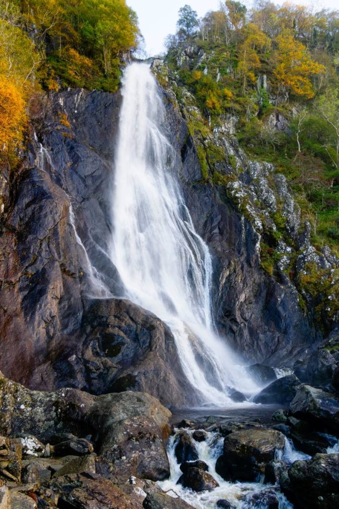
A path drops to the village of Abergwyngregyn, where anyone with surplus energy might consider extending this walk to include the famous Aber Falls. If not, simply return to the car park, and maybe succumb to the temptation to veer off-route towards the end to visit the Aber Falls Distillery, to learn the art of whisky-making. Read the detailed route description for Abergwyngregyn (opens in the Visit Snowdonia website)
Top Tip
Take binoculars for birdwatching at Traeth Lafan. Extend explorations by visiting Aber Falls. Enjoy a tour of the Aber Falls Distillery.
Clynnog and Trefor Circular Walk
History and heritage abound on this walk. Trefor is surrounded by old slate quarries and Clynnog Fawr was on a notable pilgrim route. Both villages are on the Wales Coast Path. For the sake of more effort, a strenuous circular walk can be enjoyed by climbing into remote hill country behind Bwlch Mawr, Gyrn Goch and Gyrn Ddu. The route can be anything from 10.8 miles / 17.4km for the basic circuit, to 15.4 miles / 24.8km, if an optional additional mini-circuit is included around Trefor at the end.
The Wales Coast Path follows an easy cycle path running parallel to the main A499 road between Trefor and Clynnog Fawr. A short detour at Clynnog Fawr can include an interesting Neolithic cromlech, or burial chamber. Visit St Beuno’s Church and St Beuno’s Well, which were important stops on a pilgrim route through the Llŷn peninsula to Ynys Enlli (Bardsey Island).
Leaving the coast path, the route climbs inland along a path and joins a road that runs round the lower slopes of Bwlch Mawr. Take care while following a series of scanty paths and tracks across the rugged southern slopes of Bwlch Mawr and Gyrn Ddu, hoping that the weather allows for extensive views.
A zigzag descent follows paths down to gentle farmland, where the roadside cycleway used at the start leads back into Trefor. To extend the walk, a convoluted short circuit explores features of interest around the village and finishes with a short cliff walk along the Wales Coast Path. Read the detailed route description for Clynnog and Trefor
Top Tip
Visit St Beuno’s Church at Clynnog Fawr and look out for more pilgrim churches around the Llŷn peninsula. Extend the route by including a short circular walk around Trefor.
Llithfaen Circular Walk
Yr Eifl is the the highest mountain on the Llŷn peninsula and the highest mountain that can be climbed directly from the Wales Coast Path. Its slopes are dotted with ancient monuments, including the astounding Tre’r Ceiri Iron Age hillfort. Further downhill, an old quarry village at Nant Gwrtheyrn now serves as a notable Welsh language and heritage centre, and the Wales Coast Path passes straight through it.
The route is a fairly strenuous 7.7 mile / 12.4km figure-of-eight, which can be split into equal halves if time is limited. The starting point is at a bleak moorland car park outside the village of Llithfaen, where fresh air is guaranteed, but choose a clear day in order to enjoy the scenery.
The Wales Coast Path follows a track that climbs to a gap between two prominent hills. Climb straight up the rugged slopes of Yr Eifl to its 564m summit and take in panoramic views. Go down the other side and be sure to make a detour to the remarkable Iron Age hill fort of Tre’r Ceiri, where 150 hut circles are enclosed by a substantial defensive wall.
Return to the car park and follow a zigzag road down to Nant Gwrtheyrn and be sure to explore the site and appreciate everything it stands for. There is a café if needed. The surrounding slopes bear scars and structures associated with quarrying and the Wales Coast Path gradually climbs uphill.
Leave the coast path and climb further to pass the buildings at Ciliau Canol to finish back at the car park. Read the detailed route description for Llithfaen
Top Tip
Tackle the walk as a whole or as two short circular walks. Explore the spectacular Iron Age hillfort of Tre’r Ceiri and the restored quarry village and heritage centre of Nant Gwrtheyrn.
Nefyn Circular Walk
Park overlooking the broad, sandy beach at Porth Nefyn and breathe the exhilarating sea air before embarking on an easy 3 mile / 5km walk around Nefyn and its lush, green countryside. Follow the Wales Coast Path through village, looking out for St Mary’s Church with its distinctive ship-shaped weathervane. The church now houses the Llŷn Maritime Museum, telling the story of local shipbuilding, captains and sailors. Inhabitants were nicknamed ‘Penwaig Nefyn’ or ‘Nefyn Herrings’ on account of their skill as herring fishermen.
Quiet roads are followed out of the village, then a footpath runs through a field at Cae Pysgodyn. This was the site of a tournament in 1283, celebrating the conquest of Gwynedd by Edward I. Owain Glyndŵr burnt Nefyn in 1400, due to the village being a Royal Borough established by the English Crown. The hill rising nearby is Garn Boduan, which is crowned with an Iron Age hillfort. A short walk along the main road leads onto a wide grassy verge where another footpath is followed.
A succession of field paths and farm roads lead through a dynamic patchwork landscape where the colours change with the seasons, according to whether the land is ploughed, cropped, mown or grazed by livestock. The winding farm road of Lon Pwll Wiliam narrows considerably, linking with another short farm road that leads onto the Wales Coast Path.
By all means make a short detour onto the little headland of Penrhyn Nefyn for splendid coastal views, or simply walk back along the clifftop path to return to the beach car park to finish. Read the detailed route description for Nefyn (opens in the Visit Snowdonia website)
Top Tip
Visit the Llŷn Maritime Museum and its café (llyn-maritime-museum.co.uk). Enjoy a bracing scenic detour onto the headland of Penrhyn Nefyn.
Edern Circular Walk
The unassuming little village of Edern offers access to a scenic stretch of the Wales Coast Path, where a remarkable pub and an important lifeboat station can be discovered on the narrow, rugged headland of Trwyn Porth Dinllaen. The route measures 5.6 miles / 9km, with options to shorten it in places.
Paths and tracks lead from a footbridge in Edern to the Nefyn Golf Course, linking with the Wales Coast Path. The tiny National Trust village of Porth Dinllaen is where the popular waterfront Tŷ Coch Inn is located – dating from the 18th century and accessible only on foot. Look out for Caban Griff, where heritage information is displayed. A short, convoluted coast path runs to the Porthdinllaen Lifeboat Station. The first station was established here after 18 ships were destroyed one stormy night in December 1863. The current station dates from 2014 and is sometimes open to visitors.
The headland of Trwyn Porth Dinllaen offers remarkable all-round views, made all the more dramatic if waves are beating against the cliffs, throwing salt spray into the air. The Wales Coast Path hugs the clifftop, running alongside the golf course. The headland is very narrow, with walkers only being a few paces away from the earlier part of the route. Obviously, there is a chance to short-cut straight back to Edern.
The cliff path continues around the rocky coves of Borth Wen and Aber Geirch. Birdwatchers will delight on this stretch and seals might also be spotted. At Aber Geirch a nearby marshland nature reserve is populated by several rare plants. Leaving the coast, a field path heads inland, joining a minor road that runs from Bryn Gwydd, through Groesffordd, back to Edern. Read the detailed route description for Edern (opens in the Visit Snowdonia website)
Top Tip
Visit the Tŷ Coch Inn, Caban Griff and Porthdinllaen Lifeboat Station. Carry binoculars for birdwatching and seal spotting along the cliff paths.
Tudweiliog Circular Walk
Pocket-sized Porth Ysgaden is a tiny natural rock harbour on the coast of the Llŷn peninsula, and the starting point for a wonderfully scenic and interesting 3.2 mile / 5.1km walk. An intriguing structure stands on a nearby headland – the stone-built gable end and chimney of an 18th century custom officer’s house, standing as a monument to itself and witness to the fact that this was once an important little harbour.
Small ships from as far away as Liverpool and Dublin brought a variety of goods to the harbour and often left laden with locally fished herrings. A limekiln operated nearby, producing lime used to fertilise the surrounding lush green fields. There are stories of shipwrecks and smuggling.
A delightful stretch of the Wales Coast Path traverses low cliffs around Porth Llydan and Porth Ysglaig to reach the beautiful sandy beach of Porth Towyn. Head inland to pass the Cwt Tatws (potato hut) café and lifestyle store, and spot the original little hut that the enterprise was named after. A track leads through a farmyard and fields to the village of Tudweiliog, where the 19th century St Cwyfan’s Church stands on a medieval site dedicated to a 7th century saint. The church has long served as a landmark for vessels at sea.
For car-free walkers, Tudweiliog offers an alternative starting point, boasting daily bus services to and from Pwllheli. The Lion Hotel offers food and drink, while a farm road alongside leads to Tŷ Hir, where an easy field path continues to a campsite at the farm of Porthysgaden. Roads lead back to the coastal car park at Porth Ysgaden to finish. Read the detailed route description for Tudweiliog (opens in the Visit Snowdonia website)
Top Tip
Enjoy a leisurely lunch by taking a break at Cwt Tatws or the Lion Inn. Carry binoculars for birdwatching along the coastal path.
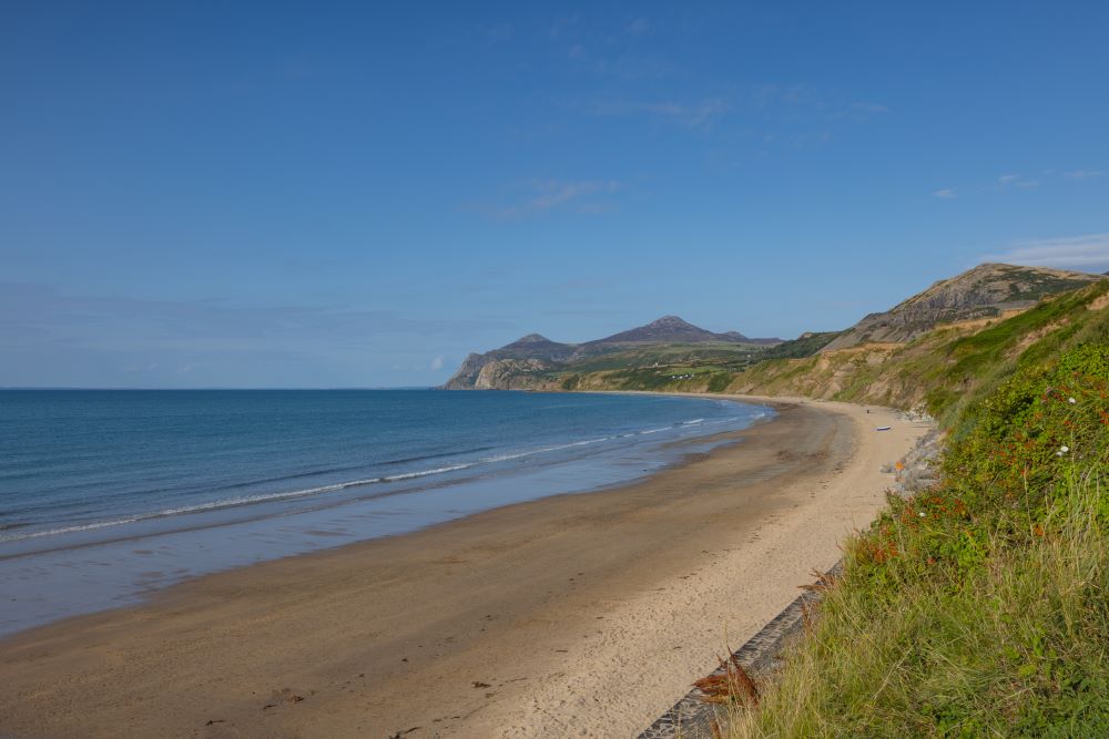
Llangwnadl Circular Walk
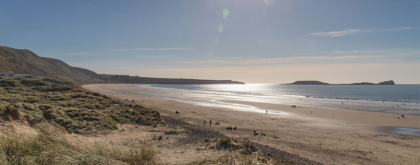
Prepare for a superb clifftop walk above Traeth Penllech by checking the tide times before starting this 4.3 mile / 7km route. The reason becomes apparent after following a path from a car park at Pont yr Afon Fawr to the lovely broad sandy beach of Traeth Penllech. The path drops walkers onto the beach, and the tide has to be out, or at least not fully in, so that a small rocky headland can be passed.
Climbing ashore, a new stretch of the Wales Coast Path was constructed in 2024 to replace a flight of steps that had collapsed a few years earlier. A splendid clifftop path leads to a delightful rocky harbour at Porth Colmon. This was once an important local port, and in 1825 around 50 local people emigrated in search of fortune in America. Hopes that the port could be expanded to export coal came to nothing as a nearby mine wasn’t profitable.
Continue along the coast path, which follows an attractive low line of cliffs, overlooking numerous rock pools. Walk as far as Porth Tŷ-mawr, where the Stuart, en route from Liverpool to New Zealand, was wrecked in 1901. Local inhabitants looted the cargo before customs officers arrived, and the cove is locally known as Porth Wisgi on account of the prized whiskey that was salvaged. The keel of the Stuart is still visible, looking like a giant fish bone among the rocks.
Follow a path inland, passing through fields to reach a road at Bryn Villa. More field paths and short road walks lead walkers close to the pilgrim church of St Gwynhoedl, a 6th century saint whose name is incorporated into Llangwnadl. After one final field path, a minor road leads back to the car park at Pont yr Afon Fawr.
Top Tip
Remember to check the tide times as the walk might not be possible when the tide is fully in. Look out for the wreckage of the Stuart, from 1901.
Aberdaron Circular Walk
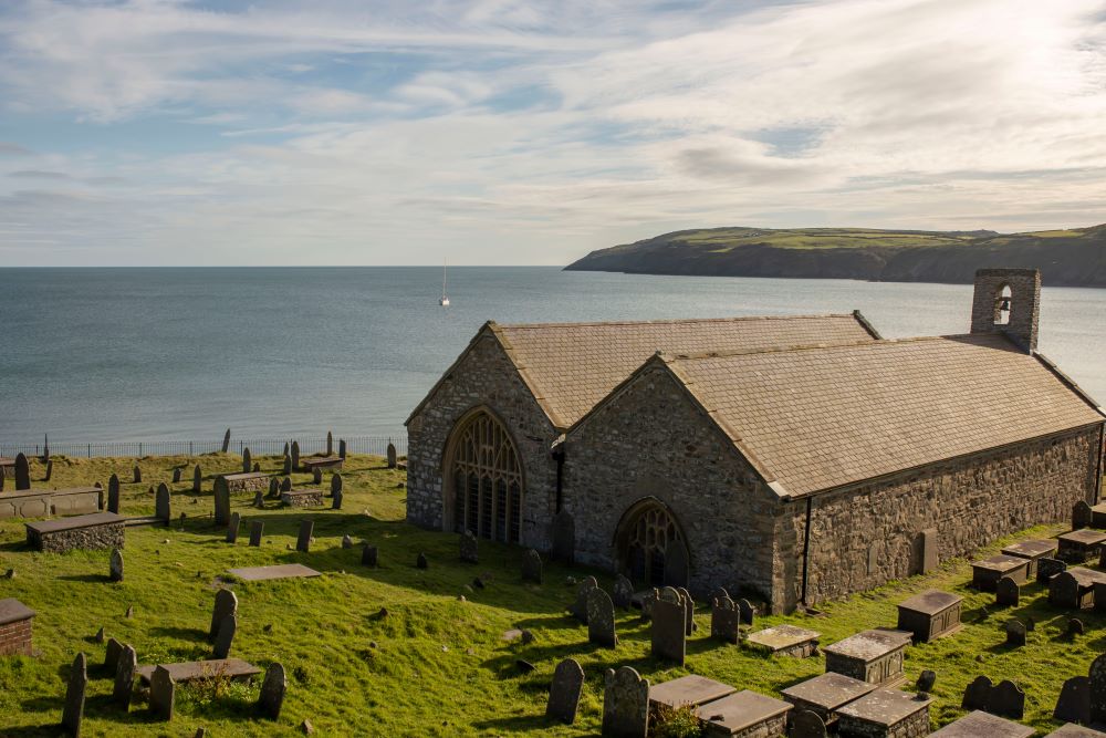
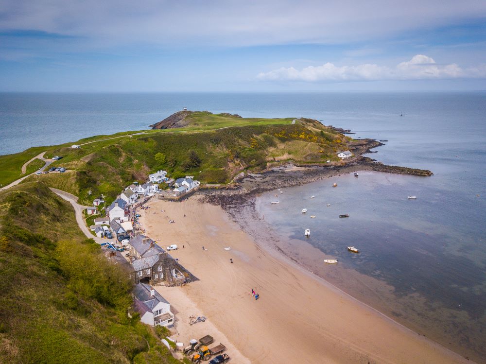
Brace yourself for a fairly difficult, but also interesting, scenic and rewarding walk of 9 miles / 14.5km, at the end of the Llŷn peninsula. Aberdaron is an attractive village with an historic pilgrim church, in an area of low hills and farmland, bound by a rugged cliff coastline. The National Trust operate a visitor centre at Porth y Swnt, which provides a good grounding into the history, heritage and wildlife of the area. There are also great places offering food and drink around the village.
The Wales Coast Path is followed from Aberdaron to the little hidden harbour of Porth Meudwy, where a tractor-launched ferry links with the incredibly interesting Bardsey Island (www.bardseyboattrips.com). The island was the ultimate destination on a pilgrim route through the Llŷn peninsula, passing several notable churches. Some 20,000 ‘saints’ are said to be buried on the island. Pope Calixtus II declared in 1120 that three pilgrimages to Bardsey Island were worth one pilgrimage to Rome!
Heading inland, the route passes through farmland at Cwrt and Pwlldefaid, then traverses the exhilarating moorland slopes of Mynydd Anelog, again linking with the Wales Coast Path. At first the path is high above the cliff coast, descending gradually on the moorland slopes of Mynydd Carreg above Porthorion and Porth Oer. A short detour can include the ‘Whistling Sands’, where every footfall provokes a slight squeaking sound from the sand, if you listen carefully. A beach café is also available.
The North Wales Pilgrim’s Way follows farm roads and field paths coast-to-coast across the Llŷn peninsula, linking with a short stretch of the Wales Coast Path to return through a little valley to Aberdaron.
Top Tip
Spend time at the National Trust Porth y Swnt visitor centre and the pilgrim church of St Hywyn’s at Aberdaron. Step onto the ‘Whistling Sands’ at Porth Oer.
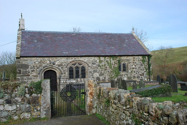
Rhiw Circular Walk
Plas yn Rhiw is a delightful 17th century National Trust property with a café, built on a much older manor house foundation (www.nationaltrust.org.uk/visit/wales/plas-yn-rhiw). The delightful woodlands feature snowdrops early in the year, followed by bluebells and primroses. The orchard comes into bloom next, while nearby grasslands feature orchids and other wildflowers. The organic garden has been planted with a range of flowers and shrubs, ensuring that something is in bloom summer and winter, while spring sees some of the outbuildings on the estate covered in colourful cascades of wisteria.
Starting from the car park, a short 2 mile / 3.2km walk leads away from Plas yn Rhiw, following the Wales Coast Path through a lovely woodland. After an uphill climb on a rugged hillside, leave the coast path and follow another path to a road in the scattered hillside village of Rhiw.
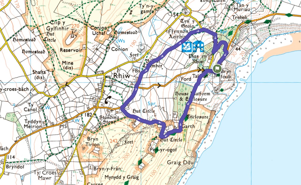
Glance at the Ordnance Survey map to appreciate how many ancient monuments and settlement sites are dotted around the immediate landscape, including a hillfort, hut circles and a burial chamber, dating back 4000 years when the area was inhabited by Neolithic people.
After a short road-walk downhill from Rhiw, continue along a field path and eventually join another road, below the 18th century St Aelrhiw’s Church, now converted into a holiday home. The road drops steeply on a wooded slope, then there is access to Plas yn Rhiw, where the house and grounds should be explored thoroughly. Afterwards, a short and pleasant woodland path returns to the car park where the walk started. Read the detailed route description for Rhiw
Top Tip
Ensure that plenty of time is available to visit the house, garden and network of woodland paths around Plas yn Rhiw. Keep an eye on the map to spot ancient monuments and settlement sites.
Botwnnog Circular Walk
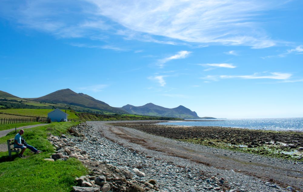
The Wales Coast Path deliberately avoids trudging along the extensive sand and shingle beach of Porth Neigwl, or Hell’s Mouth, partly to avoid disturbance to the wildlife in a site of special scientific interest, but also because it’s difficult for walkers to escape a high tide. A long, but fairly easy walk of 12 miles / 19.3km explores this area, with most of the route being inland, visiting quiet villages with historic churches.
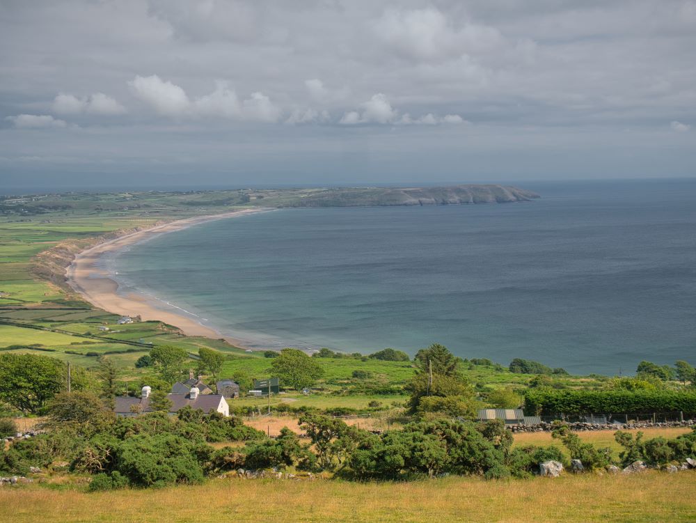
A short coastal walk later allows a view around the entire sweep of the bay.
The route mostly runs through large sheep-grazed fields, passing farms to link the villages of Botwnnog, Llangian and Llanengan. St Cian’s Church can be visited at Llangian and likewise St Engan’s Church can be visited at Llanengan. St Cian’s might have been founded in the 6th century, but both churches were definitely in service from the 13th century onwards and display features from the 15th century.
Both villages are located close to Iron Age hillforts, and the ramparts of both forts have been quarried for metal ores. The Llanengan hillfort has a prominent lead mine chimney built on it, serving as a local landmark.
After enjoying a short coastal walk at Pentowyn, where there is a fine view of Porth Neigwl, the Wales Coast Path heads inland along a country lane, then follows footpaths through large fields where there are few habitations, and it is wise to keep eyes peeled to spot marker posts. When another road is reached, more paths and farm tracks lead through fields to return to Botwnnog. Read the detailed route description for Botwnnog
Top Tip
Spend time at the historic little churches along the way. Refer to the Ordnance Survey map to spot Iron Age hill forts and mining sites. With the aid of binoculars, watch for rare choughs around Porth Neigwl.
Llanbedrog Circular Walk
The lovely little village of Llanbedrog has a popular and extensive sandy beach, with the attractive rugged headland of Trwyn Llanbedrog rising above it. The Wales Coast Path almost makes a complete circuit around it, and for the sake of a fairly easy 2.5 mile / 4km walk, the entire headland can be explored, enjoying splendid all-round views. St Pedrog was a Welsh prince who became a 6th century missionary who founded churches in the Celtic communities of Brittany, Cornwall and Wales. He was buried at St Petroc’s Church in Bodmin.
Leaving Llanbedrog on the Wales Coast Path, pass through the grounds of Plas Glyn-y-Weddw (www.oriel.org.uk), where it is worth visiting the oldest art gallery in Wales, along with an open-air theatre. A gallery was established here in 1896, then after a chequered history, the gallery was re-established in 1984. Climb along a convoluted woodland path, with flights of steps in some places, emerging from the trees close to a twisted metalwork sculpture known as the Tin Man. This is actually the second sculpture to grace the headland, and it offers a lovely view along the sandy beach below, stretching to the distant mountains of Eryri.
The Wales Coast Path continues high above the cliffs around the rugged moorland slopes of Trwyn Llanbedrog, then a path is followed to the 132m summit of Mynydd Tir-y-Cwmwd, where extensive views can be enjoyed on a clear day. Head downhill along a rugged path in the direction of Llanbedrog, where a short field path leads back to the village. Read the detailed route description for Llanbedrog
Top Tip
Be sure to allow time to visit St Pedrog’s Church and the art gallery of Plas Glyn-y-Weddw. By all means explore more of the Wales Coast Path by walking along the beach afterwards.
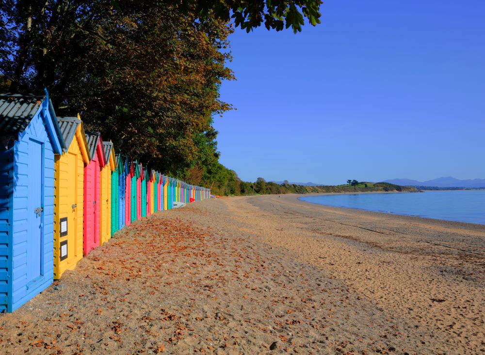
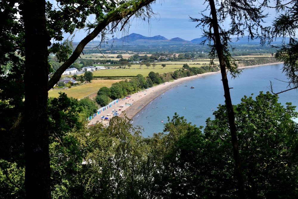
Llanystumdwy Circular Walk
David Lloyd George was the first and only Welshman to become Prime Minister, and the only Prime Minister who spoke Welsh as his first language, serving from 1916 to 1922. He was a member of the Liberal Party and a notable radical politician, moulded by his upbringing and schooling in the lovely village of Llanystumdwy.
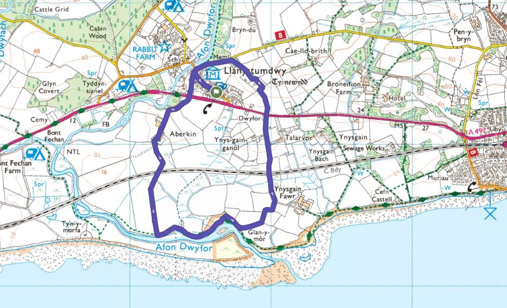
A short and easy 2.6 mile / 4.2km walk offers a breath of fresh air along the Wales Coast Path, combined with an in-depth appreciation of Lloyd George’s life and times.
For the walk, leave Llanystumdwy and join the Wales Coast Path beside the A497 road that bypasses the village. Follow the access road to Aberkin and pass all the farm buildings, then take care while using a level crossing on a railway line.
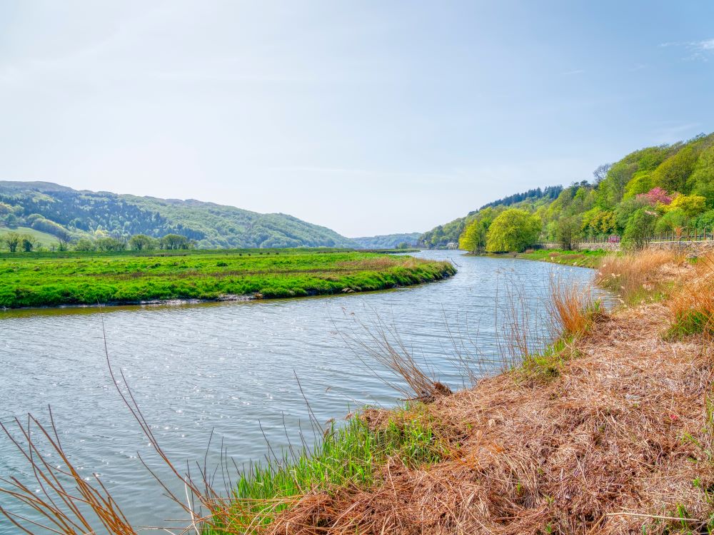
The coast path runs alongside a tidal stretch of the Afon Dwyfor, rather than the open sea. The land is marshy and the path might be muddy, but there are also long stretches of duckboards too. Look out for wildfowl, then watch out for a shed, following a path and tracks inland, crossing a bridge over the railway. Later, cross the A497 road again and follow a field path, passing Tŷ Newydd, where Lloyd George died in 1945.
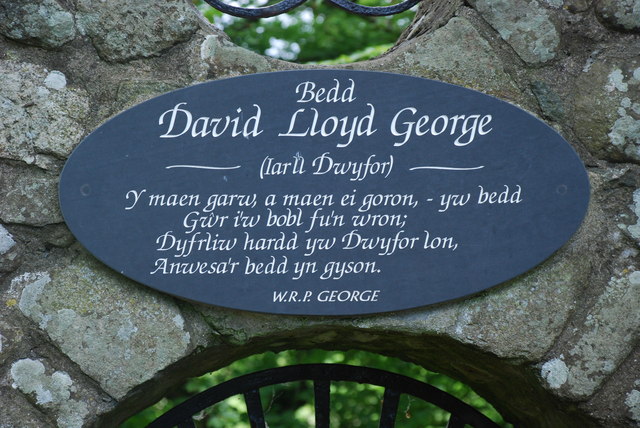
On the road-walk back into Llanystumdwy, look out for Lloyd George’s grave on the wooded banks of the Afon Dwyfor. Spurning the opportunity to be buried in Westminster Abbey, he was buried here beneath a simple boulder. A year later a decorative stone wall was built around it, featuring a gateway and inscription, designed by Clough Williams-Ellis. Visit the Lloyd George Museum in the village to learn more about this remarkable man. Read the detailed route description for Llanystumdwy
Top Tip
Enjoy the short walk, but spend as much time as possible enquiring into the life, times and turbulent politics of David Lloyd George.
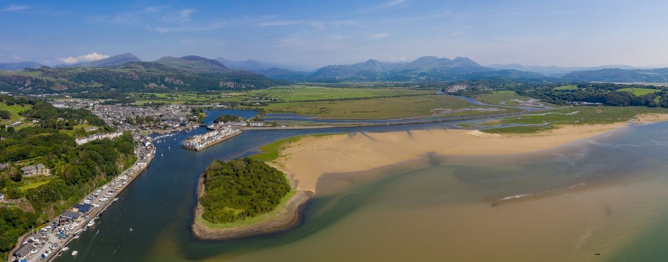
Borth-y-Gest Circular Walk
Walk through history and try to imagine what this area was like two centuries ago, when the huge estuary of Traeth Mawr stretched far inland, and most travellers had to be guided across treacherous sands to and from Borth-y-Gest. Everything changed when William Alexander Madocks started to develop the area early in the 19th century.
The planned town of Tremadog, the substantial embankment known as The Cob, and the slate-exporting and shipbuilding town of Porthmadog were astounding developments for their time, steered into being by Madocks, though the cost of these enterprises almost ruined him. The sealing of the estuary resulted in a huge tract of valuable agricultural land becoming available at Traeth Mawr. Railways were put in place, and today’s railway enthusiasts can arrive on the Cambrian Line and transfer to the steam-hauled Ffestiniog and Welsh Highland Lines.
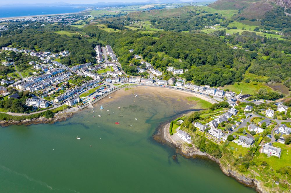
The walk that encompasses Borth-y-Gest, Tremadog and Porthmadog is an easy 5.7 mile / 9.2km circuit. A little climbing on the wooded slopes of Moel-y-Gest is followed by level walking past industrial sites to reach Tremadog. Admire the stone buildings around the central square, with the rugged Craig y Castell rising above.
Woodland and farmland give way to a walk beside the Welsh Highland Railway. After crossing the Cambrian Line the route reaches the Harbour Station on the Ffestiniog Railway. It is worth returning another day to enjoy rides on the heritage railways (www.festrail.co.uk), which link Porthmadog with Caernarfon and Blaenau Ffestiniog. A short walk along the Wales Coast Path leads along the quayside from Porthmadog back to Borth-y-Gest. Read the detailed route description for Borth-y-Gest
Top Tip
It takes time to appreciate the Ffestiniog and Welsh Highland Railways, so maybe enjoy rides along them on another day (www.festrail.co.uk).
Maentwrog Circular Walk
Revisit the earliest years of the Wales Coast Path on this exploration of the wonderfully wooded Vale of Ffestiniog. When the coast path was opened in 2012, a long detour inland was required because Pont Briwet, spanning the tidal Afon Dwyryd, was being demolished and rebuilt. The 11.5 mile / 18.5km walk from Penrhyndeudraeth to Maentwrog and back is now short-cut by a mere 0.6 mile / 1km short and easy walk across Pont Briwet.
It’s worth stepping back in time to enjoy the former detour, and maybe look out for any old Wales Coast Path signposts that might have been left standing. Leave Penrhyndeudraeth to follow roads and forest tracks, listening for the tooting and puffing of steam trains on the Ffestiniog Railway. The line is often close to hand, but screened by trees. Maybe enjoy a lunch break at The Grapes in the village of Maentwrog and admire the stout stone buildings in the village.
Take a convoluted route over the slopes of Pen y Foel to avoid walking along the main road to reach the hydro-electric Maentwrog Power Station, producing energy since 1928.
Climb through the forest of Coed Felenrhyd and pass the reservoir of Llyn Tecwyn Uchaf. Walk straight down through a valley to the little village of Llandecwyn and its tiny, modern railway station. After walking all this way, all that remains is to follow the current course of the Wales Coast Path, along a broad footpath and cycleway, straight back to Penrhyndeudraeth. It only takes a few minutes, compared to the few hours it took to detour inland before Pont Briwet was opened. Read the detailed route description for Maentwrog
Top Tip
Take a ride on the Ffestiniog Railway (www.festrail.co.uk) from Penrhyn Station to Plas Halt (both request stops), and pick up the walk close to Maentwrog.
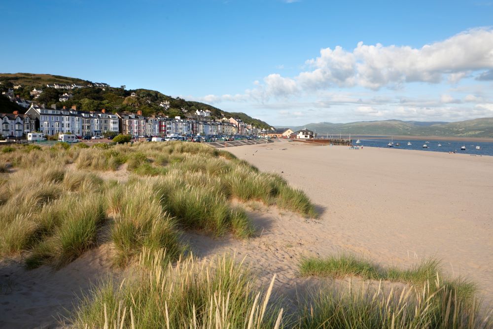
Barmouth Circular Walk
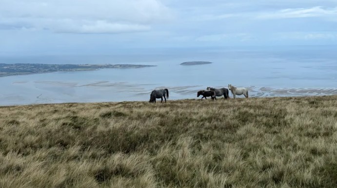
Even when you’re promised a ‘Panorama Walk’ it makes sense to choose a clear and sunny day to make the most of the opportunity. This scenic and varied walk climbs above the popular seaside town of Barmouth and measures 4.8 miles / 7.8km. It explores the rugged little hills above town, taking in hill paths, farm roads, woodland and exceptional views.
Leaving town, a steep road and a zigzag path climb past the Iron Age hillfort of Dinas Oleu, which was one of the first properties ever acquired by the National Trust. The land was donated by Fanny Talbot to the fledgling charity established by her friends Octavia Hill and Canon Hardwicke Rawnsley, in 1895. A short walk links with another National Trust property – the Panorama Walk. A short path onto a rocky, heathery hump offers splendid views out to sea, as well as inland along the Mawddach estuary to the mountains of Eryri.
After following a convoluted farm road to the isolated stone farmhouse of Gellfawr, field paths lead to the ruins of Gellfechan. From here, a path leads into woodland on the slopes of Craig y Gigfran, where a Welsh flag is usually seen flying on a rocky summit. A path descends to the main road and an easy walk leads back into Barmouth.
For the sake of a 3.3 mile / 5.3km extension, the Wales Coast Path can be followed along a promenade and the A496 coast road to and from Llanaber, where St Mary & St Bodfan’s Church, dating from the 13th century, can be visited. Read the detailed route description for Barmouth and Llanaber
Top Tip
The walk is all about extensive views, so take a map and see how many distant features can be spotted. The story of the last family to live at the ruined farm of Gellfechan is at www.tydolwar.co.uk.
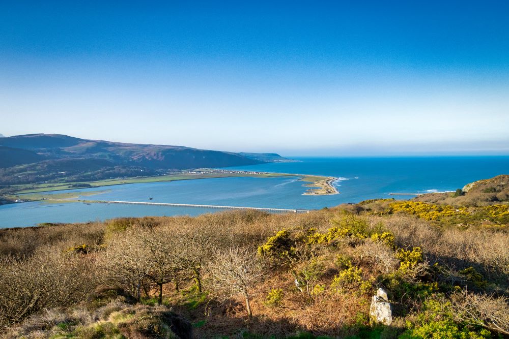
Aberdyfi Circular Walk
Aberdyfi is a popular seaside resort at the mouth of the Dyfi estuary, where extensive sandy beaches are uncovered twice daily by the tides. It’s a significant point on the Wales Coast Path, as the lack of a bridge across the estuary forces walkers on a two-day journey via Machynlleth, just to reach the other side at Borth. Barely five minutes are spent on the Wales Coast Path on this 4 mile / 6.5km walk, which instead explores farmland high above the village.
A path leaves Aberdyfi to climb through bushy scrub and heather, continuing at a gentler gradient through lush green fields to reach the farm of Trefeddian. This is all excellent grazing land for sheep, cattle and horses. Field paths lead to the neighbouring farm of Crychnant, then the farm access road links with a tarmac road signposted for the intriguingly named Bearded Lake. The road is known as the Panorama Walk, and it is followed up to a junction with the Wales Coast Path. If you can spare the time for a 5 mile / 8km extension, then the road provides a wonderfully scenic route to and from the Bearded Lake, or Llyn Barfog.
For the time being, head downhill along the farm road signposted as the Wales Coast Path, passing a couple of farms before entering a wooded valley at Allt-Goch, later emerging to enjoy splendid views across the tidal Dyfi estuary. The descent to Aberdyfi involves following a convoluted path and flights of steps that squeeze between houses that cling to a steep and rugged hillside.
The final part of the walk simply follows the road back into the centre of Aberdyfi, where there are plenty of places offering food and drink. Read the detailed route description for Aberdyfi
Top Tip
Consider extending the walk along the farm road known as the Panorama Walk, following the Wales Coast Path to and from Llyn Barfog.
We hope you have enjoyed these Circular Walking Routes in Gwynedd. There are many more exciting walking routes available to visit across Wales including all of the fabulous Welsh Coast Path Circular Routes.