This section of the Wales Coast Path comes in two distinct and contrasting halves, covering 56 miles / 90km. Gower was the first Area of Outstanding Natural Beauty, recently renamed as a National Landscape, to be designated in Britain. We hope you enjoy this selection of Gower Circular Coastal Path Walks.
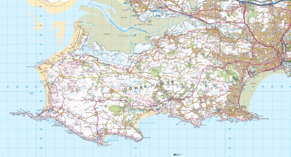
The rugged peninsula features saltmarshes, sand dunes, splendid cliffs and a succession of attractive villages, most of which have interesting old churches, quaint pubs and handy cafés. When the tide is out, with due consideration to safety, extensions from the coast path can include the rugged little islands at Worms Head and Mumbles Head.
From Mumbles to Swansea the Wales Coast Path follows a level promenade around Swansea Bay and the surroundings become increasingly urban, with The Tower at Meridian Quay forming a prominent landmark throughout. This is the tallest building in Wales at 107m, with 29 stories that are mostly residential and it must feature some apartments with tremendous views out to sea.
Naturally, Swansea is an excellent transport hub, with fleets of buses serving all the Gower villages, as well as abundant buses and trains serving all the built-up areas around Swansea Bay. There is a wonderful maritime history to discover around the city, and a huge amount of redevelopment has taken place around the docks, where there are now apartments, hotels and restaurants.
The ruins of the 12th century Swansea Castle can be visited, along with the modern National Waterfront Museum. A wooden Norwegian Church has been preserved beside the docks and now serves as a nursery school. A notable son of Swansea was the poet Dylan Thomas, who later lived on other parts of the Wales Coast Path, including Laugharne in Carmarthenshire and Tenby in Pembrokeshire.
After crossing the Afon Tawe and walking through the docklands, the Wales Coast Path leaves Swansea by following the disused Tennant Canal.
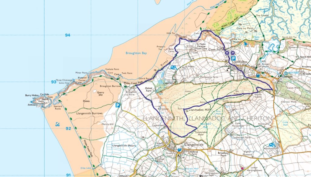
Llanmadoc Circular Coast Path Walk
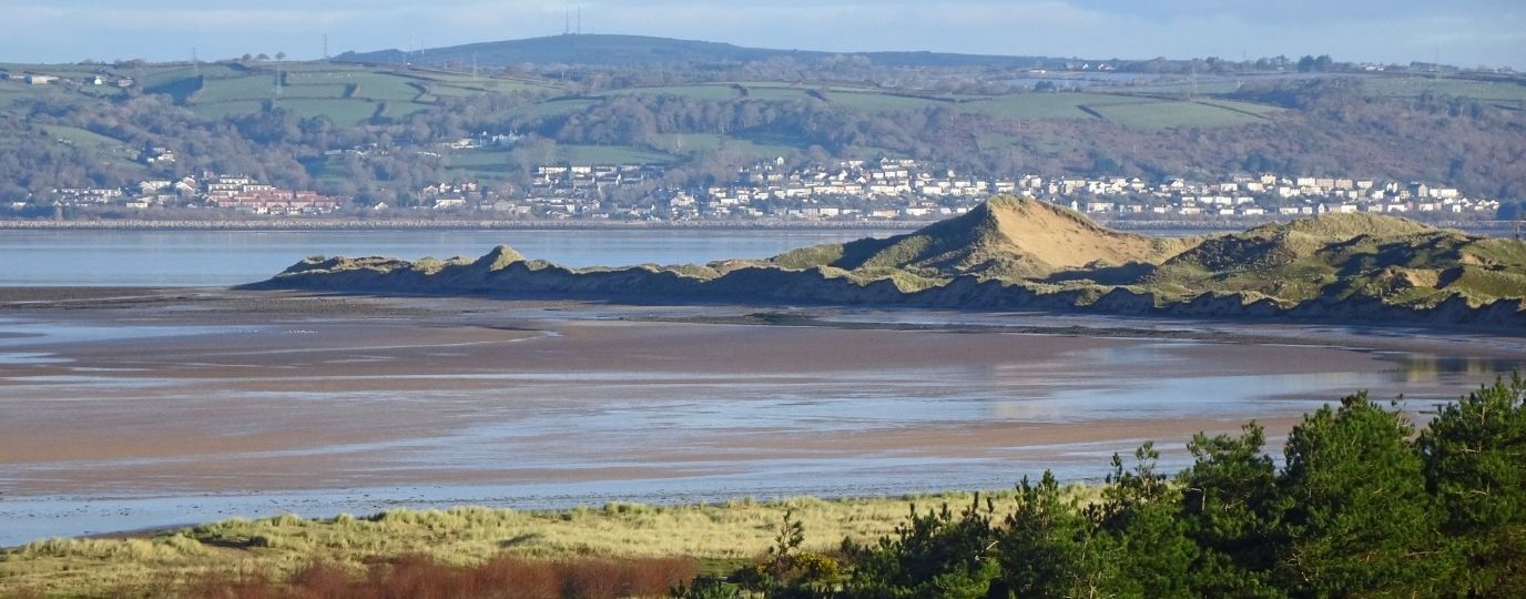
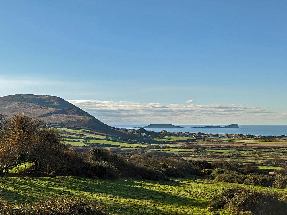
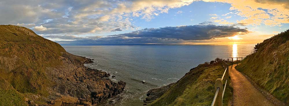
Llanmadoc and Llangennith are charming Gower villages on either side of the heathery Llanmadoc Hill. Views from the Wales Coast Path are splendid, but for the sake of a short climb an extensive panorama can be enjoyed, with the aid of a tongue-in-cheek view indicator. This 5.6 mile / 9km moderate coast walk and hill walk features two ancient churches, two lovely pubs and a delightful café.
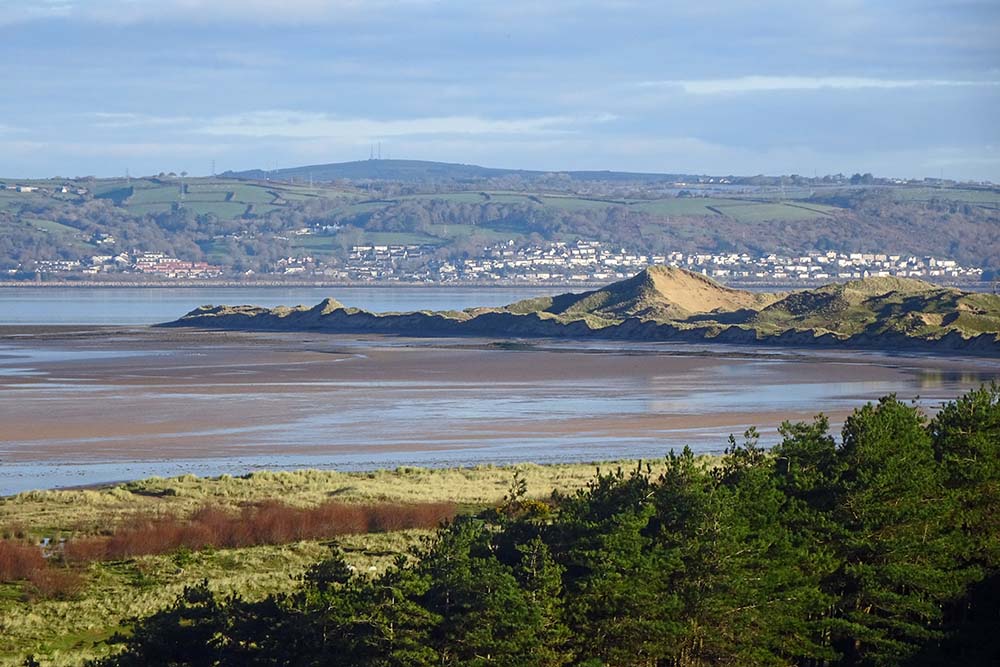
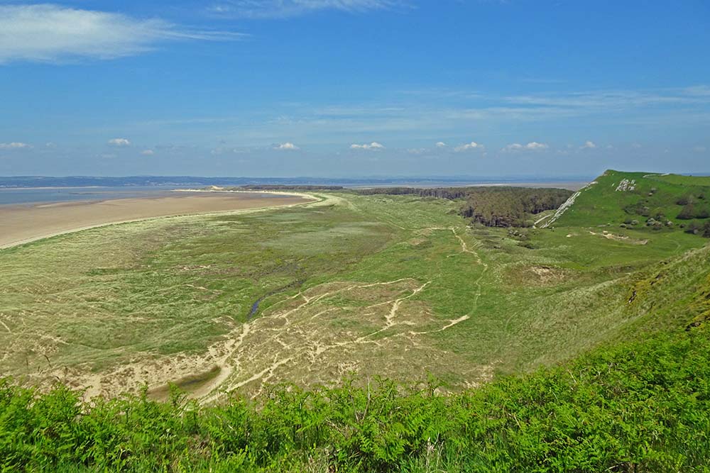
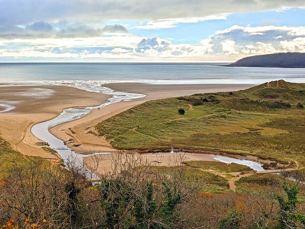
Leaving Llanmadoc, the Wales Coast Path has been diverted around Cwm Ivy Marsh and is joined at the Cwm Ivy Café. After passing the striking rock outcrop of Cwm Ivy Tor, the coast path rises and falls through lovely sand dunes and woodland close to Broughton Bay.
Heading inland, a field path rises gently to a farm and a road continues to Cockstreet. The road could be followed a little further to Llangennith, where the Kings Head Inn is located, along with St Cennydd’s Church, the largest church on Gower, founded in the 6th century and containing stonework from the 9th century.
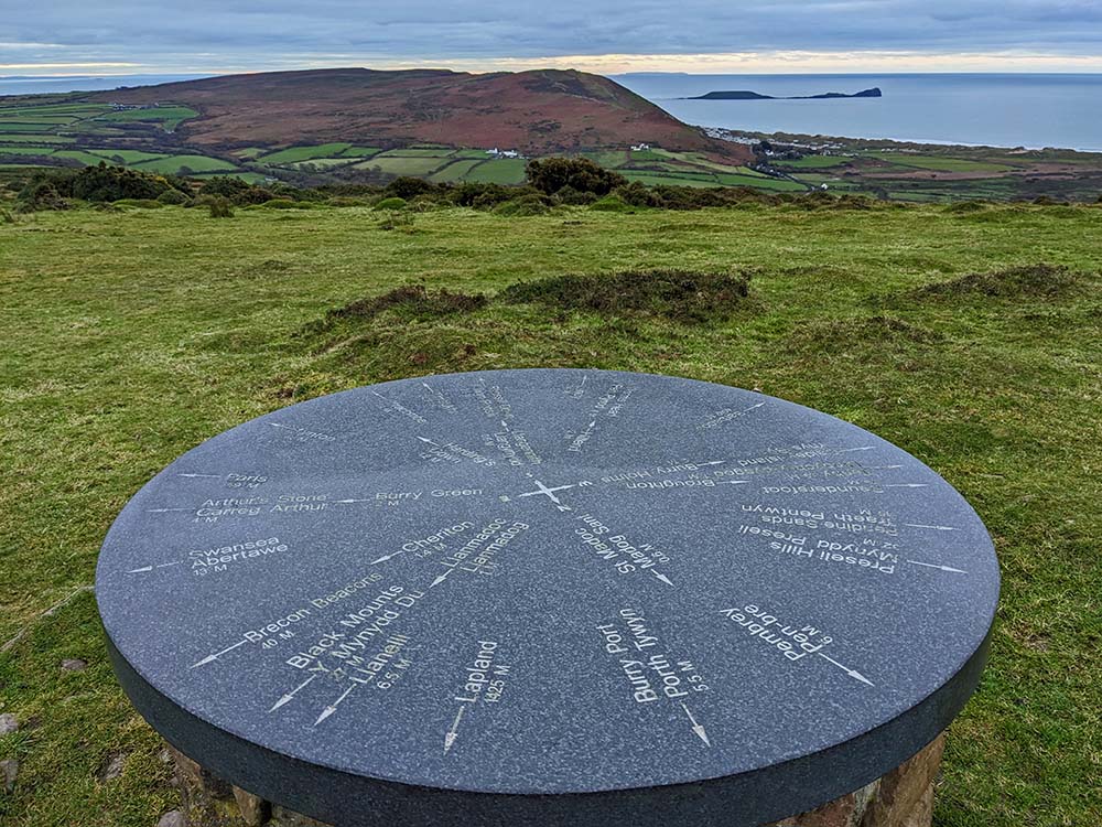
Broad paths criss-cross Llanmadoc Hill and a climb to the 186m summit reveals an extensive panorama. A view indicator points out features around South Wales and North Devon, but also gives directions to Timbuktu, Lapland and Barbados! An exhilarating walk traverses a heather moorland crest, passing Bronze Age burial cairns to reach the complex ramparts of an Iron Age hillfort known as The Bulwark.
Descending from the hill, spot the ruins of Llanmadoc School, then walk across the lower slopes to return to Llanmadoc. St Madoc’s Church, one of the smallest on Gower, contains stonework as old as the 5th or 6th century. The Britannia Inn offers food and drink. Read the detailed route description for Llanmadoc
Top Tip
Spare the time to visit the ancient churches and cosy country pubs in the villages of Llanmadoc and Llangennith. See how far you can identify places from the top of Llanmadoc Hill.
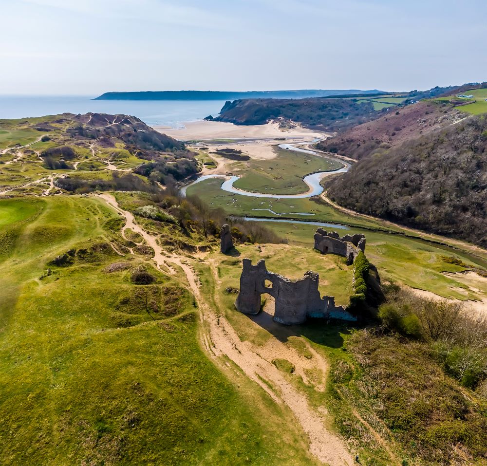
Oxwich Circular Coast Path Walk
The Oxwich National Nature Reserve encompasses a range of diverse habitats, including woodland, grassland, sand dunes, ponds, tidal creeks, marshland, rocky outcrops and exposed sand and shingle beaches. A rather convoluted figure-of-eight route measures 5 miles / 8.1km, and could be covered in two halves – one half making a circuit of Oxwich Burrows and the other half exploring Nicholaston Woods.
A fine stretch of the Wales Coast Path links with other colour-coded waymarked paths, while noticeboards explain about the wealth of flowering plants, birds, insects and animals that might be spotted around the reserve. Ponies are grazed on the dunes in order to control scrub and encourage a range of plants to flourish.
Start near the little village of Oxwich and follow the Wales Coast Path through the undulating vegetated dunes of Oxwich Burrows, where there are grassy and wooded areas. A footbridge spans a tidal creek to give access to tracks and paths exploring Nicholaston Woods, where trees grow densely on a steep limestone slope, but still offer occasional coastal views.
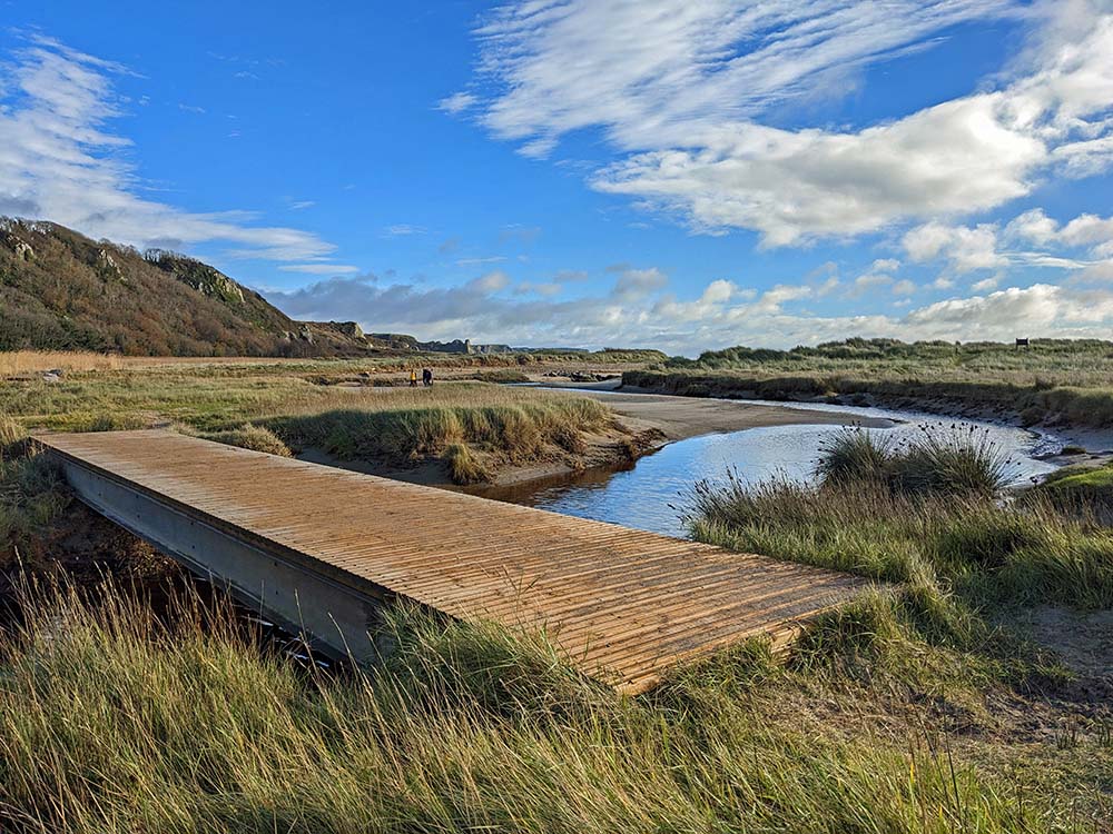
Leaving the woods, another stretch of the Wales Coast Path passes through Nicholaston Burrows and crosses two footbridges over tidal creeks, then a splendid beach walk leads back to Oxwich to finish.
By all means retire for food and drink at one of the cafés or restaurants around the village, or consider following another short stretch of the Wales Coast Path in the other direction to visit the nearby St Illtyd’s Church, hidden in Oxwich Woods and founded on the site of a 6th century cell. The church is one of several that are linked by the Gower Pilgrimage Way. Read the detailed route description for Oxwich
Top Tip
Check the noticeboards that explain about the flowering plants, birds and animals that can be spotted around the Oxwich National Nature Reserve.
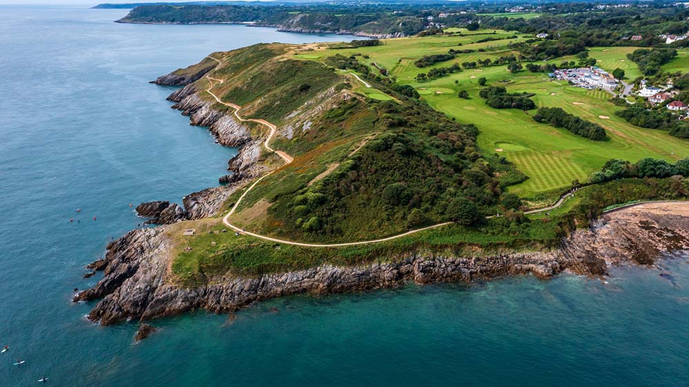
Mumbles Hill & Caswell Bay Circular Coast Path Walk
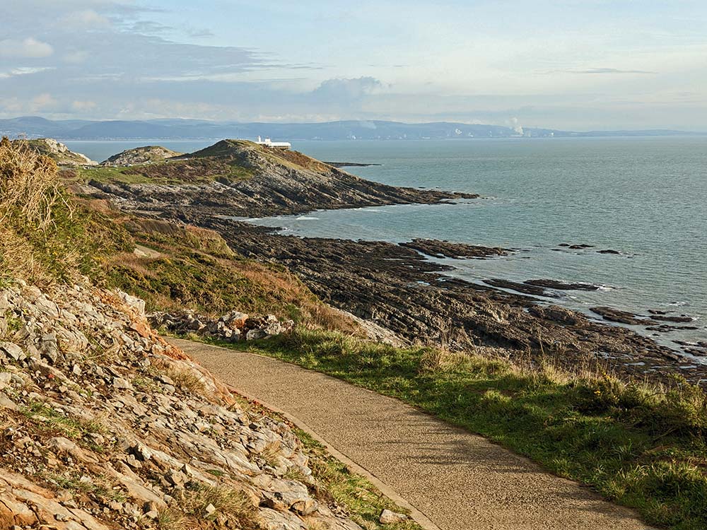
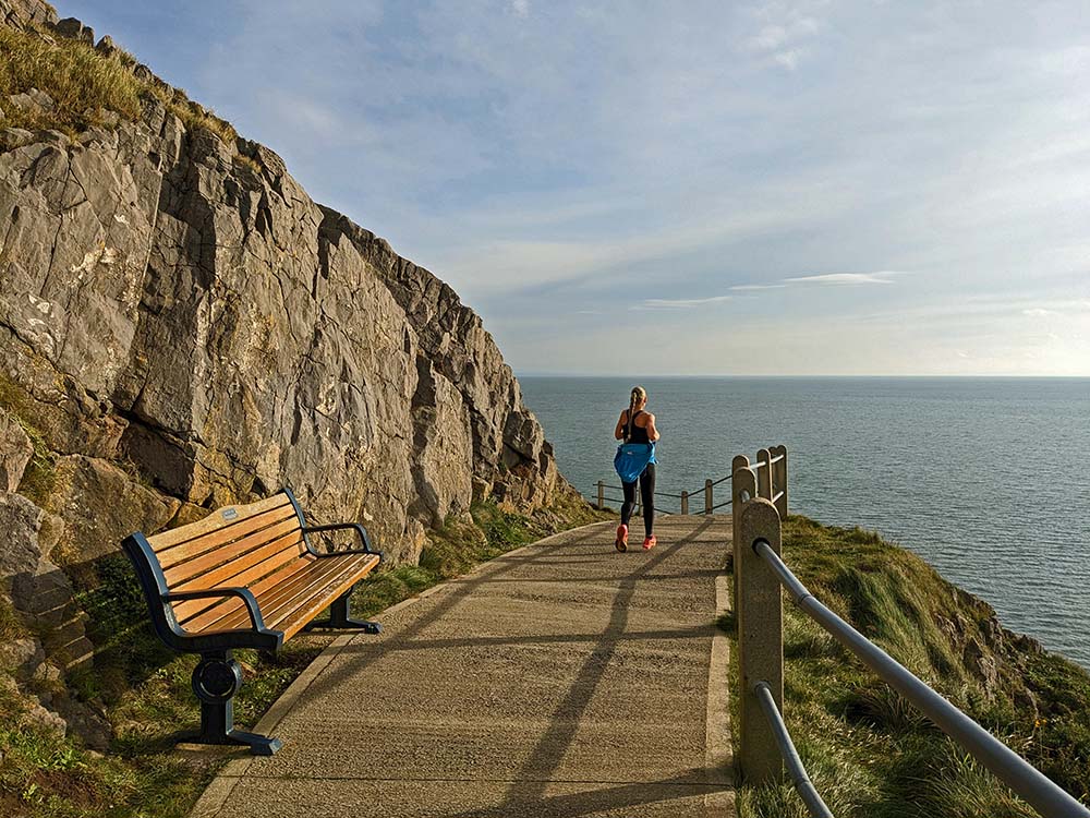
Mumbles is urban, but it boasts green spaces, nature reserves and a splendid stretch of the Wales Coast Path, all contained in a 7.7 mile / 10.8km walk. Start at Bracelet Bay, overlooking two rocky islands at Mumbles Head. Climb onto the Mumbles Hill Nature Reserve for a view of Swansea Bay. The wooded crest is a remarkable wildlife corridor that also includes wartime gun emplacements. Quiet roads and urban paths are followed through Langland, and if the walk needs to be cut in half, simply walk down Rotherslade Road to the tiny Rotherslade Bay.
The delightful Bishop’s Wood Local Nature Reserve is explored from top to bottom, passing the curious Roundhouse shelter. The Wales Coast Path is joined at Caswell Bay, where there is a popular beach and a café. The coast path is broad, obvious and easy, despite traversing rugged slopes and cliffs.

Expect to meet all sorts of people, and despite being close to urban areas, the coast path feels quite remote, especially when turning round the headlands of Whiteshell Point and Snaple Point.
Langland Bay features another busy beach and an opportunity to stop for snacks. Note how the 19th century Scottish Baronial style of Langland Manor contrasts with the simple beach huts that encircle the bay. Another broad, obvious and easy path continues past the tiny Rotherslade Bay, then the path rises round rocky Rams Tor, with no habitations in view. Make the most of the sea air on the way to Limeslade Bay, which quickly gives way to Bracelet Bay. Read the detailed route description for Mumbles Hill & Caswell Bay
Top Tip
Easily access by bus from Swansea. Read the noticeboards at the nature reserves and enjoy one of the easiest cliff walks on the Wales Coast Path.
Oystermouth & Mumbles Head Circular Coast Path Walk
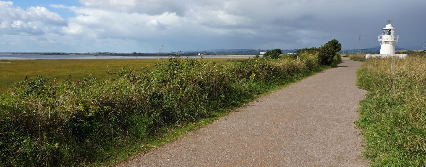
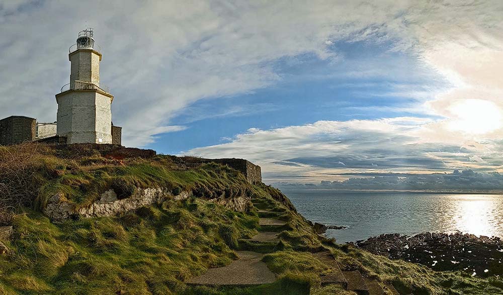
Oystermouth sounds like the sort of place you might find pearls, and Oystermouth Castle is definitely a treasure, standing on a hill yet hidden from sight. A lovely walk of 4.6 miles / 7.5km wanders through the suburbs of Mumbles, seeking out a variety of green spaces as well as encircling the headland on a splendid stretch of the Wales Coast Path. If the tide is out, a lighthouse can be visited on Mumbles Head.
Oystermouth Castle is the centrepiece of a fine little park, and it was rescued from a ruinous state in the 1840s and subsequently gifted to Swansea Corporation. Paths squeeze between allotments and houses, climbing higher and higher through the suburbs to follow a path across a wooded slope. Walk down through the interesting Oystermouth Cemetery, passing four magnificent pine trees. The next green space is a sports pitch where a café might be open, followed by steps climbing through a wood. Rotherslade Road runs down to the tiny Rotherslade Bay, joining the Wales Coast Path at another café.
A broad, obvious and easy path rises round rocky Rams Tor, with no habitations in view. Continue to Limeslade Bay, which is soon followed by Bracelet Bay, overlooking two rocky islands at Mumbles Head. If the tide is out, it is possible to walk to the island crowned with a lighthouse, there-and-back from Mumbles Pier. It’s an extra 0.7 mile / 1.1km, crossing loose and slippery pebbles. All that remains is a flat and easy promenade walk passing a harbour to finish back in Mumbles. Read the detailed route description for Oystermouth & Mumbles Head
Check The Tides
Visiting the islands at Mumbles Head can only be done when the tide is out, and remember that the beach walk there-and-back is quite rugged.
We hope you have enjoyed these Gower and Swansea Circular Walking Routes, it’s great to have a list of routes that are available to those travelling by rail, a fun way to explore the countryside.
There are many more exciting walking routes available to visit across Wales including all of the fabulous Welsh Coast Path Circular Routes.

By National Trails & The Wales Coast Path
Natural Resources Wales manages an extensive network of trails, including three National Trails: Glyndŵr’s Way, Offa’s Dyke Path, and the 870 mile long Wales Coast Path. These trails offer a variety of walking, cycling, and horse-riding routes through some of the most stunning landscapes in Wales. Their commitment to maintaining these trails ensures that visitors can enjoy the natural beauty and historical significance of the Welsh countryside.