At Ordnance Survey our mission is to help you explore the outdoors with confidence, so we’re excited to partner with the TCS London Marathon MyWay. Whether you want to amble along country lanes or power up and over hills, this is your chance to complete 26.2 miles however and wherever you wish on Marathon Day — 27th April 2025. What is more you’ll get the same TCS London Marathon medal and finishers t-shirt as the thousands finishing on the Mall.
Perhaps you want to avoid the crowds of a larger race? Take part even if you didn’t get a place in the ballot? Or do you prefer trails to tarmac? Here’s your chance. Wheel it, run it, or walk it: there are so many great OS Maps routes to explore as you plan your TCS London Marathon MyWay.
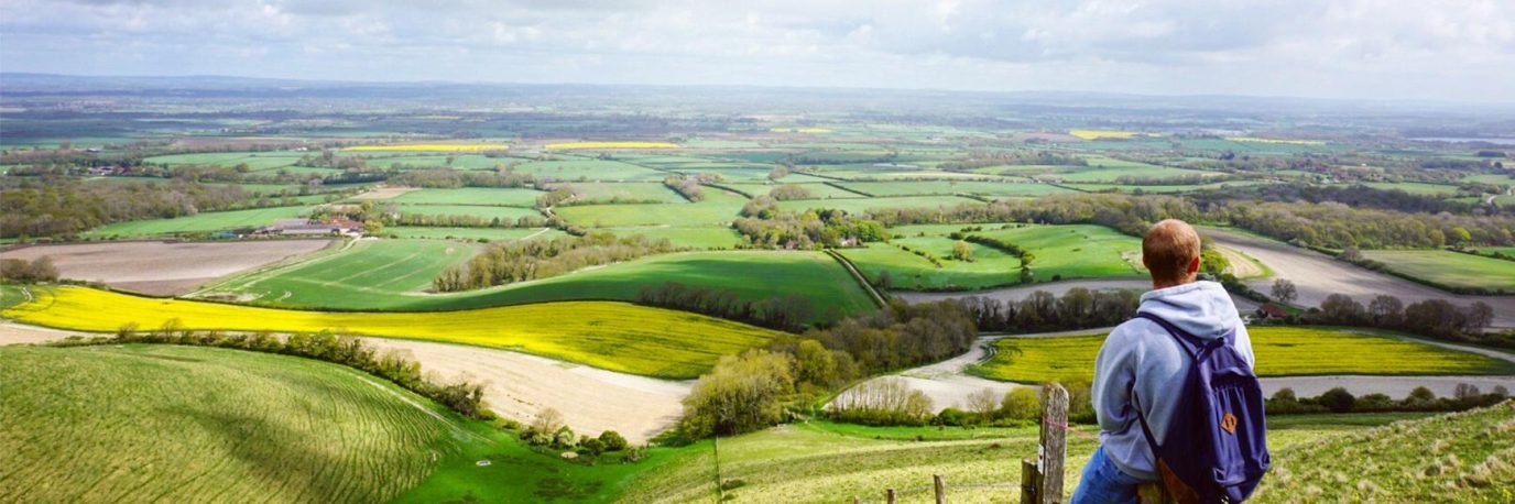
1. Richmond Park: Inclusive Adventure
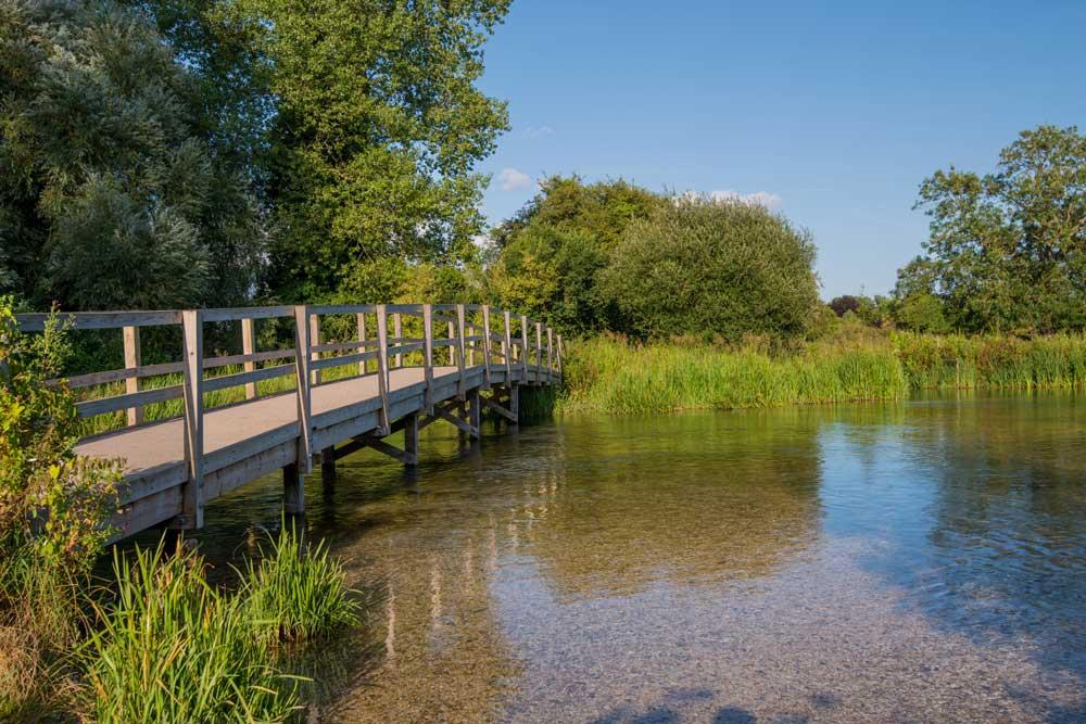
The TCS Virtual London Marathon MyWay welcomes everyone, including wheelchair users to participate. Maybe you can complete your marathon by embarking on an inspiring journey through Richmond Park? Completing just four laps of this scenic route is all it takes to achieve the marathon distance. Richmond Park has been a training ground for Paralympian David Weir, adding to its significance for athletes of all abilities. While Weir will cross the finish line at the Mall on April 21st, Richmond Park holds a special place in his training regimen. Join the MyWay marathon and experience the thrill of conquering this wheelchair-friendly course in the heart of London.
Richmond Park Route in OS Maps
2. Yorkshire: Conquer the Summits
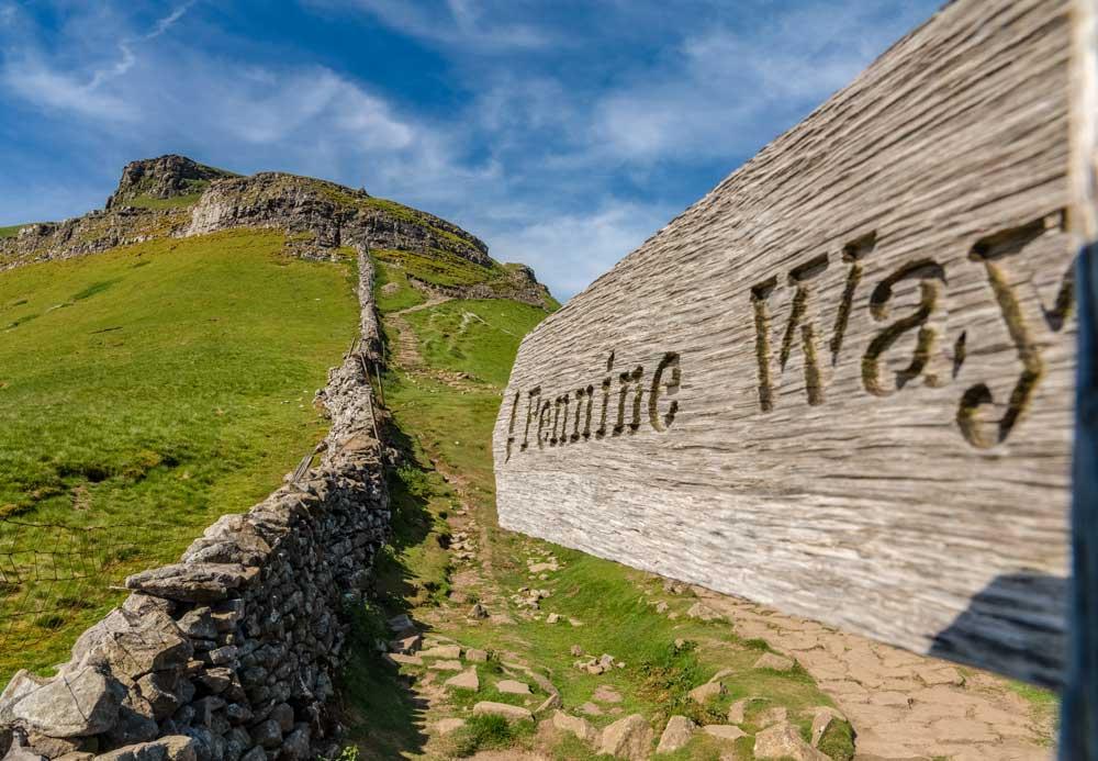
Summit Pen-y-ghent, Whernside, and Ingleborough in the Yorkshire Three Peaks Challenge, testing your endurance and determination. As you ascend each peak, you’ll encounter trials, but the sense of achievement at the summit is unparalleled. This iconic MyWay marathon challenge allows you to push your limits and experience the rugged beauty of Yorkshire’s landscape like never before. Feel the adrenaline coursing through your veins as you tackle steep ascents and rocky terrain, pushing yourself to new heights both physically and mentally. Revel in the breathtaking panoramic views from the summits, where the rolling hills and expansive skies stretch out before you in all their glory.
Yorkshire Three Peaks Challenge in OS Maps
3. Manchester: City Exploration
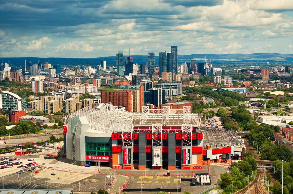
Experience the dynamic energy of Manchester with an urban MyWay marathon through its lively streets and iconic landmarks. This route offers a glimpse into Manchester’s vibrant culture and heritage, from the Northern Quarter to the historic Old Trafford, home to one of the most famous football teams in the world — Manchester United. Continue through Sale onwards to the end of the tramline in Altrincham. From there it’s up through Wythenshawe and back into the city centre to toast an exceptional achievement. Whether you’re a seasoned runner or new to the sport, this journey through Manchester promises an exhilarating experience that celebrates the city’s past and present.
Manchester Marathon in OS Maps
4. Dorset: Old World Charm
Nestled in the heart of Thomas Hardy country, near Cerne Abbas, lies a picturesque village exuding old-world charm. Despite its tranquil appearance, hidden amidst the surrounding hills are numerous tracks and trails waiting to be explored by walkers and runners alike. This corner of England is surprisingly devoid of crowds, offering solitude and serenity. With hilltops barely breaking the 250m contour, expect short yet steep climbs and breathtaking descents. Whether dry or wet, this MyWay route promises an unforgettable adventure in the English countryside.
5. North Wales Pilgrims’ Way: A Journey of Discovery
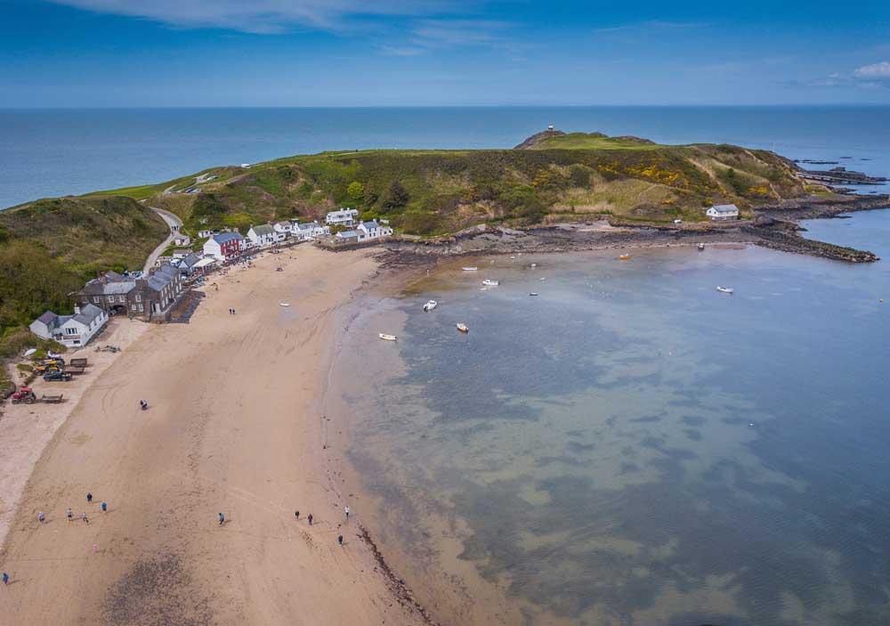
Embark on a MyWay marathon journey along a segment of the North Wales Pilgrims’ Way, retracing the paths of ancient travellers along the Wales Coast Path. Covering 26 miles, this trail gives a taste of the full 135-mile route, offering awe-inspiring coastal vistas and significant historical sites throughout. Whether you’re drawn by the pilgrimage’s spiritual significance or enticed by the natural wonders of the landscape, this trail is a true adventure through the heart of North Wales. Immerse yourself in the region’s rich history, breathe in the salty sea air, and revel in the serenity of this unforgettable journey
6. Scottish Highlands: Explore the Untamed
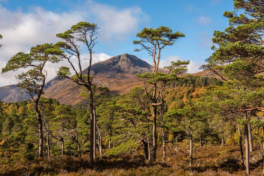
If Scotland has a perfect glen, it’s Glen Affric. Even before you reach the end of the narrow lane that infiltrates its steep wooded hillsides, you know you’re somewhere special. And you needn’t go too far beyond the road to fully appreciate the beauty of this mountainous paradise, with the loch glistening in the valley below you and the profiles of the highest mountains north of the Caledonian Canal peering over your right shoulder. The perfect glen also conceals a perfect campsite: a small patch of football-pitch-flat, deer-shorn grass, that backs onto a stunning white sand beach at the western tip of the loch. It’s an ideal place to spend a night even if you weren’t going any further. As a base camp for the magnificent Cluanie Horseshoe – one of the Highlands’ best mountain walks or runs – it’s even better.
7. Dartmoor: Wilderness Challenge
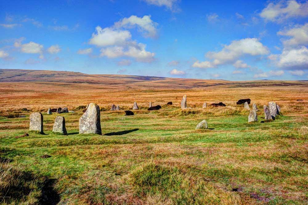
There are many reasons why people walk and run in Dartmoor National Park, not least because of the rich landscape and history. It also offers a wilderness challenge, epitomised by this exhilarating circuit. Close your eyes and imagine standing beside Grey Wethers Bronze Age dual stone circle at sunrise, then looking north to the outline of countless whaleback ridges. This MyWay marathon route offers far more than that, of course. It traverses lesser-known hills, passes the remains of a Medieval clapper bridge, and meanders along ancient trackways before reaching the high moor.
8. Lake District: Connect with Nature
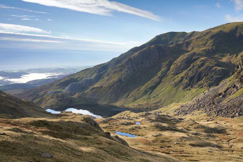
Journey off the beaten path in the Lake District, where little known gems await amidst the Coniston and Langdale Fells. This wilderness trail run leads you beyond the well-trodden routes to discover lesser-known summits and valleys. Push your limits, challenge your endurance, and fully immerse yourself in the untamed beauty of one of Britain’s most iconic landscapes. From rugged trails to wide open vistas, every step offers a chance to connect with nature and explore the true essence of the Lake District.
Old Man of Coniston walk in OS Maps
9. Northumberland: Nature’s Playground
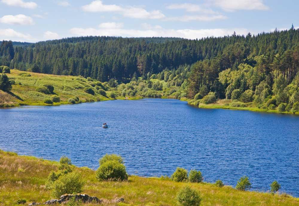
Tucked away at the head of the North Tyne valley, close to the Scottish border, lies beautiful Kielder Water – a vast man-made lake, nine miles long, with 27 miles of shoreline: the perfect distance for a MyWay marathon. Opened in 1982 to provide water for the north-east, the reservoir covers 2,740 acres and can hold 200,000 million litres of water. Kielder’s superb situation, among the Northumberland hills and surrounded by forest, is a great escape for a few. After your marathon, there’s also a wide range of watersports available, plus walking and cycling opportunities. This area is famous for its dark skies as well, so on a clear night expect a stunning view of the Milky Way in all its glory.
10. Staffordshire: Varied Terrain Adventure
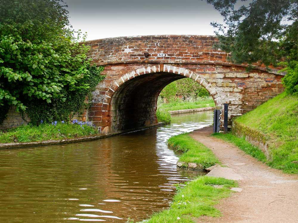
Get ready for a thrilling MyWay traverse through the landscapes of north-west Staffordshire, from Mow Cop to the Shropshire border near Market Drayton. This exhilarating route winds through Kidsgrove Bank, Red Street, Black Bank, Madeley, Black Brook, and Loggerheads, offering a mix of terrain. Encounter moorland vistas, remnants of coal mining, iron furnaces, and brick-making industries, along with lush farming countryside. Navigate sandstone ridges, like Maer and Ashley, as you push your limits and embrace the challenges of the course whilst immersing yourself in Staffordshire’s history and natural beauty.
11. Norfolk: The Edge of England
Explore the enchanting Tas Valley with a thrilling MyWay marathon through its captivating landscapes and history. Follow ancient pathways winding through countryside dotted with charming villages and fertile farmland. The route traces the meandering River Tas. Its waters irrigated soil and powered mills, contributing to the region’s important agricultural heritage, and shaping England’s rural landscape. Whether you’re a seasoned athlete seeking a new challenge or a beginner yearning for adventure, the Tas Valley offers an unparalleled experience, weaving together the natural beauty and cultural richness of England’s heartland.
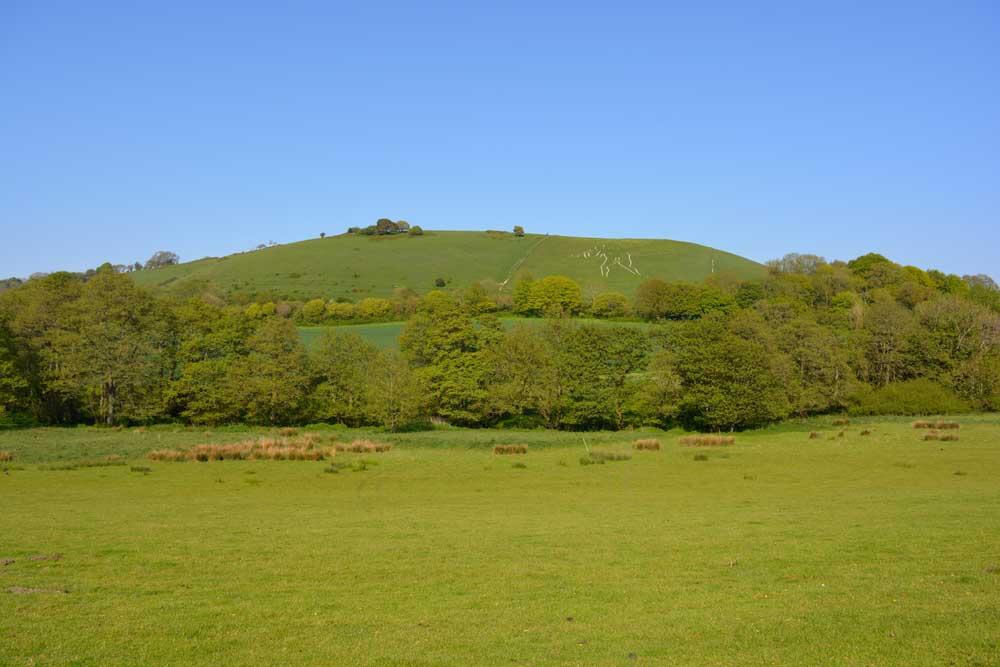
12. Wessex Downs: Run Through History
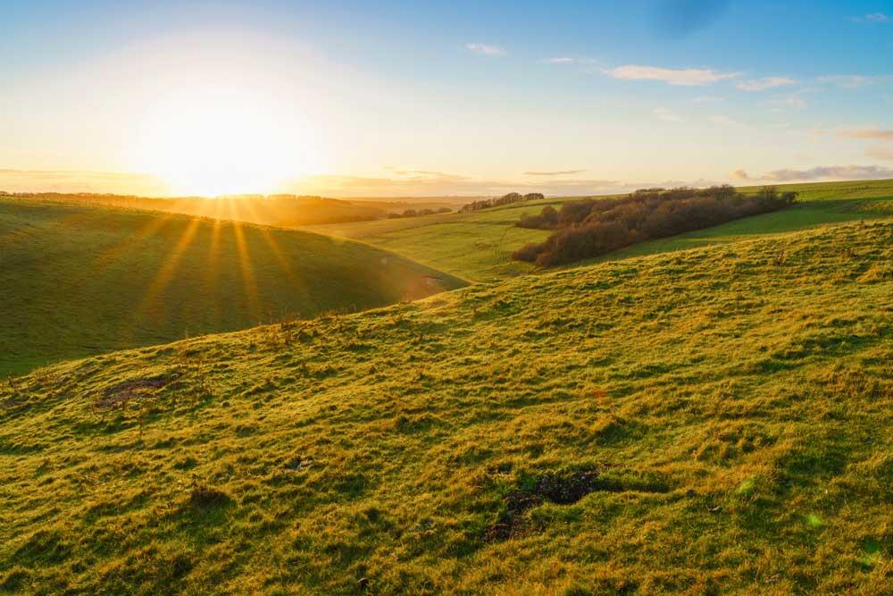
Enjoy a weekend MyWay marathon trail over the gentle contours of the Lambourn Downs, south-west of Wantage. This area is renowned for its racehorse stables, and the springy turf of the Downs makes for ideal long-distance adventures. The route starts in the village of Lambourn and follows the eponymous river, which rises in the downs and flows to the River Kennet at Newbury. After passing the pretty village of East Garston, the route leaves the valley in favour of the Downs. The next section follows part of the Ridgeway, a long-distance route which stretches for 85 miles from near Avebury in Wiltshire to Ivinghoe Beacon in Buckinghamshire. It follows the line of ancient trackways across the country. Many have been in use for more than 5000 years, making them some of the oldest roads in Britain. After passing the famous Uffington White Horse, you descend back to the village of Lambourn.
13. Glasgow: Above Ground Exploration
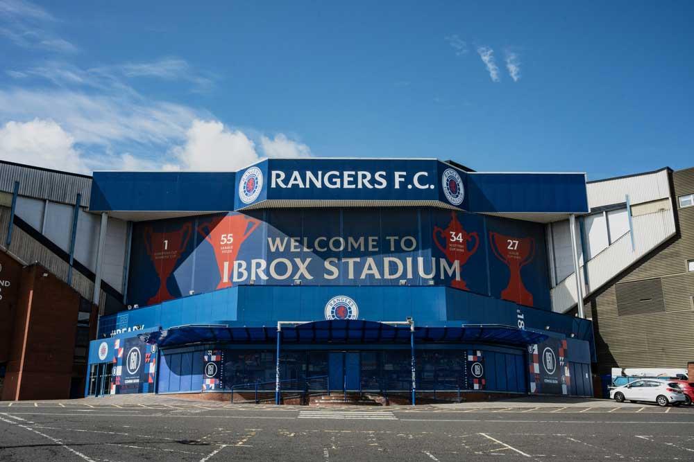
This MyWay marathon option is very loosely based on the Glasgow subway – but why not do it above ground on two feet and truly experience the city? Explore Glasgow’s vibrant streets and landmarks on foot, gaining a fresh perspective on the city. This route leads you through bustling neighbourhoods and iconic attractions, offering a glimpse into Glasgow’s rich cultural tapestry. Discover the footballing homes of Celtic, Rangers, and Partick Thistle, immersing yourself in the city’s sporting heritage. Feel the pulse of Scotland’s largest city as you soak up its energy and excitement. Whether you’re a visitor or a local, this urban adventure promises a unique way to experience Glasgow’s dynamic atmosphere and uncover its charms. Embark on a journey through Glasgow’s streets and immerse yourself in its culture and history.
Glasgow Underground Walk on OS Maps
14. Belfast: City and Seaside Exploration

This Northern Ireland classic offers a blend of city and seaside delights. Starting at Belfast’s bustling docks, this MyWay marathon route follows the picturesque coastline to Bangor. Enjoy the refreshing sea breeze and scenic vistas before looping back towards the city. With luck, the wind will be at your back as you return! Explore the vibrant cityscape and tranquil seaside landscapes on this memorable journey. Whether you’re an experienced runner or a casual adventurer, this route promises an invigorating experience that showcases the best of Northern Ireland’s urban and coastal charm.
Belfast Lough Route in OS Maps
This is just the start, whether you’re a seasoned explorer seeking wilderness solitude or a casual wheeler or jogger pushing your limits, there are so many fantastic OS Maps routes to consider as you plan your TCS London Marathon MyWay adventure. From rugged moorlands to tranquil lakeshores, historic trails to bustling city streets, there’s a journey waiting for you, so lace up your trainers, hit the trails, and create unforgettable memories in Britain’s great outdoors.