Find accessible routes near you
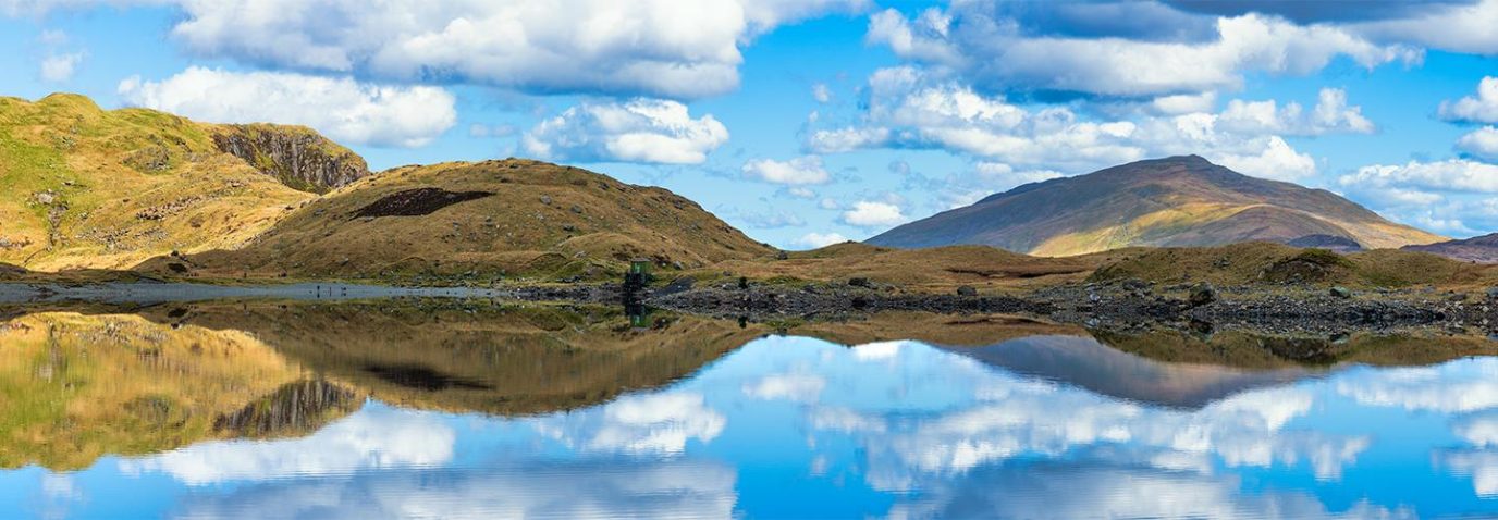
We asked our friends at Access TOG and Access The Dales to share their favourite stile-free walks. Whether you’re a wheelchair user, a family with a buggy or recovering from an injury, these accessible routes make it easier to enjoy the great outdoors. Here are the best stile-free walks in Britain.
Quick scroll to:
There are many reasons why an accessible walk suits you and you may often wonder how to plan a route without stiles as it’s not always clear where they are. That’s where a route description and route reviews/comments come in handy! There are some great resources online which help make it easier to find stile-free walks, including OS Maps which includes all these stile-free walks and more.
Discover hundreds of thousands of routes, or plot your own, with a free trial of OS Maps.
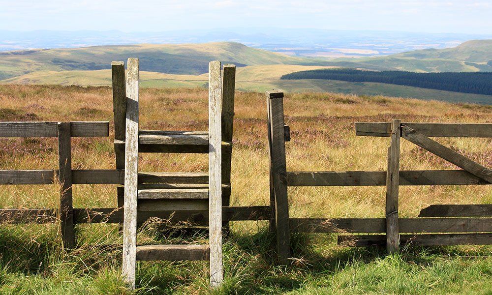
Stile
The Miles Without Stiles initiative includes a selection of well-surfaced, easy-access routes without stiles, steps, or steep gradients in National Parks across Britain. Participating National Parks have mapped out suitable walks for all ages, fitness and abilities – just visit the National Park’s website to see if they’re involved. The Outdoor Guide also has an extensive collection of wheelchair walks and Access The Dales focuses on walks around Yorkshire and includes a great deal of useful information from Debbie North about wheelchair hubs (where you can borrow specialist wheelchairs), accessible amenities (like cafes and loos) and accessible things to do all over the country.
Let’s take a look at some of Britain’s best stile-free walks…
South East England
Cliveden, Buckinghamshire
The Cliveden Views walk is a great one for all the family, even with wheelchairs, push chairs or bicycles. The views from the top of this cliff edge have been enjoyed for years and never fail to amaze.
Recommended by The Outdoor Guide.

Cliveden stile-free walk
Distance: 1.67 miles / 2.69km
Difficulty: Easy
Start/Finish: National Trust Cliveden Carpark
York and Humber
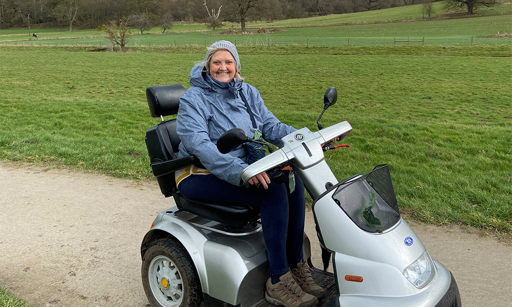
Gordale Scar, Malhamdale, Yorkshire Dales
This is one of the Yorkshire Dales National Park’s Miles without Stiles. A short walk but highly recommended, as the finale of this ramble ends in high sided limestone gorge of Gordale Scar, with dramatic waterfall and stunning scenery. The route follows the Gordale Beck on a rough track that is suitable for a sturdy all-terrain vehicle. Please note, this route is unsuitable for a manual wheelchair. There is off road parking by the entrance to the campsite. Accessible toilets are available in the Yorkshire Dales National Park car park.
Recommended by Debbie North from Access The Dales
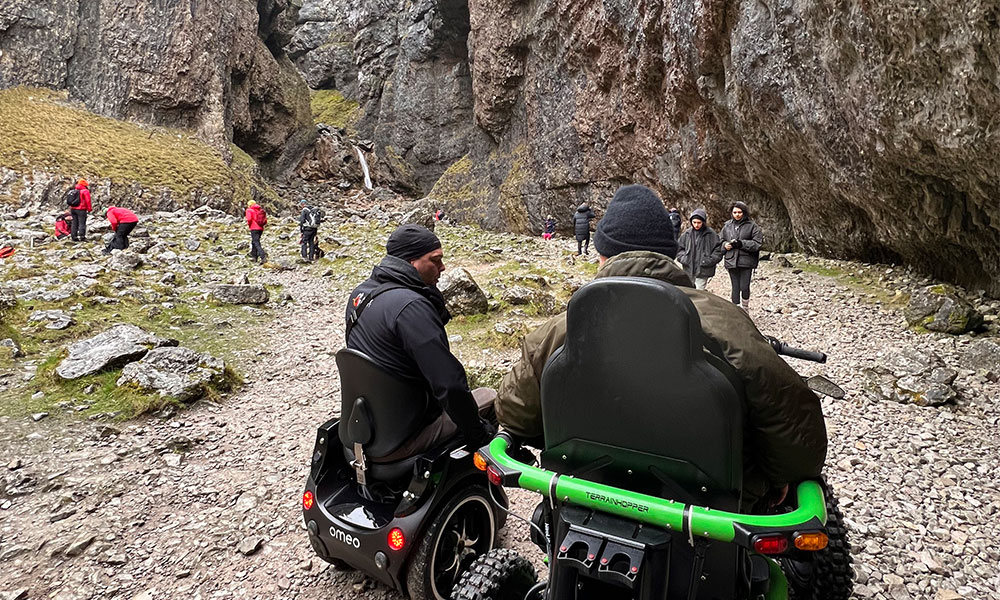
Debbie North at Gordale Scar
Gordale Scar stile-free walk
Distance: 0.67 miles / 1.1km
Difficulty: Easy
Start/Finish: Gordale Scar campsite, BD23 4DL
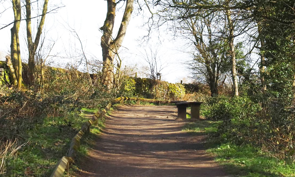
Loxley Valley, Sheffield
This short linear walk is an idyllic woodland ramble along a stile-free path in Loxley Valley. It is a haven for nature lovers, with bird life in abundance. It is perfect for a manual wheelchair user. The surface of the paths is compacted gravel and is suitable for wheelchairs. The entrance/exit is 93cm wide at the widest part and can easily accommodate wheelchairs. The path is mainly flat.
The route is clearly visible, just follow the path along the River Loxley. the route continues past the mill pond on your left and then continuing forward the path narrows as you pass by the house. Just after the house, the path turns sharply to the left, continues between two stone walls and comes out onto a broad flat lane (Black Lane).
Manual wheelchair users may need a helpful push up the short incline. You emerge onto on a very quiet country lane. You can continue along the road to Loxley Road or return the way that you came. There are several benches along this walk.
Recommended by The Outdoor Guide
Loxley Valley stile-free walk
Loxley Valley stile-free walk
Distance: 1.2 miles / 1.7km
Difficulty: Easy
Start/parking: Rowell Lane S6 6SH (opposite Rowell Bridge Water Pumping Station), where off street parking is available.
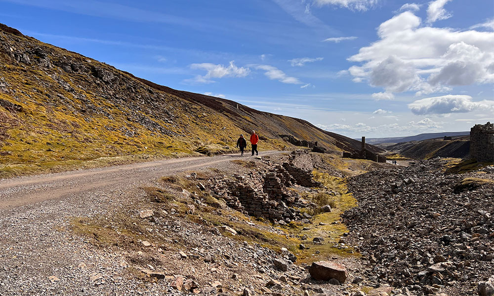
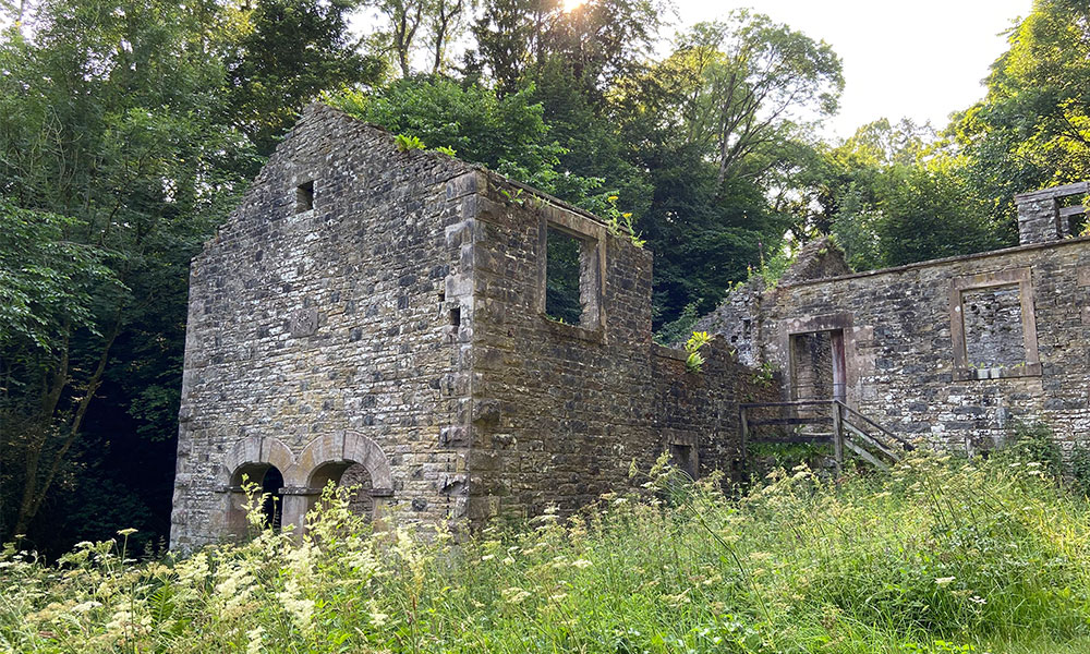
Old Gang Mines, Swaledale Yorkshire Dales
This smelting Mill was the largest to operate in Swaledale, and the main part of what is still standing was built in 1846 and operated until 1907. The ruins are one of the best-preserved lead smelt mills in the North Penninesand is now a Scheduled Ancient Monument.
The circular route follows the River Swale and passes by the mill before heading out onto the moors. The path rises gently to the indistinct summit of Great Pinseat. The route continues a bridle path back onto a minor road which lead you back to the car parking area. Because of the rough terrain and gradients, I would recommend a sturdy all-terrain wheelchair.
Nearest accessible toilets are in Reeth and Gunnerside. Recommended by Debbie North from Access The Dales
Old Gang Mines stile-free walk
Old Gang Mines stile-free walk
Distance: 5.5 miles / 8.9km
Difficulty: Moderate
Start/Finish: Surrender Bridge where there is parking
East England
Ickworth Estate, Suffolk
There are miles of track to explore at Ickworth House in Suffolk, all of which are wheelchair friendly. There is an all-terrain wheelchair to borrow from the National Trust Office too. The further you travel away from the house the more the scenery opens up. The route passes the church and the beautiful walled garden, which was built in the early 1700s. There are sweeping views across the pastures and woodlands. Refreshments are available at the Porter’s Lodge Café where you will find accessible toilets too.
Recommended by Debbie North from Access The Dales
Debbie North at Ickworth Estate
Ickworth Estate stile-free walk
Distance: 2.74 miles / 4.4km
Difficulty: Easy
Start/parking: Ickworth Estate National Trust Car Park
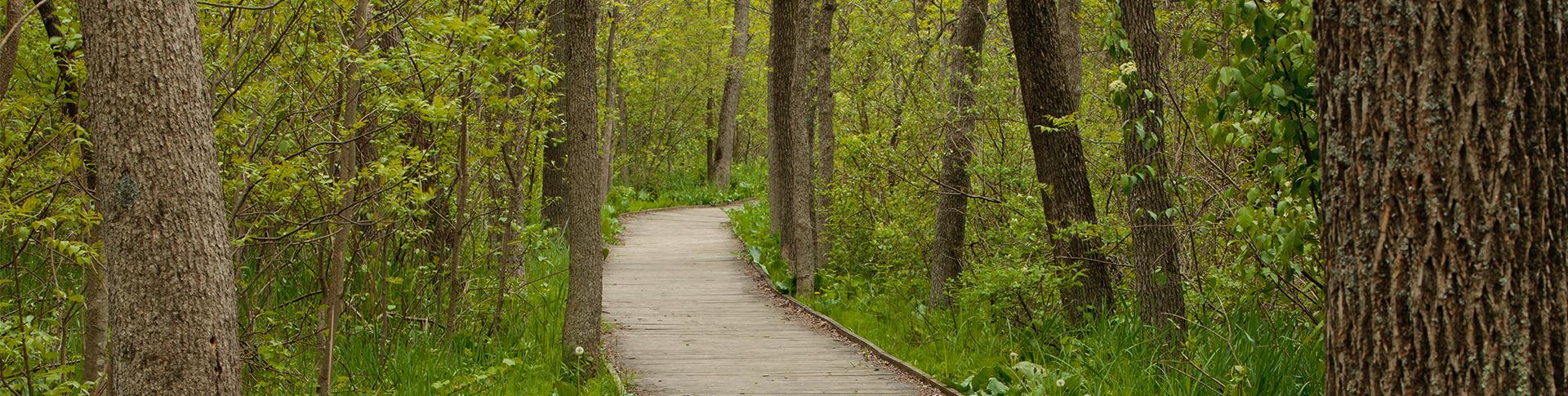
Barton Broadwalk, Norfolk
This short stroll on the southern edge of Barton Broad follows a boardwalk that unlocks a secretive woodland in the Broads National Park. This boardwalk is easily accessible by wheelchair and takes you on a journey of discovery into a lost world, which has remained isolated for half a century.
The mystery trail leads through a swampy, wildlife-filled woodland, emerging to give you glorious panoramic views over the second largest of the Norfolk Broads. The Norfolk Broads may be more famous for their waterways, but this short walk proves you can have just as much fun on foot as on boats in this beautiful National Park.
Recommended by The Outdoor Guide.
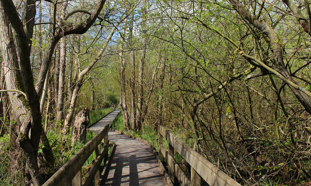
Barton Broadwalk stile-free walk
Barton Broadwalk stile-free walk
Distance: 0.4 miles / 0.7km
Difficulty: Easy
Start/parking: Irstead Road (two car parks nearby)
South West England
Boscombe Beach, Bournemouth
There are miles of golden sand at Boscombe Beach in Bournemouth together with 12 miles of promenade to enjoy. The beach features the UK’s first purpose-built accessible beach huts. Each hut has enough space for four wheelchair users, and access to an electric scooter charging point. For more information call 01202 451781. You can also access the pier which boasts great views along the shoreline.
Recommended by Debbie North from Access The Dales
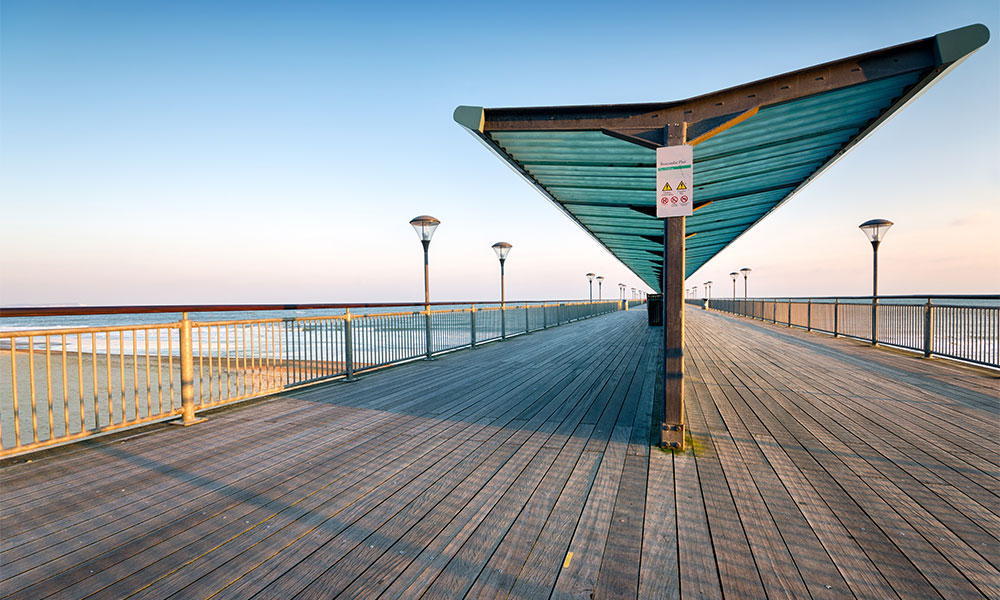
Boscombe Pier
Boscombe Beach stile-free walk
Distance: 2.5 miles / 4km
Difficulty: Easy
Start/parking: Boscombe Pier. Car park scattered along the coast and inland in Boscombe
Devoran to Bissoe Trail, Cornwall
This walk follows the route of the disused mineral tramway line, that in the 1800’s was used for the local copper mines. It is a Coast to Coast Trail, from the port of Devoran on the South Coast to the historic mining harbour of Portreath on the North Coast and is ideal for wheelchairs of all types as it follows a purpose built track and is generally flat.
You can do as much or as little of it as you like. For our walk we started the walk from the Devoran Bissoe Trail Car Park and followed the cycle trail to Bissoe, where there is a café and accessible loos. The route is very straight forward, just follow the track! Be aware, this route is popular with cyclists. Nearest Accessible loos: Old Conns Works, Bike Chain Bike Hire, Bissoe, TR4 8QZ.
Recommended by The Outdoor Guide.
Devoran to Bissoe stile-free walk
Devoran to Bissoe stile-free walk
Distance: 2.2 miles / 3.5km
Difficulty: Easy
Start/parking: Devoran Bissoe Trail Car Park
North West England
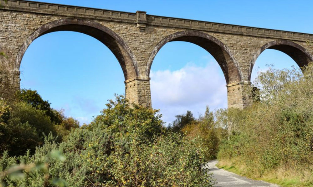
Threkeld to Keswick, Cumbria
The new and improved route between Threkeld and Keswick offers a 5km traffic-free tarmacked track and is very popular with people of all abilities. The walk is steeped in history and it is a haven for folk who love wildlife. The bridges that were damaged by storm Desmond have been repaired and the former board walk has been replaced by a tunnel.
The River Greta is roughly aligned with the railway track and there are eight bridges along the route that cross over the river. The River Greta begins its life near Threlkeld and flows west through Keswick before joining the Derwent just after the latter flows out of Derwent Water.
From the carpark in Threlkeld, head out of the village onto the cycleway which runs alongside the right-hand side of the A66 towards Keswick. Within 200m of leaving the village the track zigzags down onto what was the railway line. From here you get the first glimpse of the river.
Threkeld to Keswick stile-free walk
As part of the Woodland Management Plan a variety of species including willow, alder and oak have been planted along the way, as well as other shrubs, such as Guelder Rose, which provides food for bees and other pollinators. The tree lined path is home to much wildlife, whilst on the river heron and dippers can be spotted.
The routes come to an end at the old railway station. From here you can follow the quiet road down into Keswick. At the bottom of the steep road go through the gate on the left-hand side which leads into Fitz Park. Split into two areas covering 28 acres, Fitz Park is home to the local football, cricket, athletics, tennis and bowling clubs and has public tennis, bowling, putting and croquet available. There is also a sensory garden within the park.
There is a bus service which runs from Keswick back to Threlkeld, or alternatively you can retrace your steps. Disabled toilets are available at the railway station carpark, in Keswick and in Threlkeld. There are many pubs and cafes in Keswick which are wheelchair accessible and the Horse and Farrier Pub, as well as the community café in Threlkeld is accessible.
Recommended by Debbie North from Access The Dales
Threkeld to Keswick stile-free walk
Distance: 3.7 miles /
Difficulty: Easy
Start/parking: Threlkeld car park
The Howk, Calbeck, Cumbria
Named after the River Cold Beck, Caldbeck provided waterpower for the industries that developed along the river during the 17th and 18th centuries. Mills producing flour, wool, bobbins and paper, as well as a brewery flourished in this area. This riverside walk starts in the village and heads out towards the limestone gorge. Here you will see waterfalls and the remains of the old bobbin mill. It had the largest waterwheel in the country, 3 feet wide and 42 feet diameter. Retrace your steps back to the village and enjoy refreshments in Calbeck. An accessible toilet is available with a RADAR key at the Church in Caldbeck village.
Recommended by Debbie North from Access The Dales
Local Bobin mill during the Howk walk at Calbeck
The Howk stile-free walk
Distance: 1.2 miles / 1.9km
Difficulty: Easy
Start/parking: Car park in Calbeck, CA7 8DU
Wales
Llangollen Canal, Denbighshire
A welcome awaits in the valleys when you step out on this gentle 6-mile walk. A head for heights is a must because the high spot – literally – is the stunning Pontcytslite Aqueduct, 200 years old, with its 18 piers rising to a height of 126-feet and its 19 arches each with a 45-foot span.
The UK’s highest navigable aqueduct, it’s a World Heritage site and among Thomas Telford’s greatest legacies. The walk starts at Horseshoe Falls, a Telford designed weir, which feeds water into the canal from the River Dee, and ends at the picture postcard town of Llangollen.
Must sees include the pump-house between the river and canal – still operational today – and Pentre Fellin, once an important slate mining operation whose buildings now house a motor museum. The beautiful landscape makes it hard to imagine the days when coal and limestone travelled up and down the canal by barge.
Recommended by The Outdoor Guide.
Llangollen Canal stile-free walk
Distance: 6.7 miles / 10.8km
Difficulty: Easy
Start/parking: Horseshoe Falls, LL20 8RA
Scotland
Lochranz and Fairy Dell, Aran
The white cottage of Fairy Dell, believed to be the home of the fairies provides a great story for this coastal walk at the northern tip of the Isle of Arran, Scotland. The walk begins at Lochranz Castle which watches over peninsula and beautiful Loch Ranza. Continuing down the road and crossing over the bridge the road continues along the coastline. At the road end, the route continues over a grassy track around Newton Point. From here the path is now rougher and narrow and suitable only for a sturdy all-terrain wheelchair. It is possible, with care, to continue round the headland beneath the red sandstone cliffs to reach the whitewashed cottage at Fairy Dell.
There is off-road parking at the castle. There are accessible toilets at the ferry terminal at Lochrnaz.
Recommended by Debbie North from Access The Dales
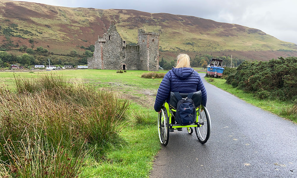
Debbie North at Lochranz castle
Isle of Arran stile-free walk
Distance: 2.3 miles / 3.7km
Difficulty: Moderate
Start/parking: Pakring at Lochranz castle, KA27 8HQ
Falkirk Wheel to the Kelpies, Falkirk
Two iconic landmarks celebrating Scottish industrial history in one short but spectacular walk through this busy lowland town. This short walk connects the stunning tourist attractions of the Falkirk Wheel and the Kelpies equine structures on the historic Forth and Clyde Canal. Two iconic landmarks celebrating Scottish industrial history in one short but spectacular walk through this busy lowland town.
Starting at the Falkirk Wheel – an immense rotating lift that connects boats to the Union Canal – you’ll wind through the outskirts of Falkirk on a section of the newly opened Queen Elizabeth II Canal, which forms the eastern gateway to the Forth and Clyde Canal.
This waterway was given the royal seal of approval in the summer of 2017, when it was officially opened by the Queen and the Duke of Edinburgh, and is regarded as one of the most complex waterways ever constructed in Scotland.
If the start at the Falkirk Wheel is impressive, the sight of the Kelpies is mind-blowing. The 30-metre high horse-head structures weigh 300 tonnes each and are the largest equine structures in the world. The statues celebrate the impact of horses on Scottish industrial history – pulling wagons, ploughs and barges – and are located in The Helix parkland, which is a great pace to explore at the end of the walk.
This route was voted 94th in a 2017 ITV poll to find Britain’s Favourite Walk. Recommended by The Outdoor Guide.
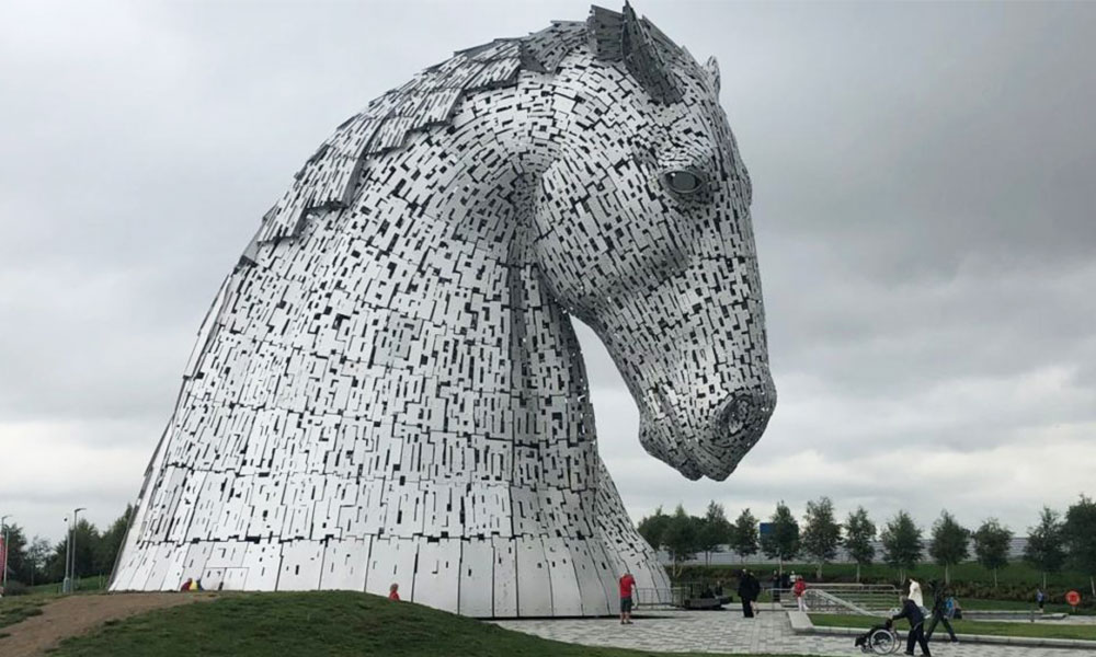
The Kelpies
Falkirk stile-free walk
Distance: 4.5 miles / 7.2km
Difficulty: Easy
Start/parking: Falkirk Wheel
Add these stile-free walks to your bucket list and have a go at finding your own in your local area. National Parks are home to a large number of stile-free walks but there are also other places to look. Disused railway lines, shorelines and boardwalks are great locations for an leisurely walk with relatively smooth stile-free surfaces, as are local parks and many lakes. The OS Lake District & Cumbria: Accessible Walks for All Pathfinder guidebook is a great place to start if heading to the Lake District. In this book you’ll find over 38 routes, all suitable for wheelchairs, buggies and those less abled.