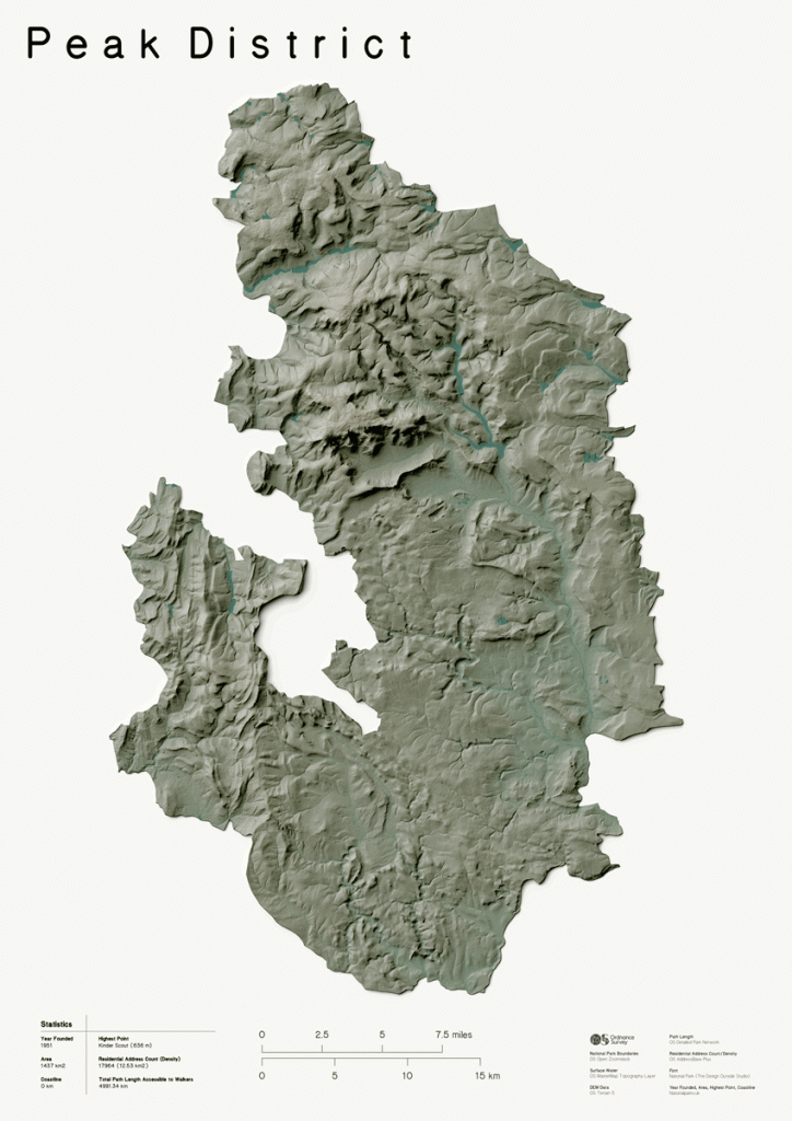
Short Walks in the Peak District for Beginner Hikers
Are you looking for some beginner hikes in the beautiful uplands of the Peak District to try this year? In this post we’ve collected together some lovely Peak District walking routes each with a link to the full route in our OS Maps App. With over 7 million routes you can guarantee our app is the best way to plan your hikes and find your way around the footpaths and hiking trails of Great Britain.
Each of these beginner friendly routes are perfect for your first hike in this picturesque National Park.
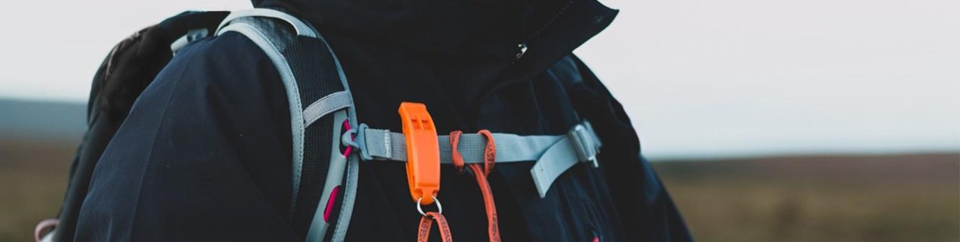
If you are a complete novice hiker please read our article Hiking For Beginners which is a great starting point for getting out into the hills and mountains of the UK.
What Kind of Terrain to Expect in the Peak District?
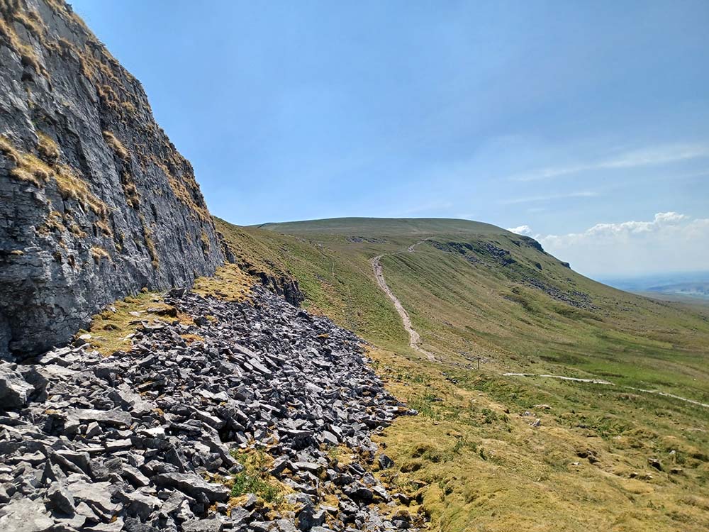
The Peak District is a favourite for hikers with its diverse scenery and terrain. Enjoy expansive moorland, lush valleys, charming villages, and historic sites. Dramatic cliffs like Stanage Edge and Curbar Edge offer breathtaking views, while rivers and reservoirs like the River Derwent and Ladybower Reservoir are all reasons to visit this beautiful part of the country.
The region features dense woodlands and open moorlands, each with unique flora and fauna. The terrain ranges from gentle, well-maintained paths ideal for beginner hikers to rocky, steep sections for those seeking a challenge.
We have a huge range of Peak District Maps and Guide Books, ideal for taking with you on your Peak District Adventures!

EXPLORE THE
OS Shop
We are with you every step of the way. Shop our trusted walking and hiking maps and guidebooks so you can explore the outdoors with confidence.
Go to the shopShort Walks in the Peak District
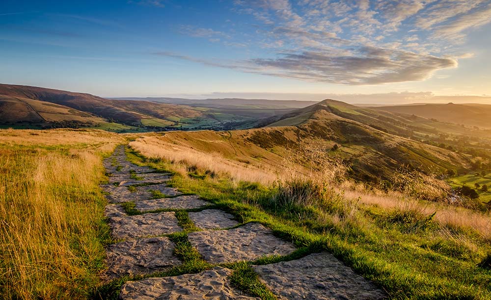
Mam Tor Circular Walk
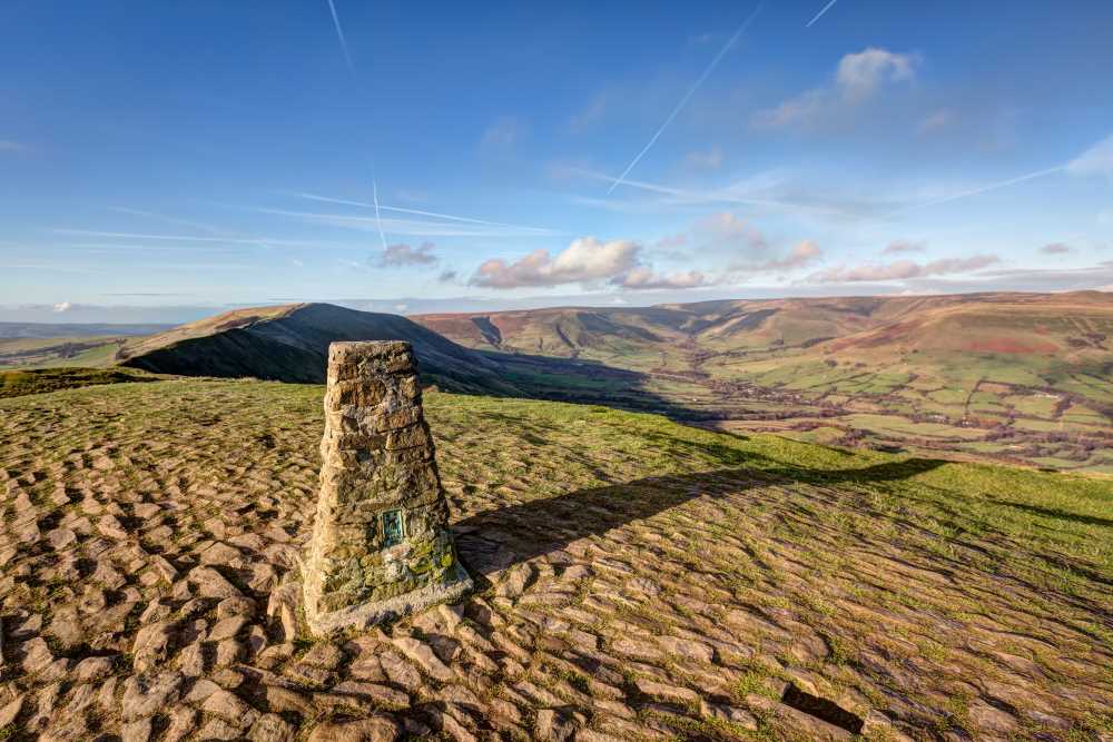
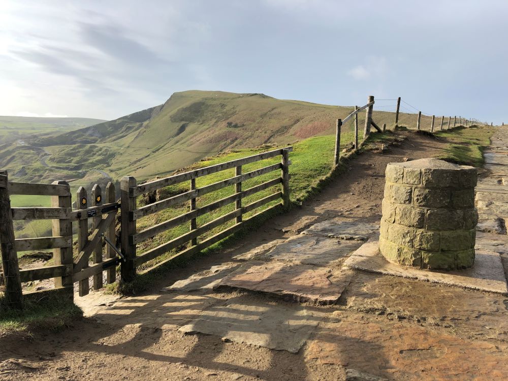
A 3-mile loop of Mam Tor offering stunning views of the Edale Valley and Hope Valley. It takes about 1.5 to 2 hours. The crumbling cliff face of Mam Tor is an iconic sight in the Hope Valley. This short walk starts and ends at the remains of the old A625 road, offering superb views from Mam Tor’s summit and a unique traverse path beneath the landslip. It’s perfect for beginner hikers and those with young families.
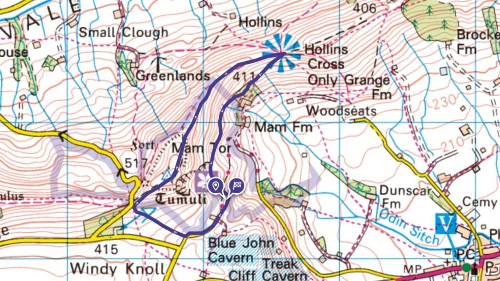
⛰️ Mam Tor 517m
⏱️ Approx. 1.5 hrs
🥾 3 miles / 4.8 km
Dovedale Circular Walk
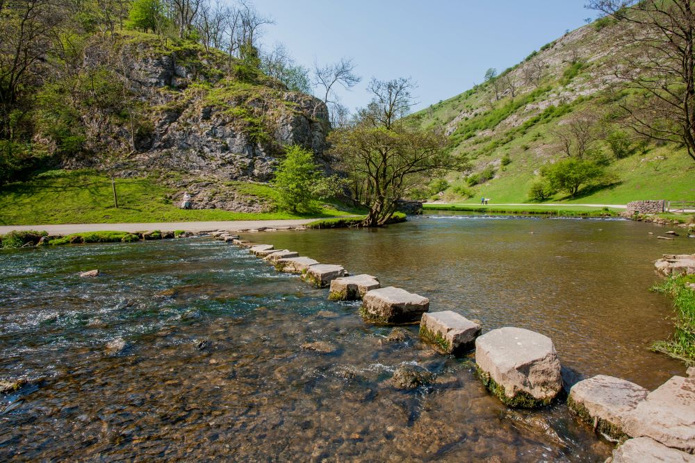
A 3-mile walk through the picturesque Dovedale Valley. It takes around 2 hours. Experience Dovedale’s iconic stepping stones and the unique limestone formations of Tissington Spire and Ilam Rocks in this scenic circular walk.
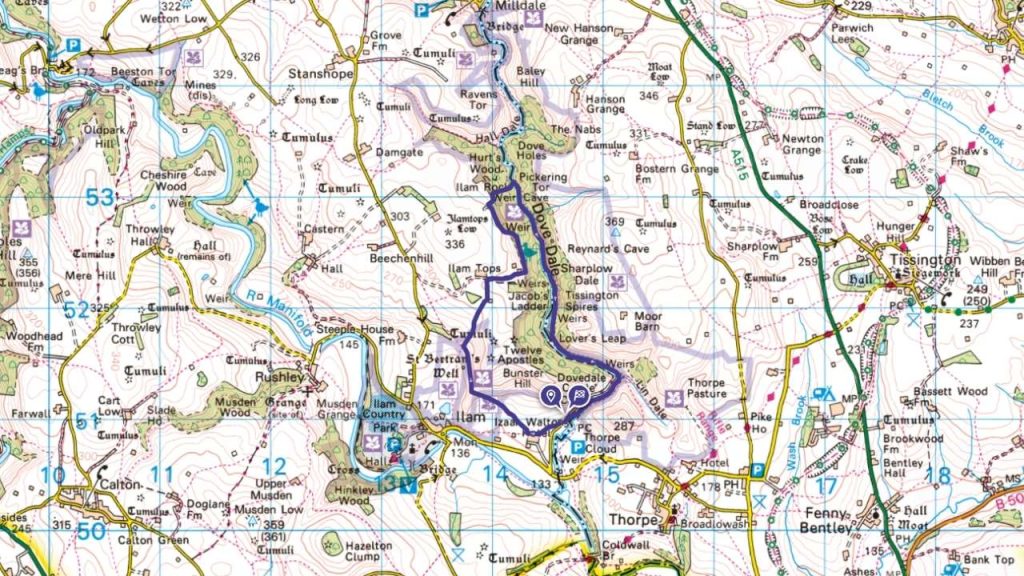
⛰️ Highest Point – 305 m
⏱️ Approx. 2 hrs
🥾 4 miles / 6.5 km
Monsal Head and High Dale
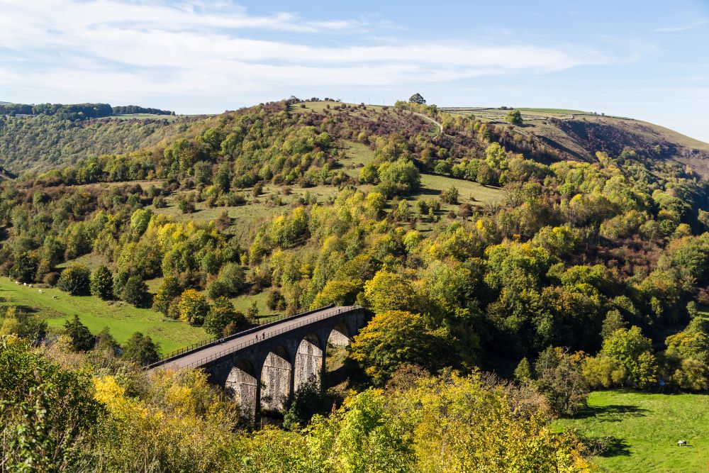
A scenic 5-mile walk from OS Champion Georgie aka @walkinggirll starting from Monsal Head, offering breathtaking views of the Monsal Dale and the iconic viaduct. The route takes you through picturesque landscapes, including the tranquil High Dale. Enjoy the mix of open countryside and wooded paths, perfect for a refreshing outdoor adventure. This route is ideal for beginner hikers, with its gentle terrain and well-marked paths.
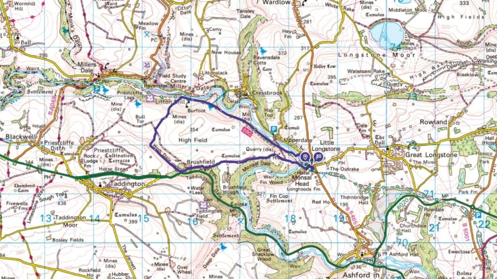
⛰️ Highest Point 333 m
⏱️ Approx. 3 hrs
🥾 5.2 miles / 8.37 km
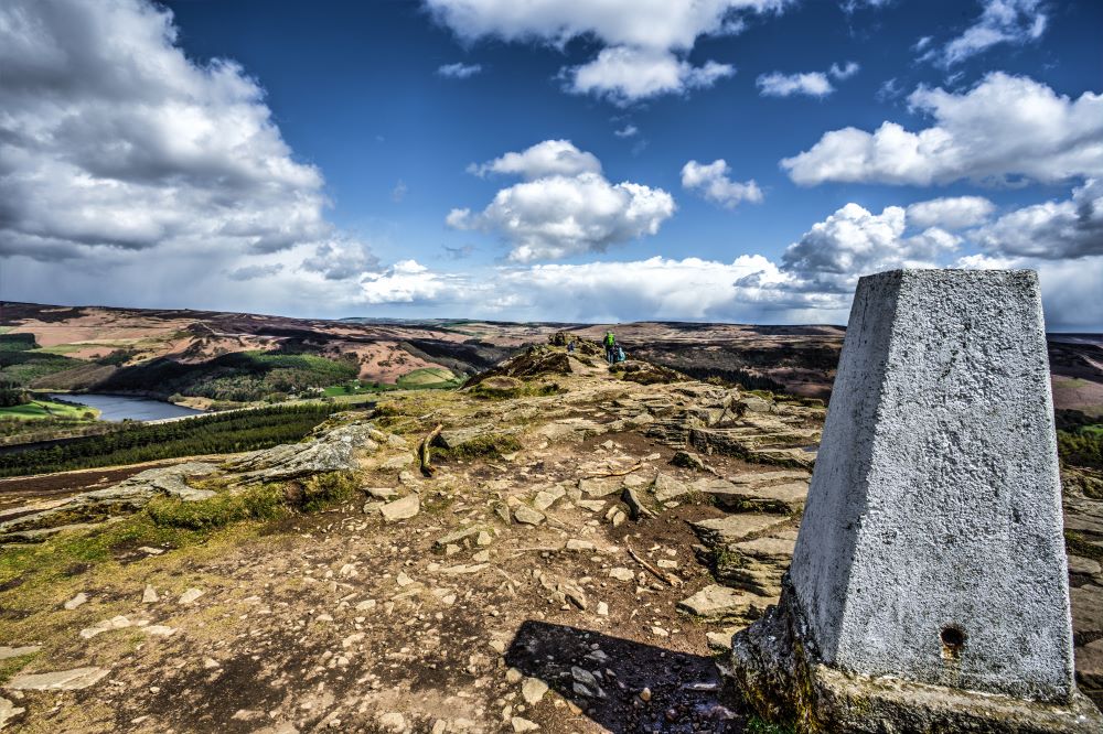
Stanage Edge and Bamford Edge Walk
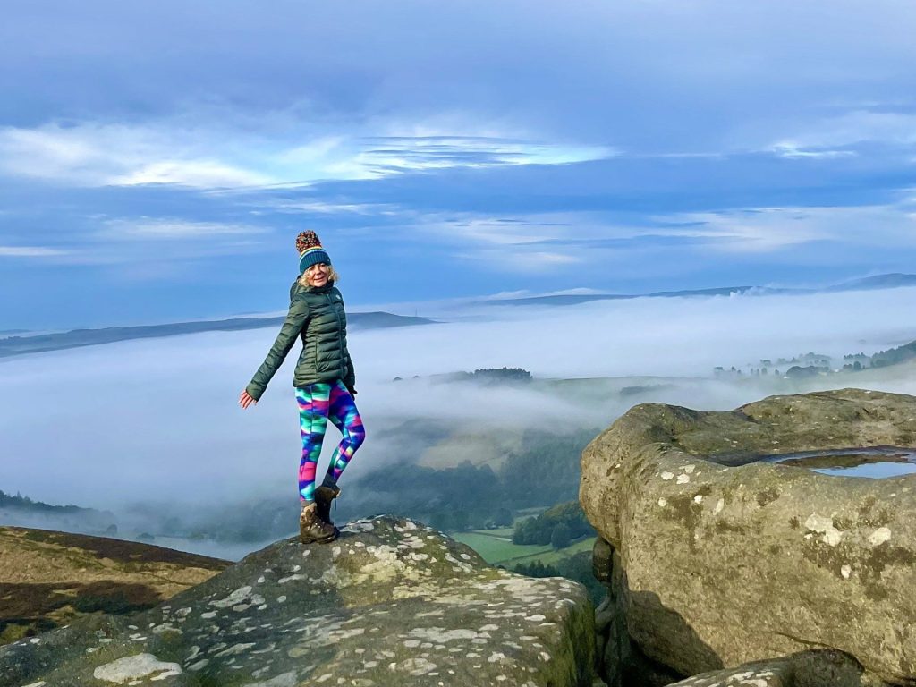
Bamford Edge offers stunning views of Ladybower Reservoir and Winhill Pike across the Derwent Valley. A walk along this edge, combined with a traverse of Stanage Edge, provides a great outing in the Peak District. The route peaks at High Neb and crosses Bamford Moor to connect the edges.
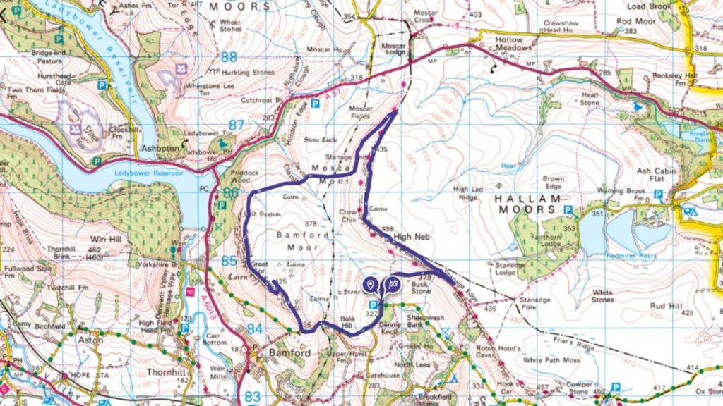
⛰️ Highest point – High Neb 457m
⏱️ Approx. 4 hrs
🥾 7.3 miles / 11.8km
Edale Train Station to Mam Tor, Back Tor and Lose Hill Circular
Edale Train station to Mam Tor, taking in Back Tor and Lose Hill from OS Champion Anna @themountaingirluk . It’s a lovely 11km circular walk and has a pub at either end of the hike. With 533m of height gain, it makes it a gentle first-time beginners hike but gives you plenty of outdoorsy and wild feel to it. It’s easily navigable and you get to stand over 500 meters above sea level which is just short of a mountain.
See more pics of this route shared by OS Champion Anna Humphries
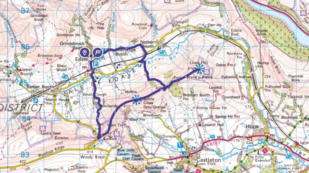
⛰️ Highest Point Mam Tor 517m
⏱️ Approx. 4 hrs
🥾 6.9 miles
Win Hill Circular from Ladybower Reservoir
It’s well worth the walk up Win Hill situated in the Hope Valley and Edale Valley of the Peak District to take in the spectacular views of the Ladybower Reservoir, Kinder Scout and the Dark Peak region.
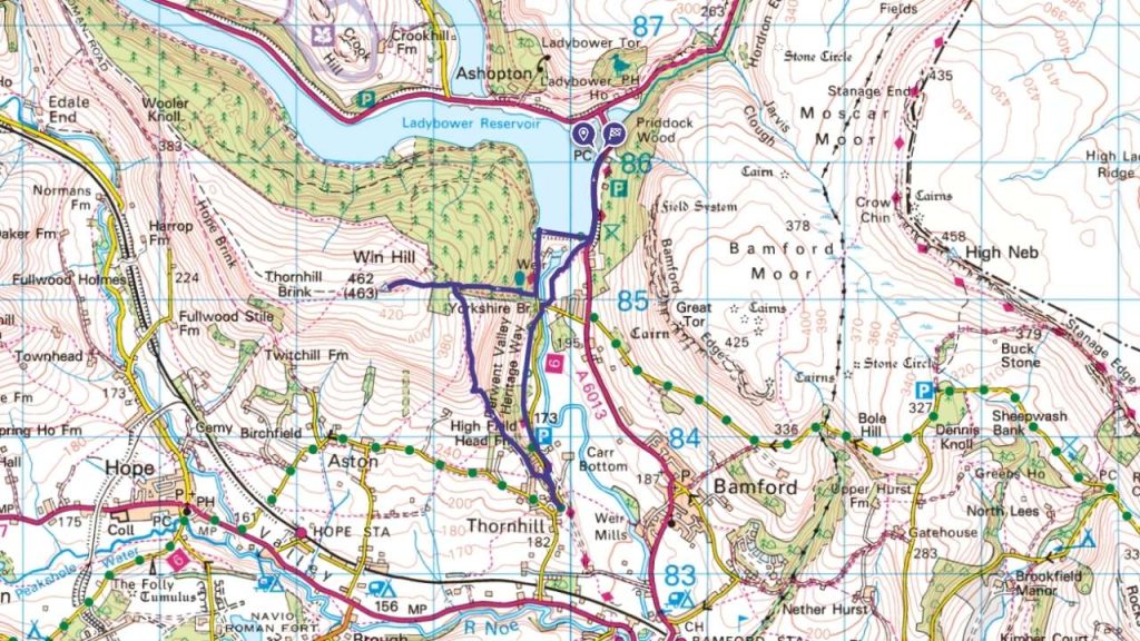
⛰️ Highest Point Win Hill 461 m
⏱️ Approx. 3 hrs
🥾 5 miles / 8 km
EXPLORE THE
OS Shop
We are with you every step of the way. Shop our trusted walking and hiking maps and guidebooks so you can explore the outdoors with confidence.
Go to the shop