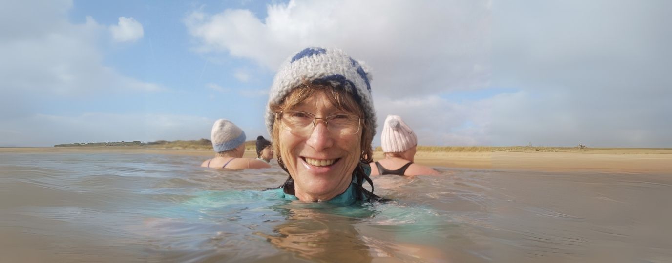
The days are getting longer and the weather’s brightening up, so now there’s plenty of opportunity to make the most of our free time and enjoy the beautiful sights of spring. Whether you’re looking to find beautiful bluebells, delicious wild garlic, or cute newborn lambs, our 10 best spring walks will help you do just that.
Follow the below links to OS Maps for detailed routes and paper maps for each spring walk. Discover more walking trails, or plot your own with a 7-day free trial of OS Maps, on us!
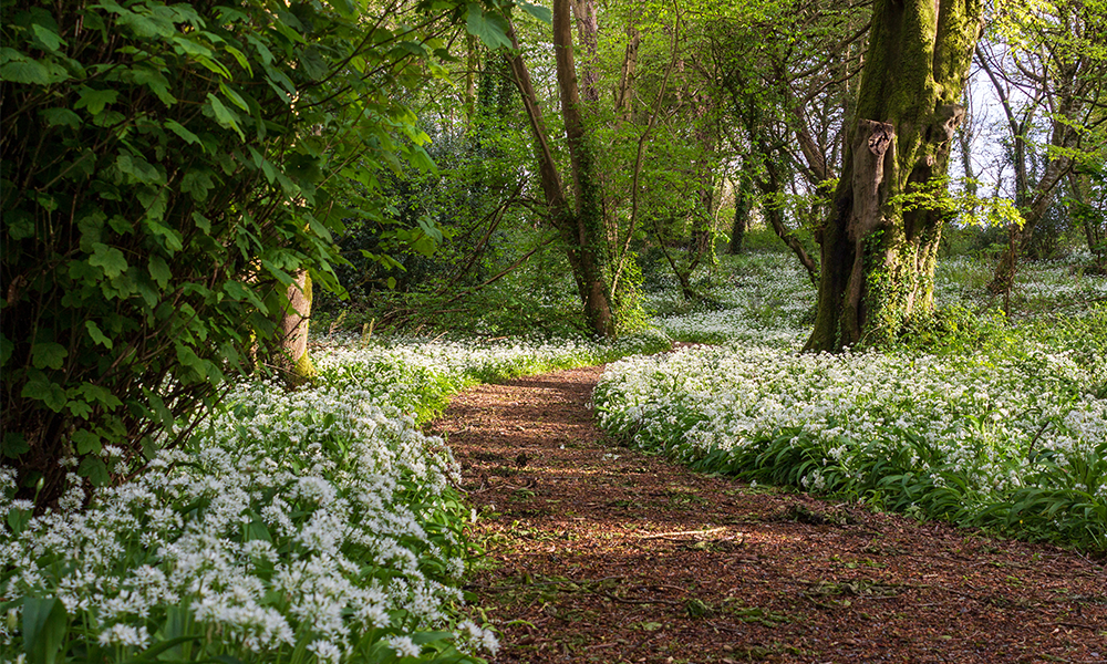
Path through beautiful wild garlic
1. Beacon Hill circular walk
Location: Exton, South East England
Distance: 6.7 miles / Time: 2.5 hours
Difficulty: Moderate
Parking: Beacon Hill car park, SO32 3LG – Charges apply

Views over the Meon Valley
This is a pleasant 6.5 mile circular springtime walk taking in the beautiful Meon Valley. In Warnford you can see the famous Hampshire Watercress Bed, a plethora of spring flowers and if you’re lucky, a mob of friendly Highland Cattle. Keep your eye open for a big rock and forged steel whale, which you’ll pass on the route. You also have the advantage of two pubs on this route – the Shoe Inn at Exton and the George and Falcon in Warnford. This walk is over mixed terrain with a few steep sections and include gates and styles.
Recommended by OS GetOutside Champion Glyn Dodwell. Follow Glyn on Instagram.
2. The Skirrid circular walk
Location: Abergavenny, Wales
Distance: 3.8 miles / Time: 2 hours
Difficulty: Leisurely
Parking: National Trust car park NP7 7LA (please check it is open) or in nearby Abergavenny NP7 5SG – charges may apply

Phillipa on top of Skirrid Fawd with her dogs
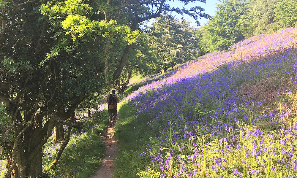
Bluebells on The Skirrid circular walk
I love this walk and do it every spring. If you love walking through fields of bluebells and along spectacular ridgelines this walk is for you. It’s a lovely walk at all times of the year, but in spring it is extra special. The Skirrid (Ysgyryd Fawr) is owned by the National Trust and it’s a beautiful place to visit. The walk takes you from the car park on a clearly-defined track, into the woodland below The Skirrid. It’s then a steep-ish walk uphill and through a gate onto the mountain itself. Instead of following the crowds and heading straight for the ridge, turn left and follow a winding path through woodland. It soon opens out into clearer areas, which in spring, are covered with thousands of bluebell – like a purple carpet!
You’ll then pass through a hidden valley and then around the far end of The Skirrid before following a clear path up onto the ridgeline. Now you’ve got a treat as you can follow the ridge slightly downhill all the way enjoying the beautiful views of the Black Mountains and Abergavenny laid out around you. To your right are the mountains and to your left are pastures and fields. At the end of the ridge you’ll drop back down and go through the gate you came onto the mountain through and then back down to the car. It’s not spring for me, if I haven’t done this walk.
Recommended by OS GetOutside Champion Phillipa Cherryson. Follow Phillipa on Instagram.
3. North Sandwick walk
Location: The Shetlands, Scotland
Distance: 3 miles / Time: 1.5 hours – return
Difficulty: Leisurely
Parking: Gutcher Ferry terminal, ZE2 9DF – Charges may apply

Brynn Hauxwell enjoying North Sandwick
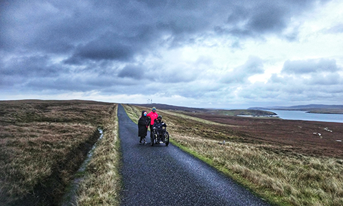
The Hauxwells on their North Sandwick walk
This linear 3-mile route is the perfect way to take in some amazing scenery and wildlife whilst waiting for the ferry to take you over to Unst or Fetlar at the Gutcher ferry terminal. The route follows a quiet single-track road, over the Hill of Gutcher and the Hill of Troliva, where you can take in the views of Unst, Fetlar and the smaller island of Linga. This route takes you to North Sandwick and in spring, it is great for wildflowers and birdwatching. You can often see golden plovers, snipe and gannets. Keep a look out along the path for lots of different wildflowers, field mice, hedgehogs and even otters. Look out towards the sea, where you may be lucky enough to see a pod of orcas or even a humpback whale. Click here for more info on the walk.
Recommended by OS GetOutside Champions the Hauxwell family. Follow the Hauxwell family on Instagram.
4. Buttermere Edge circular walk
Location: Lake District, North West England
Distance: 10 miles / Time: 5.5 hours
Difficulty: Moderate
Parking: Gatesgarth Farm, CA13 9XA – Charges may apply

Aaron enjoying a spring walk
This route is a big day out for most walkers with just over 1400m ascent. It takes some of the very best views the Lake District has to offer. Starting through fields of bluebells, you’ll then follow the ridgeline that towers over the Buttermere Valley starting with the steepest point up to Red Pike. Just after passing the beautiful Bleaberry Tarn. From there you’ll make your way up to the high point of the route, High Stile (806m), and along the ridge to High Crag and then Hay Stacks. The final peak, Fleetwith Pike is where you’ll enjoy stunning views down the valley. Head for a swim in Innominate Tarn if you’re feeling brave, it happened to be Alfred Wainwright’s favourite place in the Lake District and it’s where his ashes are scattered!
Recommended by OS GetOutside Champion Aaron Rolph. Follow Aaron on Instagram.
5. Leigh Woods circular walk
Location: Bristol, South West England
Distance: 8.5 miles / Time: 3.5 hours
Difficulty: Moderate
Parking: Bristol Zoo or Leigh Woods car park, BS8 3QB – charges may apply

Sheep and their lambs enjoying the spring weather
Cities are amazing places to walk and Bristol is surrounded by stunning countryside and has some of the most spectacular green spaces. This walk has stunning views across Bristol and the surrounding landscape. You are treated to ancient trees and an abundance of wildlife. Stokeleigh Camp hill fort is perched on the edge of the Avon Gorge and from here there are dramatic views along the river, and on a good day you can see all the way to the Sugar Loaf in the Brecon Beacons. The walk starts in Clifton Village where you skirt The Downs and cross the infamous Clifton Suspension Bridge. What awaits you is a feast for the senses.
Recommended by OS GetOutside Champion Eli Bishop. Follow Eli on Instagram.
6. Ilam Park circular walk
Location: Peak District, Midlands
Distance: 1.6 miles / Time: 40 minutes
Difficulty: Leisurely
Parking: Ilam National Trust car park, DE6 2AZ – Charges may apply
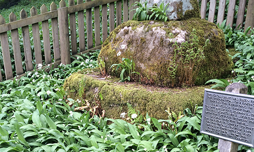
Ilam Park full of wild garlic
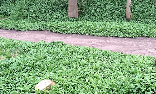
Wild garlic on the Ilam Park circular walk
In spring, this short walk is a sensory delight. Head down to the picturesque St. Bertram’s Bridge but instead of crossing, take the path right (although Hinckley Wood is also well worth exploring if you have time on your hands). As you stroll down Paradise Walk you’ll spot – or indeed smell – carpets of wild garlic on one side, and lambs grazing with their mothers on the other. You’ll also pass a Saxon cross. You may want to take a short detour to have a proper look at the unusual alpine-style cottages in Ilam village before heading back and finishing your walk at the Manifold Tea Room. There are many ways to extend this walk, for example to the popular stepping stones in Dovedale or Thorpe Cloud.
Recommended by OS GetOutside Champion Suzanne Hill. Follow Suzanne on Instagram.
7. Mickfield Meadow circular walk
Location: Suffolk, East England
Distance: 2.6 miles / Time: 53 minutes
Difficulty: Leisurely
Parking: Lay-by, IP14 5QQ
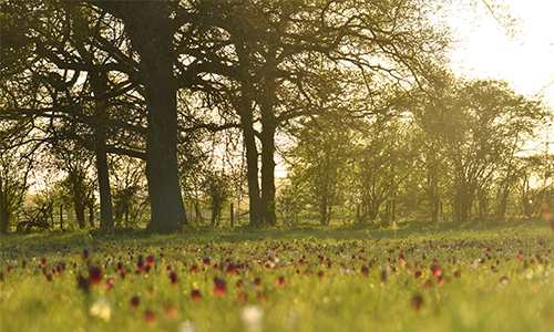
Mickfield Meadow circular walk
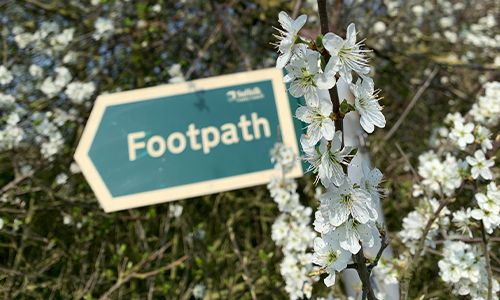
Beautiful spring flowers
A walk around Mickfield Meadow is best enjoyed in the spring months. This 2.6-mile walk can be done in just under an hour and takes in footpaths, bridleways and permissive routes which take you through stunning tree tunnels to a Suffolk Wildlife Trust site, blossom-filled hedgerows and open countryside. Mickfield Meadow is a flower rich hay meadow which has never been fertilised. This means that you will be treated to the spring spectacles of goldilocks buttercup, low growing wood anemone, ragged-robin, meadowsweet and snake’s head fritillaries. This walk is suitable for the whole family although it includes some uneven ground and bridges. Dogs are welcome in the meadow as long as they are kept on a lead.
Recommended by OS GetOutside Champion Charlotte Ditchburn. Follow Charlotte on Instagram.
8. Osterley Park circular walk
Location: Middlesex, London
Distance: 4.5 miles / Time: 1.5 hours
Difficulty: Leisurely
Parking: Osterley Park National Trust car park, TW7 4RB – Charges apply

Swans and their cygnets
Osterley Park is a wonderful place to visit during spring and you’ll be sure to walk beside beautiful bluebells and spot colourful spring flowers such as primroses. This leisurely route takes you through the estate and on to the Grand Union Canal which is another great spot in springtime. Here, you’ll find an abundance of birds returning from their migration and flourishing flora and fauna by the water’s edge.
You’ll then loop back around to Osterley Park where you have a chance to admire the house up close. Please check opening times if you wish to visit the National Trust property. Not only does this route showcase the best of spring, it has quite a history dating back to the Industrial Revolution. Learn about the history of this charming spring walk within the route description on OS Maps.
Recommended by Helen Newman from the OS team. Follow Helen on Instagram.
9. Fountains Abbey circular walk
Location: Ripon, Yorks and Humber
Distance: 8.7 miles / Time: 3.5 hours
Difficulty: Moderate
Parking: Fountains Abbey National Trust car park, HG4 3DY – charges may apply

This is a walk of great variety, especially in spring. On this route you’ll roam over secluded dales, farmland and forest bordering the site of Fountains Abbey and Studley Royal Park, a National Trust location and World Heritage site. Here you can explore the atmospheric abbey ruins and learn more about the history that surrounds this area. Look out for bluebells and daffodils on your walk, especially as you enter the very aptly named ‘Spring Wood’ (there’s two on this route!)
Recommended by Helen Newman from the OS team. Follow Helen on Instagram.
10. Embleton Coastal walk
Location: Embleton, Northumberland
Distance: 9.9 miles / Time: 3.5 hours – can easily be made shorter or longer
Difficulty: Moderate/Challenging
Parking: Lower Newton pay and display, NE66 3EW – charges may apply
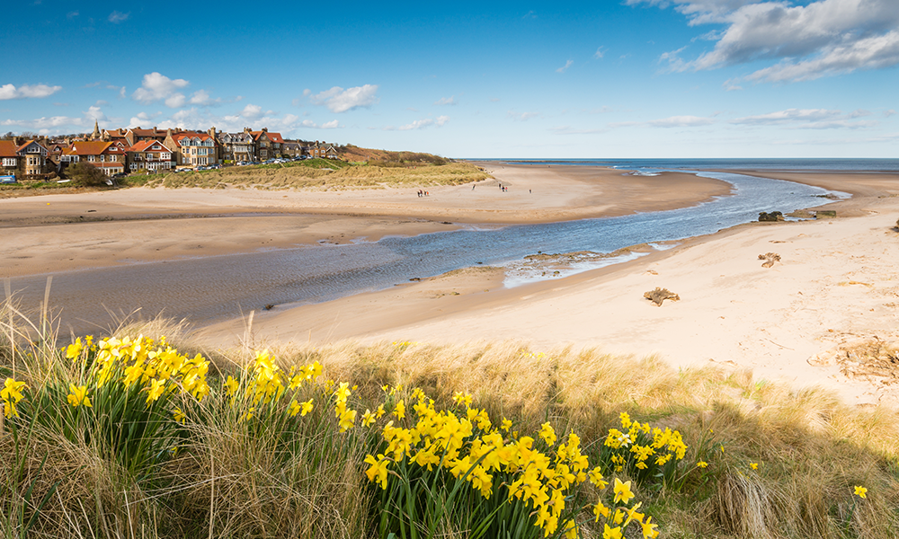
Alnmouth Beach in spring
The golden sands of Embleton Beach are a pleasent sight at any time of year, but in spring the dunes behind the beach are home to an abundance of wildlife and are a haven for wildflowers. Here you’ll find cowslips, burnet roses and bloody cranesbill but there’s no denying the bluebells are the stars of the show. This coastal day walk from Embleton to Alnmouth will certainly give you a big breath of fresh spring air. There are some ups and downs along the route but what’s great about this walk is that you can stop and turn around at any time. Make it your mission to reach Dunstanburgh Castle at least, it’s just over a mile down the coast and well worth a look.
Recommended by Helen Newman from the OS team. Follow Helen on Instagram.
We hope these routes have fuelled your excitement for upcoming spring adventures. It really is a truly wonderful time of year to get outside!
Remember to take care of the great outdoors and follow the Countryside Code at all times.


