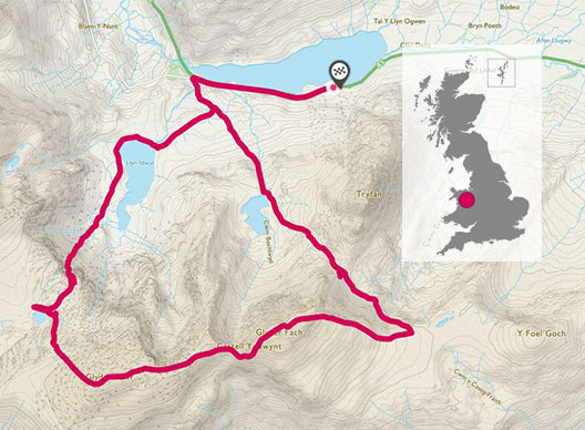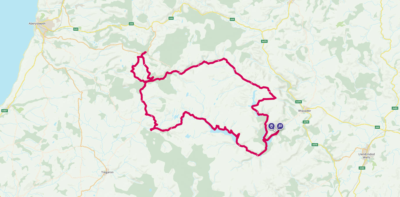
The Elan Valley in Wales is fast becoming a mecca for gravel and mountain biking. This scenic 57-mile circular route is split between two days, making the perfect bikepacking adventure.
Situated in the heart of Wales, in the Cambrian Mountains, the Elan Valley is mid-way between the Brecon Beacons (Bannau Brycheiniog) and Snowdonia. It spans 70sq miles and is known as Wales’s Lake District. Within it are a number of reservoirs and seven impressive Victorian dams. The real draw is the emptiness of the area and even though it’s gaining in popularity, you’ll still feel in the middle of a wilderness.

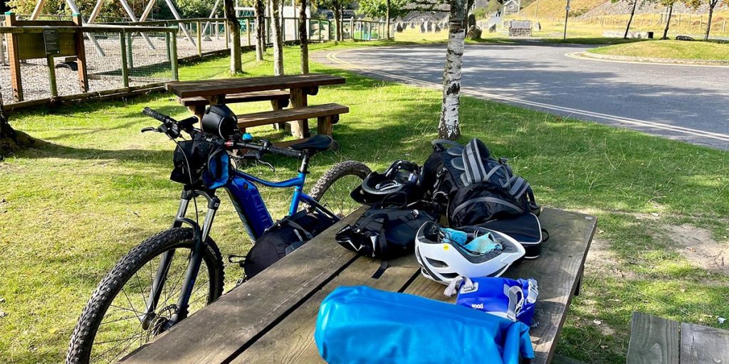
It’s an area I’ve been meaning to explore for a long time and perfect for cycling. However, I wasn’t sure whether my e-bike would be any good for a bikepacking weekend – I’d never tried it before. We planned this route with an overnight stop in a hotel at Devil’s Bridge to recharge our bikes and ourselves. We weren’t sure how it was going to work out and whether our batteries would last for a full day of hard cycling or leave us having to pedal our 25kg bikes up hills and through bogs! There was only one way to find out…
SN 978 646
We started at the Elan Valley Visitor Centre. It’s great place to leave your car and to use toilets, the shop and grab a coffee and snacks. Car parking is £3.50 a day but do contact them in advance about leaving your car for more than a day and pay at the visitor information reception.
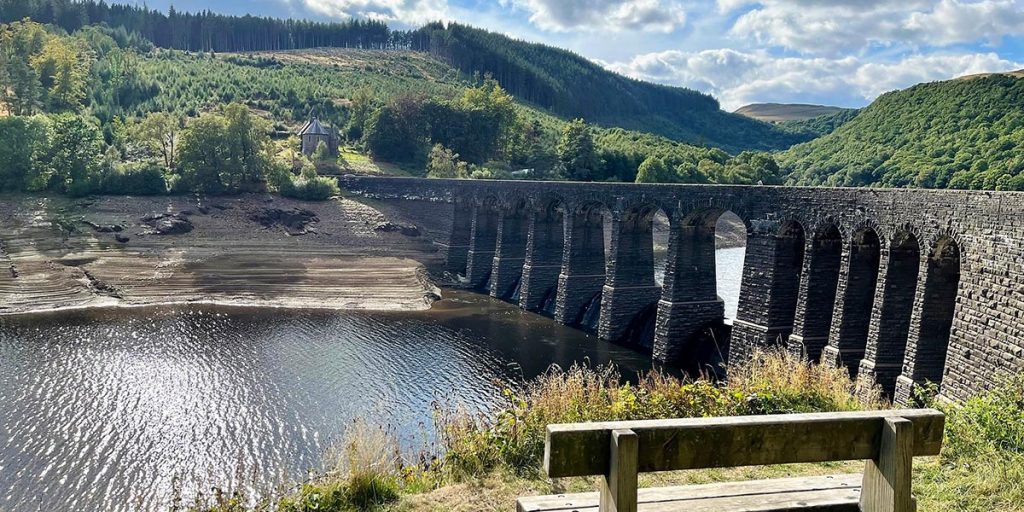
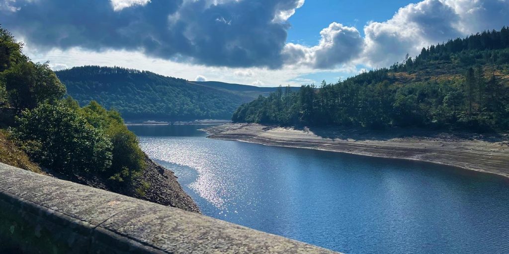
From there, join the cycle path which takes you past your first reservoir of the day, Caban Coch, the simplest and most functional of the seven dams in the area. Stay on the cycle path alongside the reservoir before you round the corner and see Garreg Ddu dam on your left. Time for another photo stop before crossing the road and carrying on along the cycle route. The views are amazing, with the reservoir on your left and the hills all around you. The further you go, the emptier it becomes.
Keep going along the cycle path and you’ll go through a cutting through the rock, called Devil’s Gulch. A train line once ran through here linking the Elan Valley to the Heart of Wales line. This cutting had to be blasted away and held up the construction of the railway for three months back in the 1890s. It caused more headaches when a rock fall left it closed for five years due to safety concerns. But after construction work, it reopened at the end of February 2023.
SN 89276 68621
You’ll then pass another dam, Graig Goch, on your left and then follow the track around to your right. Now it’s all uphill on a dirt bridleway. My hardtail e-bike coped with it brilliantly and we finally levelled out at the top of the hills and stopped to take in the views. Nothing for miles and miles. It was just us, the hills and the sheep.
We followed the grassy track, past the site of a Roman camp, until we reached the road and turned left onto the tarmac. We reached the bridge at Pont Ar Elan. It was a great place to stop for lunch, take in the surroundings and rest for a bit.
When we set off again the road snaked through the open moorland. I was watching my battery gauge and putting more and more effort into pedalling to make sure I didn’t run out of power. Finally, at a viewpoint, the road started to drop into the valley off the open moorland and cottages and fields began to appear.
When we reached Cwmystwyth, we stopped at all the information boards along the road. They make fascinating reading about the area’s history. It’s one of the most important historical mining areas in Wales. Its history stretches back to prehistoric times, it was mined in Roman times and later by Cistercian monks. You’ll pass the spoil heaps and miner’s barracks as you follow the road.
SN 77035 73878
A mile or two further on, we turned off through a gateway and onto a cycleway. This off-road path took us through the Hafod Estate which is a must see. The Hafod Estate was created by its most celebrated owner, Thomas Johnes, in the 18th Century. The grounds were designed in line with the picturesque principles popular at the time.
Circular walking routes around the 200-hectare estate were designed so that visitors could enjoy the Welsh landscape and an ever-changing sequence of views. It became a must-see destination for early tourists to Wales, including those completing the Grand Tour. The poet Samuel Taylor Coleridge wrote the famous poem Kubla Khan after staying at The Hafod.
“In Xanadu did Kubla Khan A stately pleasure-dome decree: Where Alph, the sacred river, ran Through caverns measureless to man Down to a sunless sea…”
SN 76052 73029
We forced ourselves back to the bike and back onto the road again where we headed for Devil’s Bridge and the welcoming comfort of the Hafod Hotel.
SN 74064 77066
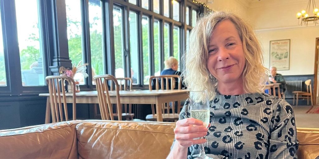
The bikes were stowed away safely and plugged in and we sat down with a cup of tea and homemade biscuits before sinking into a deep bath. The hotel boasts draft local beers, a big wine list and good hearty local Welsh food for dinner.
The next morning, after a full Welsh breakfast, we headed back down towards Pont-Rhyd-y-Groes and followed the road up and down hills until we reached Ffair Rhos.
Here we turned left at the pub and then headed off down a bridleway which took us over the hills and through a forest to the ruin of Strata Florida, which was once the Westminster Abbey of Wales.
SN 74621 65731
Not a lot remains, but it’s a fascinating stop and the Strata Florida Trust has a great display of farming history next door and coffee making facilities. Back on the bikes, we cycled to the end of the road where we joined the Cambrian Way and headed on a dirt path up the valley. It’s a beautiful route and if you are riding an e-bike you’ll be glad of it. It gets a bit boggy as you reach the Teifi Pools, but once there joins the gravel track heading north.

The Teifi Pools are another landmark. They are a group of six lakes and reservoirs at almost 1500ft above sea level, once used by the monks of Strata Florida for water and fish. Some lakes are now reservoirs and others are used for fishing, but it’s a lonely place and you’ll most likely have it to yourself.
If the weather has been wet or if you don’t fancy the long climb up to the Teifi Pools from Strata Florida then instead of following the bridleway from Ffair Rhos keep on the tarmac road until it finally turns into gravel. This will take you to the north of the Teifi Pools where our routes meet.

We kept on the gravel track heading east. It can get a bit flooded after wet weather, but it’s a good track to follow. Then we reached the Claerwen Reservoir. It looked like it went on forever, but was really low after a dry summer. We spent the next miles riding along the reservoir taking in views across the water
SN 87056 63637
I was ready for a break by the time we reached the Claerwen Dam. It’s the most modern of the dams in the Elan Valley and was declared open by the newly crowned Queen Elizabeth in 1952. There was even a picnic bench there for a sit down before we headed off again, this time along the tarmac road. That brought us out at the Garreg Ddu dam that we passed but didn’t cross on our outward route.
We crossed the dam, turned right onto the cycleway, and followed it all the way back to the visitor centre and its facilities. We had enough time for a cup of tea and a slice of cake before loading up and heading home. Not back for a two day break!
SN978 646
93 km / 58 mi
Since returning from an enjoyable bikepacking trip on her e-bike, Phillipa has shared her experience and advice in this article about e-bikepacking.