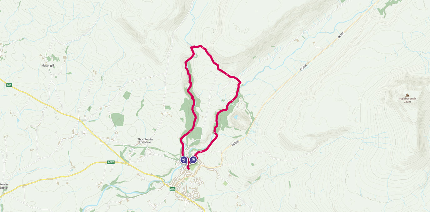
The Yorkshire Dales are awash with rolling hills and beautiful walking routes, so many that you could live there for years and still not discover them all. But if you have time for just one walk when you are in the area, you would do well to head to the Ingleton Waterfalls Trail, a well maintained and trodden route taking walkers four to five miles around five sets of waterfalls from the picturesque village of Ingleton.
SD 694 730
The trail follows a well-defined footpath which runs close to the edge of two rivers – the River Twiss and the River Doe – to provide views of five sets of waterfalls. Being a Thursday we were not surprised to find the trail car park mostly empty, and with the sun out and the skies clear we were looking forward to some great views on the circular walk.
SD 694 752 2.6KM


The information leaflet says that the four-and-a-half-mile trail boasts some of the most spectacular waterfall and oak woodland scenery in the UK. This is a huge claim as there are some truly wonderful places in this country, and some of it is just down the road, but it is definitely one of those encapsulating walks that shows off nature at its best. The trail takes you through woodland, along rivers, over bridges, alongside waterfalls, across farmland (it was lambing season and so this was pretty wonderful on its own), up and down manmade and natural steps, through root and moss-covered river banks, and finally through the village of Ingleton itself.
The waterfalls, and let’s face it that’s the reason we’re here, are beautiful. They are perhaps not quite as full of water as they should be thanks to the lack of recent rainfall, but the streams and falls here were still flowing. The most impressive is probably Thornton Force, where water cascades over 14 metres of limestone, but I particularly liked the Pecca Twin Falls which were so pretty, and there were plenty of other natural geological features to keep me interested including Baxenghyll Gorge – I love a gorge! I can definitely see why this place has been designated a Site of Special Scientific Interest.
SD 695 756 3.07KM


Despite being a bit of a tourist attraction in its marketing, this isn’t an easy walk, although it’s not quite as strenuous as the signs make out. The path is uneven and there are a large number of steps, which means it is certainly unsuitable for wheelchairs and pushchairs, but with decent footwear and reasonable fitness the views are available to anyone who wishes to put in a little effort. It took us just a couple of hours to make our way around the circular trail, stopping regularly to take photos.
You do have to pay to walk the Ingleton Waterfalls Trail, which hurts a little as there is something about hiking that should be free to all to enjoy, but as the money is used directly on the trail to keep the paths maintained and the facilities up to scratch, I don’t think it’s a terrible thing. We did comment at the number of railings and “danger” signs everywhere along the route; I guess if you’ve paid to get in you might consider suing if you fall in? If only people knew how to look after themselves in nature. Of course if you get up super early to walk the trail then you’re good to go without a ticket, but other than that you’ll need to pay the £6 entry fee (which includes parking).
SD 702 743 5.15KM


This is one of those trails that is well worth becoming a tourist for. Although it’s a popular route (and as such can be very busy at the weekend), it’s one that you shouldn’t miss out on if you’re in the area.
7km SD 694 730
7km / 4 miles