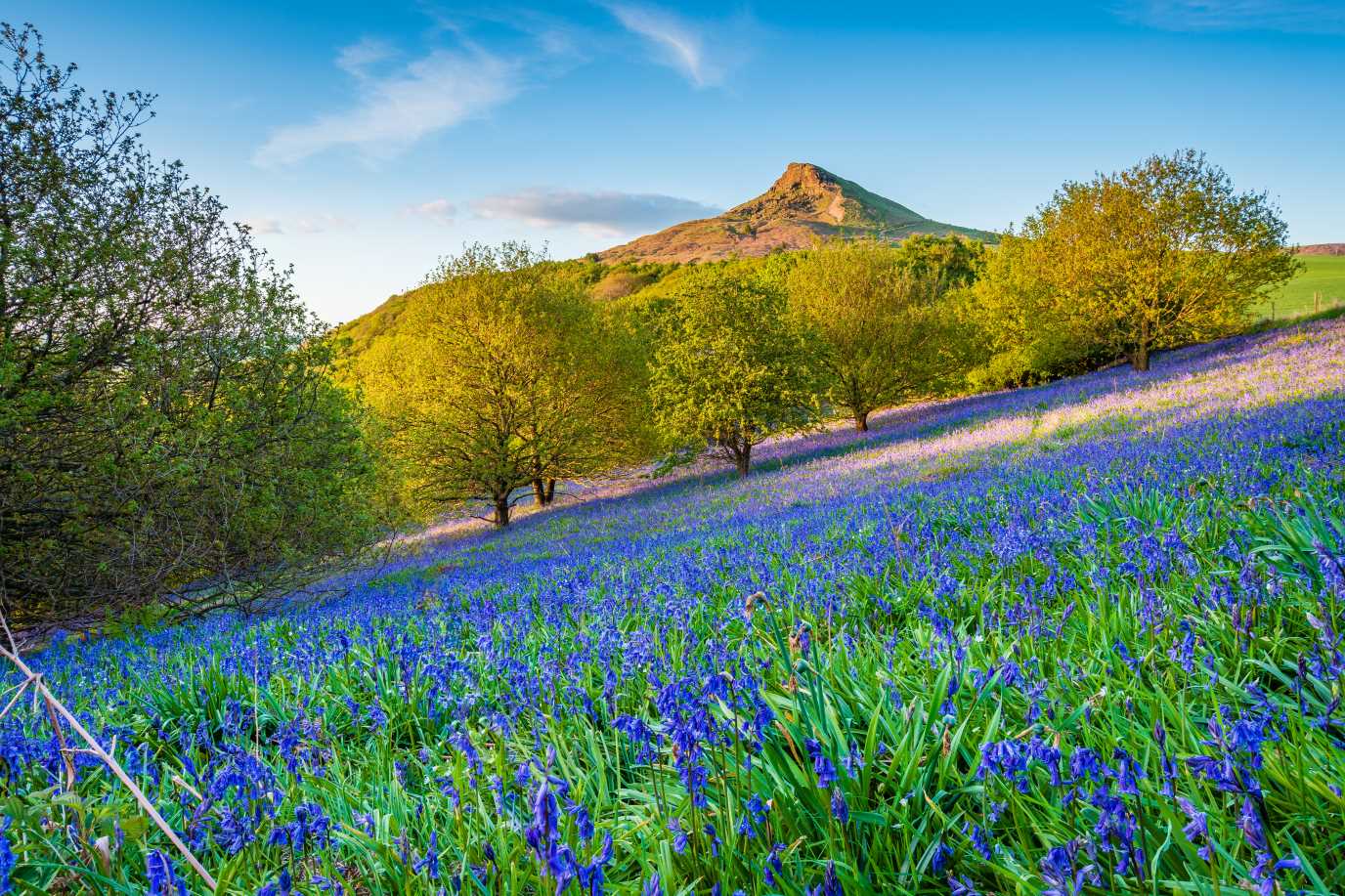
Roseberry Topping Walk
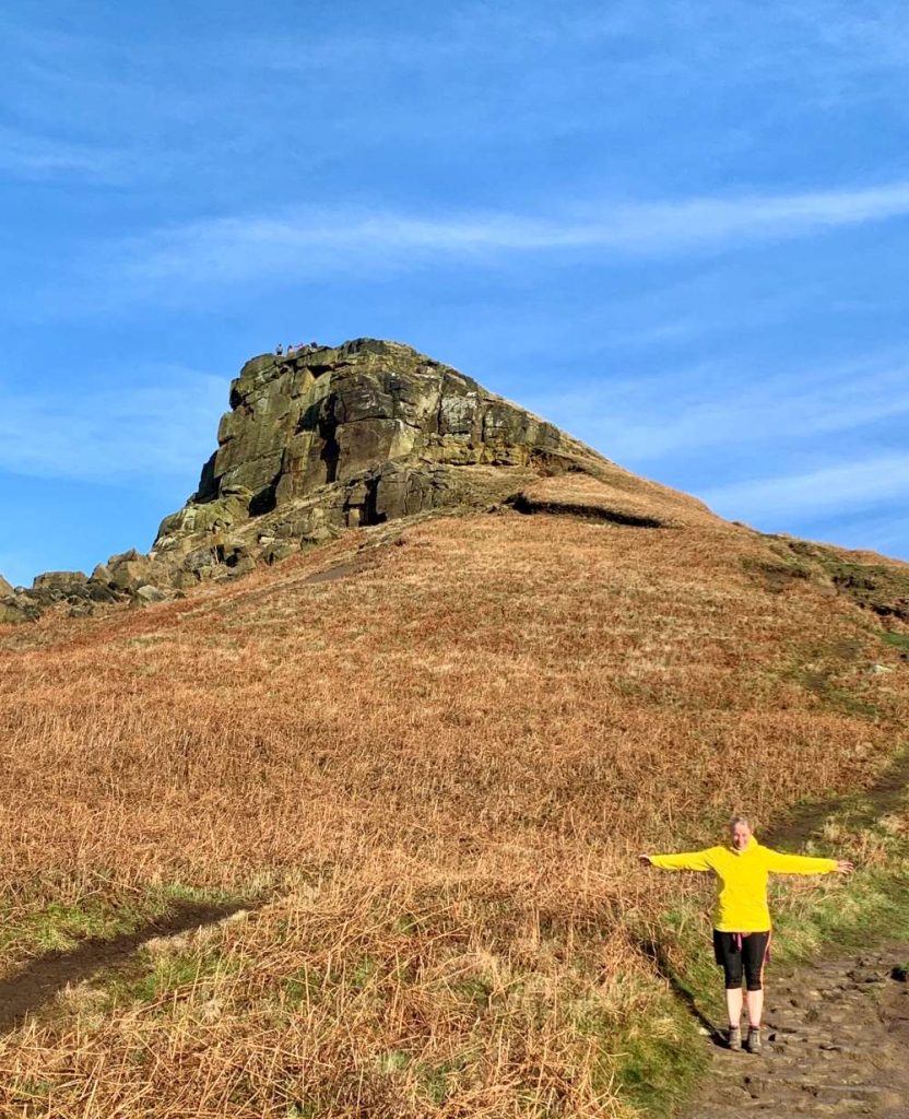
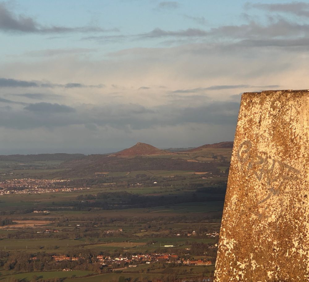
The iconic Roseberry Topping Hill dominates the southern skyline of the vast chimney-stacked expanse of the Tees estuary, sticking up like a fang from the long escarpment at the northern edge of the North York Moors.
Roseberry Topping is brimming with legends; some say it’s an old volcano; the Vikings thought that the Norse God Odin lived there; some locals even think that clouds gathering around the summit is the first sign of a storm.
How High is Roseberry Topping?
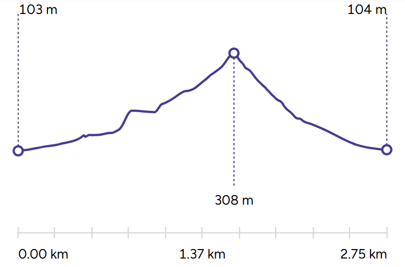
Roseberry Topping is 320m high making it a hill not a mountain.
For anyone who grows up in Teesside, an ascent of this most prominent of the North Yorks Moors’ hills is a right of passage to the great outdoors. It’s an opportunity to climb a proper peak, but at 1049ft it’s only a third of the hight of Scafell Pike, England’s highest mountain.
How long does it take to walk up Roseberry Topping?
Walking up Roseberry Topping Hill will take you just over an hour.
The route up Roseberry Topping is very manageable for a family outing, but there’s still just enough challenge here to make the views at the summit feel like a well-earned reward. The ascent is relatively short but can be quite steep and uneven in places, especially near the top. It can also get muddy, so make sure all the family wear good sturdy footwear.
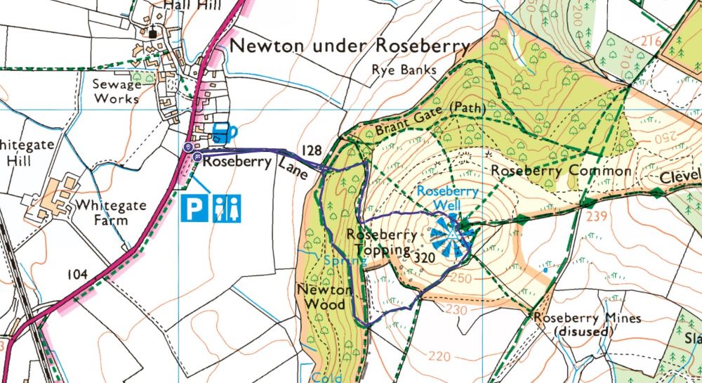
The short route takes you from the car park and toilets at the foot of the hill to the summit for breathtaking views of the North York Moors before bringing you back via Newton Wood.
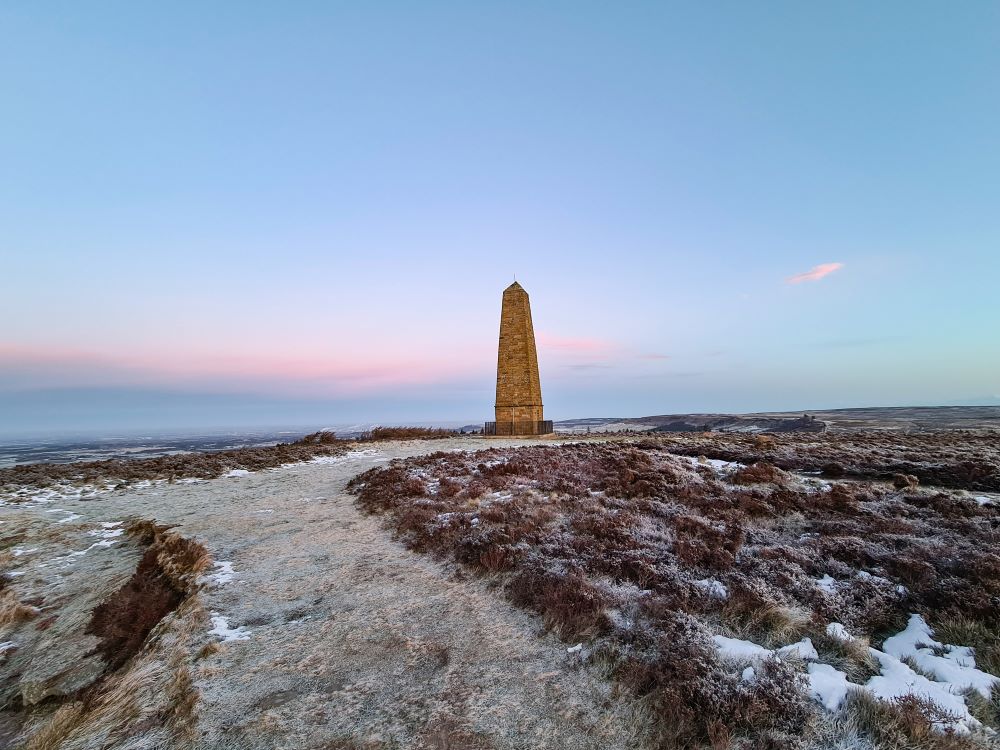
The more adventurous can continue along the escarpment to see the monument to Captain James Cook and then loop back via Great Ayton. The renowned explorer, navigator and cartographer once lived in the village at the foot of hill, and it’s rumoured that his boyhood ascents of Roseberry Topping were the inspiration for his life of adventure and discovery.
For a car free-option Roseberry Topping and Captain Cook’s monument are also reachable from the railway station at Great Ayton.