As Editor of Get Outside I wanted to share a recent walk I’ve done on the beautiful rugged island of Caergybi (Holyhead) and also let you all know I am looking for more UK hiking routes, paddling, cycling and running routes to share on Get Outside – it’s really easy to submit a walk, just email me hilary.pullen@os.uk and read our guide to submitting content linked below.
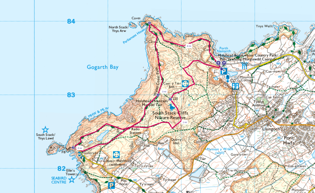
Mynydd Twr (Holyhead Mountain) Circular Walk with South Stack and North Stack
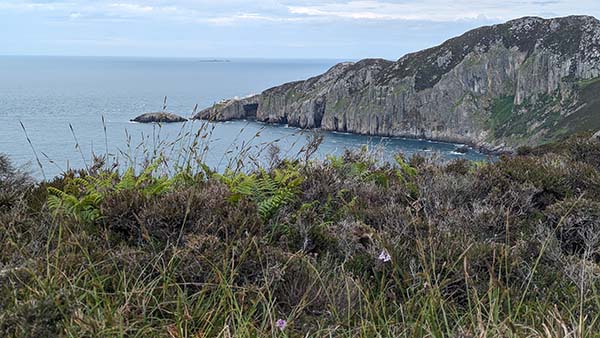
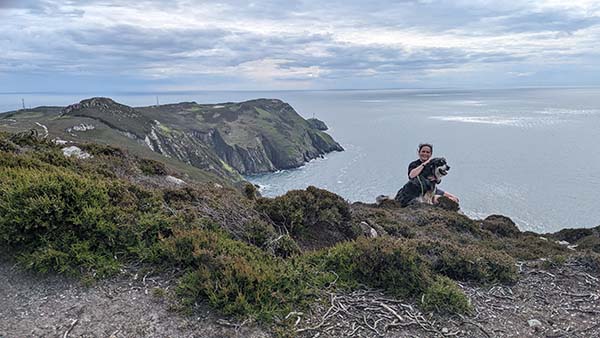
This beautiful circular walk takes you up to the summit of Mynydd Twr (Holyhead Mountain) and then onto the lighthouse at South Stack and around the coast to the fabulous cliffs at North Stack (shown above) where you can find an old fog station. It’s a circular walk with plenty to see and easy parking at Breakwater Country Park where you’ll also find loos and a cafe. It’s great for kids who will enjoy navigating the rugged cliff paths.
The walk is steep in places and there are some precarious edges to keep in mind if you have a young family with you. You can always avoid North Stack if you are not too good with heights. There’s a walled area to keep small children away from the edges.
The views of the sea and cliffs are breathtaking and it’s interesting to find out more about the history of South Stack Lighthouse and the Fog Signal Station at North Stack.
Park at Holyhead Breakwater Country Park
SH 2254 8336
From the car park head past the pond and then when given the option take the fork in the path heading up. The lower fork hugs the coast to your right and will take you direct to North Stack. There are actually a number of different paths that will take you to the summit,keep an eye for sign posts.
Mynydd Twr (Holyhead Mountain Trig Pillar)
SH 2185 8294
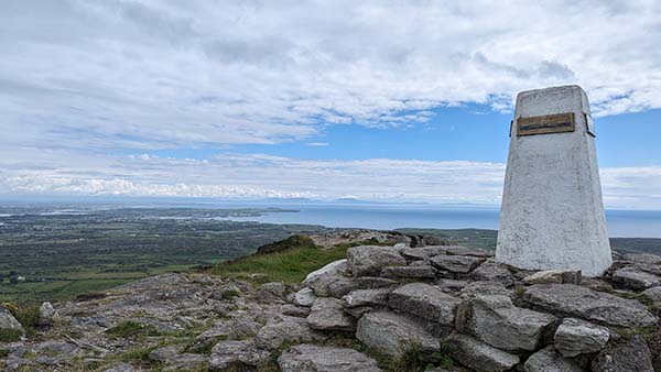
The summit of Mynydd Twr (Holyhead Mountain) is 220m. At the top there is a Trig Pillar to have your picture with and amazing views of the coast of Ynys Mon (Anglesey) and beyond to Eryri (Snowdonia). There’s also a bench, it’s a great spot to stop for a snack if it’s not too windy.
Ynys Lawd (South Stack) Lighthouse
SH 2052 8228
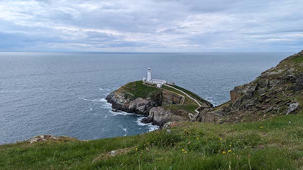
After heading down from the summit og Holyhead Mountain you will see the various paths laid out ahead of you making their way to Ynys Lawd (South Stack) Lighthouse. You’ll pass another busy car park as you reach the coast. The path down to the lighthouse is steep and can be busy but it’s lovely to get a closer look.
Continue on along the coast where you will find some fabulous paths and amazing views, with plenty of heather and pretty wild flowers along the way.
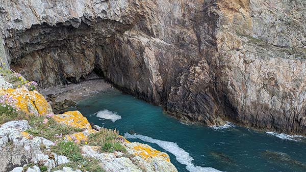
Ynys Arw (North Stack)
SH 2156 8397
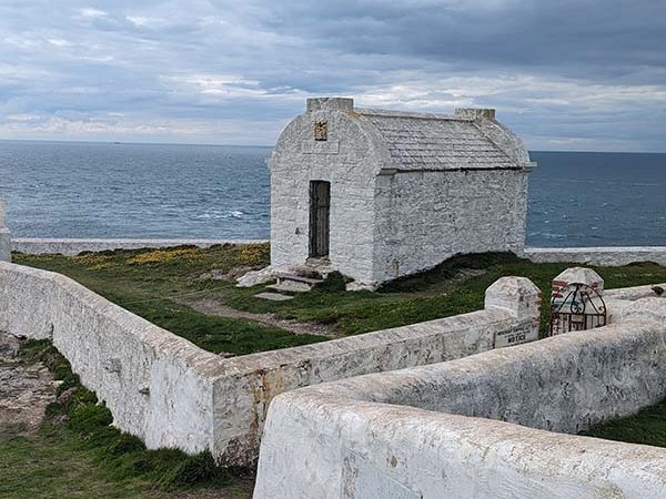
The next point of interest is the old Fog Signal Station, the above picture shows Trinity House Magazine – a place for storing the canon for the fog warnings. Not a little chapel as I had thought originally.
Here’s a little Instagram reel showing just how stunning the cliffs here at North Stack are, but also how precarious – don’t worry I was firmly footed while filming this.
Finally is the fairly leisurely walk back to the car park, with plenty more stunningly beautiful coastline paths. I hope you enjoyed this lovely walk, do share your pictures by tagging #ordnancesurvey or writing a review and sharing your pics on OS Maps
7.3km / 4.51m

EXPLORE THE
OS Shop
We are with you every step of the way. Shop our trusted walking and hiking maps and guidebooks so you can explore the outdoors with confidence.
Go to the shop
By Hilary Pullen
Meet Hilary, Editor of Get Outside – the Ordnance Survey Blog. Hilary is based in North Wales and loves hiking with her dogs in the mountains of Eryri and Bryniau Clwyd, you can find her on Instagram @nearlyuphill and read her guides to walking in North Wales on her blog. Drop her an email hilary.pullen@os.uk if you are interested in posting an article on Get Outside.