Discover what’s Golden about the Jurassic Coast’s ultimate view point
#GetOutside Champion, Martin Curtis, likes a location with big views, Golden Cap is one of his favourite locations on the Jurassic Coast. Discover this route to understand why it means so much to him.
When I go out for a walk on the Jurassic Coast it always involves a visit to a location with big views. I love to see the coastline at its best…. I love its vastness. The geology on the coast is astounding and has such an amazing story to tell. From Golden Cap you can see almost half of the World Heritage site and the prehistoric cliffs from the three Dinosaur periods Triassic, Jurassic and Cretaceous. At a height of 191m, it’s a must visit if you come to the Jurassic Coast!
On this particular day, I was on my way to Lyme Regis for a fossil hunting adventure. I’d decided that if I got up early enough I’d have enough time to walk to the summit of Golden Cap on the way. I knew it would also be quiet and I’d have one of the Jurassic Coast’s best view points to myself.
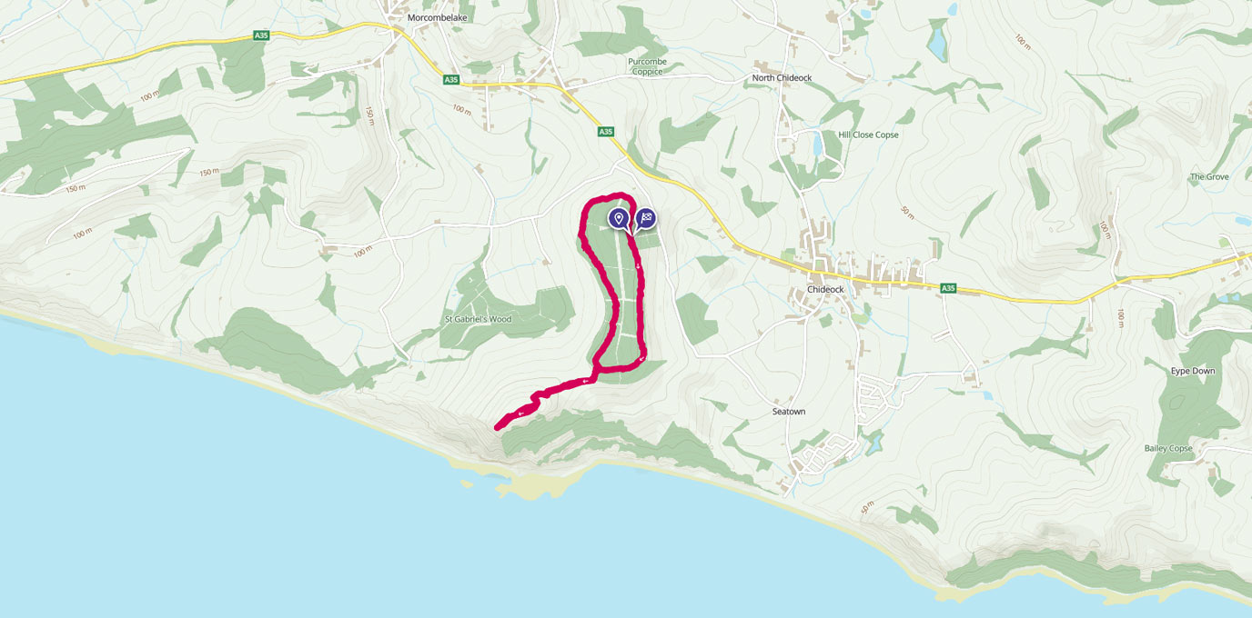
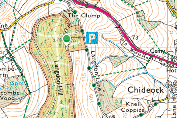
Langdon Hill car park, grid ref: SY412930
To find Langdon Hill car park, take Muddyford lane off the A35 at Chideock Hill. Turn first left once on the lane and follow the road to the car park.
From the car park look for the gate signposted Golden Cap. You’ll find this at the top left hand corner of the Car Park. Go through the gate and follow the main path around the side of the hill. As you follow the path keep an eye out for the clearings on your left. I always love to pause here and admire the magnificent views over Chideock. The surrounding Dorset countryside is framed like a famous landscaped painting. The small coastal hamlet of Seatown lies to the right of Chideock and it is here where the River Winniford drains into the sea. If you look in to the distance you’ll spot Thorncombe Beacon, look hard enough and you can see a metal beacon at its summit.
Thorncombe Beacon was one of several beacons used to warn of the approach of the Spanish Armada in 1588. It is now filled with wood and set alight on special occasions such as the Queen’s Jubilee. Along this part of the path also lookout for the felled log that has the stunning Bracket fungi growing from it.
After a few hundred metres the path bears round to your right, follow it round until you see the sign post to Golden Cap. When you reach the sign, take the path on your left and follow it down the slope. Go careful here as it is fairly steep and you could easily slip in the wet winter months. Watch out for the timber gully half way down, it is angled down the slope and is extremely slippery when wet!


As you reach the bottom of the slope go through the kissing gate. Once the other side, take a look to your left… here you get far reaching views towards Thorncombe Beacon and Seatown down below. After savouring the views, turn right and go through another gate to enter the field.


Ahead of you, you’ll see another gate; follow the hedge line on your left and head across the field to reach the stile and gate system. This section can be very muddy during the winter and the fields do sometimes contain livestock. Please leave all gates as you find them, keep all dogs on leads and stay well away from any farm animals.
Climb the stile and head up the slope towards the kissing gate that you can see at the tree line in the distance. On arrival go through this gate and head up the steps towards Golden Cap’s summit. Take care whilst taking this section, take your time and watch the timber step edges if wet… they will be slippery!
Halfway up the steps, you’ll pass a wooden bench on your left. If you’re visiting during the summer months, stop here and see if you can spot the common Lizard. In the summer months they like to walk out on to the fence rails to warm up in the sun!


After passing the bench the steps start curving round to your left, follow them round and you’ll reach the summit trig point.
From here on a clear day you can see as far as Portland looking east. Follow the Jurassic cliff line along and you’ll see Thorncombe Beacon, the famous cliffs of Broadchurch which are situated at West Bay, Chesil Beach with its naturally formed Chesil bank and Portland in the distance, home of the famous rock Portland Stone.
This is my favourite view from Golden Cap and of the Jurassic Coast; it never disappoints.
Make sure you stay here for a while to savour this moment!


From here head West and follow either of the paths from the trig point, they will lead you to the other side of the summit and the best picnic location on the Jurassic Coast.
Here you’ll pass the National Trust’s memorial to the once chairman, The Earl of Antrim.


From here, looking west you can see right down to the end of the Jurassic coast.
Looking west along the cliff line from the base of Golden Cap, you can see the cliffs of Stonebarrow and then on to Charmouth. These are Jurassic in age and it is one of the best fossil hunting locations on this coast.
In the distance, you can see Lyme Regis, the white Cretaceous cliffs of Beer and the red Triassic cliffs at the end of the World Heritage site in Devon. These are the oldest rocks to be found on this stretch of coast line. If the view is clear you can even see as far as Dartmoor. Please stay away from the cliff edge at this location, it is extremely dangerous!
This is special to me because it is one of the only locations where you can see all three dinosaur periods from the Mesozoic era, you can physically see 185 million years of life on earth from the geology in these cliff faces!
After a good stay at the summit return via the same route, take care on any descent and watch the step edges on your way back down from the summit. When you reach the top of the slope back at Langdon hill woods, take the higher path left. Stay on this track and it will lead you around the other side of Langdon Hill Woods and straight back to the car park and finish point.

For your first adventure to Golden Cap wear good walking boots, visit in good weather to see the views, bring a camera and don’t forget your picnic. This really is one of the best days out on the Jurassic Coast!
