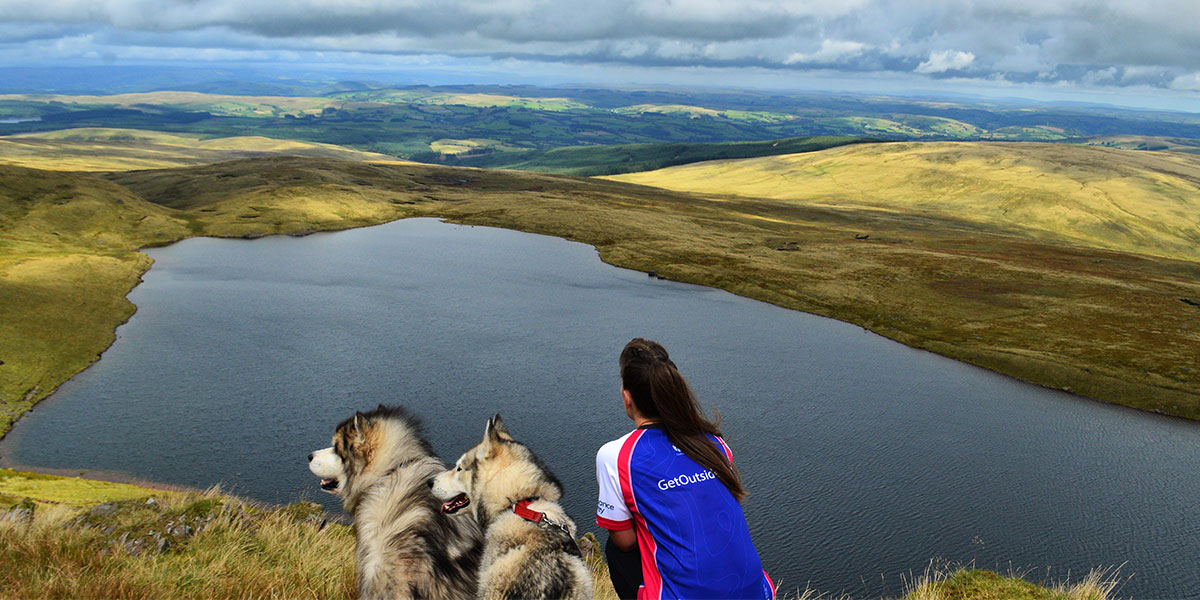
This Dartmoor National Park route is full of interest and when you reach Three Barrows, you’ll find a peaceful spot; it is easy to see why Bronze Age man chose to spend eternity there!
SX 680 628
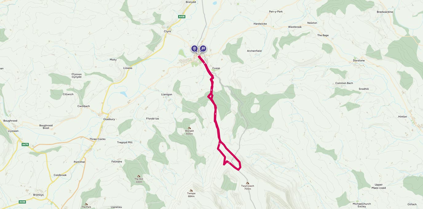
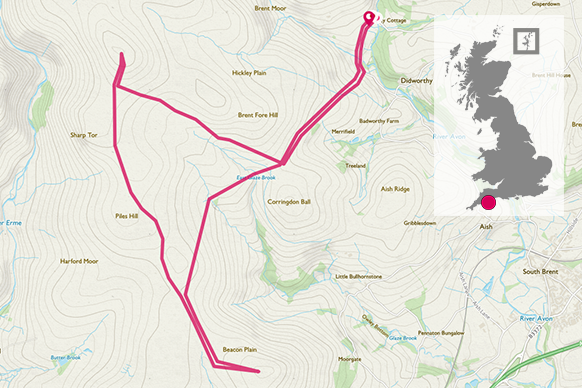
Park at Shipley Bridge SX 68082 62879 (Note: The River Avon is very pretty upstream from here; and you might want to add a wander up to the Avon Dam SX 67893 65156 and back to your walk. This easy and very accessible little detour is 5.5 km and will take you about an hour and a half.)
To get to the trig at Three Barrows SX 65325 62568, turn right out of the car park (I would use the loo first, it is that only one around) and follow the lane down until you reach the bridge over the Bala Brook. Follow the lane for another 200 metres and you will see ‘Diamond Lane’ SX 67929 62296 rising on your right. This is a very pretty green lane, which takes a while to walk up due to its steepness. As you admire the moss clad walls and trees, take a moment to work out where the lane got its jewel-like name.
At the top of the lane the scenery opens out into moorland bounded by easy-to-follow field systems. Take a breath and enjoy your first real glimpse of the moor. Now follow the path southwest along the field boundaries for 1 km, until you reach the improbably Ball Gate SX 67013 61304 (once gate to the Brent Manor Estate). Admire the balls on the gate (why wouldn’t you), and then admire the Bronze Age Long Barrow (burial mound). A perfect place for a cup of tea before the next hill!


2 km
Now you will need to set a compass bearing of 298° and follow the East Glaze Brook uphill (north west) for 2 km until you meet the clear track from Piles Hill SX 65265 62220. Turn right along the track and after 400 metres, you will reach the trig at Three Barrows. Take some time to explore the barrows and enjoy the quiet and the views. This is a perfect opportunity to use your map and see if you can spot a few other features. You might also want to explore the remains of an old boundary wall that runs northwest to southeast through the site of the barrows.
4.3 km
At this point you have a few options. You can retrace your steps straight back down to Shipley Bridge; but we would recommend a jaunt south along to Ugborough Beacon SX 65265 62220 which, as well as some more stunning views, has a tumulus, some cairns and some interesting rock formations. On the way back from Ugborough Beacon, stop at Spurrell’s Cross SX 65907 59955 and take a bearing of 18° down to Glasscombe Corner 1 km SX 66257 60972.
Now you can follow the boundary wall northeast back to Ball Gate and retrace your route down Diamond Lane to Shipley Bridge.
13.6 km SX 680 629
12 km / 7 miles