Catrigg Force Circular Waterfall Walk
The Yorkshire Dales is home to some incredible scenery including rolling hills, drystone walls, valleys, barns, spectacular waterfalls, friendly sheep and beautiful examples of limestone pavements. This short 4-ish km walk, takes in all of this and is a wonderful introduction to the Yorkshire Dales.
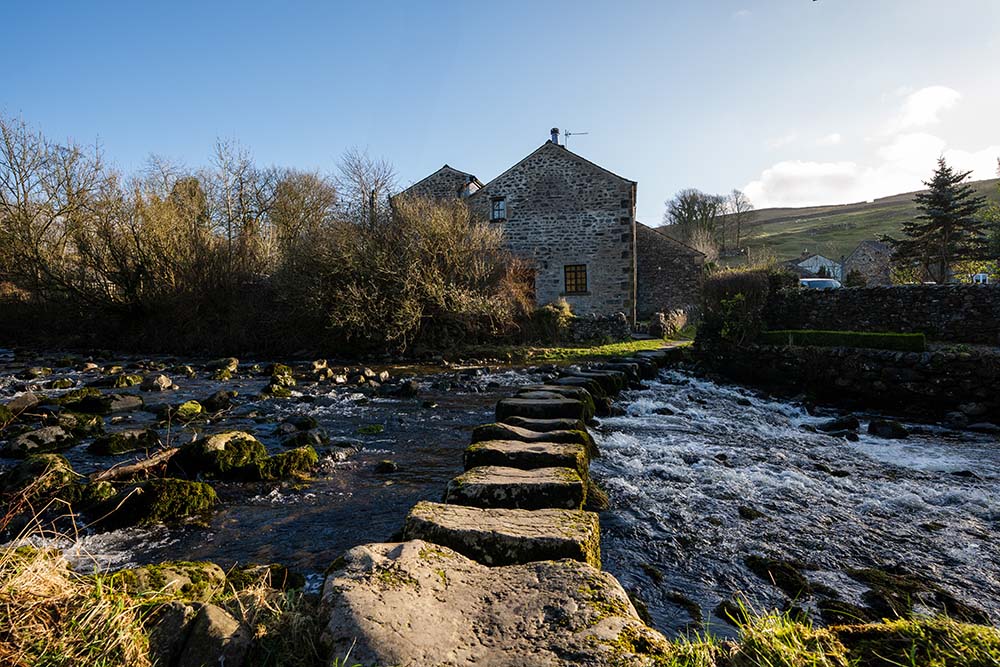
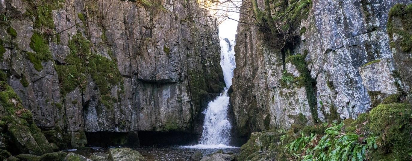
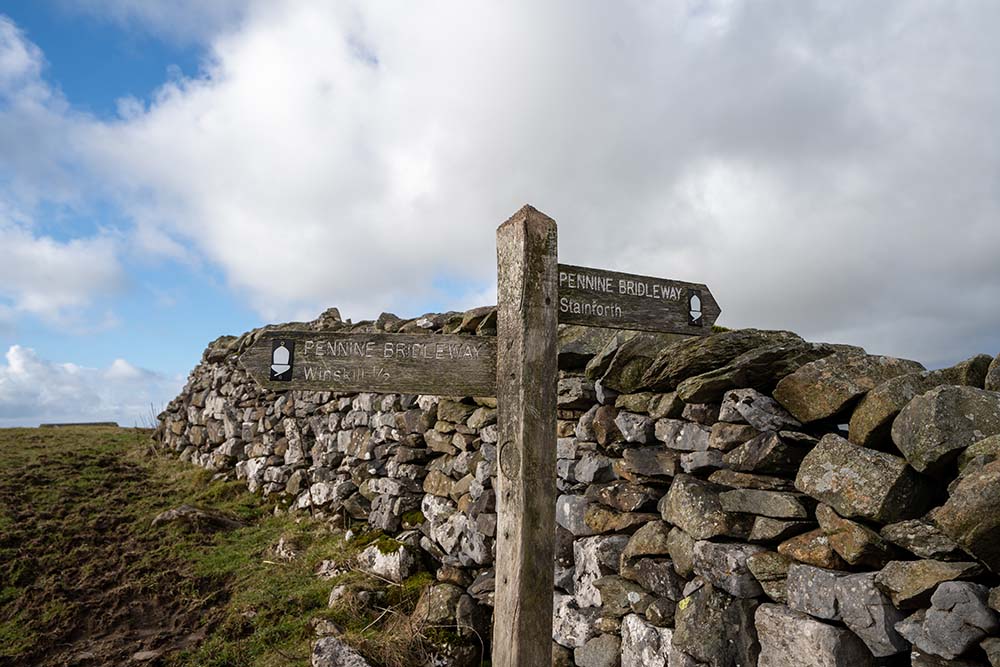
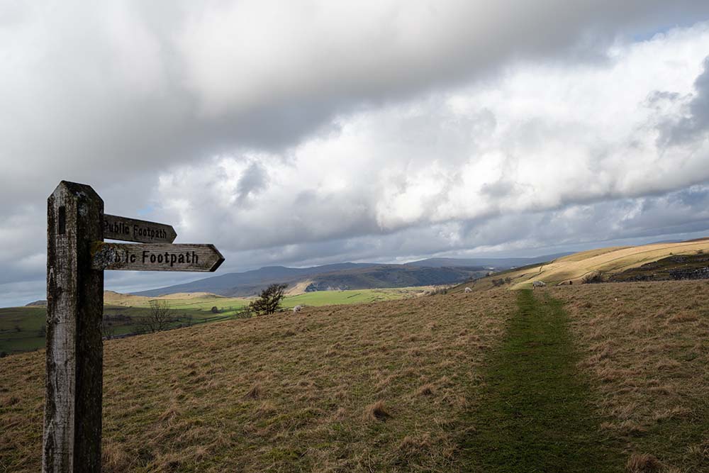
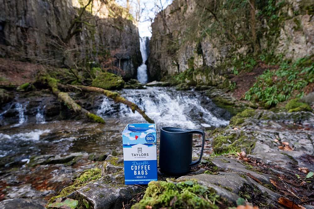
Starting in the village of Stainforth at the main car park, which sits alongside the River Ribble, the route crosses some stepping stones before following the Pennine Bridleway for the first part of the walk. This track is stony but well maintained and the route is signposted most of the way making this the perfect walk for beginners (although a map always comes in handy). After a steep start, which doesn’t last long, the route quickly detours to the 6m drop waterfall known as Catrigg Force.
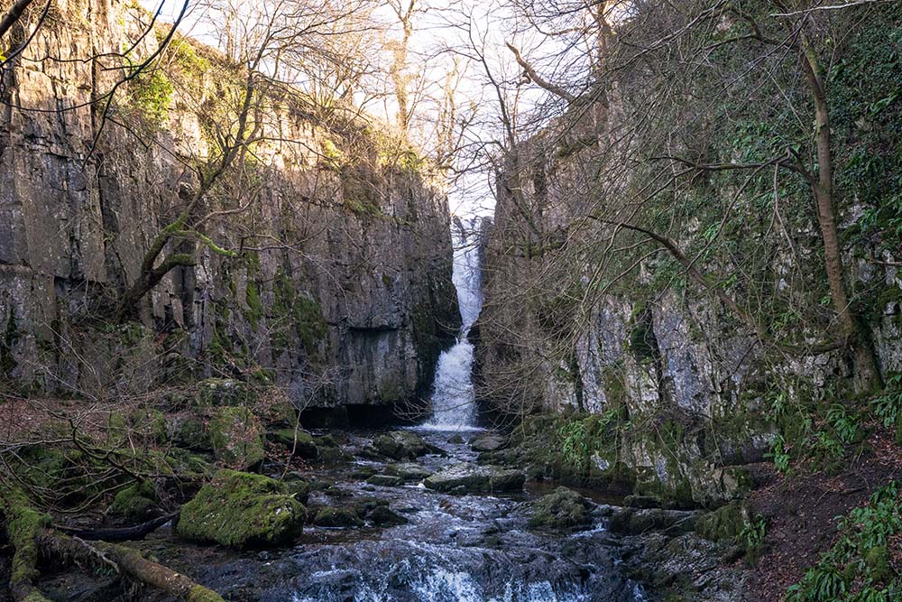
Catrigg Force sits within a steep wooded gorge with a path directly down to a stunning view of the waterfall. The rocks are slippy here so take extra care and if you’re brave enough, this is a fabulous place for a wild swim.
After visiting the waterfall, the route heads back up to the Pennine Bridleway before cutting through farmland and along the base of Winskill Stones, a nature reserve with a spectacular limestone pavement. Not far from this area is another point of interest; Victoria Cave.
The huge gaping hole was quarried out after being discovered by chance in 1837 during which time they found animal bones including that of hippos, rhinos and elephants. It’s definitely worth detouring to see if you have the time.
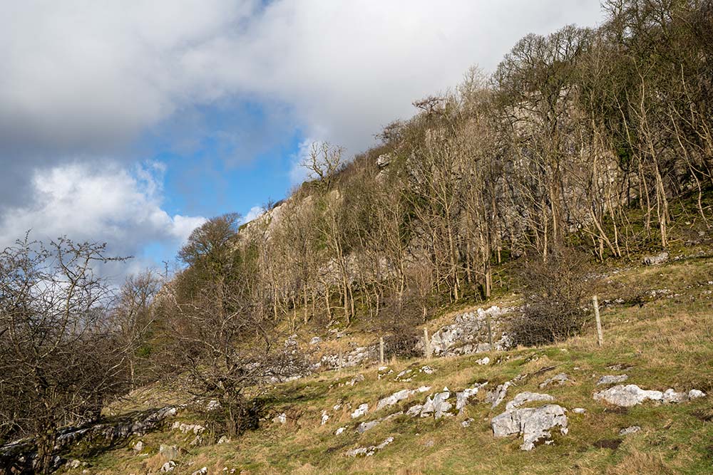
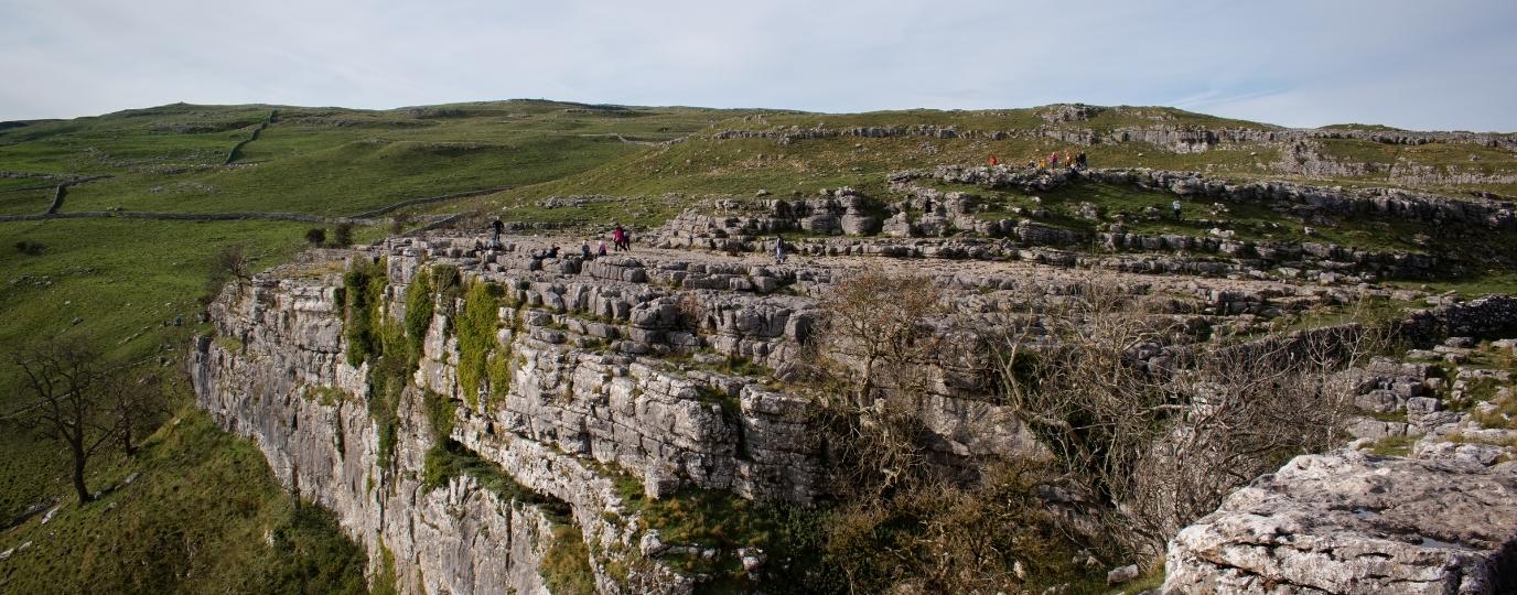
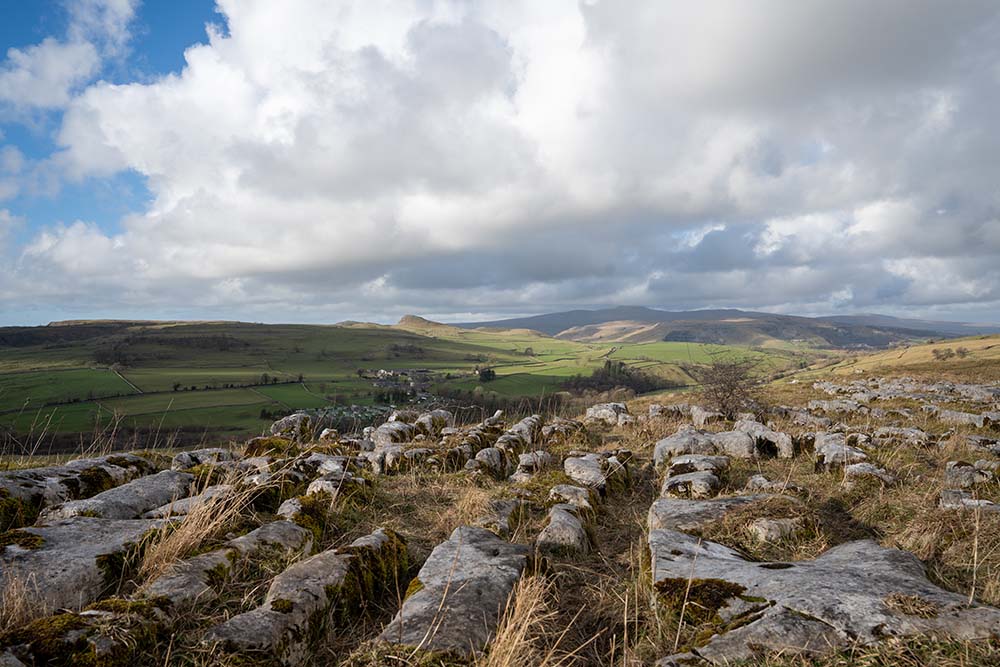
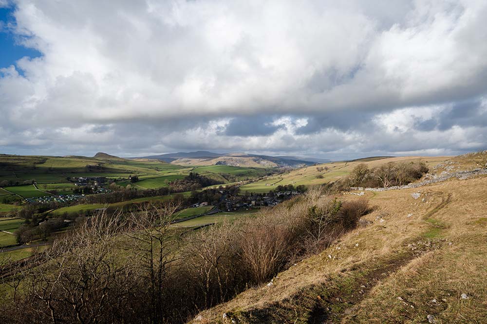
Following the path through the farm buildings, you’ll cross a stile over a wall and onto the top of Stainforth Scar. It may not look like much from above but this huge limestone cliff sits at around 280m high and the path leads you alongside a small section of limestone pavement and down through the woodland to the base before heading back to the village.
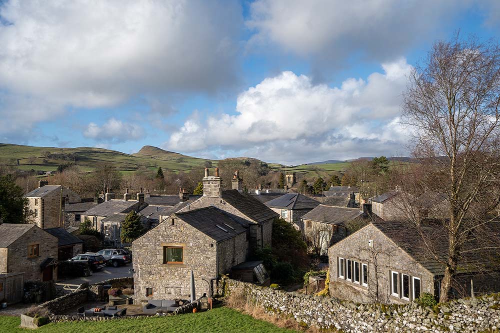
To end your walk, why not stop off at the local pub, The Craven Heifer, and as you leave the village of Stainforth, be sure to look at the sheer height of Stainforth Scar from the road below.
This route guide is part of the Taylor’s of Harrogate Coffee Bag Adventures Collection and was created by OS Champion Izzy Taylor

EXPLORE THE
OS Shop
We are with you every step of the way. Shop our trusted walking and hiking maps and guidebooks so you can explore the outdoors with confidence.
Go to the shop