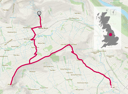
Public transport accessible walk taking in two peaks – Lose Hill and Mam Tor. Sweeping views, rocks for fun photos, possible pooh sticks and the option to descend to Edale village for refreshments.
SK 171 835
There’s two big reasons the Peak District is one of the most visited National Parks – it’s extremely lovely with a range of beautiful landscapes and it’s super accessible for much of the Midlands and North of England. With a picnic lunch and our overnight kit squashed into rucksacks, we were looking forward to an overnight stay at YHA Edale.
With well-marked paths and mostly steady grades this walk shows off the best of the area.
Being car-free, our journey to get there involved hopping on a bus from Sheffield and a bit of a walk through the still slightly snowy Peak District.
Getting off the bus in Hope (convenient conveniences available) we headed out of the village and uphill. In March very muddy tracks took us past some farm buildings and up towards Lose Hill (476m).
We could see a line of large ruck-sacked youngsters and shared our summit tea stop with some tired-looking D of E groups.
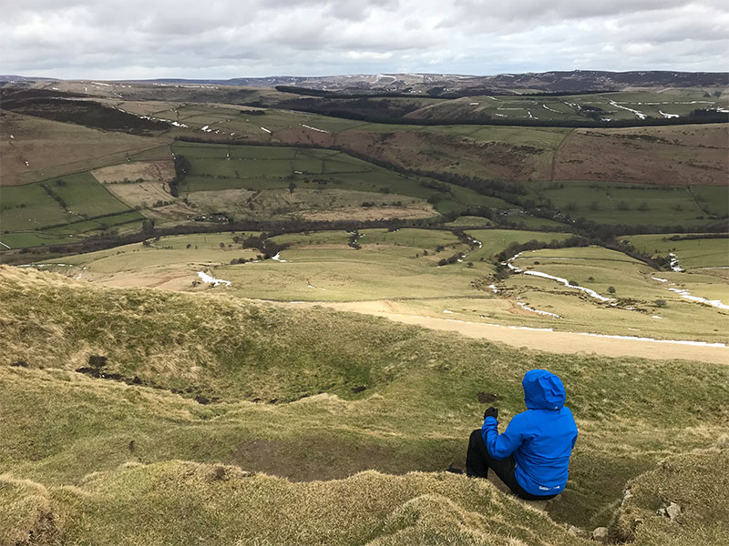
Tea break on the sheltered side of Lose Hill summit
SK 153853
Continuing west we had a short descent only, staying high along a wide ridge with fantastic views to both sides. Plenty of photo opportunities too!
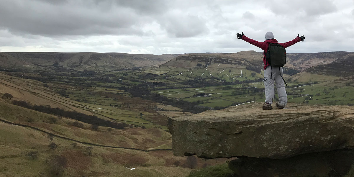
Views at summit across Mam Tor
We were heading for the top of Mam Tor – on our previous Peak District trip snow had stopped us finishing a walk to the summit. This time the weather was much kinder, though we did hide behind a stone wall for our picnic to escape the wind.
It’s always fun to be up high and look at the world around you and this was no exception. Satisfyingly you can see almost the whole route you have taken to the top.
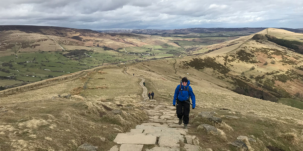
On the way up to Mam Tor SK 129 840
SK 129 840
Returning on the flag stoned path to the junction of footpaths at Hollins Cross (SK 136 845) it would be easy to descend to Edale village, with a train station (trains to Sheffield and Manchester), tea room and two pubs.
We took a different route down, heading for the Youth Hostel. It was a relatively shallow descent, eventually joining and crossing the road through the valley. On the way down there was an ideal pooh sticks bridge so we took the opportunity for a stick hunt and a few rounds of races.
By mid-afternoon we were relaxing in the hostel with tea and biscuits, looking back over at the hills we had climbed.
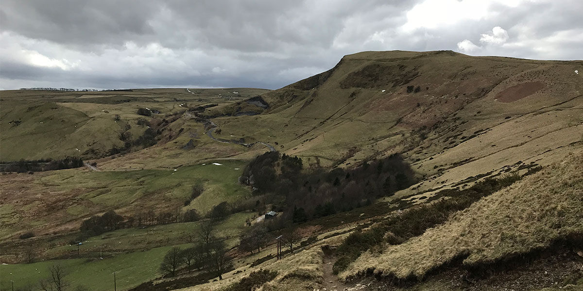
Looking West to Mam Tor from Lose Hill ascent
Getting to and from:
Hope Valley bus route from Sheffield is numbers 271/272. From the Millfield Ln stop our one-way journey was £3 per adult. Fares higher from the city centre. There’s a shop and café near the bus stop in Hope village for walking fuel.
Trains run every two hours from Edale to Sheffield in one direction, Manchester in the other. Both pubs serve food should you need to wait for a train!