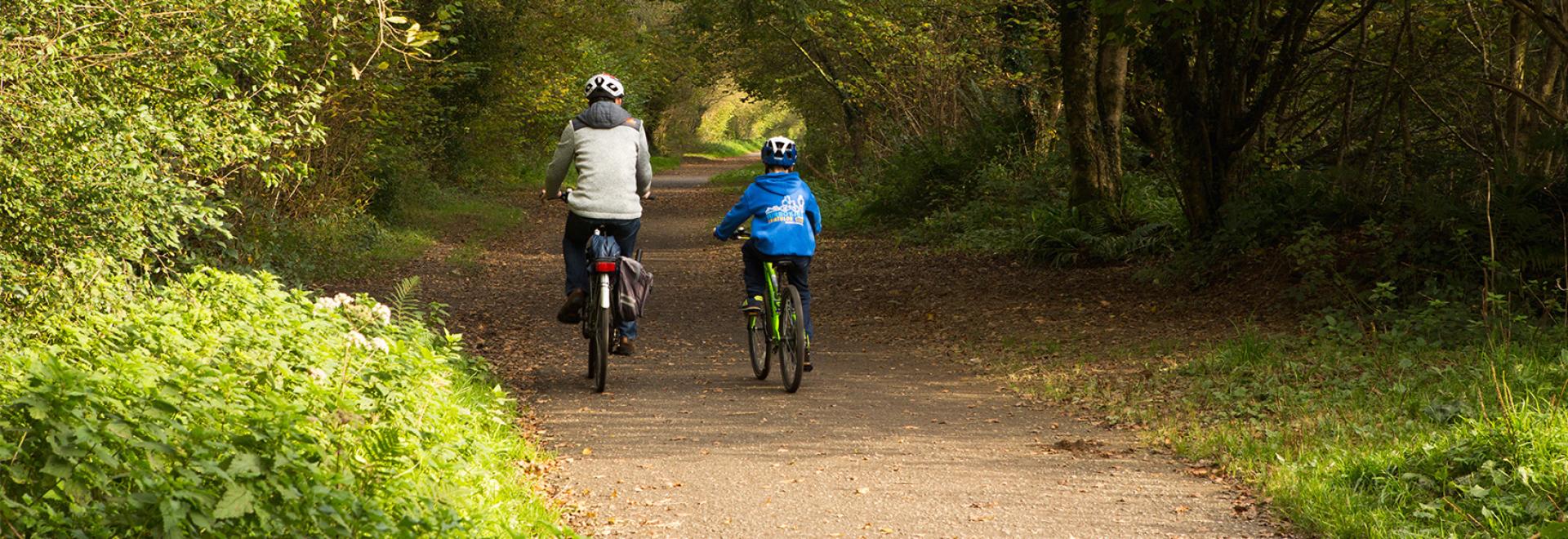
If you prefer traffic-free cycling routes, need a footpath that’s stile-free so you can walk with a pram or are looking for a route suitable for a wheelchair, former railway lines can be the ideal solution.
Great Britain has an amazing industrial heritage – key among them the development of the railways in the early 19th century. However, not all the railways constructed were successful – some continually struggled to show a profit, while others became redundant as the heavy industries they supported closed or moved. In 1963 the infamous Beeching Cuts began with a report on under-used stations and railway lines and ended with thousands of stations and their associated lines being closed.
However, these closures did present local authorities an opportunity to re-use the land over the following decades, with many of them converted into routes for walking and cycling. Some of these are the original cinder beds, while many have been resurfaced. This has created a network of routes that are largely flat, traffic-free and ideal if you are looking for an easy route for pushchairs and wheelchairs.
Most of the former railway lines have been designated as bridleways, which means they are open to cyclists and horse riders too, so they are ideal routes for younger children or those who prefer to avoid traffic.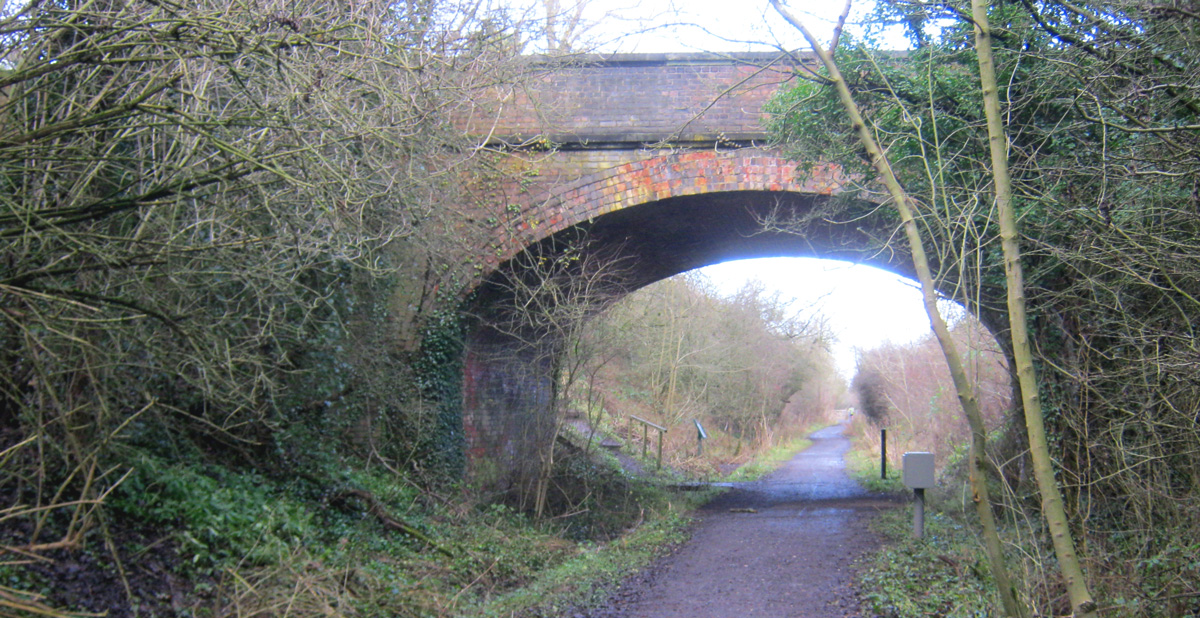
Bridge over Castle Eden Walkway – via Geograph © Peter Robinson
Finding a railway route
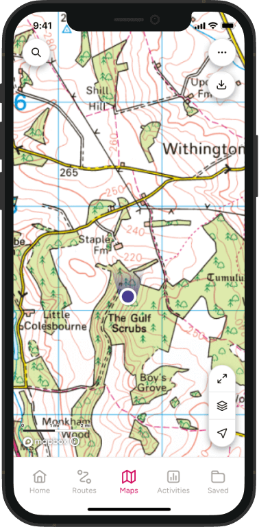
Former railway routes are usually identifiable on OS Explorer maps from the cuttings and embankments, where the route has been cut into the landscape or raised above it to create a level track. On top of this look for a green dashed line or green triangles to show that this is a footpath or bridleway. Many of them will also have orange dots showing they are designated as a traffic-free cycle route.
Some of the routes may be diverted off the original railway in places where newer constructions or missing bridges have created gaps, but most of them allow you to explore for a considerable distance.
For more help in identifying different types of path on a map, check our our guide to planning a walking route in 5 easy steps.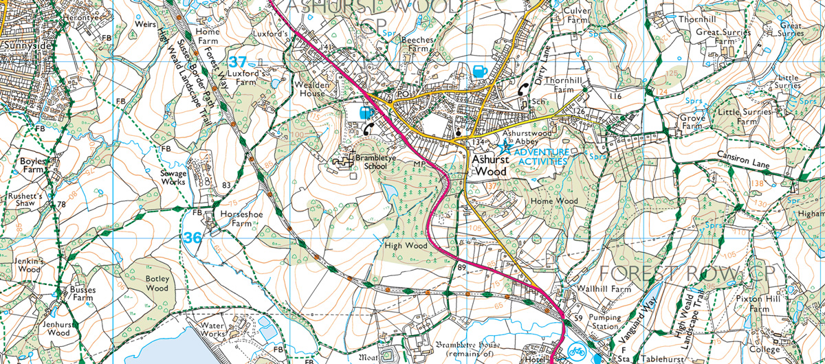
A dismantled railway with footpath and traffic free cycle route near East Grinstead
Dismantled railway routes in OS Maps
We have started adding some of the best railway routes to OS Maps, our online mapping and route planning system. Here’s a selection of routes that have been added so far.
- Auckland Way railway path near Durham
- Beacons way railway path, Brecon Beacons National Park
- Biddulph Valley Way, Stoke on Trent
- Brandon to Bishops Auckland Railway Path, near Durham
- Bristol and Bath Railway Path, Avon
- Bure Valley Path, Aylsham
- Camel Trail North, Bodmin
- Camel Trail West, Cornwall
- Castle Eden Walkway, County Durham
- Cheshire Lines Path, Liverpool
- Chiseldon and Marlborough Railway Path, Wiltshire
- Churnet Way, Derbyshire
- Consett and Sunderland Railway Path, Country Durham
- Cuckoo Trail, Eastbourne
- Deerness Valley Railway Path, Durham
- Derwent Walk, Newcastle-upon-Tyne
- Downs Link, Guildford / Brighton
- Gower Way, Swansea
- Haswell to Hart Walkway, Hartlepool
- Lancashire Coastal Way, Lancaster
- Lancashire Coastal Way and Lune Valley, Morecambe / Lancaster
- Lanchester Valley Railway Path, Durham
- Liverpool Loop Line, Liverpool
- Manifold Way, Peak District National Park
- Marriots Way, Norfolk
- Monsal Trail, Peak District National Park
- Penmaenpool Morfa Mawddach Walk, Snowdonia National Park
- Sirhowy Valley Trail, Caerphilly
- South Tyne Trail, Northumberland
- Staffordshire Moorlands Walk, Leek, Staffordshire
- Taff Trail, Pontypridd
- Tarka Trail, Devon
- Trans Pennine Way, Warrington
- Waskerley Way, Consett
- Weavers Way north, Aylsham
- Weavers Way south, Norfolk
- Whitegate Way, Winsford, Cheshire
- Worth Way, Crawley
You can view these routes on ‘standard’ mapping for free. Upgrade to a Premium subscription to see the routes on 1:25 000 scale OS Explorer mapping on both desktop and mobile devices.
These are just a handful of the hundreds of thousands of routes for walking, running and cycling you can discover in OS Maps.